Kidderminster Aqueduct
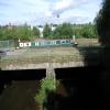
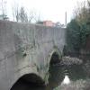
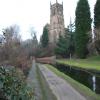
Aqueduct over the River Stour
St Mary's Ringway, Wyre Forest DY11 6TT, United Kingdom
(A456)

Kidderminster Aqueduct
is a minor waterways place
on the Staffordshire and Worcestershire Canal (Main Line: Stourport to Stourton) between
Kidderminster (¼ furlongs
to the north) and
Upper Basin Waterpoint (4 miles and 2¾ furlongs
and 4 locks
to the southwest).
The nearest place in the direction of Upper Basin Waterpoint is Kidderminster Lock No 6;
¼ furlongs
away.
Mooring here is unrated.
There is a small aqueduct or underbridge here which takes a river under the canal.
Broadwaters Aqueduct Winding Hole | 6½ furlongs | |
Stourvale New Bridge | 5 furlongs | |
Limekiln Bridge No 17 | 2 furlongs | |
Sainsbury's Moorings (Kidderminster) | 1½ furlongs | |
Kidderminster | ¼ furlongs | |
Kidderminster Aqueduct | ||
Kidderminster Lock No 6 | ¼ furlongs | |
Kidderminster Lock Turnover Bridge | ¼ furlongs | |
Kidderminster Bridge No 16 | ½ furlongs | |
Academy Winding Hole | 2¼ furlongs | |
Tesco Moorings (Kidderminster) | 3 furlongs |
Amenities here
Amenities nearby at Kidderminster Lock No 6
Amenities nearby at Kidderminster
Amenities in Kidderminster
Amenities at other places in Kidderminster
at
at
at
at
at
at
at
at
at
at
at
at
at
at
at
at
at
at
at
at
at
at
at
at
at
at
at
at
at
at
at
at
at
at
at
at
at
at
at
at
at
There are no links to external websites from here.
Why not log in and add some (select "External websites" from the menu (sometimes this is under "Edit"))?
Mouseover for more information or show routes to facility
Nearest water point
In the direction of Stourton Junction
Kinver Services — 6 miles, 2½ furlongs and 5 locks away
On this waterway in the direction of Stourton Junction
Stewponey Water Point — 7 miles, 6¼ furlongs and 7 locks away
On this waterway in the direction of Stourton Junction
Greensforge Wharf Services — 10 miles, 6 furlongs and 10 locks away
Travel to Stourton Junction, then on the Staffordshire and Worcestershire Canal (Main Line: Stourton to Aldersley) to Greensforge Wharf Services
Stourbridge Visitor Moorings — 10 miles, 7¼ furlongs and 11 locks away
Travel to Stourton Junction, then on the Stourbridge Canals (Main Line) to Wordsley Junction, then on the Stourbridge Canals (Stourbridge Branch) to Stourbridge Visitor Moorings
Blowers Green Pumphouse — 16 miles, 5 furlongs and 36 locks away
Travel to Stourton Junction, then on the Stourbridge Canals (Main Line) to Black Delph, then on the Birmingham Canal Navigations (Dudley Canal No 1 - Through Route) to Parkhead Junction, then on the Birmingham Canal Navigations (Dudley Canal No 2 - Coombeswood ) to Blowers Green Pumphouse
Bumble Hole Visitor Centre — 19 miles, 1¼ furlongs and 36 locks away
Travel to Stourton Junction, then on the Stourbridge Canals (Main Line) to Black Delph, then on the Birmingham Canal Navigations (Dudley Canal No 1 - Through Route) to Parkhead Junction, then on the Birmingham Canal Navigations (Dudley Canal No 2 - Coombeswood ) to Bumble Hole Visitor Centre
Dudley Tunnel (northern entrance) — 18 miles, 5¼ furlongs and 39 locks away
Travel to Stourton Junction, then on the Stourbridge Canals (Main Line) to Black Delph, then on the Birmingham Canal Navigations (Dudley Canal No 1 - Through Route) to Pensnett Junction, then on the Birmingham Canal Navigations (Dudley Canal No 1 - Dudley Tunnel) to Dudley Tunnel (northern entrance)
Dudley Canal & Tunnel Trust Footbridge — 18 miles, 5¾ furlongs and 39 locks away
Travel to Stourton Junction, then on the Stourbridge Canals (Main Line) to Black Delph, then on the Birmingham Canal Navigations (Dudley Canal No 1 - Through Route) to Pensnett Junction, then on the Birmingham Canal Navigations (Dudley Canal No 1 - Dudley Tunnel) to Dudley Tunnel (northern entrance), then on the Birmingham Canal Navigations (Dudley Canal No 1 - Birmingham End) to Dudley Canal & Tunnel Trust Footbridge
Black Country Museum — 18 miles, 6¼ furlongs and 39 locks away
Travel to Stourton Junction, then on the Stourbridge Canals (Main Line) to Black Delph, then on the Birmingham Canal Navigations (Dudley Canal No 1 - Through Route) to Pensnett Junction, then on the Birmingham Canal Navigations (Dudley Canal No 1 - Dudley Tunnel) to Dudley Tunnel (northern entrance), then on the Birmingham Canal Navigations (Dudley Canal No 1 - Birmingham End) to Black Country Museum
Todds End Customer Service Facility — 18 miles, 6½ furlongs and 39 locks away
Travel to Stourton Junction, then on the Stourbridge Canals (Main Line) to Black Delph, then on the Birmingham Canal Navigations (Dudley Canal No 1 - Through Route) to Pensnett Junction, then on the Birmingham Canal Navigations (Dudley Canal No 1 - Dudley Tunnel) to Dudley Tunnel (northern entrance), then on the Birmingham Canal Navigations (Dudley Canal No 1 - Birmingham End) to Todds End Customer Service Facility
In the direction of York Street Bridge
Caldwall Mill Bridge No 14 — 4½ furlongs and 1 lock away
On this waterway in the direction of York Street Bridge
Upper Basin Waterpoint — 4 miles, 2¾ furlongs and 4 locks away
Travel to York Street Bridge, then on the Staffordshire and Worcestershire Canal (Stourport Basins: Narrow Route) to Upper Basin Waterpoint
Lincomb Lock — 5 miles, 6¼ furlongs and 6 locks away
Travel to York Street Bridge, then on the Staffordshire and Worcestershire Canal (Stourport Basins: Narrow Route) to Stourport Upper Basin, then on the Staffordshire and Worcestershire Canal (Stourport Basins: Broad Route) to Severn - Stourport Broad Locks Entrance, then on the River Severn (main river - Stourport to Worcester) to Lincomb Lock
Holt Lock (Holt Fleet) — 9 miles, 7¾ furlongs and 7 locks away
Travel to York Street Bridge, then on the Staffordshire and Worcestershire Canal (Stourport Basins: Narrow Route) to Stourport Upper Basin, then on the Staffordshire and Worcestershire Canal (Stourport Basins: Broad Route) to Severn - Stourport Broad Locks Entrance, then on the River Severn (main river - Stourport to Worcester) to Holt Lock (Holt Fleet)
Worcester Trip Boat Moorings — 16 miles, 4¾ furlongs and 9 locks away
Travel to York Street Bridge, then on the Staffordshire and Worcestershire Canal (Stourport Basins: Narrow Route) to Stourport Upper Basin, then on the Staffordshire and Worcestershire Canal (Stourport Basins: Broad Route) to Severn - Stourport Broad Locks Entrance, then on the River Severn (main river - Stourport to Worcester) to Worcester Trip Boat Moorings
Diglis Locks — 17 miles, 5¼ furlongs and 9 locks away
Travel to York Street Bridge, then on the Staffordshire and Worcestershire Canal (Stourport Basins: Narrow Route) to Stourport Upper Basin, then on the Staffordshire and Worcestershire Canal (Stourport Basins: Broad Route) to Severn - Stourport Broad Locks Entrance, then on the River Severn (main river - Stourport to Worcester) to Diglis Junction, then on the River Severn (main river - Worcester to Gloucester) to Diglis Locks
Diglis Services — 17 miles, 4½ furlongs and 11 locks away
Travel to York Street Bridge, then on the Staffordshire and Worcestershire Canal (Stourport Basins: Narrow Route) to Stourport Upper Basin, then on the Staffordshire and Worcestershire Canal (Stourport Basins: Broad Route) to Severn - Stourport Broad Locks Entrance, then on the River Severn (main river - Stourport to Worcester) to Diglis Junction, then on the Worcester and Birmingham Canal (Diglis Junction to Diglis Basin) to Diglis Basin, then on the Worcester and Birmingham Canal (Diglis Basin to King's Norton Junction) to Diglis Services
Lowesmoor Basin — 18 miles, 4 furlongs and 13 locks away
Travel to York Street Bridge, then on the Staffordshire and Worcestershire Canal (Stourport Basins: Narrow Route) to Stourport Upper Basin, then on the Staffordshire and Worcestershire Canal (Stourport Basins: Broad Route) to Severn - Stourport Broad Locks Entrance, then on the River Severn (main river - Stourport to Worcester) to Diglis Junction, then on the Worcester and Birmingham Canal (Diglis Junction to Diglis Basin) to Diglis Basin, then on the Worcester and Birmingham Canal (Diglis Basin to King's Norton Junction) to Lowesmoor Basin
Netherwich Basin — 18 miles, 3¼ furlongs and 16 locks away
Travel to York Street Bridge, then on the Staffordshire and Worcestershire Canal (Stourport Basins: Narrow Route) to Stourport Upper Basin, then on the Staffordshire and Worcestershire Canal (Stourport Basins: Broad Route) to Severn - Stourport Broad Locks Entrance, then on the River Severn (main river - Stourport to Worcester) to Hawford Junction, then on the Droitwich Canals (Droitwich Barge Canal) to Netherwich Basin
Droitwich Spa Marina — 19 miles, 6¾ furlongs and 21 locks away
Travel to York Street Bridge, then on the Staffordshire and Worcestershire Canal (Stourport Basins: Narrow Route) to Stourport Upper Basin, then on the Staffordshire and Worcestershire Canal (Stourport Basins: Broad Route) to Severn - Stourport Broad Locks Entrance, then on the River Severn (main river - Stourport to Worcester) to Hawford Junction, then on the Droitwich Canals (Droitwich Barge Canal) to Droitwich Junction, then on the Droitwich Canals (Droitwich Junction Canal) to Droitwich Spa MarinaNearest rubbish disposal
In the direction of Stourton Junction
Kinver Services — 6 miles, 2½ furlongs and 5 locks away
On this waterway in the direction of Stourton Junction
Greensforge Wharf Services — 10 miles, 6 furlongs and 10 locks away
Travel to Stourton Junction, then on the Staffordshire and Worcestershire Canal (Main Line: Stourton to Aldersley) to Greensforge Wharf Services
Stourbridge Basin — 11 miles, 1½ furlongs and 11 locks away
Travel to Stourton Junction, then on the Stourbridge Canals (Main Line) to Wordsley Junction, then on the Stourbridge Canals (Stourbridge Branch) to Stourbridge Basin
Bratch Bottom Lock No 23 — 14 miles, 3½ furlongs and 16 locks away
Travel to Stourton Junction, then on the Staffordshire and Worcestershire Canal (Main Line: Stourton to Aldersley) to Bratch Bottom Lock No 23
Delph Bottom Lock No 8 — 14 miles, 4¼ furlongs and 27 locks away
Travel to Stourton Junction, then on the Stourbridge Canals (Main Line) to Black Delph, then on the Birmingham Canal Navigations (Dudley Canal No 1 - Through Route) to Delph Bottom Lock No 8
Waterfront Services (Dudley) — 15 miles, 4¼ furlongs and 35 locks away
Travel to Stourton Junction, then on the Stourbridge Canals (Main Line) to Black Delph, then on the Birmingham Canal Navigations (Dudley Canal No 1 - Through Route) to Waterfront Services (Dudley)
Blowers Green Bridge — 16 miles, 5¼ furlongs and 36 locks away
Travel to Stourton Junction, then on the Stourbridge Canals (Main Line) to Black Delph, then on the Birmingham Canal Navigations (Dudley Canal No 1 - Through Route) to Parkhead Junction, then on the Birmingham Canal Navigations (Dudley Canal No 2 - Coombeswood ) to Blowers Green Bridge
Black Country Museum — 18 miles, 6¼ furlongs and 39 locks away
Travel to Stourton Junction, then on the Stourbridge Canals (Main Line) to Black Delph, then on the Birmingham Canal Navigations (Dudley Canal No 1 - Through Route) to Pensnett Junction, then on the Birmingham Canal Navigations (Dudley Canal No 1 - Dudley Tunnel) to Dudley Tunnel (northern entrance), then on the Birmingham Canal Navigations (Dudley Canal No 1 - Birmingham End) to Black Country Museum
In the direction of York Street Bridge
Upper Basin Waterpoint — 4 miles, 2¾ furlongs and 4 locks away
Travel to York Street Bridge, then on the Staffordshire and Worcestershire Canal (Stourport Basins: Narrow Route) to Upper Basin Waterpoint
Sabrina Footbridge — 16 miles, 2¾ furlongs and 9 locks away
Travel to York Street Bridge, then on the Staffordshire and Worcestershire Canal (Stourport Basins: Narrow Route) to Stourport Upper Basin, then on the Staffordshire and Worcestershire Canal (Stourport Basins: Broad Route) to Severn - Stourport Broad Locks Entrance, then on the River Severn (main river - Stourport to Worcester) to Sabrina Footbridge
Diglis Basin — 17 miles, 4 furlongs and 11 locks away
Travel to York Street Bridge, then on the Staffordshire and Worcestershire Canal (Stourport Basins: Narrow Route) to Stourport Upper Basin, then on the Staffordshire and Worcestershire Canal (Stourport Basins: Broad Route) to Severn - Stourport Broad Locks Entrance, then on the River Severn (main river - Stourport to Worcester) to Diglis Junction, then on the Worcester and Birmingham Canal (Diglis Junction to Diglis Basin) to Diglis Basin
Lowesmoor Basin — 18 miles, 4 furlongs and 13 locks away
Travel to York Street Bridge, then on the Staffordshire and Worcestershire Canal (Stourport Basins: Narrow Route) to Stourport Upper Basin, then on the Staffordshire and Worcestershire Canal (Stourport Basins: Broad Route) to Severn - Stourport Broad Locks Entrance, then on the River Severn (main river - Stourport to Worcester) to Diglis Junction, then on the Worcester and Birmingham Canal (Diglis Junction to Diglis Basin) to Diglis Basin, then on the Worcester and Birmingham Canal (Diglis Basin to King's Norton Junction) to Lowesmoor Basin
Netherwich Basin — 18 miles, 3¼ furlongs and 16 locks away
Travel to York Street Bridge, then on the Staffordshire and Worcestershire Canal (Stourport Basins: Narrow Route) to Stourport Upper Basin, then on the Staffordshire and Worcestershire Canal (Stourport Basins: Broad Route) to Severn - Stourport Broad Locks Entrance, then on the River Severn (main river - Stourport to Worcester) to Hawford Junction, then on the Droitwich Canals (Droitwich Barge Canal) to Netherwich Basin
Droitwich Spa Marina — 19 miles, 6¾ furlongs and 21 locks away
Travel to York Street Bridge, then on the Staffordshire and Worcestershire Canal (Stourport Basins: Narrow Route) to Stourport Upper Basin, then on the Staffordshire and Worcestershire Canal (Stourport Basins: Broad Route) to Severn - Stourport Broad Locks Entrance, then on the River Severn (main river - Stourport to Worcester) to Hawford Junction, then on the Droitwich Canals (Droitwich Barge Canal) to Droitwich Junction, then on the Droitwich Canals (Droitwich Junction Canal) to Droitwich Spa MarinaNearest chemical toilet disposal
In the direction of Stourton Junction
Kinver Services — 6 miles, 2½ furlongs and 5 locks away
On this waterway in the direction of Stourton Junction
Greensforge Wharf Services — 10 miles, 6 furlongs and 10 locks away
Travel to Stourton Junction, then on the Staffordshire and Worcestershire Canal (Main Line: Stourton to Aldersley) to Greensforge Wharf Services
Stourbridge Basin — 11 miles, 1½ furlongs and 11 locks away
Travel to Stourton Junction, then on the Stourbridge Canals (Main Line) to Wordsley Junction, then on the Stourbridge Canals (Stourbridge Branch) to Stourbridge Basin
Waterfront Services (Dudley) — 15 miles, 4¼ furlongs and 35 locks away
Travel to Stourton Junction, then on the Stourbridge Canals (Main Line) to Black Delph, then on the Birmingham Canal Navigations (Dudley Canal No 1 - Through Route) to Waterfront Services (Dudley)
Blowers Green Pumphouse — 16 miles, 5 furlongs and 36 locks away
Travel to Stourton Junction, then on the Stourbridge Canals (Main Line) to Black Delph, then on the Birmingham Canal Navigations (Dudley Canal No 1 - Through Route) to Parkhead Junction, then on the Birmingham Canal Navigations (Dudley Canal No 2 - Coombeswood ) to Blowers Green Pumphouse
Dudley Tunnel (northern entrance) — 18 miles, 5¼ furlongs and 39 locks away
Travel to Stourton Junction, then on the Stourbridge Canals (Main Line) to Black Delph, then on the Birmingham Canal Navigations (Dudley Canal No 1 - Through Route) to Pensnett Junction, then on the Birmingham Canal Navigations (Dudley Canal No 1 - Dudley Tunnel) to Dudley Tunnel (northern entrance)
Black Country Museum — 18 miles, 6¼ furlongs and 39 locks away
Travel to Stourton Junction, then on the Stourbridge Canals (Main Line) to Black Delph, then on the Birmingham Canal Navigations (Dudley Canal No 1 - Through Route) to Pensnett Junction, then on the Birmingham Canal Navigations (Dudley Canal No 1 - Dudley Tunnel) to Dudley Tunnel (northern entrance), then on the Birmingham Canal Navigations (Dudley Canal No 1 - Birmingham End) to Black Country Museum
Todds End Customer Service Facility — 18 miles, 6½ furlongs and 39 locks away
Travel to Stourton Junction, then on the Stourbridge Canals (Main Line) to Black Delph, then on the Birmingham Canal Navigations (Dudley Canal No 1 - Through Route) to Pensnett Junction, then on the Birmingham Canal Navigations (Dudley Canal No 1 - Dudley Tunnel) to Dudley Tunnel (northern entrance), then on the Birmingham Canal Navigations (Dudley Canal No 1 - Birmingham End) to Todds End Customer Service Facility
In the direction of York Street Bridge
Caldwall Mill Bridge No 14 — 4½ furlongs and 1 lock away
On this waterway in the direction of York Street Bridge
Upper Basin Waterpoint — 4 miles, 2¾ furlongs and 4 locks away
Travel to York Street Bridge, then on the Staffordshire and Worcestershire Canal (Stourport Basins: Narrow Route) to Upper Basin Waterpoint
Stourport Marina — 5 miles, 2¾ furlongs and 6 locks away
Travel to York Street Bridge, then on the Staffordshire and Worcestershire Canal (Stourport Basins: Narrow Route) to Stourport Upper Basin, then on the Staffordshire and Worcestershire Canal (Stourport Basins: Broad Route) to Severn - Stourport Broad Locks Entrance, then on the River Severn (main river - Stourport to Worcester) to Stourport Marina
Diglis Services — 17 miles, 4½ furlongs and 11 locks away
Travel to York Street Bridge, then on the Staffordshire and Worcestershire Canal (Stourport Basins: Narrow Route) to Stourport Upper Basin, then on the Staffordshire and Worcestershire Canal (Stourport Basins: Broad Route) to Severn - Stourport Broad Locks Entrance, then on the River Severn (main river - Stourport to Worcester) to Diglis Junction, then on the Worcester and Birmingham Canal (Diglis Junction to Diglis Basin) to Diglis Basin, then on the Worcester and Birmingham Canal (Diglis Basin to King's Norton Junction) to Diglis Services
Lowesmoor Basin — 18 miles, 4 furlongs and 13 locks away
Travel to York Street Bridge, then on the Staffordshire and Worcestershire Canal (Stourport Basins: Narrow Route) to Stourport Upper Basin, then on the Staffordshire and Worcestershire Canal (Stourport Basins: Broad Route) to Severn - Stourport Broad Locks Entrance, then on the River Severn (main river - Stourport to Worcester) to Diglis Junction, then on the Worcester and Birmingham Canal (Diglis Junction to Diglis Basin) to Diglis Basin, then on the Worcester and Birmingham Canal (Diglis Basin to King's Norton Junction) to Lowesmoor Basin
Droitwich Spa Marina — 19 miles, 6¾ furlongs and 21 locks away
Travel to York Street Bridge, then on the Staffordshire and Worcestershire Canal (Stourport Basins: Narrow Route) to Stourport Upper Basin, then on the Staffordshire and Worcestershire Canal (Stourport Basins: Broad Route) to Severn - Stourport Broad Locks Entrance, then on the River Severn (main river - Stourport to Worcester) to Hawford Junction, then on the Droitwich Canals (Droitwich Barge Canal) to Droitwich Junction, then on the Droitwich Canals (Droitwich Junction Canal) to Droitwich Spa MarinaNearest place to turn
In the direction of Stourton Junction
Kidderminster — ¼ furlongs away
On this waterway in the direction of Stourton Junction
Broadwaters Aqueduct Winding Hole — 6½ furlongs away
On this waterway in the direction of Stourton Junction
Lea Lane Winding Hole — 2 miles, 2¼ furlongs and 2 locks away
On this waterway in the direction of Stourton Junction
Debdale Lock Winding Hole — 2 miles, 7¾ furlongs and 3 locks away
On this waterway in the direction of Stourton Junction
Cookley Forge Towpath Bridge — 3 miles, ¾ furlongs and 3 locks away
On this waterway in the direction of Stourton Junction
Whittington Winding Hole — 5 miles, 4 furlongs and 4 locks away
On this waterway in the direction of Stourton Junction
Hyde Lock Winding Hole — 6 miles, 6 furlongs and 6 locks away
On this waterway in the direction of Stourton Junction
Stourton Junction — 7 miles, 7½ furlongs and 7 locks away
On this waterway in the direction of Stourton Junction
Gothersley Winding Hole — 9 miles, 3½ furlongs and 7 locks away
Travel to Stourton Junction, then on the Staffordshire and Worcestershire Canal (Main Line: Stourton to Aldersley) to Gothersley Winding Hole
Winding Hole above Stourton Top Lock — 8 miles, 2¼ furlongs and 11 locks away
Travel to Stourton Junction, then on the Stourbridge Canals (Main Line) to Winding Hole above Stourton Top Lock
In the direction of York Street Bridge
Academy Winding Hole — 2¼ furlongs and 1 lock away
On this waterway in the direction of York Street Bridge
Pratt's Wharf — 2 miles, 1 furlong and 3 locks away
On this waterway in the direction of York Street Bridge
Former Railway Interchange Basin — 3 miles, 4½ furlongs and 3 locks away
On this waterway in the direction of York Street Bridge
Stourport Upper Basin — 4 miles, 3 furlongs and 4 locks away
Travel to York Street Bridge, then on the Staffordshire and Worcestershire Canal (Stourport Basins: Narrow Route) to Stourport Upper Basin
Stourport Clock Basin — 4 miles, 3¼ furlongs and 4 locks away
Travel to York Street Bridge, then on the Staffordshire and Worcestershire Canal (Stourport Basins: Narrow Route) to Stourport Clock Basin
Stourport Lower Basin - between Broad Locks — 4 miles, 3½ furlongs and 5 locks away
Travel to York Street Bridge, then on the Staffordshire and Worcestershire Canal (Stourport Basins: Narrow Route) to Stourport Upper Basin, then on the Staffordshire and Worcestershire Canal (Stourport Basins: Broad Route) to Stourport Lower Basin - between Broad Locks
Stourport Lower Basin - between Narrow Locks — 4 miles, 4 furlongs and 5 locks away
Travel to York Street Bridge, then on the Staffordshire and Worcestershire Canal (Stourport Basins: Narrow Route) to Stourport Upper Basin, then on the Staffordshire and Worcestershire Canal (Stourport Basins: Broad Route) to Stourport Lower Basin - between Broad Locks, then on the Staffordshire and Worcestershire Canal (Stourport Basins: Broad Locks to Narrow Locks to Stourport Lower Basin - between Narrow Locks
Severn - Stourport Narrow Locks Entrance — 4 miles, 4½ furlongs and 6 locks away
Travel to York Street Bridge, then on the Staffordshire and Worcestershire Canal (Stourport Basins: Narrow Route) to Stourport Upper Basin, then on the Staffordshire and Worcestershire Canal (Stourport Basins: Broad Route) to Severn - Stourport Broad Locks Entrance, then on the River Severn (main river - Stourport to Worcester) to Severn - Stourport Narrow Locks Entrance
Holt Lock Weir Entrance — 9 miles, 5½ furlongs and 7 locks away
Travel to York Street Bridge, then on the Staffordshire and Worcestershire Canal (Stourport Basins: Narrow Route) to Stourport Upper Basin, then on the Staffordshire and Worcestershire Canal (Stourport Basins: Broad Route) to Severn - Stourport Broad Locks Entrance, then on the River Severn (main river - Stourport to Worcester) to Holt Lock Weir Entrance
Holt Lock Weir Exit — 10 miles, ¾ furlongs and 8 locks away
Travel to York Street Bridge, then on the Staffordshire and Worcestershire Canal (Stourport Basins: Narrow Route) to Stourport Upper Basin, then on the Staffordshire and Worcestershire Canal (Stourport Basins: Broad Route) to Severn - Stourport Broad Locks Entrance, then on the River Severn (main river - Stourport to Worcester) to Holt Lock Weir ExitNearest self-operated pump-out
In the direction of Stourton Junction
Kinver Services — 6 miles, 2½ furlongs and 5 locks away
On this waterway in the direction of Stourton Junction
Dudley Tunnel (northern entrance) — 18 miles, 5¼ furlongs and 39 locks away
Travel to Stourton Junction, then on the Stourbridge Canals (Main Line) to Black Delph, then on the Birmingham Canal Navigations (Dudley Canal No 1 - Through Route) to Pensnett Junction, then on the Birmingham Canal Navigations (Dudley Canal No 1 - Dudley Tunnel) to Dudley Tunnel (northern entrance)
Black Country Museum — 18 miles, 6¼ furlongs and 39 locks away
Travel to Stourton Junction, then on the Stourbridge Canals (Main Line) to Black Delph, then on the Birmingham Canal Navigations (Dudley Canal No 1 - Through Route) to Pensnett Junction, then on the Birmingham Canal Navigations (Dudley Canal No 1 - Dudley Tunnel) to Dudley Tunnel (northern entrance), then on the Birmingham Canal Navigations (Dudley Canal No 1 - Birmingham End) to Black Country Museum
Todds End Customer Service Facility — 18 miles, 6½ furlongs and 39 locks away
Travel to Stourton Junction, then on the Stourbridge Canals (Main Line) to Black Delph, then on the Birmingham Canal Navigations (Dudley Canal No 1 - Through Route) to Pensnett Junction, then on the Birmingham Canal Navigations (Dudley Canal No 1 - Dudley Tunnel) to Dudley Tunnel (northern entrance), then on the Birmingham Canal Navigations (Dudley Canal No 1 - Birmingham End) to Todds End Customer Service Facility
In the direction of York Street Bridge
Diglis Services — 17 miles, 4½ furlongs and 11 locks away
Travel to York Street Bridge, then on the Staffordshire and Worcestershire Canal (Stourport Basins: Narrow Route) to Stourport Upper Basin, then on the Staffordshire and Worcestershire Canal (Stourport Basins: Broad Route) to Severn - Stourport Broad Locks Entrance, then on the River Severn (main river - Stourport to Worcester) to Diglis Junction, then on the Worcester and Birmingham Canal (Diglis Junction to Diglis Basin) to Diglis Basin, then on the Worcester and Birmingham Canal (Diglis Basin to King's Norton Junction) to Diglis Services
Droitwich Spa Marina — 19 miles, 6¾ furlongs and 21 locks away
Travel to York Street Bridge, then on the Staffordshire and Worcestershire Canal (Stourport Basins: Narrow Route) to Stourport Upper Basin, then on the Staffordshire and Worcestershire Canal (Stourport Basins: Broad Route) to Severn - Stourport Broad Locks Entrance, then on the River Severn (main river - Stourport to Worcester) to Hawford Junction, then on the Droitwich Canals (Droitwich Barge Canal) to Droitwich Junction, then on the Droitwich Canals (Droitwich Junction Canal) to Droitwich Spa MarinaNearest boatyard pump-out
In the direction of Stourton Junction
Withymoor Island Service Wharf — 18 miles, 6¼ furlongs and 36 locks away
Travel to Stourton Junction, then on the Stourbridge Canals (Main Line) to Black Delph, then on the Birmingham Canal Navigations (Dudley Canal No 1 - Through Route) to Parkhead Junction, then on the Birmingham Canal Navigations (Dudley Canal No 2 - Coombeswood ) to Withymoor Island Service Wharf
In the direction of York Street Bridge
Stourport Upper Basin — 4 miles, 3 furlongs and 4 locks away
Travel to York Street Bridge, then on the Staffordshire and Worcestershire Canal (Stourport Basins: Narrow Route) to Stourport Upper Basin
Upper Staircase Lock Landing Pontoon — 4 miles, 3½ furlongs and 4 locks away
Travel to York Street Bridge, then on the Staffordshire and Worcestershire Canal (Stourport Basins: Narrow Route) to Upper Staircase Lock Landing Pontoon
Stourport Marina — 5 miles, 2¾ furlongs and 6 locks away
Travel to York Street Bridge, then on the Staffordshire and Worcestershire Canal (Stourport Basins: Narrow Route) to Stourport Upper Basin, then on the Staffordshire and Worcestershire Canal (Stourport Basins: Broad Route) to Severn - Stourport Broad Locks Entrance, then on the River Severn (main river - Stourport to Worcester) to Stourport Marina
Lowesmoor Basin — 18 miles, 4 furlongs and 13 locks away
Travel to York Street Bridge, then on the Staffordshire and Worcestershire Canal (Stourport Basins: Narrow Route) to Stourport Upper Basin, then on the Staffordshire and Worcestershire Canal (Stourport Basins: Broad Route) to Severn - Stourport Broad Locks Entrance, then on the River Severn (main river - Stourport to Worcester) to Diglis Junction, then on the Worcester and Birmingham Canal (Diglis Junction to Diglis Basin) to Diglis Basin, then on the Worcester and Birmingham Canal (Diglis Basin to King's Norton Junction) to Lowesmoor BasinDirection of TV transmitter (From Wolfbane Cybernetic)
There is no page on Wikipedia called “Kidderminster Aqueduct”
Wikipedia pages that might relate to Kidderminster Aqueduct
[A456 road]
Severn, River Stour, (in both Kidderminster and Halesowen), the Staffordshire and Worcestershire Canal, the Elan Aqueduct and the BCN Main Line, along
[River Stour, Worcestershire]
area, on the western fringe of the Clent Hills. The Stour then bisects Kidderminster from north to south. Here it is hidden from sight for a short distance
[Staffordshire and Worcestershire Canal]
than the junction, crossed the Staffordshire and Worcestershire by an aqueduct, and then dropped down by a series of locks to join the Birmingham and
[Walter W. Law]
individual landholder in Westchester County. Walter Law was born in Kidderminster, England, and was one of ten children of a carpet dealer. He relocated
[Leominster Canal]
there are some remains left, including an aqueduct over the River Rea, and parts of a 3-arched aqueduct over the River Teme. The centre arch of the
[Cross-City Line]
Rails Across The City, The Story of The Birmingham Cross City Line. Kidderminster: Mid England Books. ISBN 0-9522248-0-1.CS1 maint: ref=harv (link)
[Worcester and Birmingham Canal]
under the canal adjacent to the Holliday Street Aqueduct. At Selly Oak, a new aqueduct, the 'Ariel Aqueduct', was constructed in 2011 to carry the canal
[Shropshire]
Bridgnorth into Worcestershire along the Severn Valley, terminating at Kidderminster Town. Because of its valley location and character, Church Stretton
[Coverage of Google Street View]
Hastings, Hereford, Huddersfield, Huntingdon, Ipswich, Kendal, Kettering, Kidderminster, Kingston upon Hull, Lancaster, Leicester, Lichfield, Lincoln, Loughborough
[Diglis Basin]
Holliday Street aqueduct 86 A4540 Middle Ring Road Edgbaston Tunnel (105 yd) 81 Cross-City Line Dudley Canal Selly Oak Jn Ariel Aqueduct 80 A38 Bristol
Results of Google Search
May 14, 2009 ... Kidderminster Aqueduct - eastern perspective (concrete) from the ... to the western side of the Stour, immediately before Kidderminster Lock.
The Staffordshire and Worcestershire Canal is a navigable narrow canal in Staffordshire and ... Kidderminster Lock on the Staffordshire and Worcestershire Canal .... the junction, crossed the Staffordshire and Worcestershire by an aqueduct, ...
The Stour /ˈstaʊər/ is a river flowing through the counties of Worcestershire, the West Midlands ... At the southern edge of Kidderminster the Stour is joined by the Barnett .... Sandstone aqueduct, carrying the Staffordshire and Worcestershire Canal over the Stour, a few metres before the river is joined by the River Smestow.
File:River Stour from aqueduct on Staffordshire & Worcester Canal at Kidderminster - DSCF0960.JPG. From Wikimedia Commons, the free media repository.
School closure status of Aqueduct Primary School in Telford. ... You are viewing content from Signal 107 in Kidderminster. Would you like to make this your ...
Salvage Recording of a Mesolithic Site at Lightmarsh Farm, Kidderminster Foreign ... Salvage Recording on the Trimpley to Blackstone Aqueduct, Kidderminster ...
Apr 7, 2015 ... File:Staffordshire & Worcester Canal aqueduct sign over the River Stour, Kidderminster - DSCF0961.JPG. From Wikimedia Commons, the free ...
A key part of the grid is the Elan Valley Aqueduct, which is 120 kilometers long and provides water to Severn Trent's customers in Birmingham. Completed in ...