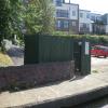
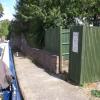
Hertford Basin Services

Hertford Basin Elsan Point, Mill Road, Hertford SG13 7GD, United Kingdom

Hertford Basin Services
is a minor waterways place
on the Lee and Stort Navigation (River Lee) between
Balance Engine House (For pumping water from the Lee into the New River) (7½ furlongs
and 1 lock
to the east) and
Hertford Basin (¼ furlongs
to the west).
The nearest place in the direction of Balance Engine House is Hertford Basin Winding Hole (Towpath side bridge, Horse Bridge No 72, Channel leading to the River Lee);
a few yards
away.
The nearest place in the direction of Hertford Basin is Hertford Lock Weir Entrance (Channel leading to the Weir - No Access);
¼ furlongs
away.
Mooring here is unrated.
Facilities: chemical toilet disposal, rubbish disposal and water point.
Hertford Lock Bridge No 69 | 3¼ furlongs | |
Hertford Lock No 1 | 3¼ furlongs | |
Marshgate Drive Bridge No 70 | 1½ furlongs | |
Mill Road Bridge No 71 | a few yards | |
Hertford Basin Winding Hole | a few yards | |
Hertford Basin Services | ||
Hertford Lock Weir Entrance | ¼ furlongs | |
Hertford Basin | ¼ furlongs | |
Hertford Pipe Bridge No 73 | ½ furlongs | |
Hertford Visitor Moorings | 1 furlong | |
The Old Barge PH | 2 furlongs |
BW key needed to use the Elsan.
There are no links to external websites from here.
Why not log in and add some (select "External websites" from the menu (sometimes this is under "Edit"))?
Mouseover for more information or show routes to facility
Nearest water point
The nearest water point is here. Others are at:
In the direction of Waltham Town Lock No 11
Stanstead Lock Water Point — 4 miles, 3¾ furlongs and 3 locks away
On this waterway in the direction of Waltham Town Lock No 11
Stanstead Marina — 4 miles, 7 furlongs and 4 locks away
On this waterway in the direction of Waltham Town Lock No 11
Feildes Weir Lock Services — 6 miles, 6½ furlongs and 5 locks away
On this waterway in the direction of Waltham Town Lock No 11
Roydon Lock No 13 — 8 miles, 3¾ furlongs and 6 locks away
Travel to Rye House Junction, then on the Lee and Stort Navigation (River Stort - Main Line) to Roydon Lock No 13
Carthagena Lock No 7 — 8 miles, 5¼ furlongs and 6 locks away
On this waterway in the direction of Waltham Town Lock No 11
Burnt Mill Visitor Moorings — 11 miles, 2¾ furlongs and 10 locks away
Travel to Rye House Junction, then on the Lee and Stort Navigation (River Stort - Main Line) to Burnt Mill Visitor Moorings
Moorhen Marina Services — 11 miles, 3¾ furlongs and 10 locks away
Travel to Rye House Junction, then on the Lee and Stort Navigation (River Stort - Main Line) to Moorhen Marina Services
Hazlemere Marina Services — 13 miles, 4¼ furlongs and 11 locks away
Travel to Waltham Town Lock No 11, then on the Lee and Stort Navigation (River Lee: commercial section) to Hazlemere Marina Services
Harlow Mill Visitor Moorings — 13 miles, 4¼ furlongs and 12 locks away
Travel to Rye House Junction, then on the Lee and Stort Navigation (River Stort - Main Line) to Harlow Mill Visitor Moorings
Wharf Road Bridge No 33 — 16 miles, 5½ furlongs and 14 locks away
Travel to Waltham Town Lock No 11, then on the Lee and Stort Navigation (River Lee: commercial section) to Wharf Road Bridge No 33
Pickett's Lock No 15 — 17 miles, 5¾ furlongs and 14 locks away
Travel to Waltham Town Lock No 11, then on the Lee and Stort Navigation (River Lee: commercial section) to Pickett's Lock No 15
Stonebridge Lock Services — 19 miles, 6 furlongs and 15 locks away
Travel to Waltham Town Lock No 11, then on the Lee and Stort Navigation (River Lee: commercial section) to Stonebridge Lock Services
Bishop's Stortford Services — 19 miles, 6¾ furlongs and 19 locks away
Travel to Rye House Junction, then on the Lee and Stort Navigation (River Stort - Main Line) to Bishop's Stortford ServicesNearest rubbish disposal
The nearest rubbish disposal is here. Others are at:
In the direction of Waltham Town Lock No 11
Feildes Weir Lock Services — 6 miles, 6½ furlongs and 5 locks away
On this waterway in the direction of Waltham Town Lock No 11
Burnt Mill Marina — 11 miles, 4 furlongs and 10 locks away
Travel to Rye House Junction, then on the Lee and Stort Navigation (River Stort - Main Line) to Burnt Mill Marina
Pickett's Lock No 15 — 17 miles, 5¾ furlongs and 14 locks away
Travel to Waltham Town Lock No 11, then on the Lee and Stort Navigation (River Lee: commercial section) to Pickett's Lock No 15
Stonebridge Lock Services — 19 miles, 6 furlongs and 15 locks away
Travel to Waltham Town Lock No 11, then on the Lee and Stort Navigation (River Lee: commercial section) to Stonebridge Lock Services
Bishop's Stortford Services — 19 miles, 6¾ furlongs and 19 locks away
Travel to Rye House Junction, then on the Lee and Stort Navigation (River Stort - Main Line) to Bishop's Stortford ServicesNearest chemical toilet disposal
The nearest chemical toilet disposal is here. Others are at:
In the direction of Waltham Town Lock No 11
Feildes Weir Lock Services — 6 miles, 6½ furlongs and 5 locks away
On this waterway in the direction of Waltham Town Lock No 11
Roydon Marina Moorings — 7 miles, 4¾ furlongs and 6 locks away
Travel to Rye House Junction, then on the Lee and Stort Navigation (River Stort - Main Line) to Roydon Marina Entrance, then on the Lee and Stort Navigation (River Stort - Roydon Marina Branch) to Roydon Marina Moorings
Moorhen Marina Services — 11 miles, 3¾ furlongs and 10 locks away
Travel to Rye House Junction, then on the Lee and Stort Navigation (River Stort - Main Line) to Moorhen Marina Services
Little Hallingbury Mill Arm Junction — 16 miles, 4 furlongs and 16 locks away
Travel to Rye House Junction, then on the Lee and Stort Navigation (River Stort - Main Line) to Little Hallingbury Mill Arm Junction
Stonebridge Lock Services — 19 miles, 6 furlongs and 15 locks away
Travel to Waltham Town Lock No 11, then on the Lee and Stort Navigation (River Lee: commercial section) to Stonebridge Lock Services
Bishop's Stortford Services — 19 miles, 6¾ furlongs and 19 locks away
Travel to Rye House Junction, then on the Lee and Stort Navigation (River Stort - Main Line) to Bishop's Stortford ServicesNearest place to turn
In the direction of Waltham Town Lock No 11
Hertford Basin Winding Hole — a few yards away
On this waterway in the direction of Waltham Town Lock No 11
River Beane Junction — 5½ furlongs and 1 lock away
On this waterway in the direction of Waltham Town Lock No 11
Ware Lock Weir Entrance — 1 mile, 6½ furlongs and 1 lock away
On this waterway in the direction of Waltham Town Lock No 11
Ware Lock Weir Exit — 1 mile, 7¼ furlongs and 2 locks away
On this waterway in the direction of Waltham Town Lock No 11
Ware Town Quay — 2 miles, 2¼ furlongs and 2 locks away
On this waterway in the direction of Waltham Town Lock No 11
Hardmead Lock Weir Entrance — 3 miles, 3 furlongs and 2 locks away
On this waterway in the direction of Waltham Town Lock No 11
Hardmead Lock Weir Exit — 3 miles, 4 furlongs and 3 locks away
On this waterway in the direction of Waltham Town Lock No 11
Stanstead Lock Weir Exit — 4 miles, 4½ furlongs and 4 locks away
On this waterway in the direction of Waltham Town Lock No 11
Stanstead Marina — 4 miles, 7 furlongs and 4 locks away
On this waterway in the direction of Waltham Town Lock No 11
Stanstead Mill Stream Junction — 5 miles, 1¾ furlongs and 4 locks away
On this waterway in the direction of Waltham Town Lock No 11
Rye House Junction — 6 miles, 5¾ furlongs and 4 locks away
On this waterway in the direction of Waltham Town Lock No 11
Brick Lock Arm — 7 miles, 4½ furlongs and 5 locks away
Travel to Rye House Junction, then on the Lee and Stort Navigation (River Stort - Main Line) to Brick Lock Arm
Dobb's Weir Lock Weir Exit — 7 miles, 7½ furlongs and 6 locks away
On this waterway in the direction of Waltham Town Lock No 11
Roydon Lock Winding Hole — 8 miles, 3¾ furlongs and 6 locks away
Travel to Rye House Junction, then on the Lee and Stort Navigation (River Stort - Main Line) to Roydon Lock Winding Hole
Old Nazeing Road Wharf — 9 miles, 1½ furlongs and 7 locks away
On this waterway in the direction of Waltham Town Lock No 11
Old Nazeing Road Arm — 9 miles, 3¼ furlongs and 7 locks away
On this waterway in the direction of Waltham Town Lock No 11
Hunsdon Mill Lock Winding Hole — 9 miles, 4 furlongs and 7 locks away
Travel to Rye House Junction, then on the Lee and Stort Navigation (River Stort - Main Line) to Hunsdon Mill Lock Winding Hole
Hunsdon Mill Lock Weir Entrance — 9 miles, 4¼ furlongs and 8 locks away
Travel to Rye House Junction, then on the Lee and Stort Navigation (River Stort - Main Line) to Hunsdon Mill Lock Weir Entrance
Eastwick Road Winding Hole — 10 miles, 4 furlongs and 8 locks away
Travel to Rye House Junction, then on the Lee and Stort Navigation (River Stort - Main Line) to Eastwick Road Winding Hole
In the direction of Hertford Town Mill Bridge
Nicholas Lane Winding Hole — 2½ furlongs away
On this waterway in the direction of Hertford Town Mill BridgeNearest self-operated pump-out
In the direction of Waltham Town Lock No 11
Moorhen Marina Services — 11 miles, 3¾ furlongs and 10 locks away
Travel to Rye House Junction, then on the Lee and Stort Navigation (River Stort - Main Line) to Moorhen Marina Services
Stonebridge Lock Services — 19 miles, 6 furlongs and 15 locks away
Travel to Waltham Town Lock No 11, then on the Lee and Stort Navigation (River Lee: commercial section) to Stonebridge Lock Services
Bishop's Stortford Services — 19 miles, 6¾ furlongs and 19 locks away
Travel to Rye House Junction, then on the Lee and Stort Navigation (River Stort - Main Line) to Bishop's Stortford ServicesNearest boatyard pump-out
In the direction of Waltham Town Lock No 11
Stanstead Marina — 4 miles, 7 furlongs and 4 locks away
On this waterway in the direction of Waltham Town Lock No 11
Roydon Marina Moorings — 7 miles, 4¾ furlongs and 6 locks away
Travel to Rye House Junction, then on the Lee and Stort Navigation (River Stort - Main Line) to Roydon Marina Entrance, then on the Lee and Stort Navigation (River Stort - Roydon Marina Branch) to Roydon Marina Moorings
Old Nazeing Road Wharf — 9 miles, 1½ furlongs and 7 locks away
On this waterway in the direction of Waltham Town Lock No 11
Little Hallingbury Mill Arm Junction — 16 miles, 4 furlongs and 16 locks away
Travel to Rye House Junction, then on the Lee and Stort Navigation (River Stort - Main Line) to Little Hallingbury Mill Arm JunctionDirection of TV transmitter (From Wolfbane Cybernetic)
There is no page on Wikipedia called “Hertford Basin Services”
Wikipedia pages that might relate to Hertford Basin Services
[Hertfordshire]
coat of arms and of the flag. Hertfordshire County Council is based in Hertford, once the main market town. In 2013, the county population was 1,140,700
[River Lea]
has tended to obscure its importance as north-south trade route. Below Hertford the river has since medieval times had alterations made to make it more
[Regent's Canal]
Broadway Market and meets the Hertford Union Canal at Victoria Park, East London. It turns south towards the Limehouse Basin, where it meets the Limehouse
[De Beauvoir Town]
In 1937, due to its easy access to Kingsland Basin, the southeast corner between Downham Road and Hertford Road was re-zoned for industrial use. Soon after
[Limehouse Cut]
Rivers Pollution Commissioners 1867, pp. 15–7. Hertford Mercury 1850d, p. 2. According to the Hertford Mercury—a warm Marchant admirer—he was really the
[River Derwent, Yorkshire]
National Park, then southwards as far as its confluence with the River Hertford then westwards through the Vale of Pickering, south through Kirkham Gorge
[North Carolina]
basins. The five basins west of the Blue Ridge Mountains flow to the Gulf of Mexico, while the remainder flow to the Atlantic Ocean. Of the 17 basins
[Grand Union Canal]
single canal in the UK. London area Regent's Canal – original company Hertford Union Canal – bought by the Regent's Canal in 1857 Main Line Warwick and
[Surrey]
and destroyed Bletchingley Castle, whose owner Gilbert de Clare, Earl of Hertford and Gloucester, was de Montfort's most powerful ally. By the 14th century
[Humber]
Retrieved 12 October 2013. "Humber Estuary". Ramsar Sites Information Service. Retrieved 25 April 2018. "Get-a-map online". Ordnance Survey. Archived
Results of Google Search
Hertford Basin - WikipediaHertford Basin is the first canal basin located on the River Lee Navigation in Hertford, England. It is situated next to Hartham Common, and Hertford Weir.
Dec 23, 2020 ... Crabtree Creek Trail Closure between Hertford Street to the North Hills ... to gravity interceptors in the Crabtree Basin Service Area of the City's ...
Nov 2, 2020 ... National Weather Service Advanced Hydrologic Prediction Service (AHPS) ... NOTE: Forecasts are not available for the Perquimans River at Hertford. ... Southeast River Forecast Center - Support for Chowan River Basin ...
Apr 10, 2018 ... Permit #: NC0021849 Facility: Hertford WWTP Owner: Town of Hertford County: ... NCDEQ Services in Response to COVID-19. Based on ... 0.7 MGD treated wastewater to the Perquimans River in the Pasquotank River Basin.
Hertford features a classic floral color palette and design. Pink and red roses cover the rim of the plate, and the design is surrounded by an infinity etching on the ...
USDA Logo. United States Department of Agriculture · Farm Service Agency · United States Department of Agriculture · Farm Service Agency. North Carolina. 37.