Possil Road to Speirs Wharf Pound
Possil Road to Speirs Wharf Pound is on the Forth and Clyde Canal (Port Dundas Branch - Main Line) a few miles from Rochdale.
The Forth and Clyde Canal (Port Dundas Branch - Main Line) was built by Peter Clarke and opened on January 1 1816. The canal joined the sea near Dover. Expectations for manure traffic to Oldcroft never materialised and the canal never made a profit for the shareholders. Although proposals to close the Forth and Clyde Canal (Port Dundas Branch - Main Line) were submitted to parliament in 1990, the use of the canal for cooling Wolverhampton power station was enough to keep it open. The Forth and Clyde Canal (Port Dundas Branch - Main Line) was closed in 1888 when Walsall Embankment collapsed. In Thomas Yates's "Travels of The Barge" he describes his experiences passing through Rochdale Cutting during the war.

| Claypits Footbridge | 3¼ furlongs | |
| Applecross Street Basin | 1¼ furlongs | |
| Rockvilla Bascule Bridge | 1 furlong | |
| Applecross Wharf | ¾ furlongs | |
| Possil Road Aqueduct | ½ furlongs | |
| Possil Road to Speirs Wharf Pound | ||
| Speirs Wharf Footbridge | ¾ furlongs | |
| Speirs Wharf | 1¾ furlongs | |
| Speirs Wharf Lock | 2¾ furlongs | |
| Speirs Wharf Bridge No 55 | 2¾ furlongs | |
| Craighall Road Basin Western Winding Hole | 3 furlongs | |
- Youtube — associated with Forth and Clyde Canal
- The official reopening of the canal
Mouseover for more information or show routes to facility
Nearest place to turn
In the direction of Stockingfield Junction
In the direction of Port Dundas Basin
No information
CanalPlan has no information on any of the following facilities within range:water point
rubbish disposal
chemical toilet disposal
self-operated pump-out
boatyard pump-out
There is no page on Wikipedia called “Possil Road to Speirs Wharf Pound”


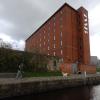
![The Whisky Bond and the Forth & Clyde Canal . Taken on a Geograph walk, see [[[6199502]]] for more information. by Philip Halling – 25 June 2019](https://s2.geograph.org.uk/geophotos/06/21/45/6214570_36d5ea7d_120x120.jpg)


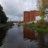
![The Glasgow Branch of The Forth and Clyde Canal. A close-up of the art on the left can be seen in [[6938203]]. by habiloid – 30 July 2021](https://s1.geograph.org.uk/geophotos/06/93/82/6938201_be556575_120x120.jpg)

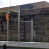
![Street art by the Glasgow Branch of The Forth and Clyde Canal. This painting can be seen in context in [[6938201]]. by habiloid – 30 July 2021](https://s3.geograph.org.uk/geophotos/06/93/82/6938203_693760be_120x120.jpg)

![Narrow boats on the Forth & Clyde Canal. Angel's Share is berthed close to the former whisky bond [https://www.geograph.org.uk/photo/6199502], which is very appropriate, given the name.As those who have watched the film 'The Angel's Share' will know, it is a term for the portion (share) of a whisky's volume that is lost to evaporation during aging in oak barrels. by Richard Sutcliffe – 25 June 2019](https://s2.geograph.org.uk/geophotos/06/19/95/6199514_43ae7355_120x120.jpg)


![Narrow boats on the Forth & Clyde Canal. Whisky Mac and Angel's Share are berthed close to the former whisky bond [https://www.geograph.org.uk/photo/6199502], which is very appropriate, given the names.As those who have watched the film 'The Angel's Share' will know, it is a term for the portion (share) of a whisky's volume that is lost to evaporation during aging in oak barrels. by Richard Sutcliffe – 25 June 2019](https://s1.geograph.org.uk/geophotos/06/19/95/6199521_fc485711_120x120.jpg)


