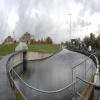
Craighall Road Basin Western Winding Hole is on the Forth and Clyde Canal (Port Dundas Branch - Main Line).
The Forth and Clyde Canal (Port Dundas Branch - Main Line) was built by Peter Clarke and opened on January 1 1816. The canal joined the sea near Dover. Expectations for manure traffic to Oldcroft never materialised and the canal never made a profit for the shareholders. Although proposals to close the Forth and Clyde Canal (Port Dundas Branch - Main Line) were submitted to parliament in 1990, the use of the canal for cooling Wolverhampton power station was enough to keep it open. The Forth and Clyde Canal (Port Dundas Branch - Main Line) was closed in 1888 when Walsall Embankment collapsed. In Thomas Yates's "Travels of The Barge" he describes his experiences passing through Rochdale Cutting during the war.

You can wind here.
| Possil Road to Speirs Wharf Pound | 3 furlongs | |
| Speirs Wharf Footbridge | 2¼ furlongs | |
| Speirs Wharf | 1¼ furlongs | |
| Speirs Wharf Lock | ¼ furlongs | |
| Speirs Wharf Bridge No 55 | ¼ furlongs | |
| Craighall Road Basin Western Winding Hole | ||
| Craighall Road Basin | ½ furlongs | |
| Craighall Road Bridge No 56 | 1 furlong | |
| Craighall Road Lock | 1 furlong | |
| Pinkston Basin | 1¾ furlongs | |
| Middle Wharf Street Footbridge | 2¼ furlongs | |
- Youtube — associated with Forth and Clyde Canal
- The official reopening of the canal
Mouseover for more information or show routes to facility
Nearest place to turn
In the direction of Stockingfield Junction
In the direction of Port Dundas Basin
No information
CanalPlan has no information on any of the following facilities within range:water point
rubbish disposal
chemical toilet disposal
self-operated pump-out
boatyard pump-out
There is no page on Wikipedia called “Craighall Road Basin Western Winding Hole”


![South end of the canal tunnel below Speaker Martin's Lock. The canal between Speirs Wharf and Pinkston Basin had to be dropped to get under a couple of roads when the area was redeveloped. For a wider view see [[3599613]]. by Stephen Craven – 25 June 2019](https://s0.geograph.org.uk/geophotos/06/32/29/6322956_f26a81e7_120x120.jpg)


![Forth and Clyde Canal [3]. Seen from the walkway the canal passes under this bridge and immediately enters the second lock of the drop lock constructed in 2006 to allow the Port Dundas basin, cut off by the construction of the M8 motorway, to be re-connected to the rest of the canal. Beyond the lock the Glasgow Branch is a Scheduled Monument with details at: http://portal.historicenvironment.scot/designation/SM6771The Forth and Clyde Canal was completed in 1790 and it provided a route for vessels between the Firth of Forth and the Firth of Clyde at the narrowest part (35 miles, 56km) of the Scottish Lowlands. Closed in 1963, the canal became semi-derelict. Millennium funds were used to regenerate the canal. by Michael Dibb – 25 June 2019](https://s2.geograph.org.uk/geophotos/06/24/35/6243566_c40a9816_120x120.jpg)


![Forth and Clyde Canal [4]. One end of the drop lock constructed in 2006 to allow the Port Dundas basin, cut off by the construction of the M8 motorway, to be re-connected to the rest of the canal. The Glasgow Branch of the canal is a Scheduled Monument with details at: http://portal.historicenvironment.scot/designation/SM6771The Forth and Clyde Canal was completed in 1790 and it provided a route for vessels between the Firth of Forth and the Firth of Clyde at the narrowest part (35 miles, 56km) of the Scottish Lowlands. Closed in 1963, the canal became semi-derelict. Millennium funds were used to regenerate the canal. by Michael Dibb – 25 June 2019](https://s0.geograph.org.uk/geophotos/06/24/35/6243568_3cff53ae_120x120.jpg)

![Speaker Martin's lock from the east side. The lock is described in [[6198429]]. This view looks east showing the flats beyond. by Alec MacKinnon – 04 March 2020](https://s2.geograph.org.uk/geophotos/06/40/48/6404850_47da9669_120x120.jpg)


![Glasgow buildings [5]. Built in 1812, Canal House is the late Georgian canal-side former offices of the Forth and Clyde Canal Company. Restored in 1990 the building now provides commercial office space. Listed, category B, with details at: http://portal.historicenvironment.scot/designation/LB33618 by Michael Dibb – 25 June 2019](https://s3.geograph.org.uk/geophotos/06/24/35/6243579_7492b615_120x120.jpg)


