Harts Lane Footbridge
Cowbridge Lane, London IG11 8LH, United Kingdom

Harts Lane Footbridge
is a minor waterways place
on the River Roding (River Roding Trust section) between
Town Quay Basin (1¼ furlongs
to the southeast) and
Ilford Bridge (Limit of Navigation ) (3 furlongs
to the north).
The nearest place in the direction of Town Quay Basin is Barking Bridge;
¾ furlongs
away.
The nearest place in the direction of Ilford Bridge is River Roding Trust Moorings (Long term community moorings operated by the River Roding Trust.);
¼ furlongs
away.
There may be access to the towpath here.
Mooring here is unrated.
There is a bridge here which takes pedestrian traffic over the canal.
| Highbridge Road Bridge | 1¼ furlongs | |
| Barking Bridge | ¾ furlongs | |
| Harts Lane Footbridge | ||
| River Roding Trust Moorings | ¼ furlongs | |
| District Line Railway Bridges | ¾ furlongs | |
| Iford Bridge Winding Hole | 3 furlongs | |
| Ilford Bridge | 3 furlongs | |
Amenities here
Amenities nearby at River Roding Trust Moorings
Amenities nearby at Barking Bridge
Amenities in Barking
Amenities at other places in Barking
There are no links to external websites from here.
Why not log in and add some (select "External websites" from the menu (sometimes this is under "Edit"))?
Mouseover for more information or show routes to facility
Nearest water point
In the direction of Highbridge Road Bridge
Tail of Bow Locks — 7 miles, 5¾ furlongs and 1 lock away
Travel to Highbridge Road Bridge, then on the River Roding (Port of London Authority section) to Thames - Barking Creek (River Roding) Junction, then on the River Thames (tidal section below the flood barrier) to Thames Flood Barrier, then on the River Thames (tidal section) to Bow Creek Junction, then on the Lee and Stort Navigation (Bow Creek) to Tail of Bow Locks
Limehouse Basin — 9 miles, 1 furlong and 2 locks away
Travel to Highbridge Road Bridge, then on the River Roding (Port of London Authority section) to Thames - Barking Creek (River Roding) Junction, then on the River Thames (tidal section below the flood barrier) to Thames Flood Barrier, then on the River Thames (tidal section) to Bow Creek Junction, then on the Lee and Stort Navigation (Bow Creek) to Tail of Bow Locks, then on the Lee and Stort Navigation (Bow Lock) to Head of Bow Locks, then on the Lee and Stort Navigation (Limehouse Cut) to Limehouse Basin
Old Ford Lock No 19 — 8 miles, 7¾ furlongs and 2 locks away
Travel to Highbridge Road Bridge, then on the River Roding (Port of London Authority section) to Thames - Barking Creek (River Roding) Junction, then on the River Thames (tidal section below the flood barrier) to Thames Flood Barrier, then on the River Thames (tidal section) to Bow Creek Junction, then on the Lee and Stort Navigation (Bow Creek) to Tail of Bow Locks, then on the Lee and Stort Navigation (Bow Lock) to Head of Bow Locks, then on the Lee and Stort Navigation (River Lee: commercial section) to Old Ford Lock No 19
East Wick Service Wharf — 9 miles, 5½ furlongs and 3 locks away
Travel to Highbridge Road Bridge, then on the River Roding (Port of London Authority section) to Thames - Barking Creek (River Roding) Junction, then on the River Thames (tidal section below the flood barrier) to Thames Flood Barrier, then on the River Thames (tidal section) to Bow Creek Junction, then on the Lee and Stort Navigation (Bow Creek) to Tail of Bow Locks, then on the Lee and Stort Navigation (Bow Lock) to Head of Bow Locks, then on the Lee and Stort Navigation (River Lee: commercial section) to East Wick Service Wharf
Meath Gardens Footbridge No 55A — 10 miles, 2½ furlongs and 6 locks away
Travel to Highbridge Road Bridge, then on the River Roding (Port of London Authority section) to Thames - Barking Creek (River Roding) Junction, then on the River Thames (tidal section below the flood barrier) to Thames Flood Barrier, then on the River Thames (tidal section) to Bow Creek Junction, then on the Lee and Stort Navigation (Bow Creek) to Tail of Bow Locks, then on the Lee and Stort Navigation (Bow Lock) to Head of Bow Locks, then on the Lee and Stort Navigation (Limehouse Cut) to Limehouse Basin, then on the Grand Union Canal (Regent's Canal) to Meath Gardens Footbridge No 55A
Victoria Park Services — 10 miles, 3½ furlongs and 7 locks away
Travel to Highbridge Road Bridge, then on the River Roding (Port of London Authority section) to Thames - Barking Creek (River Roding) Junction, then on the River Thames (tidal section below the flood barrier) to Thames Flood Barrier, then on the River Thames (tidal section) to Bow Creek Junction, then on the Lee and Stort Navigation (Bow Creek) to Tail of Bow Locks, then on the Lee and Stort Navigation (Bow Lock) to Head of Bow Locks, then on the Lee and Stort Navigation (River Lee: commercial section) to Hertford Union Canal Junction, then on the Grand Union Canal (Hertford Union Canal) to Hertford Union Junction, then on the Grand Union Canal (Regent's Canal) to Victoria Park Services
Stonebridge Lock Services — 14 miles and 5 locks away
Travel to Highbridge Road Bridge, then on the River Roding (Port of London Authority section) to Thames - Barking Creek (River Roding) Junction, then on the River Thames (tidal section below the flood barrier) to Thames Flood Barrier, then on the River Thames (tidal section) to Bow Creek Junction, then on the Lee and Stort Navigation (Bow Creek) to Tail of Bow Locks, then on the Lee and Stort Navigation (Bow Lock) to Head of Bow Locks, then on the Lee and Stort Navigation (River Lee: commercial section) to Stonebridge Lock Services
Pickett's Lock No 15 — 16 miles, ¼ furlongs and 5 locks away
Travel to Highbridge Road Bridge, then on the River Roding (Port of London Authority section) to Thames - Barking Creek (River Roding) Junction, then on the River Thames (tidal section below the flood barrier) to Thames Flood Barrier, then on the River Thames (tidal section) to Bow Creek Junction, then on the Lee and Stort Navigation (Bow Creek) to Tail of Bow Locks, then on the Lee and Stort Navigation (Bow Lock) to Head of Bow Locks, then on the Lee and Stort Navigation (River Lee: commercial section) to Pickett's Lock No 15
City Road Service Mooring — 12 miles, 7¾ furlongs and 10 locks away
Travel to Highbridge Road Bridge, then on the River Roding (Port of London Authority section) to Thames - Barking Creek (River Roding) Junction, then on the River Thames (tidal section below the flood barrier) to Thames Flood Barrier, then on the River Thames (tidal section) to Bow Creek Junction, then on the Lee and Stort Navigation (Bow Creek) to Tail of Bow Locks, then on the Lee and Stort Navigation (Bow Lock) to Head of Bow Locks, then on the Lee and Stort Navigation (River Lee: commercial section) to Hertford Union Canal Junction, then on the Grand Union Canal (Hertford Union Canal) to Hertford Union Junction, then on the Grand Union Canal (Regent's Canal) to City Road Service Mooring
Wharf Road Bridge No 33 — 17 miles, ¼ furlongs and 6 locks away
Travel to Highbridge Road Bridge, then on the River Roding (Port of London Authority section) to Thames - Barking Creek (River Roding) Junction, then on the River Thames (tidal section below the flood barrier) to Thames Flood Barrier, then on the River Thames (tidal section) to Bow Creek Junction, then on the Lee and Stort Navigation (Bow Creek) to Tail of Bow Locks, then on the Lee and Stort Navigation (Bow Lock) to Head of Bow Locks, then on the Lee and Stort Navigation (River Lee: commercial section) to Wharf Road Bridge No 33
St Pancras Lock No 4 — 14 miles, 2¼ furlongs and 10 locks away
Travel to Highbridge Road Bridge, then on the River Roding (Port of London Authority section) to Thames - Barking Creek (River Roding) Junction, then on the River Thames (tidal section below the flood barrier) to Thames Flood Barrier, then on the River Thames (tidal section) to Bow Creek Junction, then on the Lee and Stort Navigation (Bow Creek) to Tail of Bow Locks, then on the Lee and Stort Navigation (Bow Lock) to Head of Bow Locks, then on the Lee and Stort Navigation (River Lee: commercial section) to Hertford Union Canal Junction, then on the Grand Union Canal (Hertford Union Canal) to Hertford Union Junction, then on the Grand Union Canal (Regent's Canal) to St Pancras Lock No 4
Westbourne Terrace Bridge No 3C — 17 miles, 2¼ furlongs and 14 locks away
Travel to Highbridge Road Bridge, then on the River Roding (Port of London Authority section) to Thames - Barking Creek (River Roding) Junction, then on the River Thames (tidal section below the flood barrier) to Thames Flood Barrier, then on the River Thames (tidal section) to Bow Creek Junction, then on the Lee and Stort Navigation (Bow Creek) to Tail of Bow Locks, then on the Lee and Stort Navigation (Bow Lock) to Head of Bow Locks, then on the Lee and Stort Navigation (River Lee: commercial section) to Hertford Union Canal Junction, then on the Grand Union Canal (Hertford Union Canal) to Hertford Union Junction, then on the Grand Union Canal (Regent's Canal) to Little Venice, then on the Grand Union Canal (Paddington Branch) to Westbourne Terrace Bridge No 3C
Little Venice Services — 17 miles, 2½ furlongs and 14 locks away
Travel to Highbridge Road Bridge, then on the River Roding (Port of London Authority section) to Thames - Barking Creek (River Roding) Junction, then on the River Thames (tidal section below the flood barrier) to Thames Flood Barrier, then on the River Thames (tidal section) to Bow Creek Junction, then on the Lee and Stort Navigation (Bow Creek) to Tail of Bow Locks, then on the Lee and Stort Navigation (Bow Lock) to Head of Bow Locks, then on the Lee and Stort Navigation (River Lee: commercial section) to Hertford Union Canal Junction, then on the Grand Union Canal (Hertford Union Canal) to Hertford Union Junction, then on the Grand Union Canal (Regent's Canal) to Little Venice, then on the Grand Union Canal (Paddington Branch) to Little Venice Services
Diesel Boat MB Ash — 17 miles, 3 furlongs and 14 locks away
Travel to Highbridge Road Bridge, then on the River Roding (Port of London Authority section) to Thames - Barking Creek (River Roding) Junction, then on the River Thames (tidal section below the flood barrier) to Thames Flood Barrier, then on the River Thames (tidal section) to Bow Creek Junction, then on the Lee and Stort Navigation (Bow Creek) to Tail of Bow Locks, then on the Lee and Stort Navigation (Bow Lock) to Head of Bow Locks, then on the Lee and Stort Navigation (River Lee: commercial section) to Hertford Union Canal Junction, then on the Grand Union Canal (Hertford Union Canal) to Hertford Union Junction, then on the Grand Union Canal (Regent's Canal) to Little Venice, then on the Grand Union Canal (Paddington Branch) to Diesel Boat MB Ash
Mitre Bridge No 6 — 19 miles, 5¾ furlongs and 14 locks away
Travel to Highbridge Road Bridge, then on the River Roding (Port of London Authority section) to Thames - Barking Creek (River Roding) Junction, then on the River Thames (tidal section below the flood barrier) to Thames Flood Barrier, then on the River Thames (tidal section) to Bow Creek Junction, then on the Lee and Stort Navigation (Bow Creek) to Tail of Bow Locks, then on the Lee and Stort Navigation (Bow Lock) to Head of Bow Locks, then on the Lee and Stort Navigation (River Lee: commercial section) to Hertford Union Canal Junction, then on the Grand Union Canal (Hertford Union Canal) to Hertford Union Junction, then on the Grand Union Canal (Regent's Canal) to Little Venice, then on the Grand Union Canal (Paddington Branch) to Mitre Bridge No 6
Mary Seacole Gardens — 19 miles, 6 furlongs and 14 locks away
Travel to Highbridge Road Bridge, then on the River Roding (Port of London Authority section) to Thames - Barking Creek (River Roding) Junction, then on the River Thames (tidal section below the flood barrier) to Thames Flood Barrier, then on the River Thames (tidal section) to Bow Creek Junction, then on the Lee and Stort Navigation (Bow Creek) to Tail of Bow Locks, then on the Lee and Stort Navigation (Bow Lock) to Head of Bow Locks, then on the Lee and Stort Navigation (River Lee: commercial section) to Hertford Union Canal Junction, then on the Grand Union Canal (Hertford Union Canal) to Hertford Union Junction, then on the Grand Union Canal (Regent's Canal) to Little Venice, then on the Grand Union Canal (Paddington Branch) to Mary Seacole GardensNearest rubbish disposal
In the direction of Highbridge Road Bridge
Old Ford Lock No 19 — 8 miles, 7¾ furlongs and 2 locks away
Travel to Highbridge Road Bridge, then on the River Roding (Port of London Authority section) to Thames - Barking Creek (River Roding) Junction, then on the River Thames (tidal section below the flood barrier) to Thames Flood Barrier, then on the River Thames (tidal section) to Bow Creek Junction, then on the Lee and Stort Navigation (Bow Creek) to Tail of Bow Locks, then on the Lee and Stort Navigation (Bow Lock) to Head of Bow Locks, then on the Lee and Stort Navigation (River Lee: commercial section) to Old Ford Lock No 19
Limehouse Lock No 13 — 9 miles, 1¾ furlongs and 2 locks away
Travel to Highbridge Road Bridge, then on the River Roding (Port of London Authority section) to Thames - Barking Creek (River Roding) Junction, then on the River Thames (tidal section below the flood barrier) to Thames Flood Barrier, then on the River Thames (tidal section) to Bow Creek Junction, then on the Lee and Stort Navigation (Bow Creek) to Tail of Bow Locks, then on the Lee and Stort Navigation (Bow Lock) to Head of Bow Locks, then on the Lee and Stort Navigation (Limehouse Cut) to Limehouse Basin, then on the Grand Union Canal (Regent's Canal) to Limehouse Lock No 13
Wick Lane Bridge — 9 miles, 4 furlongs and 4 locks away
Travel to Highbridge Road Bridge, then on the River Roding (Port of London Authority section) to Thames - Barking Creek (River Roding) Junction, then on the River Thames (tidal section below the flood barrier) to Thames Flood Barrier, then on the River Thames (tidal section) to Bow Creek Junction, then on the Lee and Stort Navigation (Bow Creek) to Tail of Bow Locks, then on the Lee and Stort Navigation (Bow Lock) to Head of Bow Locks, then on the Lee and Stort Navigation (River Lee: commercial section) to Hertford Union Canal Junction, then on the Grand Union Canal (Hertford Union Canal) to Wick Lane Bridge
Victoria Park Services — 10 miles, 3½ furlongs and 7 locks away
Travel to Highbridge Road Bridge, then on the River Roding (Port of London Authority section) to Thames - Barking Creek (River Roding) Junction, then on the River Thames (tidal section below the flood barrier) to Thames Flood Barrier, then on the River Thames (tidal section) to Bow Creek Junction, then on the Lee and Stort Navigation (Bow Creek) to Tail of Bow Locks, then on the Lee and Stort Navigation (Bow Lock) to Head of Bow Locks, then on the Lee and Stort Navigation (River Lee: commercial section) to Hertford Union Canal Junction, then on the Grand Union Canal (Hertford Union Canal) to Hertford Union Junction, then on the Grand Union Canal (Regent's Canal) to Victoria Park Services
Stonebridge Lock Services — 14 miles and 5 locks away
Travel to Highbridge Road Bridge, then on the River Roding (Port of London Authority section) to Thames - Barking Creek (River Roding) Junction, then on the River Thames (tidal section below the flood barrier) to Thames Flood Barrier, then on the River Thames (tidal section) to Bow Creek Junction, then on the Lee and Stort Navigation (Bow Creek) to Tail of Bow Locks, then on the Lee and Stort Navigation (Bow Lock) to Head of Bow Locks, then on the Lee and Stort Navigation (River Lee: commercial section) to Stonebridge Lock Services
Pickett's Lock No 15 — 16 miles, ¼ furlongs and 5 locks away
Travel to Highbridge Road Bridge, then on the River Roding (Port of London Authority section) to Thames - Barking Creek (River Roding) Junction, then on the River Thames (tidal section below the flood barrier) to Thames Flood Barrier, then on the River Thames (tidal section) to Bow Creek Junction, then on the Lee and Stort Navigation (Bow Creek) to Tail of Bow Locks, then on the Lee and Stort Navigation (Bow Lock) to Head of Bow Locks, then on the Lee and Stort Navigation (River Lee: commercial section) to Pickett's Lock No 15
City Road Service Mooring — 12 miles, 7¾ furlongs and 10 locks away
Travel to Highbridge Road Bridge, then on the River Roding (Port of London Authority section) to Thames - Barking Creek (River Roding) Junction, then on the River Thames (tidal section below the flood barrier) to Thames Flood Barrier, then on the River Thames (tidal section) to Bow Creek Junction, then on the Lee and Stort Navigation (Bow Creek) to Tail of Bow Locks, then on the Lee and Stort Navigation (Bow Lock) to Head of Bow Locks, then on the Lee and Stort Navigation (River Lee: commercial section) to Hertford Union Canal Junction, then on the Grand Union Canal (Hertford Union Canal) to Hertford Union Junction, then on the Grand Union Canal (Regent's Canal) to City Road Service Mooring
St Pancras Lock No 4 — 14 miles, 2¼ furlongs and 10 locks away
Travel to Highbridge Road Bridge, then on the River Roding (Port of London Authority section) to Thames - Barking Creek (River Roding) Junction, then on the River Thames (tidal section below the flood barrier) to Thames Flood Barrier, then on the River Thames (tidal section) to Bow Creek Junction, then on the Lee and Stort Navigation (Bow Creek) to Tail of Bow Locks, then on the Lee and Stort Navigation (Bow Lock) to Head of Bow Locks, then on the Lee and Stort Navigation (River Lee: commercial section) to Hertford Union Canal Junction, then on the Grand Union Canal (Hertford Union Canal) to Hertford Union Junction, then on the Grand Union Canal (Regent's Canal) to St Pancras Lock No 4
St Pancras Basin — 14 miles, 2½ furlongs and 11 locks away
Travel to Highbridge Road Bridge, then on the River Roding (Port of London Authority section) to Thames - Barking Creek (River Roding) Junction, then on the River Thames (tidal section below the flood barrier) to Thames Flood Barrier, then on the River Thames (tidal section) to Bow Creek Junction, then on the Lee and Stort Navigation (Bow Creek) to Tail of Bow Locks, then on the Lee and Stort Navigation (Bow Lock) to Head of Bow Locks, then on the Lee and Stort Navigation (River Lee: commercial section) to Hertford Union Canal Junction, then on the Grand Union Canal (Hertford Union Canal) to Hertford Union Junction, then on the Grand Union Canal (Regent's Canal) to St Pancras Basin
Little Venice Services — 17 miles, 2½ furlongs and 14 locks away
Travel to Highbridge Road Bridge, then on the River Roding (Port of London Authority section) to Thames - Barking Creek (River Roding) Junction, then on the River Thames (tidal section below the flood barrier) to Thames Flood Barrier, then on the River Thames (tidal section) to Bow Creek Junction, then on the Lee and Stort Navigation (Bow Creek) to Tail of Bow Locks, then on the Lee and Stort Navigation (Bow Lock) to Head of Bow Locks, then on the Lee and Stort Navigation (River Lee: commercial section) to Hertford Union Canal Junction, then on the Grand Union Canal (Hertford Union Canal) to Hertford Union Junction, then on the Grand Union Canal (Regent's Canal) to Little Venice, then on the Grand Union Canal (Paddington Branch) to Little Venice Services
Kensal Green Bridge No 4 — 18 miles, 7 furlongs and 14 locks away
Travel to Highbridge Road Bridge, then on the River Roding (Port of London Authority section) to Thames - Barking Creek (River Roding) Junction, then on the River Thames (tidal section below the flood barrier) to Thames Flood Barrier, then on the River Thames (tidal section) to Bow Creek Junction, then on the Lee and Stort Navigation (Bow Creek) to Tail of Bow Locks, then on the Lee and Stort Navigation (Bow Lock) to Head of Bow Locks, then on the Lee and Stort Navigation (River Lee: commercial section) to Hertford Union Canal Junction, then on the Grand Union Canal (Hertford Union Canal) to Hertford Union Junction, then on the Grand Union Canal (Regent's Canal) to Little Venice, then on the Grand Union Canal (Paddington Branch) to Kensal Green Bridge No 4Nearest chemical toilet disposal
In the direction of Highbridge Road Bridge
Limehouse Basin — 9 miles, 1 furlong and 2 locks away
Travel to Highbridge Road Bridge, then on the River Roding (Port of London Authority section) to Thames - Barking Creek (River Roding) Junction, then on the River Thames (tidal section below the flood barrier) to Thames Flood Barrier, then on the River Thames (tidal section) to Bow Creek Junction, then on the Lee and Stort Navigation (Bow Creek) to Tail of Bow Locks, then on the Lee and Stort Navigation (Bow Lock) to Head of Bow Locks, then on the Lee and Stort Navigation (Limehouse Cut) to Limehouse Basin
Old Ford Lock No 19 — 8 miles, 7¾ furlongs and 2 locks away
Travel to Highbridge Road Bridge, then on the River Roding (Port of London Authority section) to Thames - Barking Creek (River Roding) Junction, then on the River Thames (tidal section below the flood barrier) to Thames Flood Barrier, then on the River Thames (tidal section) to Bow Creek Junction, then on the Lee and Stort Navigation (Bow Creek) to Tail of Bow Locks, then on the Lee and Stort Navigation (Bow Lock) to Head of Bow Locks, then on the Lee and Stort Navigation (River Lee: commercial section) to Old Ford Lock No 19
Victoria Park Services — 10 miles, 3½ furlongs and 7 locks away
Travel to Highbridge Road Bridge, then on the River Roding (Port of London Authority section) to Thames - Barking Creek (River Roding) Junction, then on the River Thames (tidal section below the flood barrier) to Thames Flood Barrier, then on the River Thames (tidal section) to Bow Creek Junction, then on the Lee and Stort Navigation (Bow Creek) to Tail of Bow Locks, then on the Lee and Stort Navigation (Bow Lock) to Head of Bow Locks, then on the Lee and Stort Navigation (River Lee: commercial section) to Hertford Union Canal Junction, then on the Grand Union Canal (Hertford Union Canal) to Hertford Union Junction, then on the Grand Union Canal (Regent's Canal) to Victoria Park Services
Acton's Lock No 7 — 11 miles, 2½ furlongs and 7 locks away
Travel to Highbridge Road Bridge, then on the River Roding (Port of London Authority section) to Thames - Barking Creek (River Roding) Junction, then on the River Thames (tidal section below the flood barrier) to Thames Flood Barrier, then on the River Thames (tidal section) to Bow Creek Junction, then on the Lee and Stort Navigation (Bow Creek) to Tail of Bow Locks, then on the Lee and Stort Navigation (Bow Lock) to Head of Bow Locks, then on the Lee and Stort Navigation (River Lee: commercial section) to Hertford Union Canal Junction, then on the Grand Union Canal (Hertford Union Canal) to Hertford Union Junction, then on the Grand Union Canal (Regent's Canal) to Acton's Lock No 7
Stonebridge Lock Services — 14 miles and 5 locks away
Travel to Highbridge Road Bridge, then on the River Roding (Port of London Authority section) to Thames - Barking Creek (River Roding) Junction, then on the River Thames (tidal section below the flood barrier) to Thames Flood Barrier, then on the River Thames (tidal section) to Bow Creek Junction, then on the Lee and Stort Navigation (Bow Creek) to Tail of Bow Locks, then on the Lee and Stort Navigation (Bow Lock) to Head of Bow Locks, then on the Lee and Stort Navigation (River Lee: commercial section) to Stonebridge Lock Services
St Pancras Lock No 4 — 14 miles, 2¼ furlongs and 10 locks away
Travel to Highbridge Road Bridge, then on the River Roding (Port of London Authority section) to Thames - Barking Creek (River Roding) Junction, then on the River Thames (tidal section below the flood barrier) to Thames Flood Barrier, then on the River Thames (tidal section) to Bow Creek Junction, then on the Lee and Stort Navigation (Bow Creek) to Tail of Bow Locks, then on the Lee and Stort Navigation (Bow Lock) to Head of Bow Locks, then on the Lee and Stort Navigation (River Lee: commercial section) to Hertford Union Canal Junction, then on the Grand Union Canal (Hertford Union Canal) to Hertford Union Junction, then on the Grand Union Canal (Regent's Canal) to St Pancras Lock No 4
St Pancras Basin — 14 miles, 2½ furlongs and 11 locks away
Travel to Highbridge Road Bridge, then on the River Roding (Port of London Authority section) to Thames - Barking Creek (River Roding) Junction, then on the River Thames (tidal section below the flood barrier) to Thames Flood Barrier, then on the River Thames (tidal section) to Bow Creek Junction, then on the Lee and Stort Navigation (Bow Creek) to Tail of Bow Locks, then on the Lee and Stort Navigation (Bow Lock) to Head of Bow Locks, then on the Lee and Stort Navigation (River Lee: commercial section) to Hertford Union Canal Junction, then on the Grand Union Canal (Hertford Union Canal) to Hertford Union Junction, then on the Grand Union Canal (Regent's Canal) to St Pancras Basin
Little Venice Services — 17 miles, 2½ furlongs and 14 locks away
Travel to Highbridge Road Bridge, then on the River Roding (Port of London Authority section) to Thames - Barking Creek (River Roding) Junction, then on the River Thames (tidal section below the flood barrier) to Thames Flood Barrier, then on the River Thames (tidal section) to Bow Creek Junction, then on the Lee and Stort Navigation (Bow Creek) to Tail of Bow Locks, then on the Lee and Stort Navigation (Bow Lock) to Head of Bow Locks, then on the Lee and Stort Navigation (River Lee: commercial section) to Hertford Union Canal Junction, then on the Grand Union Canal (Hertford Union Canal) to Hertford Union Junction, then on the Grand Union Canal (Regent's Canal) to Little Venice, then on the Grand Union Canal (Paddington Branch) to Little Venice ServicesNearest place to turn
In the direction of Ilford Bridge
Iford Bridge Winding Hole — 3 furlongs away
On this waterway in the direction of Ilford Bridge
In the direction of Highbridge Road Bridge
Town Quay Basin — 1¼ furlongs away
Travel to Highbridge Road Bridge, then on the River Roding (Port of London Authority section) to Town Quay Basin
Bow Creek Junction — 5 miles, 5¾ furlongs and 1 lock away
Travel to Highbridge Road Bridge, then on the River Roding (Port of London Authority section) to Thames - Barking Creek (River Roding) Junction, then on the River Thames (tidal section below the flood barrier) to Thames Flood Barrier, then on the River Thames (tidal section) to Bow Creek Junction
Tail of Bow Locks — 7 miles, 5¾ furlongs and 1 lock away
Travel to Highbridge Road Bridge, then on the River Roding (Port of London Authority section) to Thames - Barking Creek (River Roding) Junction, then on the River Thames (tidal section below the flood barrier) to Thames Flood Barrier, then on the River Thames (tidal section) to Bow Creek Junction, then on the Lee and Stort Navigation (Bow Creek) to Tail of Bow Locks
Head of Bow Creek (Three Mills) — 8 miles, ¼ furlongs and 1 lock away
Travel to Highbridge Road Bridge, then on the River Roding (Port of London Authority section) to Thames - Barking Creek (River Roding) Junction, then on the River Thames (tidal section below the flood barrier) to Thames Flood Barrier, then on the River Thames (tidal section) to Bow Creek Junction, then on the Lee and Stort Navigation (Bow Creek) to Head of Bow Creek (Three Mills)
Head of Bow Locks — 7 miles, 6½ furlongs and 2 locks away
Travel to Highbridge Road Bridge, then on the River Roding (Port of London Authority section) to Thames - Barking Creek (River Roding) Junction, then on the River Thames (tidal section below the flood barrier) to Thames Flood Barrier, then on the River Thames (tidal section) to Bow Creek Junction, then on the Lee and Stort Navigation (Bow Creek) to Tail of Bow Locks, then on the Lee and Stort Navigation (Bow Lock) to Head of Bow Locks
Three Mills - Prescott Junction — 8 miles, 3½ furlongs and 2 locks away
Travel to Highbridge Road Bridge, then on the River Roding (Port of London Authority section) to Thames - Barking Creek (River Roding) Junction, then on the River Thames (tidal section below the flood barrier) to Thames Flood Barrier, then on the River Thames (tidal section) to Bow Creek Junction, then on the Lee and Stort Navigation (Bow Creek) to Head of Bow Creek (Three Mills), then on the Lee and Stort Navigation - Bow Back Rivers (Channelsea River) to Channelsea - Prescott Junction, then on the Lee and Stort Navigation - Bow Back Rivers (Prescott Channel) to Three Mills - Prescott Junction
Dartford Lock Winding Hole — 9 miles, 3 furlongs and 1 lock away
Travel to Highbridge Road Bridge, then on the River Roding (Port of London Authority section) to Thames - Barking Creek (River Roding) Junction, then on the River Thames (tidal section below the flood barrier) to Thames - Dartford Junction, then on the Dartford & Crayford Navigation (Dartford Creek) to Dartford Lock Winding Hole
Abbott Wharf Dock — 8 miles, 4¾ furlongs and 2 locks away
Travel to Highbridge Road Bridge, then on the River Roding (Port of London Authority section) to Thames - Barking Creek (River Roding) Junction, then on the River Thames (tidal section below the flood barrier) to Thames Flood Barrier, then on the River Thames (tidal section) to Bow Creek Junction, then on the Lee and Stort Navigation (Bow Creek) to Tail of Bow Locks, then on the Lee and Stort Navigation (Bow Lock) to Head of Bow Locks, then on the Lee and Stort Navigation (Limehouse Cut) to Abbott Wharf Dock
Waterworks River - Three Mills Wall River Junction — 8 miles, 5¼ furlongs and 2 locks away
Travel to Highbridge Road Bridge, then on the River Roding (Port of London Authority section) to Thames - Barking Creek (River Roding) Junction, then on the River Thames (tidal section below the flood barrier) to Thames Flood Barrier, then on the River Thames (tidal section) to Bow Creek Junction, then on the Lee and Stort Navigation (Bow Creek) to Head of Bow Creek (Three Mills), then on the Lee and Stort Navigation - Bow Back Rivers (Channelsea River) to Channelsea - Prescott Junction, then on the Lee and Stort Navigation - Bow Back Rivers (Prescott Channel) to Three Mills - Prescott Junction, then on the Lee and Stort Navigation - Bow Back Rivers (Three Mills Wall River) to Waterworks River - Three Mills Wall River Junction
Olympic Park Tripboat Winding Area — 9 miles, ½ furlongs and 2 locks away
Travel to Highbridge Road Bridge, then on the River Roding (Port of London Authority section) to Thames - Barking Creek (River Roding) Junction, then on the River Thames (tidal section below the flood barrier) to Thames Flood Barrier, then on the River Thames (tidal section) to Bow Creek Junction, then on the Lee and Stort Navigation (Bow Creek) to Head of Bow Creek (Three Mills), then on the Lee and Stort Navigation - Bow Back Rivers (Channelsea River) to Channelsea - Prescott Junction, then on the Lee and Stort Navigation - Bow Back Rivers (Prescott Channel) to Three Mills - Prescott Junction, then on the Lee and Stort Navigation - Bow Back Rivers (Three Mills Wall River) to Waterworks River - Three Mills Wall River Junction, then on the Lee and Stort Navigation - Bow Back Rivers (Waterworks River) to Olympic Park Tripboat Winding Area
Limehouse Basin — 9 miles, 1 furlong and 2 locks away
Travel to Highbridge Road Bridge, then on the River Roding (Port of London Authority section) to Thames - Barking Creek (River Roding) Junction, then on the River Thames (tidal section below the flood barrier) to Thames Flood Barrier, then on the River Thames (tidal section) to Bow Creek Junction, then on the Lee and Stort Navigation (Bow Creek) to Tail of Bow Locks, then on the Lee and Stort Navigation (Bow Lock) to Head of Bow Locks, then on the Lee and Stort Navigation (Limehouse Cut) to Limehouse Basin
Waterworks River - River Lea Junction — 9 miles, 3 furlongs and 2 locks away
Travel to Highbridge Road Bridge, then on the River Roding (Port of London Authority section) to Thames - Barking Creek (River Roding) Junction, then on the River Thames (tidal section below the flood barrier) to Thames Flood Barrier, then on the River Thames (tidal section) to Bow Creek Junction, then on the Lee and Stort Navigation (Bow Creek) to Head of Bow Creek (Three Mills), then on the Lee and Stort Navigation - Bow Back Rivers (Channelsea River) to Channelsea - Prescott Junction, then on the Lee and Stort Navigation - Bow Back Rivers (Prescott Channel) to Three Mills - Prescott Junction, then on the Lee and Stort Navigation - Bow Back Rivers (Three Mills Wall River) to Waterworks River - Three Mills Wall River Junction, then on the Lee and Stort Navigation - Bow Back Rivers (Waterworks River) to Waterworks River - River Lea Junction
Waterfall Bridge Winding Hole — 9 miles, 7¾ furlongs and 2 locks away
Travel to Highbridge Road Bridge, then on the River Roding (Port of London Authority section) to Thames - Barking Creek (River Roding) Junction, then on the River Thames (tidal section below the flood barrier) to Thames Flood Barrier, then on the River Thames (tidal section) to Bow Creek Junction, then on the Lee and Stort Navigation (Bow Creek) to Head of Bow Creek (Three Mills), then on the Lee and Stort Navigation - Bow Back Rivers (Channelsea River) to Channelsea - Prescott Junction, then on the Lee and Stort Navigation - Bow Back Rivers (Prescott Channel) to Three Mills - Prescott Junction, then on the Lee and Stort Navigation - Bow Back Rivers (Three Mills Wall River) to Waterworks River - Three Mills Wall River Junction, then on the Lee and Stort Navigation - Bow Back Rivers (Waterworks River) to Waterworks River - River Lea Junction, then on the Lee and Stort Navigation - Bow Back Rivers (Old River Lea) to Waterfall Bridge Winding Hole
Hertford Union Canal Junction — 9 miles, 1¾ furlongs and 3 locks away
Travel to Highbridge Road Bridge, then on the River Roding (Port of London Authority section) to Thames - Barking Creek (River Roding) Junction, then on the River Thames (tidal section below the flood barrier) to Thames Flood Barrier, then on the River Thames (tidal section) to Bow Creek Junction, then on the Lee and Stort Navigation (Bow Creek) to Tail of Bow Locks, then on the Lee and Stort Navigation (Bow Lock) to Head of Bow Locks, then on the Lee and Stort Navigation (River Lee: commercial section) to Hertford Union Canal Junction
Hertford Union Top Lock Winding Hole — 9 miles, 5¼ furlongs and 6 locks away
Travel to Highbridge Road Bridge, then on the River Roding (Port of London Authority section) to Thames - Barking Creek (River Roding) Junction, then on the River Thames (tidal section below the flood barrier) to Thames Flood Barrier, then on the River Thames (tidal section) to Bow Creek Junction, then on the Lee and Stort Navigation (Bow Creek) to Tail of Bow Locks, then on the Lee and Stort Navigation (Bow Lock) to Head of Bow Locks, then on the Lee and Stort Navigation (River Lee: commercial section) to Hertford Union Canal Junction, then on the Grand Union Canal (Hertford Union Canal) to Hertford Union Top Lock Winding Hole
Hertford Union Junction — 10 miles, 2½ furlongs and 6 locks away
Travel to Highbridge Road Bridge, then on the River Roding (Port of London Authority section) to Thames - Barking Creek (River Roding) Junction, then on the River Thames (tidal section below the flood barrier) to Thames Flood Barrier, then on the River Thames (tidal section) to Bow Creek Junction, then on the Lee and Stort Navigation (Bow Creek) to Tail of Bow Locks, then on the Lee and Stort Navigation (Bow Lock) to Head of Bow Locks, then on the Lee and Stort Navigation (River Lee: commercial section) to Hertford Union Canal Junction, then on the Grand Union Canal (Hertford Union Canal) to Hertford Union Junction
Ferry Lane Bridge Winding Hole — 13 miles, 2 furlongs and 3 locks away
Travel to Highbridge Road Bridge, then on the River Roding (Port of London Authority section) to Thames - Barking Creek (River Roding) Junction, then on the River Thames (tidal section below the flood barrier) to Thames Flood Barrier, then on the River Thames (tidal section) to Bow Creek Junction, then on the Lee and Stort Navigation (Bow Creek) to Tail of Bow Locks, then on the Lee and Stort Navigation (Bow Lock) to Head of Bow Locks, then on the Lee and Stort Navigation (River Lee: commercial section) to Ferry Lane Bridge Winding Hole
Kingsland Basin — 11 miles, 7½ furlongs and 8 locks away
Travel to Highbridge Road Bridge, then on the River Roding (Port of London Authority section) to Thames - Barking Creek (River Roding) Junction, then on the River Thames (tidal section below the flood barrier) to Thames Flood Barrier, then on the River Thames (tidal section) to Bow Creek Junction, then on the Lee and Stort Navigation (Bow Creek) to Tail of Bow Locks, then on the Lee and Stort Navigation (Bow Lock) to Head of Bow Locks, then on the Lee and Stort Navigation (River Lee: commercial section) to Hertford Union Canal Junction, then on the Grand Union Canal (Hertford Union Canal) to Hertford Union Junction, then on the Grand Union Canal (Regent's Canal) to Kingsland Basin
Pickett's Lock Winding Hole — 16 miles and 5 locks away
Travel to Highbridge Road Bridge, then on the River Roding (Port of London Authority section) to Thames - Barking Creek (River Roding) Junction, then on the River Thames (tidal section below the flood barrier) to Thames Flood Barrier, then on the River Thames (tidal section) to Bow Creek Junction, then on the Lee and Stort Navigation (Bow Creek) to Tail of Bow Locks, then on the Lee and Stort Navigation (Bow Lock) to Head of Bow Locks, then on the Lee and Stort Navigation (River Lee: commercial section) to Pickett's Lock Winding HoleNearest self-operated pump-out
In the direction of Highbridge Road Bridge
Limehouse Basin — 9 miles, 1 furlong and 2 locks away
Travel to Highbridge Road Bridge, then on the River Roding (Port of London Authority section) to Thames - Barking Creek (River Roding) Junction, then on the River Thames (tidal section below the flood barrier) to Thames Flood Barrier, then on the River Thames (tidal section) to Bow Creek Junction, then on the Lee and Stort Navigation (Bow Creek) to Tail of Bow Locks, then on the Lee and Stort Navigation (Bow Lock) to Head of Bow Locks, then on the Lee and Stort Navigation (Limehouse Cut) to Limehouse Basin
East Wick Service Wharf — 9 miles, 5½ furlongs and 3 locks away
Travel to Highbridge Road Bridge, then on the River Roding (Port of London Authority section) to Thames - Barking Creek (River Roding) Junction, then on the River Thames (tidal section below the flood barrier) to Thames Flood Barrier, then on the River Thames (tidal section) to Bow Creek Junction, then on the Lee and Stort Navigation (Bow Creek) to Tail of Bow Locks, then on the Lee and Stort Navigation (Bow Lock) to Head of Bow Locks, then on the Lee and Stort Navigation (River Lee: commercial section) to East Wick Service Wharf
Acton's Lock No 7 — 11 miles, 2½ furlongs and 7 locks away
Travel to Highbridge Road Bridge, then on the River Roding (Port of London Authority section) to Thames - Barking Creek (River Roding) Junction, then on the River Thames (tidal section below the flood barrier) to Thames Flood Barrier, then on the River Thames (tidal section) to Bow Creek Junction, then on the Lee and Stort Navigation (Bow Creek) to Tail of Bow Locks, then on the Lee and Stort Navigation (Bow Lock) to Head of Bow Locks, then on the Lee and Stort Navigation (River Lee: commercial section) to Hertford Union Canal Junction, then on the Grand Union Canal (Hertford Union Canal) to Hertford Union Junction, then on the Grand Union Canal (Regent's Canal) to Acton's Lock No 7
Stonebridge Lock Services — 14 miles and 5 locks away
Travel to Highbridge Road Bridge, then on the River Roding (Port of London Authority section) to Thames - Barking Creek (River Roding) Junction, then on the River Thames (tidal section below the flood barrier) to Thames Flood Barrier, then on the River Thames (tidal section) to Bow Creek Junction, then on the Lee and Stort Navigation (Bow Creek) to Tail of Bow Locks, then on the Lee and Stort Navigation (Bow Lock) to Head of Bow Locks, then on the Lee and Stort Navigation (River Lee: commercial section) to Stonebridge Lock Services
Little Venice Services — 17 miles, 2½ furlongs and 14 locks away
Travel to Highbridge Road Bridge, then on the River Roding (Port of London Authority section) to Thames - Barking Creek (River Roding) Junction, then on the River Thames (tidal section below the flood barrier) to Thames Flood Barrier, then on the River Thames (tidal section) to Bow Creek Junction, then on the Lee and Stort Navigation (Bow Creek) to Tail of Bow Locks, then on the Lee and Stort Navigation (Bow Lock) to Head of Bow Locks, then on the Lee and Stort Navigation (River Lee: commercial section) to Hertford Union Canal Junction, then on the Grand Union Canal (Hertford Union Canal) to Hertford Union Junction, then on the Grand Union Canal (Regent's Canal) to Little Venice, then on the Grand Union Canal (Paddington Branch) to Little Venice ServicesNearest boatyard pump-out
In the direction of Highbridge Road Bridge
Springfield Marina (entrance No 2) — 12 miles, ½ furlongs and 3 locks away
Travel to Highbridge Road Bridge, then on the River Roding (Port of London Authority section) to Thames - Barking Creek (River Roding) Junction, then on the River Thames (tidal section below the flood barrier) to Thames Flood Barrier, then on the River Thames (tidal section) to Bow Creek Junction, then on the Lee and Stort Navigation (Bow Creek) to Tail of Bow Locks, then on the Lee and Stort Navigation (Bow Lock) to Head of Bow Locks, then on the Lee and Stort Navigation (River Lee: commercial section) to Springfield Marina (entrance No 2)
St Pancras Basin — 14 miles, 2½ furlongs and 11 locks away
Travel to Highbridge Road Bridge, then on the River Roding (Port of London Authority section) to Thames - Barking Creek (River Roding) Junction, then on the River Thames (tidal section below the flood barrier) to Thames Flood Barrier, then on the River Thames (tidal section) to Bow Creek Junction, then on the Lee and Stort Navigation (Bow Creek) to Tail of Bow Locks, then on the Lee and Stort Navigation (Bow Lock) to Head of Bow Locks, then on the Lee and Stort Navigation (River Lee: commercial section) to Hertford Union Canal Junction, then on the Grand Union Canal (Hertford Union Canal) to Hertford Union Junction, then on the Grand Union Canal (Regent's Canal) to St Pancras Basin
Diesel Boat MB Ash — 17 miles, 3 furlongs and 14 locks away
Travel to Highbridge Road Bridge, then on the River Roding (Port of London Authority section) to Thames - Barking Creek (River Roding) Junction, then on the River Thames (tidal section below the flood barrier) to Thames Flood Barrier, then on the River Thames (tidal section) to Bow Creek Junction, then on the Lee and Stort Navigation (Bow Creek) to Tail of Bow Locks, then on the Lee and Stort Navigation (Bow Lock) to Head of Bow Locks, then on the Lee and Stort Navigation (River Lee: commercial section) to Hertford Union Canal Junction, then on the Grand Union Canal (Hertford Union Canal) to Hertford Union Junction, then on the Grand Union Canal (Regent's Canal) to Little Venice, then on the Grand Union Canal (Paddington Branch) to Diesel Boat MB AshDirection of TV transmitter (From Wolfbane Cybernetic)
There is no page on Wikipedia called “Harts Lane Footbridge”
Wikipedia pages that might relate to Harts Lane Footbridge
[Tottenham Hotspur Stadium]
Hotspur in north London, replacing the club's previous stadium, White Hart Lane. With a seating capacity of 62,850, it is the third-largest football stadium
[White Hart Lane]
White Hart Lane was a football stadium in Tottenham, North London and the home of Tottenham Hotspur Football Club from 1899 to 2017. Its capacity varied
[Hart Common]
prominent local family, the Harts. The Hart family owned a small estate, which adjoined common land. The first recorded mention of Hart Common as a place name
[Grafton Lock]
Lower Hart's. The name Lower Hart's was to avoid confusion with another Hart's Weir upstream which was eventually replaced by Eaton Footbridge in 1936
[List of crossings of the River Thames]
were replaced by a footbridge when the weir was removed, as at Hart's Weir Footbridge. Around the year 2000, several footbridges were added, either as
[List of bridges in the United Kingdom]
Bridges in the United Kingdom is a link page for any road bridges or footbridges in the United Kingdom. Railway bridges are listed under: List of railway
[Bridgewater Canal]
p. xvi "Salford Hundred, Ancestry, Annals and History". Elaine and Roger Hart, Bolton, Greater Manchester. Retrieved 14 August 2008. Collins 1812, p. 213
[Old Oak Common Lane railway station]
Crossrail station on Old Oak Common Lane. It is also planned to construct a footbridge to give access to the station from Victoria Road (A4000 road) via Midland
[Ford (crossing)]
coat of arms); Hertford, the county town of Hertfordshire (the ford where harts cross or "deer crossing"); Ammanford (a ford on the River Amman); Staffort
[River Wharfe]
Grassington. The falls can be accessed from the town via Sedber Lane. There is a footbridge straddling the falls for viewing. The name Wharfe appears to
Results of Google Search
White Hart Lane footbridge - YouTubeMay 18, 2018 ... Cllr Alexander Ehmann, the Cabinet Member Designate for Transport, Streetscene and Air Quality visited the the junction between White Hart ...
Nov 26, 2018 ... Zac Goldsmith MP welcomes confirmation from Network Rail that construction of the White Hart Lane Footbridge will begin from the 3rd ...
Apr 4, 2019 ... Children from two local schools joined representatives from Richmond Council and Network Rail to open the borough's newest footbridge over ...
The latest Tweets from White Hart Lane Crossing SW13 (@whlcrossing). Campaigning for a footbridge + better safety measure at Barnes White Hart Lane Level ...
Jan 22, 2019 ... Residents can suggest the name for White Hart Lane footbridge. By Calum Rutter @CalumRutter Local Democracy Reporter - Kingston, ...
Apr 4, 2019 ... Network Rail and Richmond Council co-funded the project to build the new footbridge at the White Hart Lane level crossing. The Council has ...
Dec 3, 2018 ... Work will begin this week on construction of a new footbridge over White Hart Lane level crossing in Barnes.
May 31, 2018 ... A footbridge over White Hart Lane level crossing will be a step closer if Richmond Council's Cabinet approves a decision to part-fund the ...
Apr 5, 2019 ... Network Rail and Richmond Council co-funded the project to build the new footbridge at the White Hart Lane level crossing. The Council has ...
Apr 10, 2019 ... Richmond Council and Network Rail co-funded the project to build the new footbridge at the White Hart Lane level crossing. The Council has ...


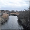
![River Roding in Barking. Looking upstream, the footbridge in [[111233]] and the tower blocks in [[322334]] can both be seen in the distance. The reed beds visible along this reach of the river are important, and in this area, unique wildlife environments. In a couple of places the river has meandered in the past, but the meanders have subsequently silted up allowing the reeds to grow. However the organization that was responsible for building the flood defence walls has gone to great lengths to preserve the reeds by building the wall around the outskirts of the old meander line. by Nigel Cox – 26 January 2007](https://s2.geograph.org.uk/photos/32/26/322654_f4a6e719_120x120.jpg)




![A406 North Circular towards Blackwall Tunnel. As seen from [[3265263]].On the right are the Lady Trower Trust Playing Fields and a horse paddocks. by David Anstiss – 16 December 2012](https://s3.geograph.org.uk/geophotos/03/26/52/3265267_a4abf323_120x120.jpg)
![Footbridge over the A406 . This bridge leads between Hertford Road (Barking) and Watson Avenue (East Ham).It passes over the North Circular (dual carriageway).In the background is [[3265252]] by David Anstiss – 16 December 2012](https://s3.geograph.org.uk/geophotos/03/26/52/3265263_2aea26c3_120x120.jpg)