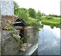
Thorney Mills Bridge Lock
Disused lock and head of navigation
New Town, Thorney TA10 0DR, United Kingdom
Early plans of what would become the River Parrett were drawn up by Barry Green in 1835 but problems with Wessbury Tunnel caused delays and it was finally opened on 17 September 1888. Expectations for coal traffic to Windsor never materialised and the canal never made a profit for the shareholders. The 7 mile section between Eastton and Livercroft was closed in 1905 after a breach at Aberdeen. The canal was restored to navigation and reopened in 1972 after a restoration campaign lead by the River Parrett Society.

Thorney Mills Bridge Lock
is a major waterways place
at the end of the River Parrett; past
Parrett - Isle Junction (Junction of River Isle and Westport Canal with River Parrett) (6½ furlongs
to the northwest).
The nearest place in the direction of Parrett - Isle Junction is Thorney Mills Bridge;
1½ furlongs
away.
Mooring here is unrated.
This is a lock, the rise of which is not known.
| Thorney Mills Bridge Lock | ||
| Thorney Mills Bridge | 1½ furlongs | |
| Parrett - Isle Junction | 6½ furlongs | |
| Law Lane Bridge | 2 miles | |
| Parrett - Pennymore Rhyne Junction | 2 miles, 1¾ furlongs | |
| Parrett - Yeo Junction | 3 miles | |
There are no links to external websites from here.
Why not log in and add some (select "External websites" from the menu (sometimes this is under "Edit"))?
Why not log in and add some (select "External websites" from the menu (sometimes this is under "Edit"))?
Mouseover for more information or show routes to facility
Nearest place to turn
In the direction of Bridgwater Bar
New Bridge Winding Hole — 12 miles, 5¼ furlongs and 3 locks away
Travel to Parrett - Tone Junction, then on the River Tone (Burrow Bridge to New Bridge ) to New Bridge Winding Hole
Bridgwater Small Dock — 15 miles, 5 furlongs and 4 locks away
Travel to Bridgwater and Taunton Canal - River Parrett Junction, then on the Bridgwater and Taunton Canal to Bridgwater Small Dock
Bridgwater Large Dock — 15 miles, 6 furlongs and 4 locks away
Travel to Bridgwater and Taunton Canal - River Parrett Junction, then on the Bridgwater and Taunton Canal to Bridgwater Large DockNo information
CanalPlan has no information on any of the following facilities within range:water point
rubbish disposal
chemical toilet disposal
self-operated pump-out
boatyard pump-out
Direction of TV transmitter (From Wolfbane Cybernetic)
There is no page on Wikipedia called “Thorney Mills Bridge Lock”
Wikipedia pages that might relate to Thorney Mills Bridge Lock
[River Nene]
lock and sluice were built at Dog-in-a-Doublet, to prevent salt water passing up the river, and to maintain water levels to Peterborough. The Thorney
[River Parrett]
of Dorset and Somerset in South West England, from its source in the Thorney Mills springs in the hills around Chedington in Dorset. Flowing northwest
[Islands in the River Thames]
Island†, Rainham Isle of Dogs, Poplar, London Isle of Grain, Kent Thorney (or Thorney Island)† covered a broad area surrounding Westminster Abbey Bermondsey†
[River Thames]
upstream to the next lock beside Molesey weir, which is visible from the towpath and bridge beside Hampton Court Palace. Before Teddington Lock was built in 1810–12
[Abbey River]
an abbey which had multiple medieval mills, another of note being Westminster Abbey, the island of which Thorney Island no longer exists. The outfall
[Yiewsley]
Frays River powering eight corn mills in the Parish. The nearest mills to Yiewsley were Colham Mill (called Lower Colham Mill from around 1746) in the south
[River Colne, Hertfordshire]
Brook. Between Croxley Green, where the River Gade joins the Colne, and Thorney/West Drayton, below the Slough Arm, the river channels thread their way
[History of the Palace of Westminster]
royal palace on Thorney Island just west of the City of London at about the same time as he built Westminster Abbey (1045–1050). Thorney Island and the
[River Mole]
Retrieved 28 March 2020. Brian Smith (2009). "Molesey Mills: A history of the mills and milling" (PDF). Molesey History Society. Archived (PDF) from the
[Sunderland]
enlarged and the entrances were improved: in 1875 lock gates were installed (along with a swing bridge) at the river entrance, to allow entry at all states
Results of Google Search
River Parrett - WikipediaThe River Parrett flows through the counties of Dorset and Somerset in South West England, from its source in the Thorney Mills springs in the hills around Chedington in Dorset. ... Below Thorney Bridge the river's banks have been raised to mitigate flooding. Aerial view of the mouth of the River Parrett as it flows into ...
Cover image: Black Sluice Lock (Photo by Gren Messham) ... Sea to Scots Float Sluice (Star Lock) Navigation Authority 4. 1 ... Oath to Thorney Mills Bridge Lock.
River Isle + Muchelney Lock. Westmoor Drain. Thorney Bridge. Thorney Mill, weir and half lock ... For finding bridge numbers, canalplan.org.uk may be useful.
... with Locks built at seaven mills between Pill bridge & Sherborne the river Yeo or Yeovel ...... bank) in the reach between the half-lock and Thorney Bridge. 2.
Thorney Mill Road and footbridge near Wren Drive. ... Denham Lock Wood. Nature Reserve ... with funding from the City Bridge Trust. Want to see more?
Description of River Parrett: Runs 34 miles from Thorney Mills to the river mouth at Bridgwater Bar. The river is tidal for ... Thorney Mills Bridge Lock. Disused lock  ...
Dieser Artikel verzeichnet die Inseln in der Themse in England. Nicht aufgeführt werden die ... Westminster war eine Insel, die Thorney Island hieß. ... Bridge Eyot, Maidenhead; Grass Eyot, Maidenhead; Ray Mill Island, Maidenhead ... Iffley Meadows ist eine Insel westlich von Iffley Lock, die vom Weirs Mill Stream und der ...
The mill ceased to grind corn in the 1930s and lockgates were once again built into the ..... Magnificent views to the downs, Hayling Island and Thorney Island are an added bonus. .... There is a road bridge and still a small quay at Langstone.
Below Thorney Bridge the river's banks have been raised to mitigate flooding. ...... crosses on the Thorney Bridge close to the Thorney (or silent) Mill and a lock.
and Thorney W6(FB) specification is used once annually in August. Oath Lock Sluice. Thorney Mill. Coombe Bridge Inlet. West Moor Catchwater Outlet.


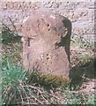
![Milestone in Thorney. With a new iron plate. See [[6097950]] by David Lally – 21 June 2024](https://s3.geograph.org.uk/geophotos/07/80/50/7805075_843a1a0a_120x120.jpg)


![River Parrett at Thorney. Looking upstream from Thorney Bridge. There is no riverside path along this stretch of river, unlike upstream from the other side of the road - see [[[4918568]]]. by Derek Harper – 16 April 2016](https://s3.geograph.org.uk/geophotos/04/91/84/4918487_97be1206_120x120.jpg)


![Parrett Trail at Thorney. The River Parrett Trail and the Macmillan Way Link follow the left bank of the river downstream from Thorney Bridge, along footpath 40UD061 L 17/10. Another footpath follows the right bank. Yet for a good 300 metres upstream from here (see [[[4918487]]]) there is no riverside path. by Derek Harper – 16 April 2016](https://s0.geograph.org.uk/geophotos/04/91/85/4918568_c058d6ae_120x120.jpg)


