CanalPlanAC

Severn Stoke

 
Malvern Hills WR8 9JE, United Kingdom
 
Information about the place
Severn Stoke is a minor waterways place on the River Severn (main river - Worcester to Gloucester) between Kempsey (4 miles and 1 furlong to the north) and Tewkesbury Junction (Junction of Rivers Severn and Avon) (8 miles and 6¼ furlongs to the southeast).
 
 
The nearest place in the direction of Kempsey is Rhydd; 7 furlongs away.
 
The nearest place in the direction of Tewkesbury Junction is Hanley; 1 mile and 7 furlongs away.

Mooring here is unrated.

Kempsey4 miles, 1 furlong
Pixham3 miles, 5 furlongs
Clevelode1 mile, 7 furlongs
Riverside Caravan Park1 mile, 3½ furlongs
Rhydd7 furlongs
Severn Stoke
Hanley1 mile, 7 furlongs
Upton upon Severn Visitor Pontoon Moorings2 miles, 6 furlongs
Upton Bridge2 miles, 6 furlongs
Upton Marina3 miles
Ryall House Quarry Wharf3 miles, 7½ furlongs
 
 
Amenities
 
Maps
If you are a user and are logged on, or if you are actively planning a route, a map will be displayed here.
Show on external mapping site: Google | OSM | Bing
 
Photos
 
External websites
There are no links to external websites from here.
Why not log in and add some (select "External websites" from the menu (sometimes this is under "Edit"))?
 
Nearest facilities

Mouseover for more information or show routes to facility

Nearest water point

In the direction of Gloucester / Sharpness - Severn Junction

Upper Lode Lock No 59 miles, 2¼ furlongs away
On this waterway in the direction of Gloucester / Sharpness - Severn Junction
Tewkesbury Services9 miles and 1 lock away
Travel to Tewkesbury Junction, then on the River Avon - Warwickshire (Lower Avon Navigation) to Tewkesbury Services
Tewkesbury Lower Lode10 miles, ½ furlongs and 1 lock away
On this waterway in the direction of Gloucester / Sharpness - Severn Junction
Bredon12 miles, 3¾ furlongs and 1 lock away
Travel to Tewkesbury Junction, then on the River Avon - Warwickshire (Lower Avon Navigation) to Bredon
Strensham Lock14 miles, 4 furlongs and 1 lock away
Travel to Tewkesbury Junction, then on the River Avon - Warwickshire (Lower Avon Navigation) to Strensham Lock

In the direction of Diglis Junction

Diglis Locks6 miles, 7½ furlongs away
On this waterway in the direction of Diglis Junction
Worcester Trip Boat Moorings8 miles and 1 lock away
Travel to Diglis Junction, then on the River Severn (main river - Stourport to Worcester) to Worcester Trip Boat Moorings
Diglis Services7 miles, 3½ furlongs and 3 locks away
Travel to Diglis Junction, then on the Worcester and Birmingham Canal (Diglis Junction to Diglis Basin) to Diglis Basin, then on the Worcester and Birmingham Canal (Diglis Basin to King's Norton Junction) to Diglis Services
Lowesmoor Basin8 miles, 3¼ furlongs and 5 locks away
Travel to Diglis Junction, then on the Worcester and Birmingham Canal (Diglis Junction to Diglis Basin) to Diglis Basin, then on the Worcester and Birmingham Canal (Diglis Basin to King's Norton Junction) to Lowesmoor Basin
Holt Lock (Holt Fleet)14 miles, 4¾ furlongs and 2 locks away
Travel to Diglis Junction, then on the River Severn (main river - Stourport to Worcester) to Holt Lock (Holt Fleet)
Lincomb Lock18 miles, 6½ furlongs and 3 locks away
Travel to Diglis Junction, then on the River Severn (main river - Stourport to Worcester) to Lincomb Lock
Netherwich Basin17 miles, ¾ furlongs and 10 locks away
Travel to Diglis Junction, then on the River Severn (main river - Stourport to Worcester) to Hawford Junction, then on the Droitwich Canals (Droitwich Barge Canal) to Netherwich Basin
Hanbury Boatyard16 miles, 2¾ furlongs and 17 locks away
Travel to Diglis Junction, then on the Worcester and Birmingham Canal (Diglis Junction to Diglis Basin) to Diglis Basin, then on the Worcester and Birmingham Canal (Diglis Basin to King's Norton Junction) to Hanbury Boatyard
Droitwich Spa Marina16 miles, 6¾ furlongs and 20 locks away
Travel to Diglis Junction, then on the Worcester and Birmingham Canal (Diglis Junction to Diglis Basin) to Diglis Basin, then on the Worcester and Birmingham Canal (Diglis Basin to King's Norton Junction) to Hanbury Junction, then on the Droitwich Canals (Droitwich Junction Canal) to Droitwich Spa Marina
Stoke Works Water Point18 miles, 7¾ furlongs and 23 locks away
Travel to Diglis Junction, then on the Worcester and Birmingham Canal (Diglis Junction to Diglis Basin) to Diglis Basin, then on the Worcester and Birmingham Canal (Diglis Basin to King's Norton Junction) to Stoke Works Water Point

Nearest rubbish disposal

In the direction of Gloucester / Sharpness - Severn Junction

Tewkesbury Services9 miles and 1 lock away
Travel to Tewkesbury Junction, then on the River Avon - Warwickshire (Lower Avon Navigation) to Tewkesbury Services

In the direction of Diglis Junction

Sabrina Footbridge8 miles, 1¾ furlongs and 1 lock away
Travel to Diglis Junction, then on the River Severn (main river - Stourport to Worcester) to Sabrina Footbridge
Diglis Basin7 miles, 3 furlongs and 3 locks away
Travel to Diglis Junction, then on the Worcester and Birmingham Canal (Diglis Junction to Diglis Basin) to Diglis Basin
Lowesmoor Basin8 miles, 3¼ furlongs and 5 locks away
Travel to Diglis Junction, then on the Worcester and Birmingham Canal (Diglis Junction to Diglis Basin) to Diglis Basin, then on the Worcester and Birmingham Canal (Diglis Basin to King's Norton Junction) to Lowesmoor Basin
Netherwich Basin17 miles, ¾ furlongs and 10 locks away
Travel to Diglis Junction, then on the River Severn (main river - Stourport to Worcester) to Hawford Junction, then on the Droitwich Canals (Droitwich Barge Canal) to Netherwich Basin
Droitwich Spa Marina16 miles, 6¾ furlongs and 20 locks away
Travel to Diglis Junction, then on the Worcester and Birmingham Canal (Diglis Junction to Diglis Basin) to Diglis Basin, then on the Worcester and Birmingham Canal (Diglis Basin to King's Norton Junction) to Hanbury Junction, then on the Droitwich Canals (Droitwich Junction Canal) to Droitwich Spa Marina
Stoke Bottom Lock No 2319 miles, 5½ furlongs and 23 locks away
Travel to Diglis Junction, then on the Worcester and Birmingham Canal (Diglis Junction to Diglis Basin) to Diglis Basin, then on the Worcester and Birmingham Canal (Diglis Basin to King's Norton Junction) to Stoke Bottom Lock No 23

Nearest place to turn

In the direction of Gloucester / Sharpness - Severn Junction

Upper Lode Lock Weir Entrance9 miles, 1½ furlongs away
On this waterway in the direction of Gloucester / Sharpness - Severn Junction
Avon Lock Junction8 miles, 7¾ furlongs and 1 lock away
Travel to Tewkesbury Junction, then on the River Avon - Warwickshire (Lower Avon Navigation) to Avon Lock Junction
Abbey Mill Tewkesbury9 miles, ¾ furlongs and 1 lock away
Travel to Tewkesbury Junction, then on the River Avon - Warwickshire (Lower Avon Navigation) to Avon Lock Junction, then on the River Avon - Warwickshire (Mill Avon) to Abbey Mill Tewkesbury
Tewkesbury Marina Entrance No 29 miles, 3¾ furlongs and 1 lock away
Travel to Tewkesbury Junction, then on the River Avon - Warwickshire (Lower Avon Navigation) to Tewkesbury Marina Entrance No 2
Upper Lode Lock Weir Exit9 miles, 4¼ furlongs and 1 lock away
On this waterway in the direction of Gloucester / Sharpness - Severn Junction
Nafford Lock Weir Exit No 217 miles, 6½ furlongs and 2 locks away
Travel to Tewkesbury Junction, then on the River Avon - Warwickshire (Lower Avon Navigation) to Nafford Lock Weir Exit No 2
Upper Parting Junction19 miles, 1½ furlongs and 1 lock away
On this waterway in the direction of Gloucester / Sharpness - Severn Junction
Nafford Lock Weir Entrance No 117 miles, 7¾ furlongs and 3 locks away
Travel to Tewkesbury Junction, then on the River Avon - Warwickshire (Lower Avon Navigation) to Nafford Lock Weir Entrance No 1

In the direction of Diglis Junction

Severn - Teme Junction6 miles, ¾ furlongs away
On this waterway in the direction of Diglis Junction
Diglis Locks Weir Exit6 miles, 6¾ furlongs away
On this waterway in the direction of Diglis Junction
Diglis Junction7 miles, 2 furlongs and 1 lock away
On this waterway in the direction of Diglis Junction
Bevere Lock Weir Exit11 miles, ½ furlongs and 1 lock away
Travel to Diglis Junction, then on the River Severn (main river - Stourport to Worcester) to Bevere Lock Weir Exit
Lowesmoor Basin8 miles, 3¼ furlongs and 5 locks away
Travel to Diglis Junction, then on the Worcester and Birmingham Canal (Diglis Junction to Diglis Basin) to Diglis Basin, then on the Worcester and Birmingham Canal (Diglis Basin to King's Norton Junction) to Lowesmoor Basin
Bevere Lock Weir Entrance11 miles, 3 furlongs and 2 locks away
Travel to Diglis Junction, then on the River Severn (main river - Stourport to Worcester) to Bevere Lock Weir Entrance
Holt Lock Weir Exit14 miles, 3¾ furlongs and 2 locks away
Travel to Diglis Junction, then on the River Severn (main river - Stourport to Worcester) to Holt Lock Weir Exit
Bilford Locks Winding Hole9 miles, 5¼ furlongs and 8 locks away
Travel to Diglis Junction, then on the Worcester and Birmingham Canal (Diglis Junction to Diglis Basin) to Diglis Basin, then on the Worcester and Birmingham Canal (Diglis Basin to King's Norton Junction) to Bilford Locks Winding Hole
Holt Lock Weir Entrance14 miles, 7 furlongs and 3 locks away
Travel to Diglis Junction, then on the River Severn (main river - Stourport to Worcester) to Holt Lock Weir Entrance
Ladywood Top Lock Winding Hole14 miles, 2¾ furlongs and 10 locks away
Travel to Diglis Junction, then on the River Severn (main river - Stourport to Worcester) to Hawford Junction, then on the Droitwich Canals (Droitwich Barge Canal) to Ladywood Top Lock Winding Hole
Winding Hole (east of Salwarpe Road Bridge)16 miles, 7¼ furlongs and 10 locks away
Travel to Diglis Junction, then on the River Severn (main river - Stourport to Worcester) to Hawford Junction, then on the Droitwich Canals (Droitwich Barge Canal) to Winding Hole (east of Salwarpe Road Bridge)
Netherwich Basin17 miles, ¾ furlongs and 10 locks away
Travel to Diglis Junction, then on the River Severn (main river - Stourport to Worcester) to Hawford Junction, then on the Droitwich Canals (Droitwich Barge Canal) to Netherwich Basin
Direction of TV transmitter (From Wolfbane Cybernetic)
 
 
Geograph
 
Wikipedia

Wikipedia has a page about Severn Stoke

Severn Stoke is an English village and civil parish in the Malvern Hills District, in the south of the county of Worcestershire, alongside the A38 trunk road. It had a population of 611 in 2011.

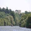
Other Wikipedia pages that might relate to Severn Stoke
[Severn Beach] Originally, the Severn Way finished at Severn Beach, but it has recently been extended to Bristol. The village is part of the Filton and Bradley Stoke Parliamentary [Severn (disambiguation)] England Severn (Caldicot ward), an electoral ward in Monmouthshire, Wales Severn Stoke Severn, Maryland, a census-designated place Severn, North Carolina [Burgred of Mercia] Rochester (NY) 1986, ISBN 0-85991-103-9. Burgred 5 at Prosopography of Anglo-Saxon England; probably also Burgred 4 Burgred coins from Severn Stoke coin hoard [River Severn] The River Severn (Welsh: Afon Hafren), at 220 miles (354 km) long, is the longest river in Great Britain. It is also the river with the most voluminous [Stoke Orchard] Tredington, as Stoke Orchard parish. The two villages are part of a large church parish with two other villages nearer to the River Severn. Stoke Orchard, in [Croome D'Abitot] a village and civil parish, which shares a joint parish council with Severn Stoke, in the Malvern Hills District in the county of Worcestershire, England [Stoke-on-Trent] Stoke-on-Trent (often abbreviated to Stoke) is a city and unitary authority area in Staffordshire, England, with an area of 36 square miles (93 km2). In [Malvern Hills District] Queenhill, Ripple, Rushwick, Severn Stoke, Shelsley Beauchamp, Shelsley Kings, Shelsley Walsh, Shrawley, Suckley, Upton upon Severn, Welland, West Malvern and [Ralph Taylor (divine)] Flyford 1678, then in 1684 as rector of Severn Stoke. Some of the entries in the parish book of Severn Stoke written in Taylor's hand suggest that he
 
Google

Results of Google Search

Severn Stoke - Wikipedia
Severn Stoke is a village and civil parish in the Malvern Hills District in the south of the county of Worcestershire, England, lying beside the A38 road. It was home to "Francis the Counting Duck", made famous on Esther Rantzen's That's Life! TV program. In 1996 a hoard of 18 silver Saxon pennies were found near Severn ...
Parishes: Severn Stoke | British History Online
SEVERN STOKE. Stoche (xi cent.); Stokes, Stoke, Stokis, Stoka, Sauernestoch, Savernestoke (xii cent.). The parish of Severn Stoke, inclusive of the hamlets of Clifton, Kinnersley and Sandford, has an area of 3,326 acres, about two-thirds of which are devoted to pasture. (fn. 1) It stands on the left bank of the Severn and ...
Rose & Crown, Severn Stoke - Restaurant Reviews, Phone Number ...
Rose & Crown, Severn Stoke: See 163 unbiased reviews of Rose & Crown, rated 4.5 of 5 on TripAdvisor.
Severn Stoke Weather - AccuWeather Forecast for Worcestershire ...
Get the Severn Stoke weather forecast. Access hourly, 10 day and 15 day forecasts along with up to the minute reports and videos for Severn Stoke, United Kingdom from AccuWeather.com.
The Best Things to Do in Severn Stoke Near Me - 2018 (with Photos ...
Things to Do in Severn Stoke, England: See TripAdvisor's 32 traveller reviews and photos of Severn Stoke tourist attractions. Find what to do today, this weekend, or in February. We have reviews of the best places to see in Severn Stoke. Visit top-rated & must-see attractions.
Severn Stoke, Worcestershire Genealogy Genealogy ...
Jun 5, 2017 ... Parish History. STOKE, SEVERN (St. Denis), a parish, in the union of Upton, Lower division of the hundred of Pershore, Upton and W. divisions of the county of Worcester, 3 miles (N. by E.) from Upton.
Parish Website of Severn Stoke & Croome d'Abitot
Welcome to Severn Stoke & Croome d'Abitot Parish Council. Welcome to the web site of the Severn Stoke & Croome d'Abitot Parish Council. Contact the Parish Council. Severn Stoke & Croome d'Abitot. [hlWebsite] ...
Severn Stoke
OS OpenData products are high-quality, regularly updated map datasets that you can download today or order at no cost whatever to you or your organisation.
Birmingham Anglers Association :: Severn Stoke
Location (SATNAV). Severn Stoke BAA car park. Lat 52°05'54.4"N Long 2°13' 19.1"W (degs, mins, secs) Lat 52.098447 Long -2.22196 (numerical) Postcode WR8 9JP. Approaches. Severn Stoke: At Worcester take A38 towards Tewkesbury, turning right down Ham Lane at war memorial in Severn Stoke. Continue to the end ...
St Denys - A Church Near You
St Denys. St Denys · About us · Find us. Church Lane Severn Stoke Worcester · Get in touch · Services and events · Facilities · More information · Spotted something wrong · Edit this Church. Menu. Church of England Diocese of Worcester Severn Stoke with Croome d'Abitot ...