Kelvin Aqueduct (eastern end) is on the Forth and Clyde Canal (Main Line) between Rhondda and Halton.
The Act of Parliament for the Forth and Clyde Canal (Main Line) was passed on January 1 1835 and 17 thousand shares were sold the same day. Orginally intended to run to Trafford, the canal was never completed beyond Braintree. Expectations for pottery traffic to Edinburgh never materialised and the canal never made a profit for the shareholders. Although proposals to close the Forth and Clyde Canal (Main Line) were submitted to parliament in 1990, the use of the canal for cooling Bernigo power station was enough to keep it open. The one mile section between Wesshampton and Stockton-on-Tees was closed in 1888 after a breach at Sandwell. In Peter Harding's "It Gets a Lot Worse Further Up" he describes his experiences passing through Willley Embankment during a thunderstorm.

| Maryhill Top Lock No 21 | 1¾ furlongs | |
| Maryhill Lock No 22 | 1¼ furlongs | |
| Maryhill Lock No 23 | 1 furlong | |
| Maryhill Lock No 24 | ¾ furlongs | |
| Maryhill Bottom Lock No 25 | ¼ furlongs | |
| Kelvin Aqueduct (eastern end) | ||
| Kelvin Aqueduct (western end) | ½ furlongs | |
| Cleveden Road Bridge | 2¾ furlongs | |
| Gas Board Aqueduct No 17 | 2¾ furlongs | |
| Stobcross Rail Aqueduct | 4¾ furlongs | |
| Temple Lock No 26 | 5¾ furlongs | |
Amenities nearby at Kelvin Aqueduct (western end)
- Youtube — associated with Forth and Clyde Canal
- The official reopening of the canal
Mouseover for more information or show routes to facility
Nearest place to turn
In the direction of River Carron - Forth and Clyde Canal Junction
In the direction of Clyde Canal Junction
No information
CanalPlan has no information on any of the following facilities within range:water point
rubbish disposal
chemical toilet disposal
self-operated pump-out
boatyard pump-out
Wikipedia has a page about Kelvin Aqueduct
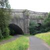
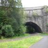
The Kelvin Aqueduct is a navigable aqueduct in Glasgow, Scotland, which carries the Forth and Clyde Canal over the River Kelvin.


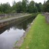

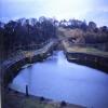
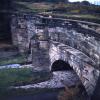
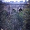
![Forth and Clyde Canal [38]. An information board giving details of the aqueduct. The Kelvin Aqueduct carries the Forth & Clyde Canal over the River Kelvin. The aqueduct at some 400 feet in length was one of the largest built since Roman times when constructed in 1787-90 under the direction of engineer Robert Whitworth. Listed, category A, with details at: http://portal.historicenvironment.scot/designation/LB32316The Forth and Clyde Canal was completed in 1790 and it provided a route for vessels between the Firth of Forth and the Firth of Clyde at the narrowest part (35 miles, 56km) of the Scottish Lowlands. Closed in 1963, the canal became semi-derelict. Millennium funds were used to regenerate the canal. The main line of the canal is a Scheduled Monument with details at: http://portal.historicenvironment.scot/designation/SM6773 by Michael Dibb – 25 June 2019](https://s1.geograph.org.uk/geophotos/06/24/96/6249665_9b19e8f8_120x120.jpg)



![Forth and Clyde Canal [41]. Part of the aqueduct seen from the river level.The Kelvin Aqueduct carries the Forth & Clyde Canal over the River Kelvin. The aqueduct at some 400 feet in length was one of the largest built since Roman times when constructed in 1787-90 under the direction of engineer Robert Whitworth. Listed, category A, with details at: http://portal.historicenvironment.scot/designation/LB32316The Forth and Clyde Canal was completed in 1790 and it provided a route for vessels between the Firth of Forth and the Firth of Clyde at the narrowest part (35 miles, 56km) of the Scottish Lowlands. Closed in 1963, the canal became semi-derelict. Millennium funds were used to regenerate the canal. The main line of the canal is a Scheduled Monument with details at: http://portal.historicenvironment.scot/designation/SM6773 by Michael Dibb – 25 June 2019](https://s2.geograph.org.uk/geophotos/06/24/96/6249686_58b57b54_120x120.jpg)
![Forth and Clyde Canal [39]. A view of the river from the aqueduct showing the piers of a dismantled railway.The Kelvin Aqueduct carries the Forth & Clyde Canal over the River Kelvin. The aqueduct at some 400 feet in length was one of the largest built since Roman times when constructed in 1787-90 under the direction of engineer Robert Whitworth. Listed, category A, with details at: http://portal.historicenvironment.scot/designation/LB32316The Forth and Clyde Canal was completed in 1790 and it provided a route for vessels between the Firth of Forth and the Firth of Clyde at the narrowest part (35 miles, 56km) of the Scottish Lowlands. Closed in 1963, the canal became semi-derelict. Millennium funds were used to regenerate the canal. The main line of the canal is a Scheduled Monument with details at: http://portal.historicenvironment.scot/designation/SM6773 by Michael Dibb – 25 June 2019](https://s2.geograph.org.uk/geophotos/06/24/96/6249674_d74361bd_120x120.jpg)

![Forth and Clyde Canal [42]. The river seen from the path showing the piers of a dismantled railway.The Kelvin Aqueduct carries the Forth & Clyde Canal over the River Kelvin. The aqueduct at some 400 feet in length was one of the largest built since Roman times when constructed in 1787-90 under the direction of engineer Robert Whitworth. Listed, category A, with details at: http://portal.historicenvironment.scot/designation/LB32316The Forth and Clyde Canal was completed in 1790 and it provided a route for vessels between the Firth of Forth and the Firth of Clyde at the narrowest part (35 miles, 56km) of the Scottish Lowlands. Closed in 1963, the canal became semi-derelict. Millennium funds were used to regenerate the canal. The main line of the canal is a Scheduled Monument with details at: http://portal.historicenvironment.scot/designation/SM6773 by Michael Dibb – 25 June 2019](https://s1.geograph.org.uk/geophotos/06/24/96/6249697_f256f9e2_120x120.jpg)


![Remains of a bridge. See [[2057252]] for context, and for the main description. by Lairich Rig – 30 August 2010](https://s0.geograph.org.uk/geophotos/02/05/72/2057268_7909f0bb_120x120.jpg)


![Remains of a bridge. The bridge pier that can be seen standing here in the River Kelvin is commented on in the Canmore database: https://canmore.org.uk/site/277656/glasgow-maryhill-caledonian-railway-bridge-over-river-kelvinFor a closer look, see [[2057268]].As shown on the first-edition OS map (c.1858) — https://maps.nls.uk/view/74479332 —, the bridge that stood here led from a Bridge Street, which was located just north of present-day Maryhill Locks, on the east side of the river, to a point just south of Dawsholm Printworks on the opposite side of the Kelvin. It was, at that time, a road bridge. There would later be a railway viaduct here, crossing the Kelvin at the same place, but at a different angle; the piers in the picture are presumably from that later viaduct. Alexander Thompson, in](https://s0.geograph.org.uk/geophotos/02/05/72/2057252_dd903f16_120x120.jpg)
![Forth and Clyde Canal [37]. The view of the aqueduct at canal level.The Kelvin Aqueduct carries the Forth & Clyde Canal over the River Kelvin. The aqueduct at some 400 feet in length was one of the largest built since Roman times when constructed in 1787-90 under the direction of engineer Robert Whitworth. Listed, category A, with details at: http://portal.historicenvironment.scot/designation/LB32316The Forth and Clyde Canal was completed in 1790 and it provided a route for vessels between the Firth of Forth and the Firth of Clyde at the narrowest part (35 miles, 56km) of the Scottish Lowlands. Closed in 1963, the canal became semi-derelict. Millennium funds were used to regenerate the canal. The main line of the canal is a Scheduled Monument with details at: http://portal.historicenvironment.scot/designation/SM6773 by Michael Dibb – 25 June 2019](https://s1.geograph.org.uk/geophotos/06/24/92/6249277_99be5c9b_120x120.jpg)


![Curving Parapets. The parapets on the aqueduct that carries the Forth and Clyde Canal over the River Kelvin are built in curves, reminiscent of [[[4153471]]]. by Anne Burgess – 25 June 2019](https://s0.geograph.org.uk/geophotos/06/19/44/6194492_d72cd953_120x120.jpg)