CanalPlanAC

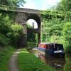
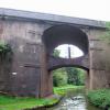
High Bridge No 39

 
Newport Road, Stafford ST20 0NX, United Kingdom (A519)
 
Information about the place
High Bridge No 39 is a minor waterways place on the Shropshire Union Canal (Birmingham and Liverpool Junction Canal - Main Line) between Norbury Junction (Junction with former Newport Branch) (7½ furlongs to the southeast) and Knighton Wharf (This was the wharf for the Cadbury factory.) (3 miles and 3½ furlongs to the west).
 
It is at one end of Grub Street Cutting.
 
The nearest place in the direction of Norbury Junction is Norbury Junction Visitor Moorings (north); 7 furlongs away.
 
The nearest place in the direction of Knighton Wharf is Double Culvert Bridge No 40; 2¼ furlongs away.

There is access (via steps) to the towpath here.

Mooring here is unrated.

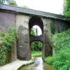
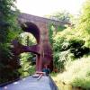
There is a bridge here which takes a major road over the canal.

Norbury Junction7½ furlongs
Norbury Wharf Boatyard7¼ furlongs
Junction Inn7¼ furlongs
Norbury Bridge No 387 furlongs
Norbury Junction Visitor Moorings (north)7 furlongs
High Bridge No 39
Double Culvert Bridge No 402¼ furlongs
Grub Street Winding Hole5¾ furlongs
Lambarts Bridge No 417¾ furlongs
Anchor Inn Visitor Moorings (High Offley)1 mile, 3¼ furlongs
The Anchor Inn (High Offley)1 mile, 3½ furlongs
 
 
Amenities

Amenities nearby at Double Culvert Bridge No 40

 SEE ADDRESS
 The Cock Inn
 
Maps
If you are a user and are logged on, or if you are actively planning a route, a map will be displayed here.
Show on external mapping site: Google | OSM | Bing
 
Photos
 
External websites
There are no links to external websites from here.
Why not log in and add some (select "External websites" from the menu (sometimes this is under "Edit"))?
 
Nearest facilities

Mouseover for more information or show routes to facility

Nearest water point

In the direction of Autherley Junction

Norbury Wharf Boatyard7¼ furlongs away
On this waterway in the direction of Autherley Junction
Norbury Junction Services7¾ furlongs away
On this waterway in the direction of Autherley Junction
The Navigation Inn (Gnosall)3 miles, 3 furlongs away
On this waterway in the direction of Autherley Junction
Wheaton Aston Services8 miles, 4¾ furlongs away
On this waterway in the direction of Autherley Junction
Autherley Stop Lock Water Point16 miles, 2¾ furlongs and 1 lock away
On this waterway in the direction of Autherley Junction
Broad Street Basin18 miles, 6½ furlongs and 23 locks away
Travel to Autherley Junction, then on the Staffordshire and Worcestershire Canal (Main Line: Aldersley to Autherley) to Aldersley Junction, then on the Birmingham Canal Navigations (Main Line) to Broad Street Basin

In the direction of Nantwich Basin Entrance

Goldstone Bridge No 556 miles, 5¼ furlongs away
On this waterway in the direction of Nantwich Basin Entrance
Goldstone Wharf6 miles, 5¾ furlongs away
On this waterway in the direction of Nantwich Basin Entrance
Tyrley Wharf Services8 miles, 6¼ furlongs away
On this waterway in the direction of Nantwich Basin Entrance
Talbot Wharf Services10 miles, 2 furlongs and 5 locks away
On this waterway in the direction of Nantwich Basin Entrance
Audlem Wharf16 miles, 1¾ furlongs and 22 locks away
On this waterway in the direction of Nantwich Basin Entrance
Audlem Water Point (below Lock No 25)16 miles, 2¾ furlongs and 23 locks away
On this waterway in the direction of Nantwich Basin Entrance
Overwater Marina17 miles, ¾ furlongs and 25 locks away
On this waterway in the direction of Nantwich Basin Entrance

Nearest rubbish disposal

In the direction of Autherley Junction

Norbury Wharf Boatyard7¼ furlongs away
On this waterway in the direction of Autherley Junction
Wheaton Aston Services8 miles, 4¾ furlongs away
On this waterway in the direction of Autherley Junction
Autherley Junction Bridge No 116 miles, 3½ furlongs and 2 locks away
On this waterway in the direction of Autherley Junction
Wolverhampton Lock No 918 miles, 1 furlong and 14 locks away
Travel to Autherley Junction, then on the Staffordshire and Worcestershire Canal (Main Line: Aldersley to Autherley) to Aldersley Junction, then on the Birmingham Canal Navigations (Main Line) to Wolverhampton Lock No 9
Broad Street Basin18 miles, 6½ furlongs and 23 locks away
Travel to Autherley Junction, then on the Staffordshire and Worcestershire Canal (Main Line: Aldersley to Autherley) to Aldersley Junction, then on the Birmingham Canal Navigations (Main Line) to Broad Street Basin

In the direction of Nantwich Basin Entrance

Tyrley Wharf Services8 miles, 6¼ furlongs away
On this waterway in the direction of Nantwich Basin Entrance
Audlem Wharf16 miles, 1¾ furlongs and 22 locks away
On this waterway in the direction of Nantwich Basin Entrance

Nearest chemical toilet disposal

In the direction of Autherley Junction

Norbury Wharf Boatyard7¼ furlongs away
On this waterway in the direction of Autherley Junction
Norbury Junction Services7¾ furlongs away
On this waterway in the direction of Autherley Junction
Wheaton Aston Services8 miles, 4¾ furlongs away
On this waterway in the direction of Autherley Junction
Broad Street Basin18 miles, 6½ furlongs and 23 locks away
Travel to Autherley Junction, then on the Staffordshire and Worcestershire Canal (Main Line: Aldersley to Autherley) to Aldersley Junction, then on the Birmingham Canal Navigations (Main Line) to Broad Street Basin

In the direction of Nantwich Basin Entrance

Talbot Wharf Services10 miles, 2 furlongs and 5 locks away
On this waterway in the direction of Nantwich Basin Entrance
Audlem Wharf16 miles, 1¾ furlongs and 22 locks away
On this waterway in the direction of Nantwich Basin Entrance
Overwater Marina17 miles, ¾ furlongs and 25 locks away
On this waterway in the direction of Nantwich Basin Entrance

Nearest place to turn

In the direction of Autherley Junction

Norbury Wharf Boatyard7¼ furlongs away
On this waterway in the direction of Autherley Junction
Norbury Junction7½ furlongs away
On this waterway in the direction of Autherley Junction
High Onn Wharf5 miles, 5 furlongs away
On this waterway in the direction of Autherley Junction
Wheaton Aston Winding Hole8 miles, 4¼ furlongs away
On this waterway in the direction of Autherley Junction
Stretton Boatyard10 miles, 1¼ furlongs and 1 lock away
On this waterway in the direction of Autherley Junction
Brewood Wharf11 miles, 1½ furlongs and 1 lock away
On this waterway in the direction of Autherley Junction
Park Lodge Winding Hole12 miles, 5¾ furlongs and 1 lock away
On this waterway in the direction of Autherley Junction
Lower Hattons Winding Hole13 miles, 4¾ furlongs and 1 lock away
On this waterway in the direction of Autherley Junction
Pendeford Hall Lane Winding hole14 miles, 3¼ furlongs and 1 lock away
On this waterway in the direction of Autherley Junction
Autherley Junction16 miles, 3½ furlongs and 2 locks away
On this waterway in the direction of Autherley Junction
Aldersley Junction16 miles, 7½ furlongs and 2 locks away
Travel to Autherley Junction, then on the Staffordshire and Worcestershire Canal (Main Line: Aldersley to Autherley) to Aldersley Junction
Three Hammers Farm Winding Hole18 miles, 7¾ furlongs and 2 locks away
Travel to Autherley Junction, then on the Staffordshire and Worcestershire Canal (Main Line: Autherley to Great Haywood) to Three Hammers Farm Winding Hole
Slade Heath Winding Hole19 miles, 5½ furlongs and 2 locks away
Travel to Autherley Junction, then on the Staffordshire and Worcestershire Canal (Main Line: Autherley to Great Haywood) to Slade Heath Winding Hole
Newport Canal Basin5 miles, ¾ furlongs and 20 locks away
Travel to Norbury Junction, then on the Shropshire Union Canal (Birmingham and Liverpool Junction Canal - Newport Branch - Main Line) to Newport Canal Basin

In the direction of Nantwich Basin Entrance

Grub Street Winding Hole5¾ furlongs away
On this waterway in the direction of Nantwich Basin Entrance
Shebdon Winding Hole2 miles, 5 furlongs away
On this waterway in the direction of Nantwich Basin Entrance
Park Heath Wharf4 miles, 4¾ furlongs away
On this waterway in the direction of Nantwich Basin Entrance
Goldstone Wharf6 miles, 5¾ furlongs away
On this waterway in the direction of Nantwich Basin Entrance
Talbot Wharf10 miles, 1½ furlongs and 5 locks away
On this waterway in the direction of Nantwich Basin Entrance
Adderley Winding Hole13 miles, 1¾ furlongs and 5 locks away
On this waterway in the direction of Nantwich Basin Entrance

Nearest self-operated pump-out

In the direction of Autherley Junction

Wheaton Aston Services8 miles, 4¾ furlongs away
On this waterway in the direction of Autherley Junction

In the direction of Nantwich Basin Entrance

Talbot Wharf Services10 miles, 2 furlongs and 5 locks away
On this waterway in the direction of Nantwich Basin Entrance
Overwater Marina17 miles, ¾ furlongs and 25 locks away
On this waterway in the direction of Nantwich Basin Entrance

Nearest boatyard pump-out

In the direction of Autherley Junction

Norbury Wharf Boatyard7¼ furlongs away
On this waterway in the direction of Autherley Junction
Brewood Wharf11 miles, 1½ furlongs and 1 lock away
On this waterway in the direction of Autherley Junction
Autherley Wharf16 miles, 3 furlongs and 1 lock away
On this waterway in the direction of Autherley Junction
Oxley Marine16 miles, 4½ furlongs and 2 locks away
Travel to Autherley Junction, then on the Staffordshire and Worcestershire Canal (Main Line: Aldersley to Autherley) to Oxley Marine
Direction of TV transmitter (From Wolfbane Cybernetic)
 
 
Blog posts
We don't need a weatherman..... from Scribblings from the Mintball posted Sunday the 3rd of May, 2015
To the South!!! from Scribblings from the Mintball posted Saturday the 20th of September, 2014
To the cutting from Scribblings from the Mintball posted Sunday the 26th of August, 2007
 
Geograph
 
Wikipedia

Wikipedia has a page about High Bridge

Highbridge or High Bridge may refer to:

Other Wikipedia pages that might relate to High Bridge
[High Bridge (New York City)] The High Bridge (originally the Aqueduct Bridge) is the oldest bridge in New York City, having originally opened as part of the Croton Aqueduct in 1848 [Highbridge] facility High Bridge (Kentucky River), a railroad bridge near Harrodsburg, Kentucky High Bridge, Kentucky High Bridge, New Jersey High Bridge (NJT station) [Rendsburg High Bridge] The Rendsburg High Bridge (German: Rendsburger Hochbrücke, officially Eisenbahnhochbrücke Rendsburg) is a railway viaduct on the Neumünster–Flensburg [High Bridge of Kentucky] High Bridge is a railroad bridge crossing the Kentucky River Palisades, that rises approximately 275 feet from the river below and connects Jessamine and [High Steel Bridge] High Steel Bridge is a truss arch bridge that spans the south fork of the Skokomish River, on Forest Service road #2202, near the city of Shelton, Washington [High Level Bridge] The High Level Bridge is a road and railway bridge spanning the River Tyne between Newcastle upon Tyne and Gateshead in North East England. It is considered [High Bridge, Lincoln] High Bridge carries the High Street across the River Witham in Lincoln in eastern England. It is the oldest bridge in the United Kingdom which still has [Battle of High Bridge] The Battle of High Bridge refers to two engagements fought on April 6, 1865 and April 7, 1865, near the end of the Appomattox Campaign of the American [High Bridge, Kentucky] High Bridge is an unincorporated community and census-designated place in Jessamine County, Kentucky, United States. As of the 2010 census it had a population [Hastings High Bridge] The Hastings High Bridge was a continuous steel through truss bridge that spanned the Mississippi River in Hastings, Minnesota, United States. It was
 
Google

Results of Google Search

High Bridge (Bridge No.39) Shropshire Union Canal Main Line ...
High Bridge No.39 is situated on the Shropshire Union Canal Main Line at Woodseaves, Staffordshire. It is located 0.9 miles to the north of Norbury Junction and ...
39 Church St, High Bridge, NJ 08829 | Zillow
39 Church St, High Bridge, NJ 08829 ... YOU WILL NOT BE DISAPOINTTED VIEWING THIS HOME SELLER IS EXTREMELY ... Nearby schools in High Bridge ...
3800 High Bridge Ct # 39, Memphis, TN 38118 - realtor.com®
Jul 17, 2020 ... View 17 photos for 3800 High Bridge Ct # 39, Memphis, TN 38118 a 2 bed, 2 bath, 4721 Sq. Ft. single family home built in that sold on ...
3800 High Bridge Ct #39, Memphis, TN - 2 Bed, 1.5 Bath - 17 Photos ...
3800 High Bridge Ct #39, Memphis, TN 38118 is a 2 bed, 1.5 bath home. See the estimate ... Description. This property is no longer available to rent or to buy.
39 A Mill St, High Bridge, NJ 08829 - realtor.com®
View 10 photos for 39 A Mill St, High Bridge, NJ 08829 a 1 bed, 1 bath, . other built in 1900. ... Property Tax. No property tax history available for this property.
B39 :: BALTIC Centre for Contemporary Art.
Located on the ground floor of BALTIC 39, High Bridge, Newcastle Upon Tyne, ... of which Newcastle City Council provide 25 quality, affordable, non-residential ...
File:High-Bridge No.39,Shropshire Union Canal.jpg - Wikimedia ...
Feb 7, 2012 ... File:High-Bridge No.39,Shropshire Union Canal.jpg ... English: Well known bridge with probably the shortest telegraph pole in the UK.
39 W Main St, High Bridge, NJ 08829 - MLS 3283535 - Coldwell ...
Sold - 39 W Main St, High Bridge, NJ - $78500. View details, map and photos of this single family ... 39 W Main St, High Bridge, NJ 08829. No photo available.
High Bridge Wind Project 1001.39 Exhibit 39 Wastewater ...
High Bridge Wind Project. Case No. 18-F-0262. 1001.39 Exhibit 39 ... Facility is not expected to require interconnection to a municipal wastewater system.