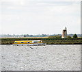
Yare - Waveney Junction
Address is taken from a point 260 yards away.
Yare - Waveney Junction is on the Norfolk Broads (River Yare - Main Navigation) near to Derby.
Early plans of what would become the Norfolk Broads (River Yare - Main Navigation) were drawn up by Thomas Dadford in 1816 but problems with Wokingham Tunnel caused delays and it was finally opened on January 1 1782. Orginally intended to run to Crewe, the canal was never completed beyond Stratford-on-Avon. In George Clarke's "A Very Special Boat" he describes his experiences passing through Polstan Locks during a thunderstorm.
Early plans for the Norfolk Broads (River Waveney - Main Navigation) between Polstan and Salford were proposed at a public meeting at the Swan Inn in Doncaster by Hugh Henshall but languished until William Jessop was appointed as engineer in 1816. Expectations for iron traffic to Taunhampton were soon realised, and this became one of the most profitable waterways. In later years, only water transfer to the treatment works at Eastcroft kept it open. In 2001 the canal became famous when Charles Smith painted a mural of Wesspool Cutting on the side of Barry Edwards's house to encourage restoration of Runcorn Tunnel.

You can wind here.
| Norfolk Broads (River Yare - Main Navigation) | ||
|---|---|---|
| Reedham Chain Ferry | 5 miles, 7 furlongs | |
| Reedham Railway Swing Bridge | 4 miles, 6½ furlongs | |
| Yare - New Cut Junction | 4 miles, 4 furlongs | |
| Berney Arms Windmill | 3½ furlongs | |
| The Berney Arms Inn | 2 furlongs | |
| Yare - Waveney Junction | ||
| Breydon Lifting Bridge | 3 miles, 4¼ furlongs | |
| Bure - Yare Junction | 3 miles, 5½ furlongs | |
| Yarmouth Haven Lifting Bridge | 4 miles, ¼ furlongs | |
| Gorleston-on-Sea | 6 miles, 6¾ furlongs | |
| Norfolk Broads (River Waveney - Main Navigation) | ||
| Yare - Waveney Junction | ||
| Burgh Castle | ¾ furlongs | |
| The Fisherman's Inn | 5½ furlongs | |
| Burgh Castle Marina & Caravan Park | 6½ furlongs | |
| St. Olaves Bridge | 5 miles, 1½ furlongs | |
| Bell Inn | 5 miles, 1½ furlongs | |
Amenities nearby at Breydon Lifting Bridge
Why not log in and add some (select "External websites" from the menu (sometimes this is under "Edit"))?
Mouseover for more information or show routes to facility
Nearest place to turn
In the direction of Yare - Wensum Junction
No information
CanalPlan has no information on any of the following facilities within range:water point
rubbish disposal
chemical toilet disposal
self-operated pump-out
boatyard pump-out
There is no page on Wikipedia called “Yare - Waveney Junction”


![Breakwater, mouth of the River Waveney. The end of the breakwater between the Waveney (left) and Yare (right). Behind are Black Drainage Mill [[TG4603]] and Waveney Forest. by Pierre Terre – 03 May 2008](https://s0.geograph.org.uk/photos/80/76/807628_07965a97_120x120.jpg)


