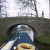
Nateby Hall Bridge No 66
is a minor waterways place
on the Lancaster Canal (Main Line) between
Ribble Link - Lancaster Canal Junction (16 miles and 3½ furlongs
to the south) and
Lodge Hill Junction (Junction with Lancaster Canal - Glasson Dock Branch) (6 miles and 1¼ furlongs
to the north).
The nearest place in the direction of Ribble Link - Lancaster Canal Junction is Garstang Marina Entrance;
3¾ furlongs
away.
The nearest place in the direction of Lodge Hill Junction is Ford Green Bridge No 67;
2¼ furlongs
away.
There may be access to the towpath here.
Mooring here is unrated.
There is a bridge here which takes a minor road over the canal.
Cathouse Bridge Winding Hole | 6½ furlongs | |
Cathouse Bridge No 64 | 6¼ furlongs | |
Bridge House Marina (entrance No 1) | 5¼ furlongs | |
Bridge House Marina (entrance No 2) | 4¾ furlongs | |
Garstang Marina Entrance | 3¾ furlongs | |
Nateby Hall Bridge No 66 | ||
Ford Green Bridge No 67 | 2¼ furlongs | |
Bells Bridge No 68 | 4 furlongs | |
Bells Bridge Winding Hole | 4 furlongs | |
Snape Wood Bridge No 69 | 5¾ furlongs | |
Davis Bridge No 70 | 1 mile, 1¾ furlongs |
There are no links to external websites from here.
Why not log in and add some (select "External websites" from the menu (sometimes this is under "Edit"))?
Mouseover for more information or show routes to facility
Nearest water point
In the direction of Preston Terminus
Moss Lane Bridge No 63 — 1 mile, ¼ furlongs away
On this waterway in the direction of Preston Terminus
Bilsborrow Winding Hole — 6 miles, 1 furlong away
On this waterway in the direction of Preston Terminus
Swill Brook Basin — 10 miles, 5½ furlongs away
On this waterway in the direction of Preston Terminus
Blackleach Lane Marina — 11 miles, ¾ furlongs away
On this waterway in the direction of Preston Terminus
Woodplumpton Road Bridge No 12 — 17 miles, 2¾ furlongs away
On this waterway in the direction of Preston Terminus
In the direction of Tewitfield
Ratcliffe Bridge No 75 — 3 miles, ½ furlongs away
On this waterway in the direction of Tewitfield
Lodge Hill Junction — 6 miles, 1¼ furlongs away
On this waterway in the direction of Tewitfield
Brows Bridge No 8 — 8 miles, 5¼ furlongs and 6 locks away
Travel to Lodge Hill Junction, then on the Lancaster Canal (Glasson Branch) to Brows Bridge No 8
Glasson Visitor Moorings — 8 miles, 5¾ furlongs and 6 locks away
Travel to Lodge Hill Junction, then on the Lancaster Canal (Glasson Branch) to Glasson Visitor Moorings
Glasson Basin — 8 miles, 7¼ furlongs and 6 locks away
Travel to Lodge Hill Junction, then on the Lancaster Canal (Glasson Branch) to Glasson Basin
Hest Bank Bridge No 118 — 16 miles, 4½ furlongs away
On this waterway in the direction of TewitfieldNearest rubbish disposal
In the direction of Preston Terminus
Bilsborrow Winding Hole — 6 miles, 1 furlong away
On this waterway in the direction of Preston Terminus
Woodplumpton Road Bridge No 12 — 17 miles, 2¾ furlongs away
On this waterway in the direction of Preston Terminus
In the direction of Tewitfield
Hest Bank Bridge No 118 — 16 miles, 4½ furlongs away
On this waterway in the direction of TewitfieldNearest chemical toilet disposal
In the direction of Preston Terminus
Bilsborrow Winding Hole — 6 miles, 1 furlong away
On this waterway in the direction of Preston Terminus
Woodplumpton Road Bridge No 12 — 17 miles, 2¾ furlongs away
On this waterway in the direction of Preston Terminus
In the direction of Tewitfield
Hest Bank Bridge No 118 — 16 miles, 4½ furlongs away
On this waterway in the direction of Tewitfield
Lundsfield Wharf — 19 miles, 7¾ furlongs away
On this waterway in the direction of TewitfieldNearest place to turn
In the direction of Preston Terminus
Cathouse Bridge Winding Hole — 6½ furlongs away
On this waterway in the direction of Preston Terminus
Moss Lane Bridge Winding Hole (north) — 1 mile, ¼ furlongs away
On this waterway in the direction of Preston Terminus
Moss Lane Bridge Winding Hole (south) — 1 mile, ½ furlongs away
On this waterway in the direction of Preston Terminus
Kepple Lane Bridge Winding Hole — 1 mile, 1¾ furlongs away
On this waterway in the direction of Preston Terminus
The Moorings Basin — 1 mile, 2¼ furlongs away
On this waterway in the direction of Preston Terminus
Dimples Bridge Winding Hole — 2 miles, ¼ furlongs away
On this waterway in the direction of Preston Terminus
Greenhalgh Castle Bridge Winding Hole — 2 miles, 2¼ furlongs away
On this waterway in the direction of Preston Terminus
Catterall Bridge Winding Hole — 3 miles, 2¾ furlongs away
On this waterway in the direction of Preston Terminus
Bilsborrow Winding Hole — 6 miles, 1 furlong away
On this waterway in the direction of Preston Terminus
White Horse Winding Hole — 7 miles, 2 furlongs away
On this waterway in the direction of Preston Terminus
Park Head Winding Hole — 8 miles, 2¼ furlongs away
On this waterway in the direction of Preston Terminus
Hollowforth Winding Hole — 9 miles, ½ furlongs away
On this waterway in the direction of Preston Terminus
Moons Bridge Marina — 9 miles, 1½ furlongs away
On this waterway in the direction of Preston Terminus
In the direction of Tewitfield
Bells Bridge Winding Hole — 4 furlongs away
On this waterway in the direction of Tewitfield
Ratcliffe Bridge Winding Hole — 2 miles, 7¾ furlongs away
On this waterway in the direction of Tewitfield
Richmond Bridge Winding Hole — 4 miles, 4½ furlongs away
On this waterway in the direction of Tewitfield
Lodge Hill Junction — 6 miles, 1¼ furlongs away
On this waterway in the direction of Tewitfield
Galgate Basin Wharf — 6 miles, 4¼ furlongs away
On this waterway in the direction of Tewitfield
Carter's Wood Winding Hole — 6 miles, 3½ furlongs and 1 lock away
Travel to Lodge Hill Junction, then on the Lancaster Canal (Glasson Branch) to Carter's Wood Winding Hole
Ashton Park Bridge Winding Hole — 8 miles, 1¾ furlongs away
On this waterway in the direction of TewitfieldNo information
CanalPlan has no information on any of the following facilities within range:self-operated pump-out
boatyard pump-out
Direction of TV transmitter (From Wolfbane Cybernetic)
There is no page on Wikipedia called “Nateby Hall Bridge”
Wikipedia pages that might relate to Nateby Hall Bridge
[Nateby railway station]
Nateby railway station served the village Nateby in Lancashire, England. It was originally named Winmarleigh railway station after the landowner at that
[Kirkby Stephen]
parish council and acts as a centre for villages and parishes that include Nateby, Ravenstonedale and Mallerstang. An electoral ward in the same name stretches
[Morecambe Promenade railway station]
after closure as part of the redevelopment plans. The town's Indoor Market Hall now occupies part of the site along with a Morrisons supermarket, and the
[List of places in Cumbria]
Morton (Eden) Mosedale, Mosser, Motherby Muncaster, Mungrisdale, Murton Nateby, Natland, Near Sawrey, Nenthall, Nenthead, Nethertown, Nether Wasdale Newbiggin
[Ashton Hall railway station]
Ashton Hall railway station was a private halt in Lancashire, England. Located on the Glasson Dock branch line, it was opened to serve Ashton Hall, the
[Ewood Bridge and Edenfield railway station]
Ewood Bridge and Edenfield railway station served the village of Edenfield, Rossendale, Lancashire. On 25 September 1916, a 179-metre (587 ft) long German
[Arkholme for Kirkby Lonsdale railway station]
Cockerham Cross Halt Cogie Hill Halt Nateby Garstang Town Garstang and Catterall Preston & Longridge Railway Maudland Bridge Deepdale Deepdale Street Ribbleton
[Hoole railway station]
Cockerham Cross Halt Cogie Hill Halt Nateby Garstang Town Garstang and Catterall Preston & Longridge Railway Maudland Bridge Deepdale Deepdale Street Ribbleton
[Maudland Bridge railway station]
Maudland Bridge railway station was once the Preston terminus of the Longridge Branch Line, in Lancashire, England. It was located on Maudland Road, between
[Shawforth railway station]
Cockerham Cross Halt Cogie Hill Halt Nateby Garstang Town Garstang and Catterall Preston & Longridge Railway Maudland Bridge Deepdale Deepdale Street Ribbleton
Results of Google Search
Feb 10, 2020 ... Please be advised navigation is closed at Bridge 66, Nateby Hall ... Type: Navigation Closure. Reason: Vegetation. Is the towpath closed? No ...
Nov 4, 2016 ... On the Lancaster Canal from Nateby Hall Bridge (66) north to the ... Liverpool Canal, Stop Line Number 14, each canal crossing became a ...
Polski: Nateby – wieś w Anglii, w hrabstwie Lancashire, w dystrykcie Wyre. ... Bridge 66 Lancaster Canal - geograph.org.uk - 998938.jpg 640 × 426; 147 KB. Bridge number 64 over the Lancaster Canal, Nateby (1).jpg 4,032 × 3,024; 3.52 MB ... Farm Track Nateby Hall - geograph.org.uk - 1107885.jpg 640 × 426; 135 KB.
1640, 2nd s. of Walter Strickland of Nateby Hall, Garstang, Lancs. by Anne, da. of ... I am glad to hear that Sir Roger Strickland is very well satisfied and thinks no ... D/Ry 2374, 2383, 2394; HMC Le Fleming, 179; HMC Dartmouth, i. 66; Cal.
View from Kepple Lane bridge, 13 miles to Lancaster ... Nateby Hall bridge ( Bridge 66), Fields and sheep ... Steps at Cartmels bridge, not been used for a while.
... Nateby and runs from bridge 54 Kenlis Arms Hotel to bridge 66 Nateby Hall. ... 59 formerly known as Garstang Turnpike Bridge then Highroad Bridge I'm not ...
Bridge 64 Cafe Bar, Garstang: See 135 unbiased reviews of Bridge 64 Cafe Bar, ... Bridge House Marina & Caravan Park Nateby Crossing Lane, Garstang PR3 0JJ ... And again Julie could not make us feel more welcome. ... .66 miles away.