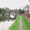
Meadow Lane Bridge No 39
is a minor waterways place
on the Grand Union Canal (Leicester Section - River Soar Navigation) between
Barrow upon Soar Junction (River Soar returns bypassing the Lock) (3 miles and ¾ furlongs
and 1 lock
to the southeast) and
Loughborough Branch Junction (4 furlongs
to the west).
The nearest place in the direction of Barrow upon Soar Junction is Nottingham Road Bridge No 38;
1¾ furlongs
away.
The nearest place in the direction of Loughborough Branch Junction is Boat Inn (Loughborough);
¼ furlongs
away.
There may be access to the towpath here.
Mooring here is impossible (it may be physically impossible, forbidden, or allowed only for specific short-term purposes).
There is a bridge here which takes a minor road over the canal.
| Moor Lane Bridge No 35 | 6½ furlongs | |
| Little Moor Lane Bridge No 36 | 4¾ furlongs | |
| Great Central Railway Bridge (disused) | 3 furlongs | |
| Loughborough CRT Visitor Moorings | 2¼ furlongs | |
| Nottingham Road Bridge No 38 | 1¾ furlongs | |
| Meadow Lane Bridge No 39 | ||
| Boat Inn (Loughborough) | ¼ furlongs | |
| Chain Bridge No 39B | 4 furlongs | |
| Loughborough Branch Junction | 4 furlongs | |
| Aqueduct by Belton Road Bridge | 5¼ furlongs | |
| Belton Road Bridge No 40 | 5½ furlongs | |
- Grand Union Canal Walk — associated with Grand Union Canal
- An illustrated walk along the Grand Union Canal from London to Birmingham
Mouseover for more information or show routes to facility
Nearest water point
In the direction of Trent Junction
Loughborough Basin — 5 furlongs away
Travel to Loughborough Branch Junction, then on the Grand Union Canal (Leicester Section - Loughborough Branch) to Loughborough Basin
Bishop Meadow Lock No 54 — 1 mile, 3¾ furlongs and 1 lock away
On this waterway in the direction of Trent Junction
Former BW Trent Lock Waterway Office — 9 miles, 5¾ furlongs and 8 locks away
Travel to Trent Junction, then on the Grand Union Canal (Erewash Canal) to Former BW Trent Lock Waterway Office
Sawley Locks No 2 — 10 miles, 3¾ furlongs and 7 locks away
Travel to Trent Junction, then on the River Trent (Western End) to Sawley Locks No 2
Cranfleet Lock No 3 — 10 miles, 2¼ furlongs and 8 locks away
Travel to Trent Junction, then on the River Trent (Western End) to Cranfleet Lock No 3
Shardlow — 12 miles, 5¾ furlongs and 10 locks away
Travel to Trent Junction, then on the River Trent (Western End) to Derwent Mouth, then on the Trent and Mersey Canal (Main Line - Derwent Mouth to Burton) to Shardlow
Beeston Lock No 5 — 14 miles, 4¾ furlongs and 9 locks away
Travel to Trent Junction, then on the River Trent (Western End) to Beeston Lock No 5
Weston Lock No 4 — 15 miles, 5¼ furlongs and 12 locks away
Travel to Trent Junction, then on the River Trent (Western End) to Derwent Mouth, then on the Trent and Mersey Canal (Main Line - Derwent Mouth to Burton) to Weston Lock No 4
Swarkestone Lock No 5 — 18 miles, 4½ furlongs and 13 locks away
Travel to Trent Junction, then on the River Trent (Western End) to Derwent Mouth, then on the Trent and Mersey Canal (Main Line - Derwent Mouth to Burton) to Swarkestone Lock No 5
In the direction of River Soar Junction
Barrow Boating — 3 miles, 4½ furlongs and 2 locks away
On this waterway in the direction of River Soar Junction
Hope and Anchor Bridge No 19 — 9 miles, 1½ furlongs and 6 locks away
On this waterway in the direction of River Soar Junction
Friars Mill Visitor Moorings — 15 miles, 1¼ furlongs and 11 locks away
On this waterway in the direction of River Soar JunctionNearest rubbish disposal
In the direction of Trent Junction
Loughborough Basin — 5 furlongs away
Travel to Loughborough Branch Junction, then on the Grand Union Canal (Leicester Section - Loughborough Branch) to Loughborough Basin
Former BW Trent Lock Waterway Office — 9 miles, 5¾ furlongs and 8 locks away
Travel to Trent Junction, then on the Grand Union Canal (Erewash Canal) to Former BW Trent Lock Waterway Office
Sawley Locks No 2 — 10 miles, 3¾ furlongs and 7 locks away
Travel to Trent Junction, then on the River Trent (Western End) to Sawley Locks No 2
Cranfleet Lock No 3 — 10 miles, 2¼ furlongs and 8 locks away
Travel to Trent Junction, then on the River Trent (Western End) to Cranfleet Lock No 3
Beeston Lock No 5 — 14 miles, 4¾ furlongs and 9 locks away
Travel to Trent Junction, then on the River Trent (Western End) to Beeston Lock No 5
Swarkestone Lock No 5 — 18 miles, 4½ furlongs and 13 locks away
Travel to Trent Junction, then on the River Trent (Western End) to Derwent Mouth, then on the Trent and Mersey Canal (Main Line - Derwent Mouth to Burton) to Swarkestone Lock No 5
In the direction of River Soar Junction
Barrow Boating — 3 miles, 4½ furlongs and 2 locks away
On this waterway in the direction of River Soar Junction
Broome Island — 4 miles, 2¾ furlongs and 2 locks away
On this waterway in the direction of River Soar JunctionNearest chemical toilet disposal
In the direction of Trent Junction
Former BW Trent Lock Waterway Office — 9 miles, 5¾ furlongs and 8 locks away
Travel to Trent Junction, then on the Grand Union Canal (Erewash Canal) to Former BW Trent Lock Waterway Office
Sawley Locks No 2 — 10 miles, 3¾ furlongs and 7 locks away
Travel to Trent Junction, then on the River Trent (Western End) to Sawley Locks No 2
Sawley Cut Wharf — 10 miles, 5½ furlongs and 8 locks away
Travel to Trent Junction, then on the River Trent (Western End) to Sawley Cut Wharf
Beeston Lock No 5 — 14 miles, 4¾ furlongs and 9 locks away
Travel to Trent Junction, then on the River Trent (Western End) to Beeston Lock No 5
In the direction of River Soar Junction
Barrow Boating — 3 miles, 4½ furlongs and 2 locks away
On this waterway in the direction of River Soar Junction
Sileby Mill Mooring Basin — 6 miles, ½ furlongs and 3 locks away
On this waterway in the direction of River Soar JunctionNearest place to turn
In the direction of Trent Junction
Loughborough Branch Junction — 4 furlongs away
On this waterway in the direction of Trent Junction
Loughborough Basin — 5 furlongs away
Travel to Loughborough Branch Junction, then on the Grand Union Canal (Leicester Section - Loughborough Branch) to Loughborough Basin
Bishops Meadow Junction — 1 mile, 7 furlongs and 2 locks away
On this waterway in the direction of Trent Junction
Soar Boat Club — 3 miles and 2 locks away
On this waterway in the direction of Trent Junction
Zouch Road Flood Gate — 3 miles, 2½ furlongs and 2 locks away
On this waterway in the direction of Trent Junction
London Road Marina (southern entrance) — 5 miles, 4¾ furlongs and 3 locks away
On this waterway in the direction of Trent Junction
London Road Marina (northern entrance) — 5 miles, 5¾ furlongs and 3 locks away
On this waterway in the direction of Trent Junction
Station Road Arm — 6 miles, 5¾ furlongs and 4 locks away
On this waterway in the direction of Trent Junction
In the direction of River Soar Junction
Pilling's Flood Lock Winding Hole — 2 miles, 1 furlong away
On this waterway in the direction of River Soar Junction
Pillings Lock Marina — 2 miles, 1½ furlongs away
On this waterway in the direction of River Soar Junction
Barrow upon Soar Junction — 3 miles, ¾ furlongs and 1 lock away
On this waterway in the direction of River Soar Junction
Barrow Boating — 3 miles, 4½ furlongs and 2 locks away
On this waterway in the direction of River Soar Junction
Meadow Farm Marina — 4 miles, 1¼ furlongs and 2 locks away
On this waterway in the direction of River Soar Junction
Meadow Farm Junction — 4 miles, 2 furlongs and 2 locks away
On this waterway in the direction of River Soar Junction
Soar Outlet by Mountsorrel Lock — 5 miles, 1¼ furlongs and 2 locks away
On this waterway in the direction of River Soar Junction
Mountsorrel Lock Junction — 5 miles, 2 furlongs and 3 locks away
On this waterway in the direction of River Soar Junction
Sileby Mill Mooring Basin — 6 miles, ½ furlongs and 3 locks away
On this waterway in the direction of River Soar Junction
Sileby Mill — 6 miles, 1¼ furlongs and 3 locks away
On this waterway in the direction of River Soar Junction
Loughborough Road Winding Hole — 7 miles, 3 furlongs and 4 locks away
On this waterway in the direction of River Soar Junction
Cossington Mill Stream Junction — 7 miles, 3½ furlongs and 4 locks away
On this waterway in the direction of River Soar JunctionNearest boatyard pump-out
In the direction of River Soar Junction
Sileby Mill Mooring Basin — 6 miles, ½ furlongs and 3 locks away
On this waterway in the direction of River Soar JunctionNo information
CanalPlan has no information on any of the following facilities within range:self-operated pump-out
Direction of TV transmitter (From Wolfbane Cybernetic)
There is no page on Wikipedia called “Meadow Lane Bridge”
Wikipedia pages that might relate to Meadow Lane Bridge
[Meadow Lane]
Meadow Lane Stadium is a football stadium in Nottingham, England. It is the home ground of Notts County, who have played there since 1910. The stadium
[Listed buildings in Stoke, Cheshire West and Chester]
"Densions Bridge (138), Stoak (1139453)", National Heritage List for England, retrieved 13 September 2013 Historic England, "Meadow Lane Bridge (139), Stoak
[Brumbaugh Bridge]
The Brumbaugh Bridge was a covered bridge in Lane County in the U.S. state of Oregon. Built in 1948, the structure originally carried Row River Road over
[Lady Bay Bridge]
Trent Bridge and connects the main thoroughfare of Radcliffe Road (on the south side) with Meadow Lane (on the north side). Originally, the bridge was the
[Aristotle Lane]
Polstead Road), with Port Meadow to the west, via bridges over the Oxford Canal and railway. The other access to the meadow from North Oxford is via Walton
[Golden Ears Bridge]
The Golden Ears Bridge is a six-lane extradosed bridge in Metro Vancouver, British Columbia. It spans the Fraser River, connecting Langley on the south
[Centennial Covered Bridge]
from the Meadows and Brumbaugh bridges, which were dismantled in 1979. List of Oregon covered bridges List of Registered Historic Places in Lane County
[Lions Gate Bridge]
the bridge, but the low flat delta land to the north required construction of the extensive North Viaduct. The bridge has three reversible lanes, the
[Pitt River Bridge]
River Bridge is a cable-stayed bridge that spans the Pitt River between Port Coquitlam and Pitt Meadows in British Columbia, Canada. The bridge is part
[Trent Bridge]
The site takes its name from the nearby main bridge over the Trent and it is also close to Meadow Lane and the City Ground, the football stadiums of


![#44 Rendell Street. There is an OS benchmark [[5187488]] on the front of the house about 1ft left of the alleyway by Roger Templeman – 05 January 2015](https://s0.geograph.org.uk/geophotos/05/18/75/5187500_d5b0f697_120x120.jpg)

![Green house on Glebe Street, Loughborough. Alongside the towpath of the Grand Union Canal [Leicester Navigation]. by Christine Johnstone – 10 May 2019](https://s1.geograph.org.uk/geophotos/06/17/84/6178449_da164a3f_120x120.jpg)


