Shipley Railway Bridge
12 Calley Avenue, Cotmanhay DE7 8BE, United Kingdom
Address is taken from a point 248 yards away.

Shipley Railway Bridge
is a minor waterways place
on the Grand Union Canal (Erewash Canal) between
Long Lane Bridge No 25 (3¼ furlongs
to the northwest) and
Bridge Street Bridge (Erewash Canal) (5 furlongs
to the south).
The nearest place in the direction of Long Lane Bridge No 25 is Shipley Mill Winding Hole;
1¾ furlongs
away.
The nearest place in the direction of Bridge Street Bridge (Erewash Canal) is Bridge Street Winding Hole;
4½ furlongs
away.
Mooring here is unrated.
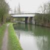
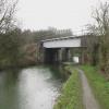
There is a bridge here which takes a railway over the canal.
Shipley Aqueduct | 4 furlongs | |
Shipley Lock No 72 | 3½ furlongs | |
Long Lane Bridge No 25 | 3¼ furlongs | |
Shipley Mill Bridge No 24 | 1¾ furlongs | |
Shipley Mill Winding Hole | 1¾ furlongs | |
Shipley Railway Bridge | ||
Bridge Street Winding Hole | 4½ furlongs | |
Bridge Street Bridge (Erewash Canal) | 5 furlongs | |
Stenson's Lock No 71 | 7¾ furlongs | |
Winding Hole below Stenson's Lock | 1 mile | |
Barker's Lock No 70 | 1 mile, 1¾ furlongs |
Amenities nearby at Bridge Street Winding Hole
- Grand Union Canal Walk — associated with Grand Union Canal
- An illustrated walk along the Grand Union Canal from London to Birmingham
Mouseover for more information or show routes to facility
Nearest water point
In the direction of Derby Road Bridge
Langley Junction — 1 mile, 6½ furlongs and 3 locks away
Travel to Derby Road Bridge, then on the Cromford Canal (broad gauge, navigable) to Langley Junction
In the direction of Trent Junction
Former BW Trent Lock Waterway Office — 9 miles, 5½ furlongs and 11 locks away
On this waterway in the direction of Trent Junction
Sawley Locks No 2 — 10 miles, 5½ furlongs and 12 locks away
Travel to Trent Junction, then on the River Trent (Western End) to Sawley Locks No 2
Cranfleet Lock No 3 — 10 miles, 4 furlongs and 13 locks away
Travel to Trent Junction, then on the River Trent (Western End) to Cranfleet Lock No 3
Shardlow — 12 miles, 7¼ furlongs and 15 locks away
Travel to Trent Junction, then on the River Trent (Western End) to Derwent Mouth, then on the Trent and Mersey Canal (Main Line - Derwent Mouth to Burton) to Shardlow
Beeston Lock No 5 — 14 miles, 6½ furlongs and 14 locks away
Travel to Trent Junction, then on the River Trent (Western End) to Beeston Lock No 5
Weston Lock No 4 — 15 miles, 7 furlongs and 17 locks away
Travel to Trent Junction, then on the River Trent (Western End) to Derwent Mouth, then on the Trent and Mersey Canal (Main Line - Derwent Mouth to Burton) to Weston Lock No 4
Bishop Meadow Lock No 54 — 17 miles, 7½ furlongs and 17 locks away
Travel to Trent Junction, then on the Grand Union Canal (Leicester Section - River Soar Navigation) to Bishop Meadow Lock No 54
Swarkestone Lock No 5 — 19 miles, ¼ furlongs and 16 locks away
Travel to Sandiacre Junction, then on the Derby and Sandiacre Canal to Swarkestone Junction, then on the Trent and Mersey Canal (Main Line - Derwent Mouth to Burton) to Swarkestone Lock No 5
Loughborough Basin — 19 miles, ¼ furlongs and 19 locks away
Travel to Trent Junction, then on the Grand Union Canal (Leicester Section - River Soar Navigation) to Loughborough Branch Junction, then on the Grand Union Canal (Leicester Section - Loughborough Branch) to Loughborough BasinNearest rubbish disposal
In the direction of Trent Junction
Former BW Trent Lock Waterway Office — 9 miles, 5½ furlongs and 11 locks away
On this waterway in the direction of Trent Junction
Sawley Locks No 2 — 10 miles, 5½ furlongs and 12 locks away
Travel to Trent Junction, then on the River Trent (Western End) to Sawley Locks No 2
Cranfleet Lock No 3 — 10 miles, 4 furlongs and 13 locks away
Travel to Trent Junction, then on the River Trent (Western End) to Cranfleet Lock No 3
Beeston Lock No 5 — 14 miles, 6½ furlongs and 14 locks away
Travel to Trent Junction, then on the River Trent (Western End) to Beeston Lock No 5
Swarkestone Lock No 5 — 19 miles, ¼ furlongs and 16 locks away
Travel to Sandiacre Junction, then on the Derby and Sandiacre Canal to Swarkestone Junction, then on the Trent and Mersey Canal (Main Line - Derwent Mouth to Burton) to Swarkestone Lock No 5
Loughborough Basin — 19 miles, ¼ furlongs and 19 locks away
Travel to Trent Junction, then on the Grand Union Canal (Leicester Section - River Soar Navigation) to Loughborough Branch Junction, then on the Grand Union Canal (Leicester Section - Loughborough Branch) to Loughborough BasinNearest chemical toilet disposal
In the direction of Derby Road Bridge
Langley Junction — 1 mile, 6½ furlongs and 3 locks away
Travel to Derby Road Bridge, then on the Cromford Canal (broad gauge, navigable) to Langley Junction
In the direction of Trent Junction
Former BW Trent Lock Waterway Office — 9 miles, 5½ furlongs and 11 locks away
On this waterway in the direction of Trent Junction
Sawley Locks No 2 — 10 miles, 5½ furlongs and 12 locks away
Travel to Trent Junction, then on the River Trent (Western End) to Sawley Locks No 2
Sawley Cut Wharf — 10 miles, 7 furlongs and 13 locks away
Travel to Trent Junction, then on the River Trent (Western End) to Sawley Cut Wharf
Beeston Lock No 5 — 14 miles, 6½ furlongs and 14 locks away
Travel to Trent Junction, then on the River Trent (Western End) to Beeston Lock No 5Nearest place to turn
In the direction of Derby Road Bridge
Shipley Mill Winding Hole — 1¾ furlongs away
On this waterway in the direction of Derby Road Bridge
Anchor Road Winding Hole — 1 mile, 4 furlongs and 2 locks away
On this waterway in the direction of Derby Road Bridge
Langley Junction — 1 mile, 6½ furlongs and 3 locks away
Travel to Derby Road Bridge, then on the Cromford Canal (broad gauge, navigable) to Langley Junction
In the direction of Trent Junction
Bridge Street Winding Hole — 4½ furlongs away
On this waterway in the direction of Trent Junction
Winding Hole below Stenson's Lock — 1 mile and 1 lock away
On this waterway in the direction of Trent Junction
Hallam Fields Lock Winding Hole — 3 miles, 6¾ furlongs and 5 locks away
On this waterway in the direction of Trent Junction
Winding Hole above Stanton Lock — 4 miles, 2½ furlongs and 6 locks away
On this waterway in the direction of Trent Junction
Sandiacre Junction — 6 miles, 4 furlongs and 8 locks away
On this waterway in the direction of Trent Junction
Long Eaton Winding Hole — 7 miles, 6¾ furlongs and 10 locks away
On this waterway in the direction of Trent Junction
Sheet Stores Basin — 9 miles, ½ furlongs and 11 locks away
On this waterway in the direction of Trent Junction
Former BW Trent Lock Waterway Office — 9 miles, 5½ furlongs and 11 locks away
On this waterway in the direction of Trent Junction
Soar Mouth — 10 miles and 12 locks away
Travel to Trent Junction, then on the Grand Union Canal (Leicester Section - River Soar Navigation) to Soar Mouth
Redhill Lock Junction — 10 miles, 2¾ furlongs and 12 locks away
Travel to Trent Junction, then on the Grand Union Canal (Leicester Section - River Soar Navigation) to Redhill Lock Junction
Sawley Lock No 2 Weir Exit — 10 miles, 4¾ furlongs and 12 locks away
Travel to Trent Junction, then on the River Trent (Western End) to Sawley Lock No 2 Weir Exit
Redhill Marine Ltd — 10 miles, 7 furlongs and 13 locks away
Travel to Trent Junction, then on the Grand Union Canal (Leicester Section - River Soar Navigation) to Redhill Marine Ltd
Ratcliffe Lock Junction — 11 miles, 1½ furlongs and 13 locks away
Travel to Trent Junction, then on the Grand Union Canal (Leicester Section - River Soar Navigation) to Ratcliffe Lock Junction
Cranfleet Lock Weir Exit — 10 miles, 4¾ furlongs and 14 locks away
Travel to Trent Junction, then on the River Trent (Western End) to Cranfleet Lock Weir Exit
Sawley Flood Lock Weir Entrance — 11 miles, 2¾ furlongs and 14 locks away
Travel to Trent Junction, then on the River Trent (Western End) to Sawley Flood Lock Weir Entrance
Ratcliffe Weir — 11 miles, 4¼ furlongs and 14 locks away
Travel to Trent Junction, then on the Grand Union Canal (Leicester Section - River Soar Navigation) to Ratcliffe Weir
Derwent Mouth — 11 miles, 6½ furlongs and 14 locks away
Travel to Trent Junction, then on the River Trent (Western End) to Derwent MouthNearest boatyard pump-out
In the direction of Derby Road Bridge
Langley Junction — 1 mile, 6½ furlongs and 3 locks away
Travel to Derby Road Bridge, then on the Cromford Canal (broad gauge, navigable) to Langley JunctionNo information
CanalPlan has no information on any of the following facilities within range:self-operated pump-out
Direction of TV transmitter (From Wolfbane Cybernetic)
There is no page on Wikipedia called “Shipley Railway Bridge”
Wikipedia pages that might relate to Shipley Railway Bridge
[Shipley railway station]
Shipley railway station serves the historic market town of Shipley in West Yorkshire, England. It is 2 3⁄4 miles (4.4 km) north of Bradford Forster Square
[Shipley and Windhill railway station]
Shipley and Windhill railway station was a railway station in Shipley, West Yorkshire, England between 1875 and 1931. During the 1860s, two small railway
[Shipley, West Yorkshire]
Shipley is a historic market town and civil parish in the City of Bradford, West Yorkshire, England, by the River Aire and the Leeds and Liverpool Canal
[Erewash Canal]
at Shipley Gate. Some of the embankments of the two branches are still in existence. The bridge abutments for the Midland Railway's wooden bridge which
[Kirkstall Forge railway station]
During 1905, the line between Leeds and Shipley was quadrupled, which involved slewing the line and building new bridges in several places. It was not considered
[Shipley Great Northern Railway branch line]
The Shipley Great Northern Railway branch line was a railway line that ran east, south and then westwards from Shipley to Bradford in West Yorkshire. The
[Frizinghall railway station]
between Forster Square and Shipley. At these times there are no trains to Leeds, though connections are available at Shipley into/out of the Skipton -
[Leeds and Bradford Railway]
a bridge and crossed the Skipton lines, coming back down on the southern side of the formation so as to be convenient for the junction at Shipley. The
[Idle railway station]
between Shipley and Idle until 1968. Little now remains to show that there was ever a railway station in Idle. The station was just south of the bridge where
[Thackley railway station]
formed to promote suburban railways in Bradford, the Bradford, Eccleshill and Idle Railway and the Idle and Shipley Railway. Their schemes - and the companies
Results of Google Search
Train Hebden Bridge to Shipley from £7 | Tickets & Timetables ...Train tickets from Hebden Bridge to Shipley start at £7, and the quickest route takes just 51 min. Check timetables and book your tickets with Rome2rio.
The Shipley Great Northern Railway branch line was a railway line that ran east, south and ... Bradford Exchange station was replaced by a smaller station built on the former Bridge Street Goods depot in the same year. This new station ...
Train tickets from Apperley Bridge to Shipley Station start at £2, and the quickest route takes just 4 min. Check timetables and book your tickets with Rome2rio.
Shipley railway station serves the historic market town of Shipley in West Yorkshire, England. ... Vehicular access is from the side away from town, under the bridge and up a long cobbled drive from Briggate and there is a large car- park ...
Aug 29, 2019 ... Today's top 14000+ Train jobs in Shipley Bridge, England, United Kingdom. Leverage your professional network, and get hired. New Train jobs ...
Travel by train from Apperley Bridge to Shipley (Yorks) in 4m. Get live times, compare prices & buy cheap train tickets. Save 61?n average when you buy in  ...
Nov 11, 2008 ... Railway_Bridge,_Leeds_Road,_Shipley_-_geograph.org.uk_-_1041840.jpg #x200e;( 640 × 427 pixels, file size: 245 KB, MIME type: image/jpeg) ...
Travel by train from Shipley (Yorks) to Apperley Bridge in 4m. Get live times, compare prices & buy cheap train tickets. Save 61?n average when you buy in  ...
English: Main Wikipedia article: Shipley railway station ... Low Well Bridge No SBF-47 - Leeds Road, Shipley - geograph.org.uk - 641585.jpg 640 × 451; 37 KB.
The character of the canal area changes markedly when passing under the railway bridge. To the west the towpath is a narrow rut between broad grass.