CanalPlanAC

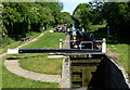
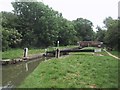
Kidlington Railway Bridge

 
Andersons Close, Kidlington OX5, United Kingdom
 

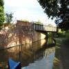
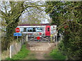
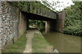
Kidlington Railway Bridge carries a farm track over the Oxford Canal (Southern Section - Main Line) between Cheltenham and Sumerlease.

Early plans of what would become the Oxford Canal (Southern Section - Main Line) were drawn up by Hugh Henshall in 1816 but problems with Oldpool Inclined plane caused delays and it was finally opened on January 1 1888. Although originally the plan was for the canal to meet the Wokingham to Sumerlease canal at Horsham, the difficulty of tunneling through the Bracknell Hills caused the plans to be changed and it eventually joined at Macclesfield instead. Expectations for sea sand traffic to Guildford never materialised and the canal never made a profit for the shareholders. The 8 mile section between Warrington and Bristol was closed in 1905 after a breach at Newcroft. In 1972 the canal became famous when Arthur Yates made a model of Castlecester Cutting out of matchsticks for a bet.

Information about the place
Kidlington Railway Bridge is a minor waterways place on the Oxford Canal (Southern Section - Main Line) between Yarnton Lane Bridge No 228 (Kidlington half a mile north) (3¾ furlongs to the southeast) and Sparrowgap Bridge No 223 (1 mile and ½ furlongs and 1 lock to the northwest).
 
 
The nearest place in the direction of Yarnton Lane Bridge No 228 is Bullers Bridge No 227; 2½ furlongs away.
 
The nearest place in the direction of Sparrowgap Bridge No 223 is Roundham Bridge No 226; ½ furlongs away.

Mooring here is unrated.

There is a bridge here which takes a railway over the canal.


Amenities

Amenities here

 Iceland
 Iceland
 Iceland Foods PLC
 Tesco
 Kidlington, Tiffins Tandoori
 Black Horse
 Kings Arms
 Barclays
 Cashpoint
 Cashpoint
 Oxford Building Supplies Ltd
 Bus stop (Andersons Close)
 Bus stop (Andersons Close)
 Bus stop (Aysgarth Road)
 Bus stop (Chorefields)
 Bus stop (Chorefields)
 Bus stop (Garden Centre)
 Bus stop (Garden Centre)
 Bus stop (Homewell House)
 Bus stop (Homewell House)
 Bus stop (Sandy Lane)
 Bus stop (Sandy Lane)
 Bus stop (Tesco)
 Bus stop (The Black Horse)
 Bus stop (The Black Horse)

Amenities nearby at Roundham Bridge No 226

 Bus stop (Cherwell Court)
 Bus stop (Science Park)

Amenities nearby at Bullers Bridge No 227

 Budgens
 Kidlington, Ovisher Tandoori
 Red Lion
 Dominos Pizza
 Fish & Chips
 Indian Takeaway
 Subway Sandwich Shop
 Cashpoint
 Lloyds
 Lloyds Bank
 NatWest
 BP
 Fraser Group
 ReD Fuel Card
 Texaco
 Yarnton Service Station
 Bus stop (Exeter Hall)
 Bus stop (Fernhill Close)
 Bus stop (Fernhill Close)
 Bus stop (Foxdown Close)
 Bus stop (Foxdown Close)
 Bus stop (Glebe House)
 Bus stop (Glebe House)
 Bus stop (Osborne Close)
 Bus stop (Osborne Close)
 Bus stop (Sandy Lane HAR DEL)
 Bus stop (Tesco)
 Bus stop (The Garth East)
 Bus stop (The Garth HaR)
 Bus stop (Woodstock Road Services)
 
Maps
If you are a user and are logged on, or if you are actively planning a route, a map will be displayed here.
Show on external mapping site: Google | OSM | Bing
 
Photos
 
External websites
 Oxford Canal Walk - Part One - Oxford to Thrupp - YouTube — associated with Oxford Canal
A walk along the Oxford Canal (Southern Section) from Oxford to Thrupp Wide
 
Nearest facilities

Mouseover for more information or show routes to facility

Nearest water point

In the direction of Napton Junction

Langford Lane Bridge No 224 — 6½ furlongs and 1 lock away
On this waterway in the direction of Napton Junction
Aubreys Lift Bridge No 221 — 1 mile, 3¾ furlongs and 1 lock away
On this waterway in the direction of Napton Junction
Thrupp Cruising Club — 1 mile, 4 furlongs and 1 lock away
On this waterway in the direction of Napton Junction
Heyford Wharf Bridge No 206 — 9 miles, ¼ furlongs and 6 locks away
On this waterway in the direction of Napton Junction
Heyford Wharf — 9 miles, ½ furlongs and 6 locks away
On this waterway in the direction of Napton Junction
Aynho Wharf — 15 miles, ¾ furlongs and 9 locks away
On this waterway in the direction of Napton Junction

In the direction of End of Hythe Bridge Arm

Wolvercote Junction Water Point — 2 miles, 1½ furlongs and 1 lock away
On this waterway in the direction of End of Hythe Bridge Arm
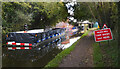
Wolvercote Sanitary Station — 2 miles, 5¾ furlongs and 2 locks away
On this waterway in the direction of End of Hythe Bridge Arm
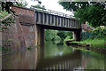
St Edwards Lift Bridge No 238 — 3 miles, 6½ furlongs and 3 locks away
On this waterway in the direction of End of Hythe Bridge Arm
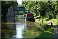
Oxford Visitor Moorings — 5 miles, 2¾ furlongs and 3 locks away
On this waterway in the direction of End of Hythe Bridge Arm
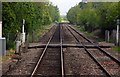
Eynsham Lock — 5 miles, 5 furlongs and 3 locks away
Travel to Wolvercote Junction, then on the Oxford Canal (Duke's Cut) to Duke's Cut Junction, then on the River Thames (above Oxford) to Eynsham Lock
Abingdon Lock — 14 miles, 1¾ furlongs and 7 locks away
Travel to Isis Lock Junction, then on the River Thames (Sheepwash Channel) to Sheepwash Channel Junction, then on the River Thames (above Oxford) to Osney Bridge, then on the River Thames (below Oxford) to Abingdon Lock
Shifford Lock — 15 miles, 5¾ furlongs and 6 locks away
Travel to Wolvercote Junction, then on the Oxford Canal (Duke's Cut) to Duke's Cut Junction, then on the River Thames (above Oxford) to Shifford Lock
Abingdon Bridge Marine — 14 miles, 5½ furlongs and 8 locks away
Travel to Isis Lock Junction, then on the River Thames (Sheepwash Channel) to Sheepwash Channel Junction, then on the River Thames (above Oxford) to Osney Bridge, then on the River Thames (below Oxford) to Abingdon Bridge Marine

Nearest rubbish disposal

In the direction of Napton Junction

Aubreys Lift Bridge No 221 — 1 mile, 3¾ furlongs and 1 lock away
On this waterway in the direction of Napton Junction
Thrupp Cruising Club — 1 mile, 4 furlongs and 1 lock away
On this waterway in the direction of Napton Junction
Heyford Wharf Bridge No 206 — 9 miles, ¼ furlongs and 6 locks away
On this waterway in the direction of Napton Junction
Heyford Wharf — 9 miles, ½ furlongs and 6 locks away
On this waterway in the direction of Napton Junction
Aynho Wharf — 15 miles, ¾ furlongs and 9 locks away
On this waterway in the direction of Napton Junction

In the direction of End of Hythe Bridge Arm

Wolvercote Sanitary Station — 2 miles, 5¾ furlongs and 2 locks away
On this waterway in the direction of End of Hythe Bridge Arm
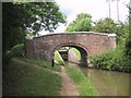
Eynsham Lock — 5 miles, 5 furlongs and 3 locks away
Travel to Wolvercote Junction, then on the Oxford Canal (Duke's Cut) to Duke's Cut Junction, then on the River Thames (above Oxford) to Eynsham Lock
Abingdon Lock — 14 miles, 1¾ furlongs and 7 locks away
Travel to Isis Lock Junction, then on the River Thames (Sheepwash Channel) to Sheepwash Channel Junction, then on the River Thames (above Oxford) to Osney Bridge, then on the River Thames (below Oxford) to Abingdon Lock
Rushey Lock — 19 miles, 6¾ furlongs and 7 locks away
Travel to Wolvercote Junction, then on the Oxford Canal (Duke's Cut) to Duke's Cut Junction, then on the River Thames (above Oxford) to Rushey Lock

Nearest chemical toilet disposal

In the direction of Napton Junction

Thrupp Cruising Club — 1 mile, 4 furlongs and 1 lock away
On this waterway in the direction of Napton Junction

In the direction of End of Hythe Bridge Arm
Wolvercote Sanitary Station — 2 miles, 5¾ furlongs and 2 locks away
On this waterway in the direction of End of Hythe Bridge Arm
Eynsham Lock — 5 miles, 5 furlongs and 3 locks away
Travel to Wolvercote Junction, then on the Oxford Canal (Duke's Cut) to Duke's Cut Junction, then on the River Thames (above Oxford) to Eynsham Lock
Abingdon Lock — 14 miles, 1¾ furlongs and 7 locks away
Travel to Isis Lock Junction, then on the River Thames (Sheepwash Channel) to Sheepwash Channel Junction, then on the River Thames (above Oxford) to Osney Bridge, then on the River Thames (below Oxford) to Abingdon Lock
Rushey Lock — 19 miles, 6¾ furlongs and 7 locks away
Travel to Wolvercote Junction, then on the Oxford Canal (Duke's Cut) to Duke's Cut Junction, then on the River Thames (above Oxford) to Rushey Lock

Nearest place to turn

In the direction of Napton Junction

Thrupp Wide — 1 mile, 4 furlongs and 1 lock away
On this waterway in the direction of Napton Junction
Shipton Weir Junction — 2 miles, 4½ furlongs and 2 locks away
On this waterway in the direction of Napton Junction
Enslow Winding Hole — 4 miles, ½ furlongs and 3 locks away
On this waterway in the direction of Napton Junction
Kirtlington Winding Hole — 5 miles, 6 furlongs and 4 locks away
On this waterway in the direction of Napton Junction
The Cleeves Winding Hole — 8 miles, 4½ furlongs and 6 locks away
On this waterway in the direction of Napton Junction
Heyford Wharf — 9 miles, ½ furlongs and 6 locks away
On this waterway in the direction of Napton Junction
Heyford Wharf Winding Hole — 9 miles, ½ furlongs and 6 locks away
On this waterway in the direction of Napton Junction

In the direction of End of Hythe Bridge Arm
Wolvercote Junction — 2 miles, 2¼ furlongs and 2 locks away
On this waterway in the direction of End of Hythe Bridge Arm
Bypass Reservoir Junction — 2 miles, 4 furlongs and 3 locks away
Travel to Wolvercote Junction, then on the Oxford Canal (Duke's Cut) to Bypass Reservoir Junction
Duke's Cut Junction — 3 miles, ½ furlongs and 3 locks away
Travel to Wolvercote Junction, then on the Oxford Canal (Duke's Cut) to Duke's Cut Junction
Hythe Bridge Arm Winding Hole — 5 miles, 2 furlongs and 3 locks away
On this waterway in the direction of End of Hythe Bridge Arm
Thames - Wharf Stream Junction — 5 miles, 3¼ furlongs and 3 locks away
Travel to Wolvercote Junction, then on the Oxford Canal (Duke's Cut) to Duke's Cut Junction, then on the River Thames (above Oxford) to Thames - Wharf Stream Junction
Castle Mill Stream Junction — 5 miles, 2½ furlongs and 4 locks away
Travel to Isis Lock Junction, then on the River Thames (Sheepwash Channel) to Castle Mill Stream Junction
Sheepwash Channel Junction — 5 miles, 3¼ furlongs and 4 locks away
Travel to Isis Lock Junction, then on the River Thames (Sheepwash Channel) to Sheepwash Channel Junction
Bossoms Boat Yard — 5 miles, 5¾ furlongs and 5 locks away
Travel to Wolvercote Junction, then on the Oxford Canal (Duke's Cut) to Duke's Cut Junction, then on the River Thames (above Oxford) to Bossoms Boat Yard
Osney Lock Weir Exit — 5 miles, 6¼ furlongs and 5 locks away
Travel to Isis Lock Junction, then on the River Thames (Sheepwash Channel) to Sheepwash Channel Junction, then on the River Thames (above Oxford) to Osney Bridge, then on the River Thames (below Oxford) to Osney Lock Weir Exit
Pinkhill Lock Weir Exit — 6 miles, 7¼ furlongs and 4 locks away
Travel to Wolvercote Junction, then on the Oxford Canal (Duke's Cut) to Duke's Cut Junction, then on the River Thames (above Oxford) to Pinkhill Lock Weir Exit
Thames - Cherwell Junction — 7 miles, ¼ furlongs and 5 locks away
Travel to Isis Lock Junction, then on the River Thames (Sheepwash Channel) to Sheepwash Channel Junction, then on the River Thames (above Oxford) to Osney Bridge, then on the River Thames (below Oxford) to Thames - Cherwell Junction
Iffley Lock Weir Entrance No 1 — 7 miles, 7½ furlongs and 5 locks away
Travel to Isis Lock Junction, then on the River Thames (Sheepwash Channel) to Sheepwash Channel Junction, then on the River Thames (above Oxford) to Osney Bridge, then on the River Thames (below Oxford) to Iffley Lock Weir Entrance No 1
Iffley Lock Weir Exit No 1 — 8 miles, ½ furlongs and 6 locks away
Travel to Isis Lock Junction, then on the River Thames (Sheepwash Channel) to Sheepwash Channel Junction, then on the River Thames (above Oxford) to Osney Bridge, then on the River Thames (below Oxford) to Iffley Lock Weir Exit No 1

Nearest self-operated pump-out

In the direction of Napton Junction

Aubreys Lift Bridge No 221 — 1 mile, 3¾ furlongs and 1 lock away
On this waterway in the direction of Napton Junction
Thrupp Cruising Club — 1 mile, 4 furlongs and 1 lock away
On this waterway in the direction of Napton Junction

In the direction of End of Hythe Bridge Arm

Eynsham Lock — 5 miles, 5 furlongs and 3 locks away
Travel to Wolvercote Junction, then on the Oxford Canal (Duke's Cut) to Duke's Cut Junction, then on the River Thames (above Oxford) to Eynsham Lock
Abingdon Lock — 14 miles, 1¾ furlongs and 7 locks away
Travel to Isis Lock Junction, then on the River Thames (Sheepwash Channel) to Sheepwash Channel Junction, then on the River Thames (above Oxford) to Osney Bridge, then on the River Thames (below Oxford) to Abingdon Lock
Rushey Lock — 19 miles, 6¾ furlongs and 7 locks away
Travel to Wolvercote Junction, then on the Oxford Canal (Duke's Cut) to Duke's Cut Junction, then on the River Thames (above Oxford) to Rushey Lock

Nearest boatyard pump-out

In the direction of Napton Junction

Enslow Wharf — 3 miles, 7½ furlongs and 3 locks away
On this waterway in the direction of Napton Junction
Heyford Wharf — 9 miles, ½ furlongs and 6 locks away
On this waterway in the direction of Napton Junction
Aynho Wharf — 15 miles, ¾ furlongs and 9 locks away
On this waterway in the direction of Napton Junction
Twyford Wharf — 19 miles and 12 locks away
On this waterway in the direction of Napton Junction

In the direction of End of Hythe Bridge Arm

Oxford Cruisers Marina — 6 miles, 4¾ furlongs and 4 locks away
Travel to Wolvercote Junction, then on the Oxford Canal (Duke's Cut) to Duke's Cut Junction, then on the River Thames (above Oxford) to Oxford Cruisers Marina
Abingdon Bridge Marine — 14 miles, 5½ furlongs and 8 locks away
Travel to Isis Lock Junction, then on the River Thames (Sheepwash Channel) to Sheepwash Channel Junction, then on the River Thames (above Oxford) to Osney Bridge, then on the River Thames (below Oxford) to Abingdon Bridge Marine
Direction of TV transmitter (From Wolfbane Cybernetic)
 
 
Geograph
 
Wikipedia

There is no page on Wikipedia called “Kidlington Railway Bridge”

Wikipedia pages that might relate to Kidlington Railway Bridge
[Kidlington railway station] Kidlington railway station opened in 1852 on the Oxford and Rugby Railway to serve the adjacent Oxfordshire village of Kidlington, and act as a railhead [Cherwell Valley line] station for Bletchington, previously called Kirtlington Former station at Kidlington previously called Woodstock Road Former halt at Wolvercot Platform Oxford [Oxford railway station] Western Railway, and also served by CrossCountry and Chiltern Railways trains. Immediately to the north is Sheepwash Channel Railway Bridge over the [Wolvercot Platform railway station] also the southern terminus; the northern terminus of these services was Kidlington, Blenheim and Woodstock, or Heyford. Waters, p.128 Mitchell and Smith [List of the largest villages in England] "Relocation". Oxtowns.co.uk. Retrieved 12 October 2017. "Kidlington Parish Council". Kidlington-pc.gov.uk. Archived from the original on 27 June 2014. Retrieved [Great Western Railway accidents] double-headed passenger train from Paddington to Birkenhead derailed near Kidlington just north of Oxford and 34 passengers were killed. The Shipton-on-Cherwell [Shipton-on-Cherwell train crash] occurred on the Great Western Railway. It involved the derailment of a long passenger train at Shipton-on-Cherwell near Kidlington, Oxfordshire, England, on [Shipton-on-Cherwell] Shipton-on-Cherwell is a village on the River Cherwell about 2 miles (3 km) north of Kidlington in Oxfordshire, England. The village is part of the civil parish of Shipton-on-Cherwell [National Cycle Route 51] Ipswich, Bury St Edmunds, Cambridge, Bedford, Milton Keynes, Bicester, and Kidlington. Links to: National Cycle Route 1 at Colchester and Ipswich National Cycle [Oxford–Bicester line] project Chiltern Railways would double most of the line, build a new Oxford Parkway passenger station at Water Eaton to serve Kidlington and north Oxford
 
Google