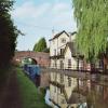
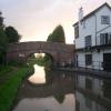
Stoke Pound Bridge No 48
is a place on the waterways
on the Worcester and Birmingham Canal (Diglis Basin to King's Norton Junction) between
Hanbury Junction (Junction with Droitwich Junction Canal (Restored - Opened 1/July/2011). Hanbury Wharf) (4 miles and 1¼ furlongs
and 12 locks
to the southwest) and
King's Norton Junction (Junction of Stratford and Worcester and Birmingham Canals) (11 miles and 1¼ furlongs
and 30 locks
to the northeast).
The nearest place in the direction of Hanbury Junction is Stoke Prior Top Lock No 28 (Bridge No 47);
¾ furlongs
away.
The nearest place in the direction of King's Norton Junction is The Queens Head PH (Stoke Pound) (Canalside);
¼ furlongs
away.
There is access (via steps) to the towpath here.
Mooring here is excellent (this is a really good mooring), mooring pins are needed. Mooring is limited to 14 days. Super pub 'The Queens Head' .
There is a bridge here which takes a minor road over the canal.
| Stoke Prior Lock No 26 | 3¾ furlongs | |
| Whitford Bridge No 46 | 2¾ furlongs | |
| Stoke Prior Lock No 27 | 2¾ furlongs | |
| Thomson's Bridge No 47 | ¾ furlongs | |
| Stoke Prior Top Lock No 28 | ¾ furlongs | |
| Stoke Pound Bridge No 48 | ||
| The Queens Head PH (Stoke Pound) | ¼ furlongs | |
| Queens Head Visitor Moorings | ¼ furlongs | |
| Tardebigge Bottom Lock No 29 | 1¼ furlongs | |
| Tardebigge Lock No 30 | 1¾ furlongs | |
| Stoke Court Bridge No 49 | 2 furlongs | |
There are no links to external websites from here.
Why not log in and add some (select "External websites" from the menu (sometimes this is under "Edit"))?
Mouseover for more information or show routes to facility
Nearest water point
In the direction of King's Norton Junction
Tardebigge Wharf — 2 miles, 3½ furlongs and 30 locks away
On this waterway in the direction of King's Norton Junction
Hopwood Visitor Moorings — 7 miles, 7¼ furlongs and 30 locks away
On this waterway in the direction of King's Norton Junction
King's Norton Water Point — 11 miles, ½ furlongs and 30 locks away
On this waterway in the direction of King's Norton Junction
Yardley Wood Water Point — 13 miles, 5¾ furlongs and 30 locks away
Travel to King's Norton Junction, then on the Stratford-on-Avon Canal (Northern Section) to Yardley Wood Water Point
Holliday Wharf — 16 miles, 3¼ furlongs and 30 locks away
Travel to King's Norton Junction, then on the Worcester and Birmingham Canal (Birmingham to King's Norton) to Holliday Wharf
Worcester Bar — 16 miles, 5¼ furlongs and 30 locks away
Travel to King's Norton Junction, then on the Worcester and Birmingham Canal (Birmingham to King's Norton) to Worcester Bar
Hawne Basin — 16 miles, 5¾ furlongs and 30 locks away
Travel to King's Norton Junction, then on the Worcester and Birmingham Canal (Birmingham to King's Norton) to New Selly Oak Junction, then on the Birmingham Canal Navigations (Dudley Canal No 2 - Lapal Canal - Original Line East End ) to Somery Road Bridge, then on the Birmingham Canal Navigations (Dudley Canal No 2 - Lapal Canal - Abandoned Line ) to Lapal Canal - New line Diverges From Original Route, then on the Birmingham Canal Navigations (Dudley Canal No 2 - Lapal Canal - Original Line West End ) to Coombeswood, then on the Birmingham Canal Navigations (Dudley Canal No 2 - Coombeswood ) to Hawne Basin
Cambrian Wharf Services — 17 miles, 1¼ furlongs and 30 locks away
Travel to King's Norton Junction, then on the Worcester and Birmingham Canal (Birmingham to King's Norton) to Worcester Bar, then on the Birmingham Canal Navigations (Main Line) to Deep Cuttings Junction, then on the Birmingham Canal Navigations (Newhall Branch) to Cambrian Wharf Services
Earlswood Reservoir Feeder — 17 miles, 6¾ furlongs and 30 locks away
Travel to King's Norton Junction, then on the Stratford-on-Avon Canal (Northern Section) to Earlswood Reservoir Feeder
Waring's Green Wharf — 18 miles, 6¾ furlongs and 30 locks away
Travel to King's Norton Junction, then on the Stratford-on-Avon Canal (Northern Section) to Waring's Green Wharf
In the direction of Diglis Basin
Stoke Works Water Point — 1 mile, 5 furlongs and 6 locks away
On this waterway in the direction of Diglis Basin
Hanbury Boatyard — 4 miles, 2¼ furlongs and 12 locks away
On this waterway in the direction of Diglis Basin
Droitwich Spa Marina — 4 miles, 4½ furlongs and 15 locks away
Travel to Hanbury Junction, then on the Droitwich Canals (Droitwich Junction Canal) to Droitwich Spa Marina
Netherwich Basin — 6 miles and 20 locks away
Travel to Hanbury Junction, then on the Droitwich Canals (Droitwich Junction Canal) to Droitwich Junction, then on the Droitwich Canals (Droitwich Barge Canal) to Netherwich Basin
Lowesmoor Basin — 12 miles, 1½ furlongs and 24 locks away
On this waterway in the direction of Diglis Basin
Diglis Services — 13 miles, 1¼ furlongs and 26 locks away
On this waterway in the direction of Diglis Basin
Diglis Locks — 13 miles, 5¼ furlongs and 28 locks away
Travel to Diglis Basin, then on the Worcester and Birmingham Canal (Diglis Junction to Diglis Basin) to Diglis Junction, then on the River Severn (main river - Worcester to Gloucester) to Diglis Locks
Worcester Trip Boat Moorings — 14 miles, 1 furlong and 28 locks away
Travel to Diglis Basin, then on the Worcester and Birmingham Canal (Diglis Junction to Diglis Basin) to Diglis Junction, then on the River Severn (main river - Stourport to Worcester) to Worcester Trip Boat Moorings
Holt Lock (Holt Fleet) — 14 miles, 3¼ furlongs and 28 locks away
Travel to Hanbury Junction, then on the Droitwich Canals (Droitwich Junction Canal) to Droitwich Junction, then on the Droitwich Canals (Droitwich Barge Canal) to Hawford Junction, then on the River Severn (main river - Stourport to Worcester) to Holt Lock (Holt Fleet)
Lincomb Lock — 18 miles, 5 furlongs and 29 locks away
Travel to Hanbury Junction, then on the Droitwich Canals (Droitwich Junction Canal) to Droitwich Junction, then on the Droitwich Canals (Droitwich Barge Canal) to Hawford Junction, then on the River Severn (main river - Stourport to Worcester) to Lincomb LockNearest rubbish disposal
In the direction of King's Norton Junction
Tardebigge Wharf — 2 miles, 3½ furlongs and 30 locks away
On this waterway in the direction of King's Norton Junction
Worcester Bar — 16 miles, 5¼ furlongs and 30 locks away
Travel to King's Norton Junction, then on the Worcester and Birmingham Canal (Birmingham to King's Norton) to Worcester Bar
Hawne Basin — 16 miles, 5¾ furlongs and 30 locks away
Travel to King's Norton Junction, then on the Worcester and Birmingham Canal (Birmingham to King's Norton) to New Selly Oak Junction, then on the Birmingham Canal Navigations (Dudley Canal No 2 - Lapal Canal - Original Line East End ) to Somery Road Bridge, then on the Birmingham Canal Navigations (Dudley Canal No 2 - Lapal Canal - Abandoned Line ) to Lapal Canal - New line Diverges From Original Route, then on the Birmingham Canal Navigations (Dudley Canal No 2 - Lapal Canal - Original Line West End ) to Coombeswood, then on the Birmingham Canal Navigations (Dudley Canal No 2 - Coombeswood ) to Hawne Basin
Cambrian Wharf Services — 17 miles, 1¼ furlongs and 30 locks away
Travel to King's Norton Junction, then on the Worcester and Birmingham Canal (Birmingham to King's Norton) to Worcester Bar, then on the Birmingham Canal Navigations (Main Line) to Deep Cuttings Junction, then on the Birmingham Canal Navigations (Newhall Branch) to Cambrian Wharf Services
Waring's Green Wharf — 18 miles, 6¾ furlongs and 30 locks away
Travel to King's Norton Junction, then on the Stratford-on-Avon Canal (Northern Section) to Waring's Green Wharf
Farmers Bridge Lock No 8 — 17 miles, 4½ furlongs and 37 locks away
Travel to King's Norton Junction, then on the Worcester and Birmingham Canal (Birmingham to King's Norton) to Worcester Bar, then on the Birmingham Canal Navigations (Main Line) to Deep Cuttings Junction, then on the Birmingham Canal Navigations (Newhall Branch) to Farmers Bridge Junction, then on the Birmingham Canal Navigations (Birmingham and Fazeley Canal - Main Line) to Farmers Bridge Lock No 8
In the direction of Diglis Basin
Stoke Bottom Lock No 23 — 7¼ furlongs and 5 locks away
On this waterway in the direction of Diglis Basin
Droitwich Spa Marina — 4 miles, 4½ furlongs and 15 locks away
Travel to Hanbury Junction, then on the Droitwich Canals (Droitwich Junction Canal) to Droitwich Spa Marina
Netherwich Basin — 6 miles and 20 locks away
Travel to Hanbury Junction, then on the Droitwich Canals (Droitwich Junction Canal) to Droitwich Junction, then on the Droitwich Canals (Droitwich Barge Canal) to Netherwich Basin
Lowesmoor Basin — 12 miles, 1½ furlongs and 24 locks away
On this waterway in the direction of Diglis Basin
Diglis Basin — 13 miles, 1¾ furlongs and 26 locks away
On this waterway in the direction of Diglis Basin
Sabrina Footbridge — 14 miles, 2¾ furlongs and 28 locks away
Travel to Diglis Basin, then on the Worcester and Birmingham Canal (Diglis Junction to Diglis Basin) to Diglis Junction, then on the River Severn (main river - Stourport to Worcester) to Sabrina FootbridgeNearest chemical toilet disposal
In the direction of King's Norton Junction
Tardebigge Wharf — 2 miles, 3½ furlongs and 30 locks away
On this waterway in the direction of King's Norton Junction
Holliday Wharf — 16 miles, 3¼ furlongs and 30 locks away
Travel to King's Norton Junction, then on the Worcester and Birmingham Canal (Birmingham to King's Norton) to Holliday Wharf
Worcester Bar — 16 miles, 5¼ furlongs and 30 locks away
Travel to King's Norton Junction, then on the Worcester and Birmingham Canal (Birmingham to King's Norton) to Worcester Bar
Hawne Basin — 16 miles, 5¾ furlongs and 30 locks away
Travel to King's Norton Junction, then on the Worcester and Birmingham Canal (Birmingham to King's Norton) to New Selly Oak Junction, then on the Birmingham Canal Navigations (Dudley Canal No 2 - Lapal Canal - Original Line East End ) to Somery Road Bridge, then on the Birmingham Canal Navigations (Dudley Canal No 2 - Lapal Canal - Abandoned Line ) to Lapal Canal - New line Diverges From Original Route, then on the Birmingham Canal Navigations (Dudley Canal No 2 - Lapal Canal - Original Line West End ) to Coombeswood, then on the Birmingham Canal Navigations (Dudley Canal No 2 - Coombeswood ) to Hawne Basin
Cambrian Wharf Services — 17 miles, 1¼ furlongs and 30 locks away
Travel to King's Norton Junction, then on the Worcester and Birmingham Canal (Birmingham to King's Norton) to Worcester Bar, then on the Birmingham Canal Navigations (Main Line) to Deep Cuttings Junction, then on the Birmingham Canal Navigations (Newhall Branch) to Cambrian Wharf Services
Earlswood Reservoir Feeder — 17 miles, 6¾ furlongs and 30 locks away
Travel to King's Norton Junction, then on the Stratford-on-Avon Canal (Northern Section) to Earlswood Reservoir Feeder
Waring's Green Wharf — 18 miles, 6¾ furlongs and 30 locks away
Travel to King's Norton Junction, then on the Stratford-on-Avon Canal (Northern Section) to Waring's Green Wharf
In the direction of Diglis Basin
Stoke Bottom Lock No 23 — 7¼ furlongs and 5 locks away
On this waterway in the direction of Diglis Basin
Droitwich Spa Marina — 4 miles, 4½ furlongs and 15 locks away
Travel to Hanbury Junction, then on the Droitwich Canals (Droitwich Junction Canal) to Droitwich Spa Marina
Lowesmoor Basin — 12 miles, 1½ furlongs and 24 locks away
On this waterway in the direction of Diglis Basin
Diglis Services — 13 miles, 1¼ furlongs and 26 locks away
On this waterway in the direction of Diglis Basin
Stourport Marina — 19 miles, ¼ furlongs and 30 locks away
Travel to Hanbury Junction, then on the Droitwich Canals (Droitwich Junction Canal) to Droitwich Junction, then on the Droitwich Canals (Droitwich Barge Canal) to Hawford Junction, then on the River Severn (main river - Stourport to Worcester) to Stourport MarinaNearest place to turn
In the direction of King's Norton Junction
Tardebigge Wharf — 2 miles, 3½ furlongs and 30 locks away
On this waterway in the direction of King's Norton Junction
Tardebigge Old Wharf — 3 miles, ½ furlongs and 30 locks away
On this waterway in the direction of King's Norton Junction
Scarfield Hill Bridge Winding Hole — 5 miles, 2¾ furlongs and 30 locks away
On this waterway in the direction of King's Norton Junction
Crown Meadow Arm — 6 miles, 1¼ furlongs and 30 locks away
On this waterway in the direction of King's Norton Junction
In the direction of Diglis Basin
Stoke Wharf — 6¾ furlongs and 5 locks away
On this waterway in the direction of Diglis Basin
Astwood Winding Hole — 2 miles, 3¾ furlongs and 10 locks away
On this waterway in the direction of Diglis Basin
Hanbury Junction Winding Hole — 4 miles and 12 locks away
On this waterway in the direction of Diglis Basin
Hanbury Junction — 4 miles, 1¼ furlongs and 12 locks away
On this waterway in the direction of Diglis Basin
Hanbury Boatyard — 4 miles, 2¼ furlongs and 12 locks away
On this waterway in the direction of Diglis Basin
Dunhampstead Boatyard — 6 miles, ½ furlongs and 12 locks away
On this waterway in the direction of Diglis Basin
Dunhampstead Winding Hole — 6 miles, 2¾ furlongs and 12 locks away
On this waterway in the direction of Diglis Basin
Tibberton Winding Hole — 7 miles, 2¼ furlongs and 12 locks away
On this waterway in the direction of Diglis Basin
Droitwich Spa Marina — 4 miles, 4½ furlongs and 15 locks away
Travel to Hanbury Junction, then on the Droitwich Canals (Droitwich Junction Canal) to Droitwich Spa Marina
Lock No 6 Winding Hole — 4 miles, 7½ furlongs and 17 locks away
Travel to Hanbury Junction, then on the Droitwich Canals (Droitwich Junction Canal) to Lock No 6 Winding Hole
Droitwich Town Wharf — 5 miles, 6 furlongs and 20 locks away
Travel to Hanbury Junction, then on the Droitwich Canals (Droitwich Junction Canal) to Droitwich Junction, then on the Droitwich Canals (Droitwich Barge Canal) to Droitwich Town Wharf
Netherwich Basin — 6 miles and 20 locks away
Travel to Hanbury Junction, then on the Droitwich Canals (Droitwich Junction Canal) to Droitwich Junction, then on the Droitwich Canals (Droitwich Barge Canal) to Netherwich Basin
Winding Hole (east of Salwarpe Road Bridge) — 6 miles, 1½ furlongs and 20 locks away
Travel to Hanbury Junction, then on the Droitwich Canals (Droitwich Junction Canal) to Droitwich Junction, then on the Droitwich Canals (Droitwich Barge Canal) to Winding Hole (east of Salwarpe Road Bridge)
Ladywood Top Lock Winding Hole — 8 miles, 6 furlongs and 20 locks away
Travel to Hanbury Junction, then on the Droitwich Canals (Droitwich Junction Canal) to Droitwich Junction, then on the Droitwich Canals (Droitwich Barge Canal) to Ladywood Top Lock Winding Hole
Bilford Locks Winding Hole — 10 miles, 7¾ furlongs and 21 locks away
On this waterway in the direction of Diglis Basin
Lowesmoor Basin — 12 miles, 1½ furlongs and 24 locks away
On this waterway in the direction of Diglis BasinNearest self-operated pump-out
In the direction of Diglis Basin
Droitwich Spa Marina — 4 miles, 4½ furlongs and 15 locks away
Travel to Hanbury Junction, then on the Droitwich Canals (Droitwich Junction Canal) to Droitwich Spa Marina
Diglis Services — 13 miles, 1¼ furlongs and 26 locks away
On this waterway in the direction of Diglis BasinNearest boatyard pump-out
In the direction of King's Norton Junction
Hawne Basin — 16 miles, 5¾ furlongs and 30 locks away
Travel to King's Norton Junction, then on the Worcester and Birmingham Canal (Birmingham to King's Norton) to New Selly Oak Junction, then on the Birmingham Canal Navigations (Dudley Canal No 2 - Lapal Canal - Original Line East End ) to Somery Road Bridge, then on the Birmingham Canal Navigations (Dudley Canal No 2 - Lapal Canal - Abandoned Line ) to Lapal Canal - New line Diverges From Original Route, then on the Birmingham Canal Navigations (Dudley Canal No 2 - Lapal Canal - Original Line West End ) to Coombeswood, then on the Birmingham Canal Navigations (Dudley Canal No 2 - Coombeswood ) to Hawne Basin
Sherborne Wharf Services — 17 miles, 1½ furlongs and 30 locks away
Travel to King's Norton Junction, then on the Worcester and Birmingham Canal (Birmingham to King's Norton) to Worcester Bar, then on the Birmingham Canal Navigations (Main Line) to Sherborne Wharf Services
Earlswood Reservoir Feeder — 17 miles, 6¾ furlongs and 30 locks away
Travel to King's Norton Junction, then on the Stratford-on-Avon Canal (Northern Section) to Earlswood Reservoir Feeder
Waring's Green Wharf — 18 miles, 6¾ furlongs and 30 locks away
Travel to King's Norton Junction, then on the Stratford-on-Avon Canal (Northern Section) to Waring's Green Wharf
Withymoor Island Service Wharf — 19 miles, 6¾ furlongs and 30 locks away
Travel to King's Norton Junction, then on the Worcester and Birmingham Canal (Birmingham to King's Norton) to New Selly Oak Junction, then on the Birmingham Canal Navigations (Dudley Canal No 2 - Lapal Canal - Original Line East End ) to Somery Road Bridge, then on the Birmingham Canal Navigations (Dudley Canal No 2 - Lapal Canal - Abandoned Line ) to Lapal Canal - New line Diverges From Original Route, then on the Birmingham Canal Navigations (Dudley Canal No 2 - Lapal Canal - Original Line West End ) to Coombeswood, then on the Birmingham Canal Navigations (Dudley Canal No 2 - Coombeswood ) to Withymoor Island Service Wharf
In the direction of Diglis Basin
Hanbury Boatyard — 4 miles, 2¼ furlongs and 12 locks away
On this waterway in the direction of Diglis Basin
Dunhampstead Boatyard — 6 miles, ½ furlongs and 12 locks away
On this waterway in the direction of Diglis Basin
Lowesmoor Basin — 12 miles, 1½ furlongs and 24 locks away
On this waterway in the direction of Diglis Basin
Stourport Marina — 19 miles, ¼ furlongs and 30 locks away
Travel to Hanbury Junction, then on the Droitwich Canals (Droitwich Junction Canal) to Droitwich Junction, then on the Droitwich Canals (Droitwich Barge Canal) to Hawford Junction, then on the River Severn (main river - Stourport to Worcester) to Stourport MarinaDirection of TV transmitter (From Wolfbane Cybernetic)
There is no page on Wikipedia called “Stoke Pound Bridge”
Wikipedia pages that might relate to Stoke Pound Bridge
[Tardebigge Locks]
the Tardebigge tunnel (580 yards or 530 metres long) to the North and the Stoke Prior flight of six narrow locks to the South. The Tardebigge Engine House
[Listed buildings in Stoke upon Tern]
churchyard, another church, a row of cottages, two milestones, a bridge, and an animal pound. Historic England Historic England & 1176600 Historic England
[List of places in Worcestershire]
Stanford Bridge, Stanford-on-Teme, Stanklyn, Staple Hill, Stitchin's Hill, Stock Green, Stock Wood, Stockton-on-Teme, Stoke Bliss, Stoke Heath, Stoke Pound, Stoke
[Peter Crouch]
Premier League. He joined Stoke City in August 2011, for a club record fee of £10 million. In his first season with Stoke, he scored 14 goals and won
[Whitchurch-on-Thames]
In 1787 the flash lock was replaced with a pound lock, Whitchurch Lock. The original Whitchurch Toll Bridge between Whitchurch and Pangbourne was built
[List of Live episodes]
Omari Hardwick, A Great Big World July 6 Jim Parsons 50 Cent, Julia Stiles, Pound Rockout Workout July 7 Dwyane Wade Eric Stonestreet, Magic! July 8 Guillermo
[Tay Bridge disaster]
British bridge designs had to allow for wind loadings of up to 56 pounds per square foot (2.7 kilopascals). Bouch's design for the Forth Bridge was not
[Staffordshire]
and Shropshire to the west. The largest settlement in Staffordshire is Stoke-on-Trent, which is administered as an independent unitary authority, separately
[HMS Beagle]
Journal, John Lort Stokes said that the ship was taken up the River Thames to salute the coronation, passing through the old London Bridge, and was the first
[Whilton Locks]
flight is a long level pound, which stretches 14.6 miles (23.5 km) to the Stoke Bruerne Canal Museum and the top of the Stoke Bruerne flight of seven
Results of Google Search
WORCESTER AND BIRMINGHAM CANAL, STOKE POUND BRIDGESO 96 NE STOKE PRIOR CP WORCESTER & BIRMINGHAM CANAL 9/118 Stoke Pound Bridge (No 48) GV II Canal bridge. c1805 with some late C19 and ...
Feb 19, 2009 ... English: Worcester & Birmingham Canal - Bridge No 48 The Queen's Head at Stoke Pound lies between the six lock Stoke Flight and thirty lock ...
Jul 16, 1986 ... Worcester and Birmingham Canal, Stoke Pound Bridge (Number 48) is a Grade II listed building in Stoke, Worcestershire, England. See why it ...
Jan 25, 2011 ... This is Bridge No 48 on the Worcester and Birmingham Canal at the foot of the Tardebigge flight of locks. A former pub is on the left, which is ...
Jan 26, 2011 ... This is bridge No 48 on the Worcester and Birmingham Canal near the foot of the thirty lock Tardebigge flight. On the left is a former pub, The ...
Feb 5, 2011 ... Ahead is Stoke Pound Bridge, No 48. On the right is the Queen's Head Inn, formerly a traditional public house, but now transformed to a ...


![The Queen's Head Inn (2) - signs, Sugarbrook Lane, Stoke Pound. These are very modern signs, and no doubt when the pub was renamed from the Blacksmith's Arms to the Queen's Head, there would have been a sign showing the head of Queen Victoria. During her reign (1837-1901), especially in the earlier part, there would have been many people unable to read and write, so easily recognisable signs were essential for pubs and inns. [[3205745]].[[3205775]]. by P L Chadwick – 21 January 2012](https://s1.geograph.org.uk/geophotos/03/20/57/3205757_2dbc3cee_120x120.jpg)
![The Queen's Head Inn (1), Sugarbrook Lane, Stoke Pound. Adjacent to the Worcester & Birmingham Canal, but the pub precedes the canal and was known as the Blacksmith's Arms, because for many years it was also the site of a blacksmith's smithy. The last blacksmith to work there was Jack Bennett who was there from 1920 to 1970. However the pub became the Queen's Head during the reign of Queen Victoria. Today it is a restaurant as well as a pub.[[3205757]].[[3205775]]. by P L Chadwick – 21 January 2012](https://s1.geograph.org.uk/geophotos/03/20/57/3205745_fa706a41_120x120.jpg)


![The Queen's Head Inn (3), Sugarbrook Lane, Stoke Pound. It is very likely that the range of single story buildings on the left, only part of which are seen in this view, would have been the location of the blacksmith's smithy. This operated alongside the pub from before Victorian times until as late as 1970.[[3205745]].[[3205757]]. by P L Chadwick – 21 January 2012](https://s3.geograph.org.uk/geophotos/03/20/57/3205775_5007a538_120x120.jpg)