CanalPlanAC

Staveley Town Basin

 
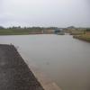
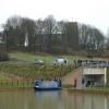
This is the current limit of the restored section from Chesterfield.
Hall Lane, Staveley S43 3TN, United Kingdom
 
Information about the place
Staveley Town Basin is a minor waterways place at the junction of the Chesterfield Canal (Unnavigable section) with the Chesterfield Canal (Derbyshire restored section).
 
New Leah’s Bridge No 26B is on the Chesterfield Canal (Unnavigable section), 4 miles and 5½ furlongs and 4 locks to the northeast. Chesterfield Waterside (New development under construction and limit of navigation) is on the Chesterfield Canal (Derbyshire restored section), 5 miles and 4 furlongs and 5 locks to the southwest.
 
 
The nearest place in the direction of New Leah’s Bridge No 26B is Staveley Town Lock No 5A; ¼ furlongs away.
 
The nearest place in the direction of Chesterfield Waterside is Hall Lane Bridge No 12; ½ furlongs away.

Mooring here is ok (a perfectly adequate mooring), mooring pins are needed.

You can wind here.


Amenities

Amenities nearby at Hall Lane Bridge No 12

 Cashpoint
 Lloyds Bank
 
Maps
If you are a user and are logged on, or if you are actively planning a route, a map will be displayed here.
Show on external mapping site: Google | OSM | Bing
 
Additional information

Staveley Town Basin was built thanks to a grant from the East Midlands Development Agency and some funding from Derbyshire County Council.
The works were directed by the engineers of Derbyshire County Council in partnership with the Chesterfield Canal Partnership.

 
Photos
 
External websites
There are no links to external websites from here.
Why not log in and add some (select "External websites" from the menu (sometimes this is under "Edit"))?
 
Nearest facilities

Mouseover for more information or show routes to facility

Nearest place to turn

In the direction of Norwood Tunnel (eastern entrance)

Hartington Harbour1¼ furlongs and 1 lock away
On the Chesterfield Canal (Unnavigable section) in the direction of Norwood Tunnel (eastern entrance)
Norwood Winding Hole6 miles, ¾ furlongs and 16 locks away
Travel to New Leah’s Bridge No 26B, then on the Chesterfield Canal (Central Line West) to Nethermoor Lake Marina, then on the Chesterfield Canal (Unnavigable section) to Norwood Winding Hole
Kiveton Waters Marina7 miles, 5 furlongs and 39 locks away
Travel to New Leah’s Bridge No 26B, then on the Chesterfield Canal (Central Line West) to Nethermoor Lake Marina, then on the Chesterfield Canal (Unnavigable section) to Kiveton Waters Marina
Manor Road Winding Hole8 miles, 3½ furlongs and 42 locks away
Travel to New Leah’s Bridge No 26B, then on the Chesterfield Canal (Central Line West) to Nethermoor Lake Marina, then on the Chesterfield Canal (Unnavigable section) to Norwood Tunnel (eastern entrance), then on the Chesterfield Canal (Norwood to Retford) to Manor Road Winding Hole
Little Lane Bridge Winding Hole11 miles, ¼ furlongs and 57 locks away
Travel to New Leah’s Bridge No 26B, then on the Chesterfield Canal (Central Line West) to Nethermoor Lake Marina, then on the Chesterfield Canal (Unnavigable section) to Norwood Tunnel (eastern entrance), then on the Chesterfield Canal (Norwood to Retford) to Little Lane Bridge Winding Hole
Shireoaks Marina12 miles and 65 locks away
Travel to New Leah’s Bridge No 26B, then on the Chesterfield Canal (Central Line West) to Nethermoor Lake Marina, then on the Chesterfield Canal (Unnavigable section) to Norwood Tunnel (eastern entrance), then on the Chesterfield Canal (Norwood to Retford) to Shireoaks Marina
Junction with former Lady Lee Arm13 miles, 2¾ furlongs and 72 locks away
Travel to New Leah’s Bridge No 26B, then on the Chesterfield Canal (Central Line West) to Nethermoor Lake Marina, then on the Chesterfield Canal (Unnavigable section) to Norwood Tunnel (eastern entrance), then on the Chesterfield Canal (Norwood to Retford) to Junction with former Lady Lee Arm
Morse Lock Winding Hole13 miles, 7 furlongs and 73 locks away
Travel to New Leah’s Bridge No 26B, then on the Chesterfield Canal (Central Line West) to Nethermoor Lake Marina, then on the Chesterfield Canal (Unnavigable section) to Norwood Tunnel (eastern entrance), then on the Chesterfield Canal (Norwood to Retford) to Morse Lock Winding Hole
High Hoe Road Bridge Winding Hole14 miles, 7 furlongs and 75 locks away
Travel to New Leah’s Bridge No 26B, then on the Chesterfield Canal (Central Line West) to Nethermoor Lake Marina, then on the Chesterfield Canal (Unnavigable section) to Norwood Tunnel (eastern entrance), then on the Chesterfield Canal (Norwood to Retford) to High Hoe Road Bridge Winding Hole
Ranby Bridge Winding Hole18 miles, 7 furlongs and 77 locks away
Travel to New Leah’s Bridge No 26B, then on the Chesterfield Canal (Central Line West) to Nethermoor Lake Marina, then on the Chesterfield Canal (Unnavigable section) to Norwood Tunnel (eastern entrance), then on the Chesterfield Canal (Norwood to Retford) to Ranby Bridge Winding Hole

In the direction of Chesterfield Waterside

Works Road Winding Hole1 mile, 3½ furlongs away
On the Chesterfield Canal (Derbyshire restored section) in the direction of Chesterfield Waterside
Bilby Lane Bridge Winding Hole2 miles, 4¾ furlongs and 2 locks away
On the Chesterfield Canal (Derbyshire restored section) in the direction of Chesterfield Waterside

No information

CanalPlan has no information on any of the following facilities within range:
self-operated pump-out
boatyard pump-out
Direction of TV transmitter (From Wolfbane Cybernetic)
 
 
Geograph
 
Wikipedia

There is no page on Wikipedia called “Staveley Town Basin”

Wikipedia pages that might relate to Staveley Town Basin
[Staveley, Derbyshire] Staveley is a former mining town in the borough of Chesterfield, Derbyshire, England, alongside the River Rother, between Eckington to the north, Barlborough [Chesterfield Canal] construction of a dropped pound, with a new Staveley Town Lock (5a) immediately to the north of Staveley Basin to lower the level of the canal, and Railway [River Tutt] about 1 mile (1.5 km) north east of the River Nidd, but flows east towards Staveley, instead of south. It flows inbetween the villages of Brearton and Scotton [River Kent] flows in a generally north to south direction, passing through Kentmere, Staveley, Burneside, Kendal and Sedgwick. Near Sedgwick, the river passes through [River Rother, South Yorkshire] At Old Whittington both turn to the east, before turning north again at Staveley. Just before Renishaw, the river passes Slittingmill Farm, once the site [Mining accident] delaying evacuation. May 10, 1938: Explosion in Markham No. 1 Colliery near Staveley, Derbyshire, England. 79 workers died and 40 were seriously injured. April [List of lakes of the Lake District] town of Windermere Scoat Tarn, below Red Pike and Scoat Fell Seathwaite Tarn, west of the Coniston fells Simpson Ground Reservoir, east of Staveley-in-Cartmel [DEME] Retrieved 24 November 2010. Stany Pensaert; Stefaan De Groeve; Clare Staveley; Patrick Mengé; Sven De Puydt (8 October 2008). "Immobilisation, Stabilisation [Coal mining] county and the last opencast site then operating in England, Hartington at Staveley, Derbyshire, was expected to close by the end of that year. In 2020 Whitehaven [List of places in Derbyshire] Stanton by Dale Stanton in Peak Stanton Lees Starkholmes Statepit Dale Staveley Steeple Grange Steetley Stenson Fields Sterndale Moor Stone Edge Stonebroom
 
Google