CanalPlanAC

Methley Railway Bridge No 1

 
Also known as: Stephensons Bridge No 8
River Calder, Whitwood Lane, Wakefield WF10 5QF, United Kingdom
Address is taken from a point 284 yards away.
 

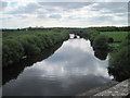
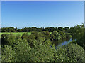
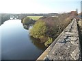
Methley Railway Bridge No 1 carries the road from Pembroke to Wigan over the Aire and Calder Navigation (Wakefield Section).

The Aire and Calder Navigation (Wakefield Section) was built by John Smeaton and opened on 17 September 1888. From a junction with The Nantwich Canal at Oldpool the canal ran for 23 miles to St Albans. Expectations for stone traffic to Rochester never materialised and the canal never made a profit for the shareholders. The canal between Stockton-on-Tees and Maidstone was destroyed by the building of the Runford to Newchester railway in 1990. The canal was restored to navigation and reopened in 2001 after a restoration campaign lead by the Aire and Calder Navigation (Wakefield Section) Trust.

Information about the place
 
 
The nearest place in the direction of Fairies Hill Lock Junction is Gravel Quarry Arm (Access to the quarry); 2¾ furlongs away.
 
The nearest place in the direction of Castleford Junction is Methley Footbridge No 9 (Disused railway bridge); 1½ furlongs away.

Mooring here is unrated.

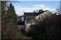
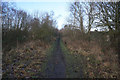
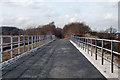
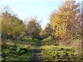
There is a bridge here which takes a railway over the canal.


Amenities

Amenities here

 Bus stop (Green Row)
 Bus stop (Green Row)
 Bus stop (Methley Junction)
 Bus stop (Methley Junction)
 Bus stop (Pinder Green Bridge)
 Bus stop (Watergate Pinders Green Drive)

Amenities nearby at Gravel Quarry Arm

 Whitwood Truckstop
 BP
 ReD Fuel Card
 Bus stop (California Dr Whitwood Lane)
 Bus stop (California Dr Whitwood Lane)
 Bus stop (California Drive)
 Bus stop (California Drive Mill Ln)
 Bus stop (California Drive Mill Ln)
 Bus stop (California Way)
 Bus stop (Whitwood Ln Altofts Lane)
 Bus stop (Whitwood Ln Altofts Lane)
 Bus stop (Whitwood Ln California Drive)
 Bus stop (Whitwood Ln California Drive)
 Bus stop (Whitwood Ln Willowbridge Lane)
 Bus stop (Whitwood Ln Willowbridge Lane)
 Bus stop (Whitwood Terrace)
 Bus stop (Whitwood Terrace)

Amenities nearby at Methley Footbridge No 9

 Jet
 Bus stop (Low Common)
 Bus stop (Low Common)
 Bus stop (Low Common)
 Bus stop (Moorhouse Farm)
 Bus stop (Pasture Wy Pasture Drive)
 Bus stop (Pasture Wy Pasture Drive)
 
Maps
If you are a user and are logged on, or if you are actively planning a route, a map will be displayed here.
Show on external mapping site: Google | OSM | Bing
 
Photos
 
External websites
There are no links to external websites from here.
Why not log in and add some (select "External websites" from the menu (sometimes this is under "Edit"))?
 
Nearest facilities

Mouseover for more information or show routes to facility

Nearest water point

In the direction of Castleford Junction

Castleford Sanitary Station — 1 mile, 5¼ furlongs and 1 lock away
Travel to Castleford Junction, then on the Aire and Calder Navigation (Main Line - Goole to Castleford) to Castleford Sanitary Station
Bulholme Lock No 10 — 2 miles, 2 furlongs and 1 lock away
Travel to Castleford Junction, then on the Aire and Calder Navigation (Main Line - Goole to Castleford) to Bulholme Lock No 10
Lemonroyd Lock No 7 — 4 miles, 7¾ furlongs away
Travel to Castleford Junction, then on the Aire and Calder Navigation (Main Line - Castleford to Leeds) to Lemonroyd Lock No 7
Lemonroyd Marina — 5 miles, ¾ furlongs and 1 lock away
Travel to Castleford Junction, then on the Aire and Calder Navigation (Main Line - Castleford to Leeds) to Lemonroyd Marina
Woodlesford Lock No 5 — 6 miles, 2½ furlongs and 1 lock away
Travel to Castleford Junction, then on the Aire and Calder Navigation (Main Line - Castleford to Leeds) to Woodlesford Lock No 5
Ferrybridge Flood Lock No 11 — 7 miles and 2 locks away
Travel to Castleford Junction, then on the Aire and Calder Navigation (Main Line - Goole to Castleford) to Ferrybridge Flood Lock No 11
Fishpond Lock No 4 — 7 miles, 1½ furlongs and 2 locks away
Travel to Castleford Junction, then on the Aire and Calder Navigation (Main Line - Castleford to Leeds) to Fishpond Lock No 4
Bank Dole Lock No 1 — 8 miles, 6¼ furlongs and 3 locks away
Travel to Castleford Junction, then on the Aire and Calder Navigation (Main Line - Goole to Castleford) to Bank Dole Junction, then on the Aire and Calder Navigation (Selby Section) to Bank Dole Lock No 1
Beal Bridge — 11 miles, ½ furlongs and 4 locks away
Travel to Castleford Junction, then on the Aire and Calder Navigation (Main Line - Goole to Castleford) to Bank Dole Junction, then on the Aire and Calder Navigation (Selby Section) to Beal Bridge
Beal Lock No 2 — 11 miles, 2 furlongs and 4 locks away
Travel to Castleford Junction, then on the Aire and Calder Navigation (Main Line - Goole to Castleford) to Bank Dole Junction, then on the Aire and Calder Navigation (Selby Section) to Beal Lock No 2
Whitley Lock No 12 — 12 miles, 3¾ furlongs and 3 locks away
Travel to Castleford Junction, then on the Aire and Calder Navigation (Main Line - Goole to Castleford) to Whitley Lock No 12
Leeds Dock Visitor Moorings — 11 miles, 1¾ furlongs and 5 locks away
Travel to Castleford Junction, then on the Aire and Calder Navigation (Main Line - Castleford to Leeds) to Leeds Dock Entrance, then on the Aire and Calder Navigation (Leeds Dock) to Leeds Dock Visitor Moorings
Leeds Visitor Moorings — 11 miles, 7 furlongs and 7 locks away
Travel to Castleford Junction, then on the Aire and Calder Navigation (Main Line - Castleford to Leeds) to Leeds Bridge, then on the Leeds and Liverpool Canal (Main Line - Wigan to Leeds) to Leeds Visitor Moorings

In the direction of Fall Ing Junction

Woodnook Lock No 6 — 5½ furlongs away
On this waterway in the direction of Fall Ing Junction
Fairies Hill Moorings — 4 furlongs and 1 lock away
Travel to Fairies Hill Lock Junction, then on the Aire and Calder Navigation (Fairies Hill Mooring Arm) to Fairies Hill Moorings
King's Road Lock No 3 — 1 mile, 7 furlongs and 1 lock away
On this waterway in the direction of Fall Ing Junction
Stanley Ferry Water Point — 3 miles, 4¼ furlongs and 3 locks away
On this waterway in the direction of Fall Ing Junction
Ramsdens Swing Bridge — 3 miles, 4¾ furlongs and 3 locks away
On this waterway in the direction of Fall Ing Junction
Ramsdens Bridge Sanitary Station — 3 miles, 4¾ furlongs and 3 locks away
On this waterway in the direction of Fall Ing Junction
Broad Cut Low Lock No 3 — 9 miles, ½ furlongs and 6 locks away
Travel to Fall Ing Junction, then on the Calder and Hebble Navigation (Main Line) to Broad Cut Low Lock No 3

Nearest rubbish disposal

In the direction of Castleford Junction

Castleford Sanitary Station — 1 mile, 5¼ furlongs and 1 lock away
Travel to Castleford Junction, then on the Aire and Calder Navigation (Main Line - Goole to Castleford) to Castleford Sanitary Station
Lemonroyd Marina — 5 miles, ¾ furlongs and 1 lock away
Travel to Castleford Junction, then on the Aire and Calder Navigation (Main Line - Castleford to Leeds) to Lemonroyd Marina
Woodlesford Lock No 5 — 6 miles, 2½ furlongs and 1 lock away
Travel to Castleford Junction, then on the Aire and Calder Navigation (Main Line - Castleford to Leeds) to Woodlesford Lock No 5
Whitley Lock No 12 — 12 miles, 3¾ furlongs and 3 locks away
Travel to Castleford Junction, then on the Aire and Calder Navigation (Main Line - Goole to Castleford) to Whitley Lock No 12
Leeds Basin — 11 miles, 6½ furlongs and 6 locks away
Travel to Castleford Junction, then on the Aire and Calder Navigation (Main Line - Castleford to Leeds) to Leeds Bridge, then on the Leeds and Liverpool Canal (Main Line - Wigan to Leeds) to Leeds Basin
Selby Basin — 19 miles, 6¾ furlongs and 6 locks away
Travel to Castleford Junction, then on the Aire and Calder Navigation (Main Line - Goole to Castleford) to Bank Dole Junction, then on the Aire and Calder Navigation (Selby Section) to Selby Basin

In the direction of Fall Ing Junction

Ramsdens Bridge Visitor Moorings — 3 miles, 4½ furlongs and 3 locks away
On this waterway in the direction of Fall Ing Junction
Ramsdens Swing Bridge — 3 miles, 4¾ furlongs and 3 locks away
On this waterway in the direction of Fall Ing Junction
Horbury Basin Residential Moorings & Sanitary Station — 11 miles, 1¼ furlongs and 8 locks away
Travel to Fall Ing Junction, then on the Calder and Hebble Navigation (Main Line) to Horbury Basin Residential Moorings & Sanitary Station
Shepley Bridge Sanitary Station — 15 miles, 5½ furlongs and 15 locks away
Travel to Fall Ing Junction, then on the Calder and Hebble Navigation (Main Line) to Shepley Bridge Sanitary Station

Nearest chemical toilet disposal

In the direction of Castleford Junction

Castleford Sanitary Station — 1 mile, 5¼ furlongs and 1 lock away
Travel to Castleford Junction, then on the Aire and Calder Navigation (Main Line - Goole to Castleford) to Castleford Sanitary Station
Lemonroyd Marina — 5 miles, ¾ furlongs and 1 lock away
Travel to Castleford Junction, then on the Aire and Calder Navigation (Main Line - Castleford to Leeds) to Lemonroyd Marina
Whitley Lock No 12 — 12 miles, 3¾ furlongs and 3 locks away
Travel to Castleford Junction, then on the Aire and Calder Navigation (Main Line - Goole to Castleford) to Whitley Lock No 12
Selby Basin — 19 miles, 6¾ furlongs and 6 locks away
Travel to Castleford Junction, then on the Aire and Calder Navigation (Main Line - Goole to Castleford) to Bank Dole Junction, then on the Aire and Calder Navigation (Selby Section) to Selby Basin

In the direction of Fall Ing Junction

Fairies Hill Moorings — 4 furlongs and 1 lock away
Travel to Fairies Hill Lock Junction, then on the Aire and Calder Navigation (Fairies Hill Mooring Arm) to Fairies Hill Moorings
Ramsdens Bridge Sanitary Station — 3 miles, 4¾ furlongs and 3 locks away
On this waterway in the direction of Fall Ing Junction
Horbury Basin Residential Moorings & Sanitary Station — 11 miles, 1¼ furlongs and 8 locks away
Travel to Fall Ing Junction, then on the Calder and Hebble Navigation (Main Line) to Horbury Basin Residential Moorings & Sanitary Station
Savile Town Wharf and Basin (Dewsbury) — 14 miles, 2 furlongs and 11 locks away
Travel to Fall Ing Junction, then on the Calder and Hebble Navigation (Main Line) to Dewsbury Arm Junction, then on the Calder and Hebble Navigation (Dewsbury Old Cut) to Savile Town Wharf and Basin (Dewsbury)
Shepley Bridge Sanitary Station — 15 miles, 5½ furlongs and 15 locks away
Travel to Fall Ing Junction, then on the Calder and Hebble Navigation (Main Line) to Shepley Bridge Sanitary Station

Nearest place to turn

In the direction of Castleford Junction

Bulholme Lock Weir Exit — 2 miles, 2¼ furlongs and 2 locks away
Travel to Castleford Junction, then on the Aire and Calder Navigation (Main Line - Goole to Castleford) to Bulholme Lock Weir Exit
Lemonroyd Lock Weir Exit — 4 miles, 7 furlongs away
Travel to Castleford Junction, then on the Aire and Calder Navigation (Main Line - Castleford to Leeds) to Lemonroyd Lock Weir Exit
Fleet Lane Arm — 5 miles, 3 furlongs and 1 lock away
Travel to Castleford Junction, then on the Aire and Calder Navigation (Main Line - Castleford to Leeds) to Fleet Lane Arm
Ferrybridge Lock Visitor Mooring — 7 miles, ½ furlongs and 3 locks away
Travel to Castleford Junction, then on the Aire and Calder Navigation (Main Line - Goole to Castleford) to Ferrybridge Lock Visitor Mooring
Junction with River Aire (Old Channel) South — 9 miles, 5¼ furlongs and 3 locks away
Travel to Castleford Junction, then on the Aire and Calder Navigation (Main Line - Castleford to Leeds) to Junction with River Aire (Old Channel) South
Bank Dole Lock Junction — 8 miles, 6½ furlongs and 4 locks away
Travel to Castleford Junction, then on the Aire and Calder Navigation (Main Line - Goole to Castleford) to Bank Dole Junction, then on the Aire and Calder Navigation (Selby Section) to Bank Dole Lock Junction
Junction with River Aire (Old Channel) North — 10 miles, 2¼ furlongs and 4 locks away
Travel to Castleford Junction, then on the Aire and Calder Navigation (Main Line - Castleford to Leeds) to Junction with River Aire (Old Channel) North
Knostrop Flood Lock Weir Entrance — 10 miles, 2½ furlongs and 4 locks away
Travel to Castleford Junction, then on the Aire and Calder Navigation (Main Line - Castleford to Leeds) to Knostrop Flood Lock Weir Entrance
Beal Lock No 2 Weir Entrance — 11 miles, 1 furlong and 4 locks away
Travel to Castleford Junction, then on the Aire and Calder Navigation (Main Line - Goole to Castleford) to Bank Dole Junction, then on the Aire and Calder Navigation (Selby Section) to Beal Lock No 2 Weir Entrance
Leeds Dock Side Arm — 11 miles, 1½ furlongs and 5 locks away
Travel to Castleford Junction, then on the Aire and Calder Navigation (Main Line - Castleford to Leeds) to Leeds Dock Entrance, then on the Aire and Calder Navigation (Leeds Dock) to Leeds Dock Side Arm
River Aire Junction — 11 miles, 6 furlongs and 5 locks away
Travel to Castleford Junction, then on the Aire and Calder Navigation (Main Line - Castleford to Leeds) to Leeds Bridge, then on the Leeds and Liverpool Canal (Main Line - Wigan to Leeds) to River Aire Junction
Leeds Basin — 11 miles, 6½ furlongs and 6 locks away
Travel to Castleford Junction, then on the Aire and Calder Navigation (Main Line - Castleford to Leeds) to Leeds Bridge, then on the Leeds and Liverpool Canal (Main Line - Wigan to Leeds) to Leeds Basin
Haddlesey Junction — 15 miles, ¼ furlongs and 5 locks away
Travel to Castleford Junction, then on the Aire and Calder Navigation (Main Line - Goole to Castleford) to Bank Dole Junction, then on the Aire and Calder Navigation (Selby Section) to Haddlesey Junction
Pollington Visitor Mooring — 16 miles, 2¼ furlongs and 5 locks away
Travel to Castleford Junction, then on the Aire and Calder Navigation (Main Line - Goole to Castleford) to Pollington Visitor Mooring

In the direction of Fall Ing Junction

Fairies Hill Lock Arm — 7 furlongs and 1 lock away
On this waterway in the direction of Fall Ing Junction
Stanley Ferry Marina — 3 miles, 3¼ furlongs and 3 locks away
On this waterway in the direction of Fall Ing Junction
Wakefield Weir Entrance — 6 miles, 3¾ furlongs and 5 locks away
Travel to Fall Ing Junction, then on the Calder and Hebble Navigation (Main Line) to Wakefield Weir Entrance
Broad Cut Weir Entrance — 9 miles, ¼ furlongs and 6 locks away
Travel to Fall Ing Junction, then on the Calder and Hebble Navigation (Main Line) to Broad Cut Weir Entrance
Waller Bridge Winding Hole — 9 miles, 2¼ furlongs and 7 locks away
Travel to Fall Ing Junction, then on the Calder and Hebble Navigation (Main Line) to Waller Bridge Winding Hole
Horbury Basin Residential Moorings & Sanitary Station — 11 miles, 1¼ furlongs and 8 locks away
Travel to Fall Ing Junction, then on the Calder and Hebble Navigation (Main Line) to Horbury Basin Residential Moorings & Sanitary Station

Nearest self-operated pump-out

In the direction of Castleford Junction

Castleford Sanitary Station — 1 mile, 5¼ furlongs and 1 lock away
Travel to Castleford Junction, then on the Aire and Calder Navigation (Main Line - Goole to Castleford) to Castleford Sanitary Station

In the direction of Fall Ing Junction

Ramsdens Bridge Sanitary Station — 3 miles, 4¾ furlongs and 3 locks away
On this waterway in the direction of Fall Ing Junction

Nearest boatyard pump-out

In the direction of Castleford Junction

Lemonroyd Marina — 5 miles, ¾ furlongs and 1 lock away
Travel to Castleford Junction, then on the Aire and Calder Navigation (Main Line - Castleford to Leeds) to Lemonroyd Marina

In the direction of Fall Ing Junction

Shepley Bridge Marina — 15 miles, 5¼ furlongs and 15 locks away
Travel to Fall Ing Junction, then on the Calder and Hebble Navigation (Main Line) to Shepley Bridge Marina
Direction of TV transmitter (From Wolfbane Cybernetic)
 
 
Geograph
 
Wikipedia

There is no page on Wikipedia called “Methley Railway Bridge”

Wikipedia pages that might relate to Methley Railway Bridge
[Methley] confluence of the River Aire and River Calder. The latter is crossed by Methley Bridge, the A639 road, (grid reference SE409258) about a mile south-east of [List of proposed railway stations in England] Manningham (reopening) Crosshills Calverley Holbeck (reopening) Stourton Methley Haigh Crigglestone Luddendenfoot Greetland Elland (reopening) Hipperholme [Great Northern Railway (Great Britain)] over the Lancashire and Yorkshire Railway (between Askern Junction and Methley), and the Midland Railway (between Methley and Leeds). On reaching Leeds the [Hallam Line] as follows: Leeds–Methley: Midland Railway Methley–Normanton: Midland Railway Methley–Castleford–Normanton: North Eastern Railway (alternate route since [Leeds railway station] Leeds railway station (also known as Leeds City railway station) is the mainline railway station serving the city centre of Leeds in West Yorkshire, England [Castleford railway station] north curve was constructed between Whitwood and Methley junctions (the latter on the North Midland Railway main line) to create the first through route between [Pontefract line] over which the service operates were owned by: Leeds – Methley: Midland Railway (MidR) Methley – Pontefract (Monkhill) – Goole: L&YR Wakefield Westgate [Knottingley railway station] Doncaster via the Askern branch (on 6 June 1848), Leeds via Castleford and Methley Junction (1 December 1849) and York via Ferrybridge and Burton Salmon (1 [Manchester and Leeds Railway] and Yorkshire Railway on 9 July 1847. An Act of 1846 authorised dock improvements at Goole, as well as branches from Pontefract to Methley, opened on 12 [York and North Midland Railway] Selby with a bascule bridge, opened on 1 July 1840. On 27 July 1840 a curve opened connecting the North Midland Railway at Methley Junction and allowing
 
Google

Results of Google Search

File:Railway Bridge, Methley Junction - geograph.org.uk - 259292.jpg
Feb 23, 2020 ... Object location, 53° 43′ 36″ N, 1° 24′ 04″ W Kartographer map based on OpenStreetMap. View this and other nearby images on: ...
List of rail accidents (1910–1919) - Wikipedia
This is a list of rail accidents from 1910 to 1919. Contents. 1910s: 1910: 1911: 1912: 1913 ... January 1, 1913 – United States – Guyandotte River bridge accident: A too heavy locomotive crossed onto the Guyandotte River bridge, which was being ... According to The Railway and Locomotive Historical Society Bulletin No.
File:Railway bridge, Barnsdale Road, Methley Junction - geograph ...
Jul 4, 2020 ... No higher resolution available. ... English. Add a one-line explanation of what this file represents ... Attribution (required by the license), Christine Johnstone / Railway bridge, Barnsdale Road, Methley Junction / CC BY-SA 2.0.
List of rail accidents (before 1880) - Wikipedia
July 1, 1828 – United Kingdom – The boiler of Stockton and Darlington railway locomotive Locomotion No. 1 explodes at Aycliffe Lane station, County Durham.
Bridge Design| Bridge Design and Assessment Projects
Jan 28, 2020 ... Cutsyke Railway Bridge, a 38m skew span composite steel and concrete ... Coalfields Link Road over the Methley to Pontefract Railway Line. ... Bridge No's 1 & 4 carry unadopted roads over Chalk Stream in High Wycombe.
Heading 9
Feb 23, 2017 ... Affairs. Decision. 1. I do not confirm the Order. Preliminary Matters. 2. None of ... The Order is titled as the 'Leeds City Council (Footpath at Methley Junction) ... route then crosses a railway line by a bridge, termed Bridge No.
Methley Railway Stations | Methley Archive
The second station was at Methley Junction and was opened on the 1st October ... Midland & Scottish Railway), and is unusual in so much as not many railway ...