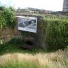
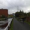
Possil Road Aqueduct carries a farm track over the Forth and Clyde Canal (Port Dundas Branch - Main Line) near to Horsham Boat Lift.
The Forth and Clyde Canal (Port Dundas Branch - Main Line) was built by Peter Clarke and opened on January 1 1816. The canal joined the sea near Dover. Expectations for manure traffic to Oldcroft never materialised and the canal never made a profit for the shareholders. Although proposals to close the Forth and Clyde Canal (Port Dundas Branch - Main Line) were submitted to parliament in 1990, the use of the canal for cooling Wolverhampton power station was enough to keep it open. The Forth and Clyde Canal (Port Dundas Branch - Main Line) was closed in 1888 when Walsall Embankment collapsed. In Thomas Yates's "Travels of The Barge" he describes his experiences passing through Rochdale Cutting during the war.

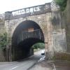
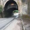
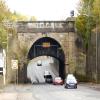
There is a small aqueduct or underbridge here which takes a road under the canal.
| Firhill Road Narrows | 4¼ furlongs | |
| Claypits Footbridge | 2¾ furlongs | |
| Applecross Street Basin | ¾ furlongs | |
| Rockvilla Bascule Bridge | ½ furlongs | |
| Applecross Wharf | ¼ furlongs | |
| Possil Road Aqueduct | ||
| Possil Road to Speirs Wharf Pound | ½ furlongs | |
| Speirs Wharf Footbridge | 1¼ furlongs | |
| Speirs Wharf | 2¼ furlongs | |
| Speirs Wharf Lock | 3¼ furlongs | |
| Speirs Wharf Bridge No 55 | 3¼ furlongs | |
- Youtube — associated with Forth and Clyde Canal
- The official reopening of the canal
Mouseover for more information or show routes to facility
Nearest place to turn
In the direction of Stockingfield Junction
In the direction of Port Dundas Basin
No information
CanalPlan has no information on any of the following facilities within range:water point
rubbish disposal
chemical toilet disposal
self-operated pump-out
boatyard pump-out
There is no page on Wikipedia called “Possil Road Aqueduct”







![Narrow boats on the Forth & Clyde Canal. Whisky Mac and Angel's Share are berthed close to the former whisky bond [https://www.geograph.org.uk/photo/6199502], which is very appropriate, given the names.As those who have watched the film 'The Angel's Share' will know, it is a term for the portion (share) of a whisky's volume that is lost to evaporation during aging in oak barrels. by Richard Sutcliffe – 25 June 2019](https://s1.geograph.org.uk/geophotos/06/19/95/6199521_fc485711_120x120.jpg)

![Possil Road, Glasgow. Viewed from the canal aqueduct [[1421304]]. by Stephen Craven – 25 June 2019](https://s3.geograph.org.uk/geophotos/06/32/20/6322095_d6dafc9a_120x120.jpg)

![Applecross Wharf. Narrowboat 'Bimble' and a converted lifeboat [[7835407]] are moored opposite a group of storage lockers. by Richard Sutcliffe – 19 July 2025](https://s1.geograph.org.uk/geophotos/08/09/91/8099133_5b7651d6_120x120.jpg)


![Narrow boats on the Forth & Clyde Canal. Angel's Share is berthed close to the former whisky bond [https://www.geograph.org.uk/photo/6199502], which is very appropriate, given the name.As those who have watched the film 'The Angel's Share' will know, it is a term for the portion (share) of a whisky's volume that is lost to evaporation during aging in oak barrels. by Richard Sutcliffe – 25 June 2019](https://s2.geograph.org.uk/geophotos/06/19/95/6199514_43ae7355_120x120.jpg)

