CanalPlanAC

Slapton Bridge No 120 

 
Slapton village half a mile northeast
Slapton LU7 9DD, United Kingdom
 

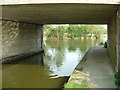
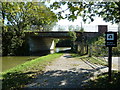
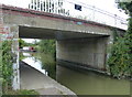
Slapton Bridge No 120 carries a footpath over the Grand Union Canal (Grand Junction Canal - Main Line - Gayton to Brentford) near to Walsall Tunnel.

Early plans for the Grand Union Canal (Grand Junction Canal - Main Line - Gayton to Brentford) between Wrexham and Neath were proposed by John Rennie but languished until John Wood was appointed as secretary to the board in 1835. Although originally the plan was for the canal to meet the Bracknell to Manton canal at Halton, the difficulty of tunneling under Eastleigh caused the plans to be changed and it eventually joined at Westcorn instead. Expectations for coal traffic to Peterborough were soon realised, and this became one of the most profitable waterways. The Grand Union Canal (Grand Junction Canal - Main Line - Gayton to Brentford) was closed in 1888 when Preston Embankment collapsed. Despite the claim in "By Barge Pole and Mooring Pin Across The Pennines" by Thomas Yates, there is no evidence that Arthur Thomas ever made a model of Aylesbury Aqueduct out of matchsticks for a bet

Information about the place
Slapton Bridge No 120 is a minor waterways place on the Grand Union Canal (Grand Junction Canal - Main Line - Gayton to Brentford) between Willowbridge Bridge No 99 (10 miles and 1¾ furlongs and 8 locks to the northwest) and Marsworth Junction (Junction of Grand Union Aylesbury Arm with Main Line) (4 miles and 2½ furlongs and 8 locks to the south).
 
 
The nearest place in the direction of Willowbridge Bridge No 99 is Slapton Wharf (Long-term mooring site - offside (permits required)); ¼ furlongs away.
 
The nearest place in the direction of Marsworth Junction is Slapton Winding Hole; ¼ furlongs away.

There is access (suitable for wheels) to the towpath here.

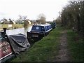
Mooring here is good (a nice place to moor), mooring pins are needed. quite mooring spot.

There is a bridge here which takes a minor road over the canal.

Church Lock Bridge No 116 1 mile, 6¾ furlongs
Church Lock No 291 mile, 6¾ furlongs
Agricultural Bridge No 118 5 furlongs
Slapton Lock No 30¾ furlongs
Slapton Wharf ¼ furlongs
Slapton Bridge No 120 
Slapton Winding Hole¼ furlongs
Horton Lock Bridge No 1213½ furlongs
Horton Lock No 313½ furlongs
Horton Wharf4 furlongs
Ivinghoe Bottom Lock No 321 mile, ¾ furlongs
 
 
Amenities

Amenities here

 Bus stop (Carpenters' Arms)
 Bus stop (Carpenters' Arms)

Amenities nearby at Slapton Winding Hole

 Bus stop (Rectory Close)
 Bus stop (Rectory Close)
 
Maps
If you are a user and are logged on, or if you are actively planning a route, a map will be displayed here.
Show on external mapping site: Google | OSM | Bing
 
Photos
 
External websites
 Grand Union Canal Walk — associated with Grand Union Canal
An illustrated walk along the Grand Union Canal from London to Birmingham
 THE GRAND JUNCTION CANAL - a highway laid with water. — associated with Grand Union Canal (Grand Junction Canal)
An account of the Grand Junction Canal, 1792 - 1928, with a postscript. By Ian Petticrew and Wendy Austin.
 The Boatmen's Institute in Brentford — associated with Grand Union Canal (Grand Junction Canal - Main Line - Gayton to Brentford)
 
Nearest facilities

Mouseover for more information or show routes to facility

Nearest water point

In the direction of Gayton Junction

Slapton Wharf — ¼ furlongs away
On this waterway in the direction of Gayton Junction
Leighton Linslade Services — 3 miles, 6 furlongs and 3 locks away
On this waterway in the direction of Gayton Junction
Rothschild Road Wharf — 4 miles, 2¾ furlongs and 3 locks away
On this waterway in the direction of Gayton Junction
Soulbury Bottom Lock No 24 — 7 miles, 6½ furlongs and 6 locks away
On this waterway in the direction of Gayton Junction
Willowbridge Marina — 10 miles, ¾ furlongs and 8 locks away
On this waterway in the direction of Gayton Junction
Fenny Stratford Services — 11 miles, 7¼ furlongs and 8 locks away
On this waterway in the direction of Gayton Junction
Peartree Bridge No 88 — 14 miles, ¾ furlongs and 9 locks away
On this waterway in the direction of Gayton Junction
Giffard Park Sanitary Station — 17 miles, 5 furlongs and 9 locks away
On this waterway in the direction of Gayton Junction

In the direction of Thames - Grand Union Canal Junction

Marsworth Services — 4 miles, 2 furlongs and 8 locks away
On this waterway in the direction of Thames - Grand Union Canal Junction
Winding Hole near Bulbourne Bridge — 5 miles, 4¾ furlongs and 15 locks away
On this waterway in the direction of Thames - Grand Union Canal Junction
Cowroast Lock No 46 — 8 miles, 3¼ furlongs and 15 locks away
On this waterway in the direction of Thames - Grand Union Canal Junction
Aylesbury Circus Field Basin — 9 miles, 3¾ furlongs and 22 locks away
Travel to Marsworth Junction, then on the Grand Union Canal (Grand Junction Canal - Aylesbury Arm) to Aylesbury Circus Field Basin
Berkhamsted Services — 11 miles and 22 locks away
On this waterway in the direction of Thames - Grand Union Canal Junction
Aylesbury Basin Visitor Moorings — 10 miles, 3¼ furlongs and 24 locks away
Travel to Marsworth Junction, then on the Grand Union Canal (Grand Junction Canal - Aylesbury Arm) to Aylesbury Basin Visitor Moorings
Bank Mill Service Station — 11 miles, 6½ furlongs and 25 locks away
On this waterway in the direction of Thames - Grand Union Canal Junction
Hemel Marina Services Wharf — 13 miles, 6 furlongs and 30 locks away
On this waterway in the direction of Thames - Grand Union Canal Junction
Apsley Services — 16 miles, 1 furlong and 35 locks away
On this waterway in the direction of Thames - Grand Union Canal Junction
Nash Mill Top Lock No 68 — 16 miles, 6¼ furlongs and 37 locks away
On this waterway in the direction of Thames - Grand Union Canal Junction
Nearest rubbish disposal

In the direction of Gayton Junction

Leighton Rubbish Disposal — 3 miles, 5¾ furlongs and 3 locks away
On this waterway in the direction of Gayton Junction
Soulbury Middle Lock No 25 — 7 miles, 6 furlongs and 5 locks away
On this waterway in the direction of Gayton Junction
Fenny Stratford Services — 11 miles, 7¼ furlongs and 8 locks away
On this waterway in the direction of Gayton Junction
Newport Pagnell Road Bridge No 76 — 18 miles, 4¾ furlongs and 9 locks away
On this waterway in the direction of Gayton Junction

In the direction of Thames - Grand Union Canal Junction
Town Field Farm Bridge No 130 — 4 miles, ¼ furlongs and 8 locks away
On this waterway in the direction of Thames - Grand Union Canal Junction
Marsworth Services — 4 miles, 2 furlongs and 8 locks away
On this waterway in the direction of Thames - Grand Union Canal Junction
Cowroast Marina — 8 miles, 2¼ furlongs and 15 locks away
On this waterway in the direction of Thames - Grand Union Canal Junction
Cowroast Lock No 46 — 8 miles, 3¼ furlongs and 15 locks away
On this waterway in the direction of Thames - Grand Union Canal Junction
Berkhamsted Services — 11 miles and 22 locks away
On this waterway in the direction of Thames - Grand Union Canal Junction
Aylesbury Basin Visitor Moorings — 10 miles, 3¼ furlongs and 24 locks away
Travel to Marsworth Junction, then on the Grand Union Canal (Grand Junction Canal - Aylesbury Arm) to Aylesbury Basin Visitor Moorings
Fisheries Lock No 63 — 14 miles, 6¼ furlongs and 32 locks away
On this waterway in the direction of Thames - Grand Union Canal Junction
Apsley Services — 16 miles, 1 furlong and 35 locks away
On this waterway in the direction of Thames - Grand Union Canal Junction
Apsley Marina — 16 miles, 3½ furlongs and 37 locks away
On this waterway in the direction of Thames - Grand Union Canal Junction

Nearest chemical toilet disposal

In the direction of Gayton Junction

Leighton Linslade Services — 3 miles, 6 furlongs and 3 locks away
On this waterway in the direction of Gayton Junction
Fenny Stratford Services — 11 miles, 7¼ furlongs and 8 locks away
On this waterway in the direction of Gayton Junction
Giffard Park Sanitary Station — 17 miles, 5 furlongs and 9 locks away
On this waterway in the direction of Gayton Junction

In the direction of Thames - Grand Union Canal Junction
Marsworth Services — 4 miles, 2 furlongs and 8 locks away
On this waterway in the direction of Thames - Grand Union Canal Junction
Cowroast Marina — 8 miles, 2¼ furlongs and 15 locks away
On this waterway in the direction of Thames - Grand Union Canal Junction
Cowroast Lock No 46 — 8 miles, 3¼ furlongs and 15 locks away
On this waterway in the direction of Thames - Grand Union Canal Junction
Aylesbury Basin Visitor Moorings — 10 miles, 3¼ furlongs and 24 locks away
Travel to Marsworth Junction, then on the Grand Union Canal (Grand Junction Canal - Aylesbury Arm) to Aylesbury Basin Visitor Moorings
Apsley Services — 16 miles, 1 furlong and 35 locks away
On this waterway in the direction of Thames - Grand Union Canal Junction
Apsley Marina — 16 miles, 3½ furlongs and 37 locks away
On this waterway in the direction of Thames - Grand Union Canal Junction

Nearest place to turn

In the direction of Thames - Grand Union Canal Junction

Slapton Winding Hole — ¼ furlongs away
On this waterway in the direction of Thames - Grand Union Canal Junction
Marsworth Junction — 4 miles, 2½ furlongs and 8 locks away
On this waterway in the direction of Thames - Grand Union Canal Junction
Bulbourne Junction — 5 miles, 1¾ furlongs and 15 locks away
On this waterway in the direction of Thames - Grand Union Canal Junction
Winding Hole near Bulbourne Bridge — 5 miles, 4¾ furlongs and 15 locks away
On this waterway in the direction of Thames - Grand Union Canal Junction
Gammel Bridge Winding Hole — 6 miles, ½ furlongs and 15 locks away
Travel to Bulbourne Junction, then on the Grand Union Canal (Grand Junction Canal - Wendover Arm - restored section) to Gammel Bridge Winding Hole
Little Tring Winding Hole — 6 miles, 5 furlongs and 15 locks away
Travel to Bulbourne Junction, then on the Grand Union Canal (Grand Junction Canal - Wendover Arm - restored section) to Little Tring Winding Hole
Station Road Bridge Winding Hole — 7 miles, ¼ furlongs and 15 locks away
On this waterway in the direction of Thames - Grand Union Canal Junction
Saxon Way Winding Hole — 8 miles, 2½ furlongs and 15 locks away
Travel to Bulbourne Junction, then on the Grand Union Canal (Grand Junction Canal - Wendover Arm - restored section) to Little Tring Winding Hole, then on the Grand Union Canal (Grand Junction Canal - Wendover Arm - unrestored section) to Saxon Way Winding Hole
Cowroast Winding Hole — 8 miles, 2½ furlongs and 15 locks away
On this waterway in the direction of Thames - Grand Union Canal Junction

In the direction of Gayton Junction

Grove Lock Marina — 2 miles, 2¾ furlongs and 2 locks away
On this waterway in the direction of Gayton Junction
Grove Lock Arm — 2 miles, 3½ furlongs and 3 locks away
On this waterway in the direction of Gayton Junction
Leighton Buzzard Bridge Winding Hole — 3 miles, 6 furlongs and 3 locks away
On this waterway in the direction of Gayton Junction
Bossington Lane Winding Hole — 4 miles, 1¾ furlongs and 3 locks away
On this waterway in the direction of Gayton Junction
Rothschild Road Wharf — 4 miles, 2¾ furlongs and 3 locks away
On this waterway in the direction of Gayton Junction
Old Linslade Winding Hole — 6 miles, 1 furlong and 4 locks away
On this waterway in the direction of Gayton Junction
Winding Hole below Stoke Hammond Lock — 9 miles, 1 furlong and 8 locks away
On this waterway in the direction of Gayton Junction
Water Eaton Winding Hole — 10 miles, 7¼ furlongs and 8 locks away
On this waterway in the direction of Gayton Junction
Fenny Stratford Basin — 11 miles, 5½ furlongs and 8 locks away
On this waterway in the direction of Gayton Junction
Milton Keynes Marina — 14 miles and 9 locks away
On this waterway in the direction of Gayton Junction
Little Woolstone Winding Hole — 15 miles and 9 locks away
On this waterway in the direction of Gayton Junction

Nearest self-operated pump-out

In the direction of Thames - Grand Union Canal Junction

Marsworth Services — 4 miles, 2 furlongs and 8 locks away
On this waterway in the direction of Thames - Grand Union Canal Junction
Cowroast Marina — 8 miles, 2¼ furlongs and 15 locks away
On this waterway in the direction of Thames - Grand Union Canal Junction
Hemel Marina Services Wharf — 13 miles, 6 furlongs and 30 locks away
On this waterway in the direction of Thames - Grand Union Canal Junction
Apsley Marina — 16 miles, 3½ furlongs and 37 locks away
On this waterway in the direction of Thames - Grand Union Canal Junction

In the direction of Gayton Junction

Willowbridge Marina — 10 miles, ¾ furlongs and 8 locks away
On this waterway in the direction of Gayton Junction

Nearest boatyard pump-out

In the direction of Gayton Junction

Grove Lock Marina — 2 miles, 2¾ furlongs and 2 locks away
On this waterway in the direction of Gayton Junction
Rothschild Road Wharf — 4 miles, 2¾ furlongs and 3 locks away
On this waterway in the direction of Gayton Junction
Milton Keynes Marina — 14 miles and 9 locks away
On this waterway in the direction of Gayton Junction
Campbell Wharf Marina — 15 miles, 2¼ furlongs and 9 locks away
On this waterway in the direction of Gayton Junction

In the direction of Thames - Grand Union Canal Junction

Cheddington Wharf — 2 miles, 6¾ furlongs and 6 locks away
On this waterway in the direction of Thames - Grand Union Canal Junction
Hemel Marina Services Wharf — 13 miles, 6 furlongs and 30 locks away
On this waterway in the direction of Thames - Grand Union Canal Junction
Direction of TV transmitter (From Wolfbane Cybernetic)
 
 
Geograph
 
Wikipedia

There is no page on Wikipedia called “Slapton Bridge”

Wikipedia pages that might relate to Slapton Bridge
[Slapton, Buckinghamshire] Slapton is a village and also a civil parish within Aylesbury Vale district in Buckinghamshire, England. It is located between the Grand Union Canal and [Exercise Tiger] for the D-Day invasion of Normandy, which took place in April 1944 on Slapton Sands in Devon. Coordination and communication problems resulted in friendly [Dartmouth, Devon] nearest bridge across the Dart is in Totnes, some 11 miles (18 km) away by road. The A379 road runs through Dartmouth, linking the town to Slapton and Kingsbridge [South Hams] near the fishing port of Brixham through Churston, Kingswear, Dartmouth, Slapton Sands, Torcross, East Prawle, Salcombe and Bigbury Bay almost to the boundaries [Grand Union Canal] Cheddington, Horton and Slapton until it reaches Leighton Buzzard. Traditionally this section of the canal is called "Slapton Fields" or just "The Fields" [Operation Overlord] nearby beach resembled the planned Normandy landing-site, the town of Slapton in Devon, was evacuated in December 1943, and taken over by the armed forces [A379 road] Fleming and then along the coast at Slapton. Here the road runs behind the beach, between the sea and the Slapton Ley lagoon. Turning inland, it then [Cheddington] and its catchment area includes the neighbouring parishes of Horton and Slapton. Cheddington has various clubs including a tennis club, a bell ringers' [82nd Airborne Division] Hoyt, Edwin Palmer. The Invasion Before Normandy: The Secret Battle of Slapton Sands. Lanham, MD: Scarborough House, 1999. ISBN 0-8128-8562-7 OCLC 41712914 [List of rivers of England] Red River (MS) River Cober (MS) Dawlish Water (MS) Gara River (enters Slapton Ley) Helford catchment Helford River (MS) Ponsontuel Creek (R) Frenchman's
 
Google