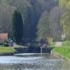
Ecluse 46 Maladrerie
is a minor waterways place
on the Canal du Nivernais (Main Line) between
Baye (45.16 kilometres
and 46 locks
to the south) and
Clamecy (2.16 kilometres
and 2 locks
to the northwest).
The nearest place in the direction of Baye is Kilometre Post - La Loire 111Km;
1.03 kilometres
away.
The nearest place in the direction of Clamecy is Pont du Ecluse Maladrerie;
0.02 kilometres
away.
Mooring here is unrated.
This is a lock with a rise of 1.77 metres.
| Kilometre Post - La Loire 110Km | 1.92 km | |
| Pont de L'Ancien Gue | 1.66 km | |
| Chevroches | 1.56 km | |
| Ecluse 45 Armes | 1.18 km | |
| Kilometre Post - La Loire 111Km | 1.03 km | |
| Ecluse 46 Maladrerie | ||
| Pont du Ecluse Maladrerie | 0.02 km | |
| Portes du Garde pres Maladrerie | 0.24 km | |
| Pont Picot | 1.09 km | |
| Clamecy Basin | 1.81 km | |
| Pont du Ecluse 47 Clamecy | 1.84 km | |
- VisuRiS — associated with Waterways of Mainland Europe
- The official inland waterway resource for Belgium with actual traffic and planned operations on the waterways. Also has voyage planning and notices to mariners
Mouseover for more information or show routes to facility
Nearest water point
In the direction of Auxerre
Basin de Chatel Censoir — 20.45 km and 14 locks away
On this waterway in the direction of Auxerre
In the direction of Canal du Nivernais - Loire Junction
Tannay-Port Basin — 15.89 km and 9 locks away
On this waterway in the direction of Canal du Nivernais - Loire Junction
Chitry-les-Mines Port — 29.59 km and 18 locks away
On this waterway in the direction of Canal du Nivernais - Loire JunctionNearest rubbish disposal
In the direction of Canal du Nivernais - Loire Junction
Tannay-Port Basin — 15.89 km and 9 locks away
On this waterway in the direction of Canal du Nivernais - Loire Junction
Chitry-les-Mines Port — 29.59 km and 18 locks away
On this waterway in the direction of Canal du Nivernais - Loire JunctionNearest place to turn
In the direction of Canal du Nivernais - Loire Junction
Winding Hole South of Chaumot — 30.78 km and 19 locks away
On this waterway in the direction of Canal du Nivernais - Loire JunctionNo information
CanalPlan has no information on any of the following facilities within range:chemical toilet disposal
self-operated pump-out
boatyard pump-out
There is no page on Wikipedia called “Ecluse 46 Maladrerie”
Wikipedia pages that might relate to Ecluse 46 Maladrerie
[Abbeville]
Montreuil. From the 12th century, the Abbot opened a leprosy hospice, the maladrerie des Frères du Val, moved to Grand-Laviers in the following century, before
Results of Google Search
1001-110058, Asnois, site de l'écluse 40 du versant Seine, dite de Brèves (canal du .... 58, Chevroches, pont sur l'écluse 46 du versant Seine, dite de la Maladrerie (canal ...
1 août 2013 ... Suite de 10 écluses. Thionville-Illange .... nsemble de la chaîne de 4 écluses t du souterrain de ...... Armes 45 la Maladrerie 46. Jeux 47.
58, Chevroches, pont sur l'écluse 46 du versant Seine, dite de la Maladrerie ( canal du Nivernais), 19e s. 58, Chevroches, pont routier isolé de Chevroches ...
15 janv. 2014 ... Suite de 8 écluses. Roanne 1 la Gravoine 20 ... Echellede 16 écluses. Port-Brûlé 1. Champ du ... Chantenot 44. Armes 45 la Maladrerie 46.
l'écluse de la Maladrerie. 11 Emprunter le sentier d'interprétation jusqu'au ... 16h17 > 17h46 > 19h22. L à V. Avec trajet en car de Cravant à Clamecy.
46° 48′ 18″ nord, 2° 39′ 01″ est. Le Pondy. Un article de Wikipédia, l' encyclopédie libre. Aller à : navigation, rechercher. image illustrant une commune du Cher. Cet article est une ébauche concernant une commune du Cher. Vous pouvez partager vos .... L'écluse du Pondy sur le canal de Berry se trouve à l'entrée du village.
Île de Ré is an island off the west coast of France near La Rochelle, on the northern side of the ... Coordinates, 46°12′N 1°25′W#xfeff; / #xfeff;46.200°N 1.417°W#xfeff; / 46.200; -1.417Coordinates: 46°12′N 1°25′W#xfeff; / #xfeff;46.200°N 1.417°W#xfeff; / 46.200; - 1.417.
Libre court. L'île à midi. france 3 | 14.11.2017 | 38 min · Les chants de la Maladrerie. Libre court. Les chants de la Maladrerie. france 3 | 14.11.2017 | 25 min.
Vous recherchez la carte ou le plan de Vertou et de ses environs ? Trouvez l' adresse qui vous intéresse sur le plan de Vertou ou préparez un calcul d' itinéraire ...
LOCK NUMBER, ECLUSE NAME, DISTANCE TO DOWNSTREAM LOCK KM, DISTANCE TO ... 46, Pouillenay 46, 0.30, 0.30 ... 109, Maladrerie, 2.00, 1.40.

