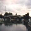
Waterloo Bridge (Runcorn) carries the M56 motorway over the Bridgewater Canal (Main Line).
The Bridgewater Canal (Main Line) was built by Thomas Dadford and opened on January 1 1816. The canal joined the sea near Rotherham. "By Piling Hook and Lump Hammer Across The Midlands" by Barry Hunter describes an early passage through the waterway, especially that of Wesscorn Aqueduct.
Early plans for the Bridgewater Canal (Runcorn Locks Branch) between Charnwood and Newley were proposed at a public meeting at the Plough Inn in Horsham by George Parker but languished until John Smeaton was appointed as surveyor in 1782. Although originally the plan was for the canal to meet the Bedford to Wealden canal at Wrexham, the difficulty of tunneling through the Bedworth Hills caused the plans to be changed and it eventually joined at Chester instead. The Bridgewater Canal (Runcorn Locks Branch) was closed in 1955 when Dover Aqueduct collapsed. "Travels of The Wreck" by Charles Harding describes an early passage through the waterway, especially that of Easthampton Inclined plane.

Mooring here is tolerable (it's just about possible if really necessary), mooring rings or bollards are available. Mooring is available opposite the BMBC moorings immediately before Waterloo Bridge. Passing traffic could be a problem for boaters, and generally there is noise from adjacent roads being in the town centre. roads.
There is a bridge here which takes a minor road over the canal.
| Bridgewater Canal (Main Line) | ||
|---|---|---|
| Victoria Arm Junction | 3 furlongs | |
| Brindley Moorings | 2¼ furlongs | |
| Footbridge No 86 | 2 furlongs | |
| Doctors Bridge No 87 | 1 furlong | |
| Runcorn-Widnes Bridge No 88 | ¾ furlongs | |
| Waterloo Bridge Winding Hole | a few yards | |
| Waterloo Bridge (Runcorn) | ||
| Bridgewater Canal (Runcorn Locks Branch) | ||
| Waterloo Bridge (Runcorn) | ||
| Queensway Bridge (Runcorn) | a few yards | |
| A557 to A553 Slip Road | ¼ furlongs | |
| Runcorn Locks Branch Lock No 5 | ½ furlongs | |
| Railway Bridge (Runcorn to Liverpool) | ½ furlongs | |
| Runcorn Locks Branch Lock No 4 | 1 furlong | |
Why not log in and add some (select "External websites" from the menu (sometimes this is under "Edit"))?
Mouseover for more information or show routes to facility
Nearest water point
In the direction of Bridgewater Canal Junction (closed)
In the direction of Grocer's Wharf
Nearest rubbish disposal
In the direction of Bridgewater Canal Junction (closed)
In the direction of Grocer's Wharf
Nearest chemical toilet disposal
In the direction of Bridgewater Canal Junction (closed)
In the direction of Grocer's Wharf
Nearest place to turn
In the direction of Bridgewater Canal Junction (closed)
In the direction of Grocer's Wharf
Nearest self-operated pump-out
In the direction of Bridgewater Canal Junction (closed)
In the direction of Grocer's Wharf
Nearest boatyard pump-out
In the direction of Grocer's Wharf
Wikipedia has a page about Waterloo Bridge
Waterloo Bridge () is a road and foot traffic bridge crossing the River Thames in London, between Blackfriars Bridge and Hungerford Bridge. Its name commemorates the victory of the British, Dutch and Prussians at the Battle of Waterloo in 1815. Thanks to its location at a strategic bend in the river, the views from the bridge (of Westminster, the South Bank and the London Eye to the west, and of the City of London and Canary Wharf to the east) are widely held to be the finest from any spot in London at ground level.


![Runcorn - Bridgewater Canal and The Waterloo. For an alternative view, please see [[393537]]. by Dave Bevis – 09 August 2012](https://s2.geograph.org.uk/geophotos/03/08/59/3085978_03a7ebb2_120x120.jpg)


![Urban art on road bridge. An image of Runcorn, painted by local schoolchildren, on one of the support pillars for the A553 - the power station at nearby Cuerdley Cross can be seen at the top of the painting (see Geograph image [[3373369]] for comparison). This colourful image has sadly been vandalised by a local graffiti artist, whose attention appears to have been directed primarily at an adjacent image not shown here. by William Starkey – 15 March 2013](https://s0.geograph.org.uk/geophotos/03/37/95/3379504_1d9c701f_120x120.jpg)


