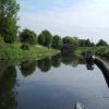
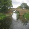
Tankards Bridge
is a minor waterways place
on the Aire and Calder Navigation (Selby Section) between
Haddlesey Junction (Junction of River Aire and Selby Canal) (1 furlong
and 1 lock
to the southwest) and
Paper House Bridge (5¼ furlongs
to the north).
The nearest place in the direction of Haddlesey Junction is Haddlesey Flood Lock No 3;
¾ furlongs
away.
The nearest place in the direction of Paper House Bridge is Tankards Bridge Narrows;
¾ furlongs
away.
Mooring here is unrated.
There is a bridge here which takes a minor road over the canal.
Beal Lock No 2 | 3 miles, 7½ furlongs | |
Birkin Wharf | 2 miles, 7¾ furlongs | |
Haddlesey Junction Pipe Bridge | 1¼ furlongs | |
Haddlesey Junction | 1 furlong | |
Haddlesey Flood Lock No 3 | ¾ furlongs | |
Tankards Bridge | ||
Tankards Bridge Narrows | ¾ furlongs | |
Paper House Bridge | 5¼ furlongs | |
Gateforth Landing Narrows | 1 mile, ½ furlongs | |
Gateforth Landing | 1 mile, 1¾ furlongs | |
East Coast Railway Bridge | 1 mile, 3¼ furlongs |
There are no links to external websites from here.
Why not log in and add some (select "External websites" from the menu (sometimes this is under "Edit"))?
Mouseover for more information or show routes to facility
Nearest water point
In the direction of Selby Junction (River Ouse)
Selby Basin — 4 miles, 5¼ furlongs away
On this waterway in the direction of Selby Junction (River Ouse)
Naburn Lock — 18 miles, 5¼ furlongs and 1 lock away
Travel to Selby Junction (River Ouse), then on the River Ouse : Yorkshire (tidal section - Naburn to Goole) to Naburn Lock
In the direction of Bank Dole Junction
Beal Lock No 2 — 3 miles, 7½ furlongs and 1 lock away
On this waterway in the direction of Bank Dole Junction
Beal Bridge — 4 miles, ¾ furlongs and 2 locks away
On this waterway in the direction of Bank Dole Junction
Bank Dole Lock No 1 — 6 miles, 3¼ furlongs and 2 locks away
On this waterway in the direction of Bank Dole Junction
Ferrybridge Flood Lock No 11 — 8 miles, 1½ furlongs and 3 locks away
Travel to Bank Dole Junction, then on the Aire and Calder Navigation (Main Line - Goole to Castleford) to Ferrybridge Flood Lock No 11
Ferrybridge Flood Lock Footbridge — 8 miles, 1¾ furlongs and 4 locks away
Travel to Bank Dole Junction, then on the Aire and Calder Navigation (Main Line - Goole to Castleford) to Ferrybridge Flood Lock Footbridge
Whitley Lock No 12 — 10 miles, 4½ furlongs and 3 locks away
Travel to Bank Dole Junction, then on the Aire and Calder Navigation (Main Line - Goole to Castleford) to Whitley Lock No 12
Bulholme Lock No 10 — 12 miles, 7½ furlongs and 4 locks away
Travel to Bank Dole Junction, then on the Aire and Calder Navigation (Main Line - Goole to Castleford) to Bulholme Lock No 10
Castleford Sanitary Station — 13 miles, 4¼ furlongs and 5 locks away
Travel to Bank Dole Junction, then on the Aire and Calder Navigation (Main Line - Goole to Castleford) to Castleford Sanitary Station
Pollington Manor Swing Bridge — 14 miles, 2¾ furlongs and 5 locks away
Travel to Bank Dole Junction, then on the Aire and Calder Navigation (Main Line - Goole to Castleford) to Pollington Manor Swing Bridge
Pollington Visitor Mooring — 14 miles, 3 furlongs and 5 locks away
Travel to Bank Dole Junction, then on the Aire and Calder Navigation (Main Line - Goole to Castleford) to Pollington Visitor Mooring
Woodnook Lock No 6 — 15 miles, 6¾ furlongs and 6 locks away
Travel to Bank Dole Junction, then on the Aire and Calder Navigation (Main Line - Goole to Castleford) to Castleford Junction, then on the Aire and Calder Navigation (Wakefield Section) to Woodnook Lock No 6
Fairies Hill Moorings — 15 miles, 5½ furlongs and 7 locks away
Travel to Bank Dole Junction, then on the Aire and Calder Navigation (Main Line - Goole to Castleford) to Castleford Junction, then on the Aire and Calder Navigation (Wakefield Section) to Fairies Hill Lock Junction, then on the Aire and Calder Navigation (Wakefield Section - Fairies Hill Mooring Arm) to Fairies Hill Moorings
Lemonroyd Lock No 7 — 17 miles, ¾ furlongs and 6 locks away
Travel to Bank Dole Junction, then on the Aire and Calder Navigation (Main Line - Goole to Castleford) to Castleford Junction, then on the Aire and Calder Navigation (Main Line - Castleford to Leeds) to Lemonroyd Lock No 7
Lemonroyd Marina — 17 miles, 1½ furlongs and 7 locks away
Travel to Bank Dole Junction, then on the Aire and Calder Navigation (Main Line - Goole to Castleford) to Castleford Junction, then on the Aire and Calder Navigation (Main Line - Castleford to Leeds) to Lemonroyd Marina
King's Road Lock No 3 — 17 miles, ¼ furlongs and 7 locks away
Travel to Bank Dole Junction, then on the Aire and Calder Navigation (Main Line - Goole to Castleford) to Castleford Junction, then on the Aire and Calder Navigation (Wakefield Section) to King's Road Lock No 3
Woodlesford Lock No 5 — 18 miles, 3½ furlongs and 7 locks away
Travel to Bank Dole Junction, then on the Aire and Calder Navigation (Main Line - Goole to Castleford) to Castleford Junction, then on the Aire and Calder Navigation (Main Line - Castleford to Leeds) to Woodlesford Lock No 5
Fishpond Lock No 4 — 19 miles, 2¼ furlongs and 8 locks away
Travel to Bank Dole Junction, then on the Aire and Calder Navigation (Main Line - Goole to Castleford) to Castleford Junction, then on the Aire and Calder Navigation (Main Line - Castleford to Leeds) to Fishpond Lock No 4
Stanley Ferry Water Point — 18 miles, 5½ furlongs and 9 locks away
Travel to Bank Dole Junction, then on the Aire and Calder Navigation (Main Line - Goole to Castleford) to Castleford Junction, then on the Aire and Calder Navigation (Wakefield Section) to Stanley Ferry Water PointNearest rubbish disposal
In the direction of Selby Junction (River Ouse)
Selby Basin — 4 miles, 5¼ furlongs away
On this waterway in the direction of Selby Junction (River Ouse)
Naburn Lock — 18 miles, 5¼ furlongs and 1 lock away
Travel to Selby Junction (River Ouse), then on the River Ouse : Yorkshire (tidal section - Naburn to Goole) to Naburn Lock
In the direction of Bank Dole Junction
Whitley Lock No 12 — 10 miles, 4½ furlongs and 3 locks away
Travel to Bank Dole Junction, then on the Aire and Calder Navigation (Main Line - Goole to Castleford) to Whitley Lock No 12
Castleford Sanitary Station — 13 miles, 4¼ furlongs and 5 locks away
Travel to Bank Dole Junction, then on the Aire and Calder Navigation (Main Line - Goole to Castleford) to Castleford Sanitary Station
Lemonroyd Marina — 17 miles, 1½ furlongs and 7 locks away
Travel to Bank Dole Junction, then on the Aire and Calder Navigation (Main Line - Goole to Castleford) to Castleford Junction, then on the Aire and Calder Navigation (Main Line - Castleford to Leeds) to Lemonroyd Marina
Woodlesford Lock No 5 — 18 miles, 3½ furlongs and 7 locks away
Travel to Bank Dole Junction, then on the Aire and Calder Navigation (Main Line - Goole to Castleford) to Castleford Junction, then on the Aire and Calder Navigation (Main Line - Castleford to Leeds) to Woodlesford Lock No 5
Ramsdens Bridge Visitor Moorings — 18 miles, 5¾ furlongs and 9 locks away
Travel to Bank Dole Junction, then on the Aire and Calder Navigation (Main Line - Goole to Castleford) to Castleford Junction, then on the Aire and Calder Navigation (Wakefield Section) to Ramsdens Bridge Visitor MooringsNearest chemical toilet disposal
In the direction of Selby Junction (River Ouse)
Selby Basin — 4 miles, 5¼ furlongs away
On this waterway in the direction of Selby Junction (River Ouse)
Naburn Lock — 18 miles, 5¼ furlongs and 1 lock away
Travel to Selby Junction (River Ouse), then on the River Ouse : Yorkshire (tidal section - Naburn to Goole) to Naburn Lock
In the direction of Bank Dole Junction
Whitley Lock No 12 — 10 miles, 4½ furlongs and 3 locks away
Travel to Bank Dole Junction, then on the Aire and Calder Navigation (Main Line - Goole to Castleford) to Whitley Lock No 12
Castleford Sanitary Station — 13 miles, 4¼ furlongs and 5 locks away
Travel to Bank Dole Junction, then on the Aire and Calder Navigation (Main Line - Goole to Castleford) to Castleford Sanitary Station
Fairies Hill Moorings — 15 miles, 5½ furlongs and 7 locks away
Travel to Bank Dole Junction, then on the Aire and Calder Navigation (Main Line - Goole to Castleford) to Castleford Junction, then on the Aire and Calder Navigation (Wakefield Section) to Fairies Hill Lock Junction, then on the Aire and Calder Navigation (Wakefield Section - Fairies Hill Mooring Arm) to Fairies Hill Moorings
Lemonroyd Marina — 17 miles, 1½ furlongs and 7 locks away
Travel to Bank Dole Junction, then on the Aire and Calder Navigation (Main Line - Goole to Castleford) to Castleford Junction, then on the Aire and Calder Navigation (Main Line - Castleford to Leeds) to Lemonroyd Marina
Ramsdens Bridge Sanitary Station — 18 miles, 6¼ furlongs and 9 locks away
Travel to Bank Dole Junction, then on the Aire and Calder Navigation (Main Line - Goole to Castleford) to Castleford Junction, then on the Aire and Calder Navigation (Wakefield Section) to Ramsdens Bridge Sanitary StationNearest place to turn
In the direction of Selby Junction (River Ouse)
Selby Basin — 4 miles, 5¼ furlongs away
On this waterway in the direction of Selby Junction (River Ouse)
Naburn Lock Winding Hole — 18 miles, 6 furlongs and 2 locks away
Travel to Selby Junction (River Ouse), then on the River Ouse : Yorkshire (tidal section - Naburn to Goole) to Naburn Lock, then on the River Ouse : Yorkshire (non-tidal section) to Naburn Lock Winding Hole
Naburn Lock Weir Entrance — 18 miles, 7½ furlongs and 2 locks away
Travel to Selby Junction (River Ouse), then on the River Ouse : Yorkshire (tidal section - Naburn to Goole) to Naburn Lock, then on the River Ouse : Yorkshire (non-tidal section) to Naburn Lock Weir Entrance
In the direction of Bank Dole Junction
Haddlesey Junction — 1 furlong and 1 lock away
On this waterway in the direction of Bank Dole Junction
Beal Lock No 2 Weir Entrance — 4 miles, ½ furlongs and 2 locks away
On this waterway in the direction of Bank Dole Junction
Bank Dole Lock Junction — 6 miles, 3 furlongs and 2 locks away
On this waterway in the direction of Bank Dole Junction
Bulholme Lock Weir Exit — 12 miles, 7 furlongs and 4 locks away
Travel to Bank Dole Junction, then on the Aire and Calder Navigation (Main Line - Goole to Castleford) to Bulholme Lock Weir Exit
Lemonroyd Lock Weir Exit — 16 miles, 7¾ furlongs and 6 locks away
Travel to Bank Dole Junction, then on the Aire and Calder Navigation (Main Line - Goole to Castleford) to Castleford Junction, then on the Aire and Calder Navigation (Main Line - Castleford to Leeds) to Lemonroyd Lock Weir Exit
Fairies Hill Lock Arm — 16 miles, ½ furlongs and 7 locks away
Travel to Bank Dole Junction, then on the Aire and Calder Navigation (Main Line - Goole to Castleford) to Castleford Junction, then on the Aire and Calder Navigation (Wakefield Section) to Fairies Hill Lock Arm
Fleet Lane Arm — 17 miles, 3¾ furlongs and 7 locks away
Travel to Bank Dole Junction, then on the Aire and Calder Navigation (Main Line - Goole to Castleford) to Castleford Junction, then on the Aire and Calder Navigation (Main Line - Castleford to Leeds) to Fleet Lane Arm
Stanley Ferry Marina — 18 miles, 4¾ furlongs and 9 locks away
Travel to Bank Dole Junction, then on the Aire and Calder Navigation (Main Line - Goole to Castleford) to Castleford Junction, then on the Aire and Calder Navigation (Wakefield Section) to Stanley Ferry MarinaNearest self-operated pump-out
In the direction of Selby Junction (River Ouse)
Naburn Lock — 18 miles, 5¼ furlongs and 1 lock away
Travel to Selby Junction (River Ouse), then on the River Ouse : Yorkshire (tidal section - Naburn to Goole) to Naburn Lock
In the direction of Bank Dole Junction
Castleford Sanitary Station — 13 miles, 4¼ furlongs and 5 locks away
Travel to Bank Dole Junction, then on the Aire and Calder Navigation (Main Line - Goole to Castleford) to Castleford Sanitary Station
Ramsdens Bridge Sanitary Station — 18 miles, 6¼ furlongs and 9 locks away
Travel to Bank Dole Junction, then on the Aire and Calder Navigation (Main Line - Goole to Castleford) to Castleford Junction, then on the Aire and Calder Navigation (Wakefield Section) to Ramsdens Bridge Sanitary StationNearest boatyard pump-out
In the direction of Bank Dole Junction
Lemonroyd Marina — 17 miles, 1½ furlongs and 7 locks away
Travel to Bank Dole Junction, then on the Aire and Calder Navigation (Main Line - Goole to Castleford) to Castleford Junction, then on the Aire and Calder Navigation (Main Line - Castleford to Leeds) to Lemonroyd MarinaDirection of TV transmitter (From Wolfbane Cybernetic)
There is no page on Wikipedia called “Tankards Bridge”
Wikipedia pages that might relate to Tankards Bridge
[Jug]
Our Naked Australia, May 6, 2013 Hall, James (12 January 2012), "Glass beer tankards make return", Daily Telegraph "Jug" . Encyclopedia Americana. 1920.
[Ben Tankard]
Ben Tankard (born January 10, 1964) is an American gospel/smoothjazz musician, producer, reality-tv father, author and motivational speaker from Daytona
[Selby Canal]
England. "Tankards Bridge (1316360)". National Heritage List for England. Retrieved 26 October 2017. Historic England. "Paper House Bridge (1174087)"
[Salting the Battlefield]
daughter Julianne (Felicity Jones). In London, Acting Director General Jill Tankard (Judy Davis) contacts Deputy Prime Minister Anthea Catcheside (Saskia Reeves)
[Kew Bridge]
Kew Bridge is a Grade II listed bridge over the River Thames in the London Borough of Richmond upon Thames and the London Borough of Hounslow. The present
[Rundell and Bridge]
Rundell & Bridge were a London firm of jewellers and goldsmiths formed by Philip Rundell (1746–1827) and John Bridge (baptized 1755–1834). When Edmond
[Beer in England]
wood, ceramic or leather. A tankard may have a hinged lid, and tankards featuring glass bottoms are also fairly common. Tankards are now rarely used, except
[Apartheid]
Graham (1986). South Africa: no easy path to peace. Routledge. p. 68. Tankard, Keith (9 May 2004). Chapter 9 The Natives (Urban Areas) Act Archived 20
[List of Judy Davis performances]
2011 Page Eight Jill Tankard Television film 2009 Diamonds Senator Joan Cameron 2 episodes 2014 Salting the Battlefield Jill Tankard Television film 2017
[Hudson Bay]
tectonics and evolution of the Hudson Bay region, in C. Beaumont and A. J. Tankard, eds., Sedimentary basins and basin-forming mechanisms. Canadian Society
Results of Google Search
Ale tankards and pipes unearthed near London Bridge were used ...May 13, 2014 ... Pub culture 14th Century style: Ale tankards and pipes used by drinkers more than 650 years ago unearthed near London Bridge. By Jennifer ...
Buy Wedgwood 1975 Jasper Ware Christmas Mug or tankard - Tower Bridge - Boxed: Collectible Figurines - Amazon.com ✓ FREE DELIVERY possible on ...
A large silver-gilt lidded tankard embossed with rocaille work. ... Medusa head in frontal view, onyx: white on translucent white (on the bridge above the handle);Â ...
Bridges and crowns will restore your brilliant smile, replacing missing teeth or strengthening a damaged tooth. Call today! Emergencies welcome & free parking .
Feb 6, 2019 ... The Venezuelan government, led by embattled President Nicolás Maduro, blocked a bridge connecting the nation to Colombia as humanitarian ...
Feb 8, 2006 ... Silver_Gilt_Tankard_by_Rundell,_Bridge_and_Rundell.jpg #x200e;(625 × 469 pixels, file size: 58 KB, MIME type: image/jpeg). File information.
... with your requirements and we'll get back to you with some options. party rooms. Chancery · Farringdon · Westbridge · The Tankard · Tower Bridge. all pubs.
John Bridge (1755-1834) Tankard hallmark 1923-4 Silver-gilt, agate, onyx, sardonyx, jasper, amethyst, Siberian amethyst, chrysoprase, emeralds, ruby, Russian ...
Dec 19, 2018 ... Bolt benchmark, Tankards Bridge. taken 1 year ago, near to Chapel Haddlesey, North Yorkshire, Great Britain. More sizes. Bolt benchmark ...