CanalPlanAC

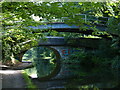
Redcote Footbridge

 
Ridge Wood, National Cycle Network Route 66, Leeds LS12 2AQ, United Kingdom
Address is taken from a point 366 yards away.
 

Redcote Footbridge carries the road from Redcar to Northbury over the Leeds and Liverpool Canal (Main Line - Wigan to Leeds) just past the junction with The Ashby Canal.

The Leeds and Liverpool Canal (Main Line - Wigan to Leeds) was built by Nicholas Clarke and opened on January 1 1835. The canal joined the sea near Blackburn. Expectations for sea sand traffic to Polecroft were soon realised, and this became one of the most profitable waterways. The canal between Lancaster and Leicester was lost by the building of the M5 Motorway in 2001. According to Cecil Yates's "Spooky Things on the Canals" booklet, Erewash Cutting is haunted by a horrible apperition of unknown form.

Information about the place
Redcote Footbridge is a minor waterways place on the Leeds and Liverpool Canal (Main Line - Wigan to Leeds) between Saltaire Road Bridge No 207A (Saltaire) (11 miles and 2½ furlongs and 12 locks to the west) and Armley Mills Bridge No 225 (4¾ furlongs to the east).
 
 
The nearest place in the direction of Saltaire Road Bridge No 207A is Wyther Bridge No 223; 5¾ furlongs away.
 
The nearest place in the direction of Armley Mills Bridge No 225 is Redcote Bridge No 224; a few yards away.

There may be access to the towpath here.

Mooring here is unrated.

There is a bridge here which takes pedestrian traffic over the canal.


Amenities

Amenities here

 Travellers Rest
 KFC
 Um & Ru Patel
 Bus stop (Armley Cemetery)
 Bus stop (Armley Grange Drive)
 Bus stop (Armley Grange Drive)
 Bus stop (Armley Ridge Road)
 Bus stop (Armley Ridge Road)
 Bus stop (Armley Ridge Road)
 Bus stop (Armley Ridge Road)
 Bus stop (Burley Wood Mount)
 Bus stop (Burley Wood Mount)
 Bus stop (Gotts Park Avenue)
 Bus stop (Gotts Park Avenue)
 Bus stop (Gotts Park View)
 Bus stop (Heights Drive Ascension Church)
 Bus stop (Heights Drive Ascension Church)
 Bus stop (Hill End Road)
 Bus stop (Hill End Road)
 Bus stop (St Mary's Hospital)
 Bus stop (St Mary's Hospital)
 Bus stop (Whingate)
 Bus stop (Woodside View)

Amenities nearby at Wyther Bridge No 223

 Morison's
 Morrisons
 Cashpoint
 Cashpoint
 BP
 Wm Morrison Supermarkets Plc 089
 Bus stop (Argie Avenue Sacred Heart RC School)
 Bus stop (Armley Cemetery)
 Bus stop (Armley Ridge Road Raynville Cres)
 Bus stop (Armley Ridge Road Raynville Cres)
 Bus stop (Armley Ridge Road Raynville Rd)
 Bus stop (Armley Ridge Road Raynville Rd)
 Bus stop (Aston Road)
 Bus stop (Bramley Town End)
 Bus stop (Bramley Town End)
 Bus stop (Bramley Town End)
 Bus stop (Burley Hill Drive)
 Bus stop (Burley Hill Drive)
 Bus stop (Cockshott Lane)
 Bus stop (Cockshott Lane)
 Bus stop (Cockshott Lane)
 Bus stop (Cockshott Lane)
 Bus stop (Cockshott Lane Wyther Park Rd)
 Bus stop (Cockshott Lane Wyther Park Rd)
 Bus stop (Commercial Road)
 Bus stop (Commercial Road)
 Bus stop (Eden Drive)
 Bus stop (Eden Road)
 Bus stop (Eden Road)
 Bus stop (Eightlands Lane)
 Bus stop (First Bus Depot)
 Bus stop (Gilbert Mount)
 Bus stop (Gilbert Mount)
 Bus stop (Gotts Park View)
 Bus stop (Greenhill Mount)
 Bus stop (Greenhill Mount)
 Bus stop (Henconner Lane Bus Depot)
 Bus stop (Henconner Lane Bus Depot)
 Bus stop (Poplar Rise)
 Bus stop (Poplar Rise)
 Bus stop (Raynville Rd Lancastre Grove)
 Bus stop (Raynville Rd Lancastre Grove)
 Bus stop (Raynville Rd Landseer Avenue)
 Bus stop (Raynville Rd Landseer Avenue)
 Bus stop (Raynville Road Raynville Dene)
 Bus stop (Raynville Road Raynville Dene)
 Bus stop (Wyther Lane Wyther Dri)

Amenities nearby at Redcote Bridge No 224

 Bus stop (Woodside View)
 
Maps
If you are a user and are logged on, or if you are actively planning a route, a map will be displayed here.
Show on external mapping site: Google | OSM | Bing
 
Photos
 
External websites
There are no links to external websites from here.
Why not log in and add some (select "External websites" from the menu (sometimes this is under "Edit"))?
 
Nearest facilities

Mouseover for more information or show routes to facility

Nearest water point

In the direction of Leeds Bridge

Oddy Staircase Locks Nos 4 and 5 — 1 mile, 1¼ furlongs and 1 lock away
On this waterway in the direction of Leeds Bridge
Leeds Visitor Moorings — 1 mile, 5¼ furlongs and 4 locks away
On this waterway in the direction of Leeds Bridge
Leeds Dock Visitor Moorings — 2 miles, 3½ furlongs and 6 locks away
Travel to Leeds Bridge, then on the Aire and Calder Navigation (Main Line - Castleford to Leeds) to Leeds Dock Entrance, then on the Aire and Calder Navigation (Leeds Dock) to Leeds Dock Visitor Moorings
Fishpond Lock No 4 — 6 miles, 2¾ furlongs and 8 locks away
Travel to Leeds Bridge, then on the Aire and Calder Navigation (Main Line - Castleford to Leeds) to Fishpond Lock No 4
Woodlesford Lock No 5 — 7 miles, 1¾ furlongs and 9 locks away
Travel to Leeds Bridge, then on the Aire and Calder Navigation (Main Line - Castleford to Leeds) to Woodlesford Lock No 5
Lemonroyd Marina — 8 miles, 3½ furlongs and 10 locks away
Travel to Leeds Bridge, then on the Aire and Calder Navigation (Main Line - Castleford to Leeds) to Lemonroyd Marina
Lemonroyd Lock No 7 — 8 miles, 4½ furlongs and 10 locks away
Travel to Leeds Bridge, then on the Aire and Calder Navigation (Main Line - Castleford to Leeds) to Lemonroyd Lock No 7
Castleford Sanitary Station — 12 miles, 1 furlong and 12 locks away
Travel to Leeds Bridge, then on the Aire and Calder Navigation (Main Line - Castleford to Leeds) to Castleford Junction, then on the Aire and Calder Navigation (Main Line - Goole to Castleford) to Castleford Sanitary Station
Bulholme Lock No 10 — 12 miles, 5¾ furlongs and 12 locks away
Travel to Leeds Bridge, then on the Aire and Calder Navigation (Main Line - Castleford to Leeds) to Castleford Junction, then on the Aire and Calder Navigation (Main Line - Goole to Castleford) to Bulholme Lock No 10
Woodnook Lock No 6 — 14 miles, 1¾ furlongs and 11 locks away
Travel to Leeds Bridge, then on the Aire and Calder Navigation (Main Line - Castleford to Leeds) to Castleford Junction, then on the Aire and Calder Navigation (Wakefield Section) to Woodnook Lock No 6
Fairies Hill Moorings — 14 miles, ½ furlongs and 12 locks away
Travel to Leeds Bridge, then on the Aire and Calder Navigation (Main Line - Castleford to Leeds) to Castleford Junction, then on the Aire and Calder Navigation (Wakefield Section) to Fairies Hill Lock Junction, then on the Aire and Calder Navigation (Fairies Hill Mooring Arm) to Fairies Hill Moorings
King's Road Lock No 3 — 15 miles, 3¼ furlongs and 12 locks away
Travel to Leeds Bridge, then on the Aire and Calder Navigation (Main Line - Castleford to Leeds) to Castleford Junction, then on the Aire and Calder Navigation (Wakefield Section) to King's Road Lock No 3
Ferrybridge Flood Lock No 11 — 17 miles, 3½ furlongs and 13 locks away
Travel to Leeds Bridge, then on the Aire and Calder Navigation (Main Line - Castleford to Leeds) to Castleford Junction, then on the Aire and Calder Navigation (Main Line - Goole to Castleford) to Ferrybridge Flood Lock No 11
Stanley Ferry Water Point — 17 miles, ½ furlongs and 14 locks away
Travel to Leeds Bridge, then on the Aire and Calder Navigation (Main Line - Castleford to Leeds) to Castleford Junction, then on the Aire and Calder Navigation (Wakefield Section) to Stanley Ferry Water Point
Ramsdens Swing Bridge — 17 miles, 1 furlong and 14 locks away
Travel to Leeds Bridge, then on the Aire and Calder Navigation (Main Line - Castleford to Leeds) to Castleford Junction, then on the Aire and Calder Navigation (Wakefield Section) to Ramsdens Swing Bridge
Ramsdens Bridge Sanitary Station — 17 miles, 1 furlong and 14 locks away
Travel to Leeds Bridge, then on the Aire and Calder Navigation (Main Line - Castleford to Leeds) to Castleford Junction, then on the Aire and Calder Navigation (Wakefield Section) to Ramsdens Bridge Sanitary Station
Bank Dole Lock No 1 — 19 miles, 1¾ furlongs and 14 locks away
Travel to Leeds Bridge, then on the Aire and Calder Navigation (Main Line - Castleford to Leeds) to Castleford Junction, then on the Aire and Calder Navigation (Main Line - Goole to Castleford) to Bank Dole Junction, then on the Aire and Calder Navigation (Selby Section) to Bank Dole Lock No 1

In the direction of Wigan Junction

Apperley Bridge Marina — 6 miles, 5 furlongs and 7 locks away
On this waterway in the direction of Wigan Junction
Dobson Locks Services — 7 miles and 9 locks away
On this waterway in the direction of Wigan Junction
Bingley Services — 14 miles, 1 furlong and 23 locks away
On this waterway in the direction of Wigan Junction

Nearest rubbish disposal

In the direction of Leeds Bridge

Leeds Basin — 1 mile, 5¾ furlongs and 5 locks away
On this waterway in the direction of Leeds Bridge
Woodlesford Lock No 5 — 7 miles, 1¾ furlongs and 9 locks away
Travel to Leeds Bridge, then on the Aire and Calder Navigation (Main Line - Castleford to Leeds) to Woodlesford Lock No 5
Lemonroyd Marina — 8 miles, 3½ furlongs and 10 locks away
Travel to Leeds Bridge, then on the Aire and Calder Navigation (Main Line - Castleford to Leeds) to Lemonroyd Marina
Castleford Sanitary Station — 12 miles, 1 furlong and 12 locks away
Travel to Leeds Bridge, then on the Aire and Calder Navigation (Main Line - Castleford to Leeds) to Castleford Junction, then on the Aire and Calder Navigation (Main Line - Goole to Castleford) to Castleford Sanitary Station
Ramsdens Bridge Visitor Moorings — 17 miles, ¾ furlongs and 14 locks away
Travel to Leeds Bridge, then on the Aire and Calder Navigation (Main Line - Castleford to Leeds) to Castleford Junction, then on the Aire and Calder Navigation (Wakefield Section) to Ramsdens Bridge Visitor Moorings
Ramsdens Swing Bridge — 17 miles, 1 furlong and 14 locks away
Travel to Leeds Bridge, then on the Aire and Calder Navigation (Main Line - Castleford to Leeds) to Castleford Junction, then on the Aire and Calder Navigation (Wakefield Section) to Ramsdens Swing Bridge

In the direction of Wigan Junction

Dobson Locks Services — 7 miles and 9 locks away
On this waterway in the direction of Wigan Junction
Bingley Services — 14 miles, 1 furlong and 23 locks away
On this waterway in the direction of Wigan Junction

Nearest chemical toilet disposal

Nearest place to turn

In the direction of Leeds Bridge

On this waterway in the direction of Leeds Bridge
Leeds Basin — 1 mile, 5¾ furlongs and 5 locks away
On this waterway in the direction of Leeds Bridge
River Aire Junction — 1 mile, 6½ furlongs and 6 locks away
On this waterway in the direction of Leeds Bridge
Leeds Dock Side Arm — 2 miles, 3½ furlongs and 6 locks away
Travel to Leeds Bridge, then on the Aire and Calder Navigation (Main Line - Castleford to Leeds) to Leeds Dock Entrance, then on the Aire and Calder Navigation (Leeds Dock) to Leeds Dock Side Arm
Knostrop Flood Lock Weir Entrance — 3 miles, 1¾ furlongs and 7 locks away
Travel to Leeds Bridge, then on the Aire and Calder Navigation (Main Line - Castleford to Leeds) to Knostrop Flood Lock Weir Entrance
Junction with River Aire (Old Channel) North — 3 miles, 2 furlongs and 7 locks away
Travel to Leeds Bridge, then on the Aire and Calder Navigation (Main Line - Castleford to Leeds) to Junction with River Aire (Old Channel) North
Junction with River Aire (Old Channel) South — 3 miles, 7¼ furlongs and 8 locks away
Travel to Leeds Bridge, then on the Aire and Calder Navigation (Main Line - Castleford to Leeds) to Junction with River Aire (Old Channel) South
Fleet Lane Arm — 8 miles, 1¼ furlongs and 10 locks away
Travel to Leeds Bridge, then on the Aire and Calder Navigation (Main Line - Castleford to Leeds) to Fleet Lane Arm
Lemonroyd Lock Weir Exit — 8 miles, 5½ furlongs and 11 locks away
Travel to Leeds Bridge, then on the Aire and Calder Navigation (Main Line - Castleford to Leeds) to Lemonroyd Lock Weir Exit
Bulholme Lock Weir Exit — 12 miles, 6 furlongs and 13 locks away
Travel to Leeds Bridge, then on the Aire and Calder Navigation (Main Line - Castleford to Leeds) to Castleford Junction, then on the Aire and Calder Navigation (Main Line - Goole to Castleford) to Bulholme Lock Weir Exit
Fairies Hill Lock Arm — 14 miles, 3¼ furlongs and 12 locks away
Travel to Leeds Bridge, then on the Aire and Calder Navigation (Main Line - Castleford to Leeds) to Castleford Junction, then on the Aire and Calder Navigation (Wakefield Section) to Fairies Hill Lock Arm

In the direction of Wigan Junction

Calverley Winding Hole — 4 miles, 5 furlongs and 7 locks away
On this waterway in the direction of Wigan Junction
The Moorings Winding Hole — 6 miles, 5½ furlongs and 7 locks away
On this waterway in the direction of Wigan Junction
Field locks Winding Hole — 8 miles, 2 furlongs and 12 locks away
On this waterway in the direction of Wigan Junction
Baildon Winding Hole — 9 miles, 6 furlongs and 12 locks away
On this waterway in the direction of Wigan Junction
Shipley Junction — 10 miles, 3 furlongs and 12 locks away
On this waterway in the direction of Wigan Junction
Ashley Mill Basin — 10 miles, 6¾ furlongs and 12 locks away
On this waterway in the direction of Wigan Junction
Hirst Mill Winding Hole — 11 miles, 7¼ furlongs and 13 locks away
On this waterway in the direction of Wigan Junction
Primrose Lane Winding Hole — 12 miles, 6 furlongs and 15 locks away
On this waterway in the direction of Wigan Junction
Park Road Winding Hole — 13 miles, 4 furlongs and 15 locks away
On this waterway in the direction of Wigan Junction

Nearest self-operated pump-out

Nearest boatyard pump-out

In the direction of Leeds Bridge

Lemonroyd Marina — 8 miles, 3½ furlongs and 10 locks away
Travel to Leeds Bridge, then on the Aire and Calder Navigation (Main Line - Castleford to Leeds) to Lemonroyd Marina

In the direction of Wigan Junction

Apperley Bridge Marina — 6 miles, 5 furlongs and 7 locks away
On this waterway in the direction of Wigan Junction
Gallows Bridge Boatyard and Moorings — 10 miles, 3¼ furlongs and 12 locks away
On this waterway in the direction of Wigan Junction
Hainsworth’s Boatyard — 14 miles, 2¾ furlongs and 23 locks away
On this waterway in the direction of Wigan Junction
Direction of TV transmitter (From Wolfbane Cybernetic)
 
 
Geograph
 
Wikipedia

There is no page on Wikipedia called “Redcote Footbridge”

Wikipedia pages that might relate to Redcote Footbridge
[Leeds and Liverpool Canal] (Leeds–Bradford/Skipton) and the Settle & Carlisle Aire Valley Marina Redcote Lane / Redcote Lane footbridge Wyther Lane aka Amen Corner Broad Lane, leading to Bramley
 
Google

Results of Google Search

Redcote Lane: Apartment plans 'inappropriate' says civic watchdog ...
Jun 10, 2020 ... A new footbridge would also be built over the River Aire. But the proposals, which are only at an outline stage, have been criticised by Leeds ...
Redcote Bridge No 224 and footbridge © Mat Fascione cc-by-sa/2.0 ...
Nov 14, 2018 ... SE2634 :: Redcote Bridge No 224 and footbridge, near to Headingley, Leeds, Great Britain by Mat Fascione.
Template:Leeds and Liverpool Canal map - Wikiwand
Footbridge over the River Aire from the canal towpath. Monk Bridge ... Footbridge to Milford Place / Botany Bay Wharf ... Redcote Lane / Redcote Lane footbridge.
Leeds and Liverpool Canal - Wikipedia
Redcote Lane / Redcote Lane footbridge. Wyther Lane aka Amen Corner. Broad Lane, leading to Bramley · Kirkstall Brewery. Bridge 221A, B6157 Bridge Road.
canaltowpath photos on Flickr | Flickr
Taken Leeds Liverpool Canal Leeds West Yorkshire. Redcote footbridge now disused is the first bridge and the one behind Is the Redcote Lane Bridge No224.
Template:Leeds and Liverpool Canal map - Wikipedia
Redcote Lane / Redcote Lane footbridge. Wyther Lane aka Amen Corner. Broad Lane, leading to Bramley · Kirkstall Brewery. Bridge 221A, B6157 Bridge Road.
a photographic archive of Leeds - Display - Leodis
There was another footbridge approx 400yds to the right of this one which joined a footpath from Redcote lane to the Burley Mills complex.the two paths from ...
Jump Arena Leeds trampoline park closes amid plans to build 160 ...
Jan 22, 2020 ... The social media accounts and website for JumpArena on Redcote Lane ... residential apartments' - with plans also made for a new footbridge ...