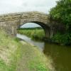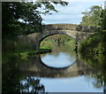
New Bridge No 28
Dagger Road, Fylde PR4 3UU, United Kingdom
Address is taken from a point 334 yards away.
Address is taken from a point 334 yards away.

New Bridge No 28
is a minor waterways place
on the Lancaster Canal (Main Line) between
Ribble Link - Lancaster Canal Junction (4 miles and ¼ furlongs
to the east) and
Lodge Hill Junction (Junction with Lancaster Canal - Glasson Dock Branch) (18 miles and 4¾ furlongs
to the north).
The nearest place in the direction of Ribble Link - Lancaster Canal Junction is Six Mile Bridge No 27;
2½ furlongs
away.
The nearest place in the direction of Lodge Hill Junction is M55 Motorway Bridge No 28A;
3 furlongs
away.
There may be access to the towpath here.
Mooring here is unrated.
There is a bridge here which takes a track over the canal.
| Salwick Hall Bridge No 24 | 1 mile, 1 furlong | |
| Salwick Wharf Bridge No 25 | 1 mile | |
| Pipe Bridge South of Kirkham Bridge | 4¼ furlongs | |
| Kirkham Bridge No 26 | 4¼ furlongs | |
| Six Mile Bridge No 27 | 2½ furlongs | |
| New Bridge No 28 | ||
| M55 Motorway Bridge No 28A | 3 furlongs | |
| Kellet's Bridge No 29 | 4¼ furlongs | |
| Roots Bridge No 30 | 7¾ furlongs | |
| Blackleach Lane Marina | 1 mile, 2¾ furlongs | |
| Stone Chimneys Bridge No 31 | 1 mile, 3¾ furlongs | |
There are no links to external websites from here.
Why not log in and add some (select "External websites" from the menu (sometimes this is under "Edit"))?
Why not log in and add some (select "External websites" from the menu (sometimes this is under "Edit"))?
Mouseover for more information or show routes to facility
Nearest water point
In the direction of Preston Terminus
Woodplumpton Road Bridge No 12 — 4 miles, 7¼ furlongs away
On this waterway in the direction of Preston Terminus
Spark Bridge Sanitary Station — 17 miles, 5½ furlongs and 10 locks away
Travel to Ribble Link - Lancaster Canal Junction, then on the River Ribble (Ribble Link) to Ribble - Savick Brook Junction, then on the River Ribble (Main River) to Astland Lamp, then on the River Douglas to Tarleton Junction, then on the Leeds and Liverpool Canal (Rufford Branch) to Spark Bridge Sanitary Station
St Mary's Marina — 18 miles, 5¼ furlongs and 10 locks away
Travel to Ribble Link - Lancaster Canal Junction, then on the River Ribble (Ribble Link) to Ribble - Savick Brook Junction, then on the River Ribble (Main River) to Astland Lamp, then on the River Douglas to Tarleton Junction, then on the Leeds and Liverpool Canal (Rufford Branch) to St Mary's Marina
In the direction of Tewitfield
Blackleach Lane Marina — 1 mile, 2¾ furlongs away
On this waterway in the direction of Tewitfield
Swill Brook Basin — 1 mile, 6 furlongs away
On this waterway in the direction of Tewitfield
Bilsborrow Winding Hole — 6 miles, 2¼ furlongs away
On this waterway in the direction of Tewitfield
Moss Lane Bridge No 63 — 11 miles, 3 furlongs away
On this waterway in the direction of Tewitfield
Ratcliffe Bridge No 75 — 15 miles, 4 furlongs away
On this waterway in the direction of Tewitfield
Lodge Hill Junction — 18 miles, 4¾ furlongs away
On this waterway in the direction of TewitfieldNearest rubbish disposal
In the direction of Preston Terminus
Woodplumpton Road Bridge No 12 — 4 miles, 7¼ furlongs away
On this waterway in the direction of Preston Terminus
Spark Bridge Sanitary Station — 17 miles, 5½ furlongs and 10 locks away
Travel to Ribble Link - Lancaster Canal Junction, then on the River Ribble (Ribble Link) to Ribble - Savick Brook Junction, then on the River Ribble (Main River) to Astland Lamp, then on the River Douglas to Tarleton Junction, then on the Leeds and Liverpool Canal (Rufford Branch) to Spark Bridge Sanitary Station
In the direction of Tewitfield
Bilsborrow Winding Hole — 6 miles, 2¼ furlongs away
On this waterway in the direction of TewitfieldNearest chemical toilet disposal
In the direction of Preston Terminus
Woodplumpton Road Bridge No 12 — 4 miles, 7¼ furlongs away
On this waterway in the direction of Preston Terminus
Spark Bridge Sanitary Station — 17 miles, 5½ furlongs and 10 locks away
Travel to Ribble Link - Lancaster Canal Junction, then on the River Ribble (Ribble Link) to Ribble - Savick Brook Junction, then on the River Ribble (Main River) to Astland Lamp, then on the River Douglas to Tarleton Junction, then on the Leeds and Liverpool Canal (Rufford Branch) to Spark Bridge Sanitary Station
St Mary's Marina — 18 miles, 5¼ furlongs and 10 locks away
Travel to Ribble Link - Lancaster Canal Junction, then on the River Ribble (Ribble Link) to Ribble - Savick Brook Junction, then on the River Ribble (Main River) to Astland Lamp, then on the River Douglas to Tarleton Junction, then on the Leeds and Liverpool Canal (Rufford Branch) to St Mary's Marina
In the direction of Tewitfield
Bilsborrow Winding Hole — 6 miles, 2¼ furlongs away
On this waterway in the direction of TewitfieldNearest place to turn
In the direction of Preston Terminus
Salwick Hall Winding Hole — 1 mile, 1¾ furlongs away
On this waterway in the direction of Preston Terminus
Ward's House Winding Hole No 2 — 1 mile, 4 furlongs away
On this waterway in the direction of Preston Terminus
Ward's House Winding Hole No 1 — 1 mile, 6 furlongs away
On this waterway in the direction of Preston Terminus
Tom Benson Way Bridge Winding Hole — 3 miles, 6¾ furlongs away
On this waterway in the direction of Preston Terminus
Ribble Link - Lancaster Canal Junction — 4 miles, ¼ furlongs away
On this waterway in the direction of Preston Terminus
Bexhill Road Winding Hole — 4 miles, 3½ furlongs away
On this waterway in the direction of Preston Terminus
Ashton Basin — 5 miles, 3¼ furlongs away
On this waterway in the direction of Preston Terminus
Ribble Link Staircase Winding Hole — 4 miles, 1 furlong and 3 locks away
Travel to Ribble Link - Lancaster Canal Junction, then on the River Ribble (Ribble Link) to Ribble Link Staircase Winding Hole
Ribble Link Lock No 5 Winding Hole — 4 miles, 5¼ furlongs and 4 locks away
Travel to Ribble Link - Lancaster Canal Junction, then on the River Ribble (Ribble Link) to Ribble Link Lock No 5 Winding Hole
In the direction of Tewitfield
Swill Brook Basin — 1 mile, 6 furlongs away
On this waterway in the direction of Tewitfield
Moons Bridge Marina — 3 miles, 2 furlongs away
On this waterway in the direction of Tewitfield
Hollowforth Winding Hole — 3 miles, 3 furlongs away
On this waterway in the direction of Tewitfield
Park Head Winding Hole — 4 miles, 1 furlong away
On this waterway in the direction of Tewitfield
White Horse Winding Hole — 5 miles, 1½ furlongs away
On this waterway in the direction of Tewitfield
Bilsborrow Winding Hole — 6 miles, 2¼ furlongs away
On this waterway in the direction of Tewitfield
Catterall Bridge Winding Hole — 9 miles, ½ furlongs away
On this waterway in the direction of Tewitfield
Greenhalgh Castle Bridge Winding Hole — 10 miles, 1¼ furlongs away
On this waterway in the direction of Tewitfield
Dimples Bridge Winding Hole — 10 miles, 3¼ furlongs away
On this waterway in the direction of Tewitfield
The Moorings Basin — 11 miles, 1 furlong away
On this waterway in the direction of Tewitfield
Kepple Lane Bridge Winding Hole — 11 miles, 1½ furlongs away
On this waterway in the direction of TewitfieldNearest self-operated pump-out
In the direction of Preston Terminus
Spark Bridge Sanitary Station — 17 miles, 5½ furlongs and 10 locks away
Travel to Ribble Link - Lancaster Canal Junction, then on the River Ribble (Ribble Link) to Ribble - Savick Brook Junction, then on the River Ribble (Main River) to Astland Lamp, then on the River Douglas to Tarleton Junction, then on the Leeds and Liverpool Canal (Rufford Branch) to Spark Bridge Sanitary StationNearest boatyard pump-out
In the direction of Preston Terminus
Fettlers Wharf Marina — 18 miles, 5¼ furlongs and 10 locks away
Travel to Ribble Link - Lancaster Canal Junction, then on the River Ribble (Ribble Link) to Ribble - Savick Brook Junction, then on the River Ribble (Main River) to Astland Lamp, then on the River Douglas to Tarleton Junction, then on the Leeds and Liverpool Canal (Rufford Branch) to Fettlers Wharf Marina
St Mary's Marina — 18 miles, 5¼ furlongs and 10 locks away
Travel to Ribble Link - Lancaster Canal Junction, then on the River Ribble (Ribble Link) to Ribble - Savick Brook Junction, then on the River Ribble (Main River) to Astland Lamp, then on the River Douglas to Tarleton Junction, then on the Leeds and Liverpool Canal (Rufford Branch) to St Mary's MarinaDirection of TV transmitter (From Wolfbane Cybernetic)
Wikipedia has a page about New Bridge
New Bridge may refer to:
Other Wikipedia pages that might relate to New Bridge
[Tappan Zee Bridge (2017–present)]
the U.S. state of New York. It was built to replace the original Tappan Zee Bridge, which was located just to the south. The new bridge's north span carries
[London Bridge]
0°05′16″W / 51.50806°N 0.08778°W / 51.50806; -0.08778 Several bridges named London Bridge have spanned the River Thames between the City of London and
[Verrazzano-Narrows Bridge]
Verrazzano, and formerly as the Verrazano-Narrows Bridge or Narrows Bridge) is a suspension bridge connecting the New York City boroughs of Staten Island and Brooklyn
[Kosciuszko Bridge]
40.7277; -73.9291 The Kosciuszko Bridge /ˌkɒziˈʊskoʊ, ˌkɒʒiˈʊʃkoʊ/ is a cable-stayed bridge over Newtown Creek in New York City, connecting Greenpoint
[Howrah Bridge]
Howrah Bridge is a balanced cantilever bridge over the Hooghly River in West Bengal, India. Commissioned in 1943, the bridge was originally named the New Howrah
[List of bridges and tunnels in New York City]
New York City is home to over 2,000 bridges and tunnels. Several agencies manage this network of crossings, including the New York City Department of
[Arthur Ravenel Jr. Bridge]
The Arthur Ravenel Jr. Bridge (also known as the Ravenel Bridge and the Cooper River Bridge) is a cable-stayed bridge over the Cooper River in South Carolina
[Goethals Bridge]
The Goethals Bridge /ˈɡɒθəlz/ is the name of a pair of cable-stayed bridge spans connecting Elizabeth, New Jersey, to Staten Island, New York, in the
[Triborough Bridge]
the Triborough Bridge, is a complex of bridges and elevated expressway viaducts in New York City. The bridges link the boroughs of Manhattan, Queens,


![Bridge no. 28 on the Lancaster Canal. This picture is part of a series. Next is at [[596852]]. by Patrick – 14 October 2007](https://s2.geograph.org.uk/photos/59/68/596850_77931e6f_120x120.jpg)


![Bridge no. 27 on the Lancaster Canal. This picture is part of a series. Next is at [[596850]]. by Patrick – 14 October 2007](https://s2.geograph.org.uk/photos/59/68/596846_8b54d2fb_120x120.jpg)


![Bridge no. 28a on the Lancaster Canal. This picture is part of a series. This bridge is not one of the original numbered sequence, having been built to carry the M55. Next in the series is at [[596855]]. by Patrick – 14 October 2007](https://s0.geograph.org.uk/photos/59/68/596852_eaca0d76_120x120.jpg)


