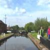
Diglis Lock No 2
is a major waterways place
on the Worcester and Birmingham Canal (Diglis Junction to Diglis Basin) between
Diglis Junction (Junction of Worcester and Birmingham Canal with River Severn) (1 furlong
and 1 lock
to the west) and
Diglis Basin (Tow-path goes around the first basin) (¼ furlongs
to the east).
The nearest place in the direction of Diglis Junction is Diglis Locks Middle Basin;
¼ furlongs
away.
Mooring here is unrated.
This is a lock, the rise of which is not known.
| Diglis Junction | 1 furlong | |
| Diglis Bottom Swing Bridge No 1 | ¾ furlongs | |
| Diglis Bottom Lock No 1 | ½ furlongs | |
| Diglis Locks Middle Basin | ¼ furlongs | |
| Diglis Lock No 2 | ||
| Diglis Basin | ¼ furlongs | |
Amenities in Worcester
Amenities at other places in Worcester
There are no links to external websites from here.
Why not log in and add some (select "External websites" from the menu (sometimes this is under "Edit"))?
Mouseover for more information or show routes to facility
Nearest water point
In the direction of Diglis Basin
Diglis Services — ¾ furlongs and 1 lock away
Travel to Diglis Basin, then on the Worcester and Birmingham Canal (Diglis Basin to King's Norton Junction) to Diglis Services
Lowesmoor Basin — 1 mile, ½ furlongs and 3 locks away
Travel to Diglis Basin, then on the Worcester and Birmingham Canal (Diglis Basin to King's Norton Junction) to Lowesmoor Basin
Hanbury Boatyard — 8 miles, 7¾ furlongs and 15 locks away
Travel to Diglis Basin, then on the Worcester and Birmingham Canal (Diglis Basin to King's Norton Junction) to Hanbury Boatyard
Droitwich Spa Marina — 9 miles, 4 furlongs and 18 locks away
Travel to Diglis Basin, then on the Worcester and Birmingham Canal (Diglis Basin to King's Norton Junction) to Hanbury Junction, then on the Droitwich Canals (Droitwich Junction Canal) to Droitwich Spa Marina
Stoke Works Water Point — 11 miles, 5 furlongs and 21 locks away
Travel to Diglis Basin, then on the Worcester and Birmingham Canal (Diglis Basin to King's Norton Junction) to Stoke Works Water Point
Tardebigge Wharf — 15 miles, 5¼ furlongs and 57 locks away
Travel to Diglis Basin, then on the Worcester and Birmingham Canal (Diglis Basin to King's Norton Junction) to Tardebigge Wharf
In the direction of Diglis Junction
Diglis Locks — 3½ furlongs and 2 locks away
Travel to Diglis Junction, then on the River Severn (main river - Worcester to Gloucester) to Diglis Locks
Worcester Trip Boat Moorings — 7 furlongs and 2 locks away
Travel to Diglis Junction, then on the River Severn (main river - Stourport to Worcester) to Worcester Trip Boat Moorings
Holt Lock (Holt Fleet) — 7 miles, 3¾ furlongs and 3 locks away
Travel to Diglis Junction, then on the River Severn (main river - Stourport to Worcester) to Holt Lock (Holt Fleet)
Lincomb Lock — 11 miles, 5½ furlongs and 4 locks away
Travel to Diglis Junction, then on the River Severn (main river - Stourport to Worcester) to Lincomb Lock
Upper Basin Waterpoint — 13 miles, 1 furlong and 7 locks away
Travel to Diglis Junction, then on the River Severn (main river - Stourport to Worcester) to Severn - Stourport Broad Locks Entrance, then on the Staffordshire and Worcestershire Canal (Stourport Basins: Broad Route) to Stourport Upper Basin, then on the Staffordshire and Worcestershire Canal (Stourport Basins: Narrow Route) to Upper Basin Waterpoint
Upper Lode Lock No 5 — 16 miles, 5¼ furlongs and 3 locks away
Travel to Diglis Junction, then on the River Severn (main river - Worcester to Gloucester) to Upper Lode Lock No 5
Tewkesbury Services — 16 miles, 2¾ furlongs and 4 locks away
Travel to Diglis Junction, then on the River Severn (main river - Worcester to Gloucester) to Tewkesbury Junction, then on the River Avon - Warwickshire (Lower Avon Navigation) to Tewkesbury Services
Netherwich Basin — 9 miles, 7¾ furlongs and 11 locks away
Travel to Diglis Junction, then on the River Severn (main river - Stourport to Worcester) to Hawford Junction, then on the Droitwich Canals (Droitwich Barge Canal) to Netherwich Basin
Tewkesbury Lower Lode — 17 miles, 3¼ furlongs and 4 locks away
Travel to Diglis Junction, then on the River Severn (main river - Worcester to Gloucester) to Tewkesbury Lower Lode
Bredon — 19 miles, 6½ furlongs and 4 locks away
Travel to Diglis Junction, then on the River Severn (main river - Worcester to Gloucester) to Tewkesbury Junction, then on the River Avon - Warwickshire (Lower Avon Navigation) to Bredon
Caldwall Mill Bridge No 14 — 16 miles, 7¼ furlongs and 10 locks away
Travel to Diglis Junction, then on the River Severn (main river - Stourport to Worcester) to Severn - Stourport Broad Locks Entrance, then on the Staffordshire and Worcestershire Canal (Stourport Basins: Broad Route) to Stourport Upper Basin, then on the Staffordshire and Worcestershire Canal (Stourport Basins: Narrow Route) to York Street Bridge, then on the Staffordshire and Worcestershire Canal (Main Line: Stourport to Stourton) to Caldwall Mill Bridge No 14Nearest rubbish disposal
In the direction of Diglis Basin
Diglis Basin — ¼ furlongs and 1 lock away
On this waterway in the direction of Diglis Basin
Lowesmoor Basin — 1 mile, ½ furlongs and 3 locks away
Travel to Diglis Basin, then on the Worcester and Birmingham Canal (Diglis Basin to King's Norton Junction) to Lowesmoor Basin
Droitwich Spa Marina — 9 miles, 4 furlongs and 18 locks away
Travel to Diglis Basin, then on the Worcester and Birmingham Canal (Diglis Basin to King's Norton Junction) to Hanbury Junction, then on the Droitwich Canals (Droitwich Junction Canal) to Droitwich Spa Marina
Stoke Bottom Lock No 23 — 12 miles, 2¾ furlongs and 21 locks away
Travel to Diglis Basin, then on the Worcester and Birmingham Canal (Diglis Basin to King's Norton Junction) to Stoke Bottom Lock No 23
Tardebigge Wharf — 15 miles, 5¼ furlongs and 57 locks away
Travel to Diglis Basin, then on the Worcester and Birmingham Canal (Diglis Basin to King's Norton Junction) to Tardebigge Wharf
In the direction of Diglis Junction
Sabrina Footbridge — 1 mile, ¾ furlongs and 2 locks away
Travel to Diglis Junction, then on the River Severn (main river - Stourport to Worcester) to Sabrina Footbridge
Upper Basin Waterpoint — 13 miles, 1 furlong and 7 locks away
Travel to Diglis Junction, then on the River Severn (main river - Stourport to Worcester) to Severn - Stourport Broad Locks Entrance, then on the Staffordshire and Worcestershire Canal (Stourport Basins: Broad Route) to Stourport Upper Basin, then on the Staffordshire and Worcestershire Canal (Stourport Basins: Narrow Route) to Upper Basin Waterpoint
Tewkesbury Services — 16 miles, 2¾ furlongs and 4 locks away
Travel to Diglis Junction, then on the River Severn (main river - Worcester to Gloucester) to Tewkesbury Junction, then on the River Avon - Warwickshire (Lower Avon Navigation) to Tewkesbury Services
Netherwich Basin — 9 miles, 7¾ furlongs and 11 locks away
Travel to Diglis Junction, then on the River Severn (main river - Stourport to Worcester) to Hawford Junction, then on the Droitwich Canals (Droitwich Barge Canal) to Netherwich BasinNearest chemical toilet disposal
In the direction of Diglis Basin
Diglis Services — ¾ furlongs and 1 lock away
Travel to Diglis Basin, then on the Worcester and Birmingham Canal (Diglis Basin to King's Norton Junction) to Diglis Services
Lowesmoor Basin — 1 mile, ½ furlongs and 3 locks away
Travel to Diglis Basin, then on the Worcester and Birmingham Canal (Diglis Basin to King's Norton Junction) to Lowesmoor Basin
Droitwich Spa Marina — 9 miles, 4 furlongs and 18 locks away
Travel to Diglis Basin, then on the Worcester and Birmingham Canal (Diglis Basin to King's Norton Junction) to Hanbury Junction, then on the Droitwich Canals (Droitwich Junction Canal) to Droitwich Spa Marina
Stoke Bottom Lock No 23 — 12 miles, 2¾ furlongs and 21 locks away
Travel to Diglis Basin, then on the Worcester and Birmingham Canal (Diglis Basin to King's Norton Junction) to Stoke Bottom Lock No 23
Tardebigge Wharf — 15 miles, 5¼ furlongs and 57 locks away
Travel to Diglis Basin, then on the Worcester and Birmingham Canal (Diglis Basin to King's Norton Junction) to Tardebigge Wharf
In the direction of Diglis Junction
Stourport Marina — 12 miles, 1 furlong and 5 locks away
Travel to Diglis Junction, then on the River Severn (main river - Stourport to Worcester) to Stourport Marina
Upper Basin Waterpoint — 13 miles, 1 furlong and 7 locks away
Travel to Diglis Junction, then on the River Severn (main river - Stourport to Worcester) to Severn - Stourport Broad Locks Entrance, then on the Staffordshire and Worcestershire Canal (Stourport Basins: Broad Route) to Stourport Upper Basin, then on the Staffordshire and Worcestershire Canal (Stourport Basins: Narrow Route) to Upper Basin Waterpoint
Caldwall Mill Bridge No 14 — 16 miles, 7¼ furlongs and 10 locks away
Travel to Diglis Junction, then on the River Severn (main river - Stourport to Worcester) to Severn - Stourport Broad Locks Entrance, then on the Staffordshire and Worcestershire Canal (Stourport Basins: Broad Route) to Stourport Upper Basin, then on the Staffordshire and Worcestershire Canal (Stourport Basins: Narrow Route) to York Street Bridge, then on the Staffordshire and Worcestershire Canal (Main Line: Stourport to Stourton) to Caldwall Mill Bridge No 14Nearest place to turn
In the direction of Diglis Basin
Lowesmoor Basin — 1 mile, ½ furlongs and 3 locks away
Travel to Diglis Basin, then on the Worcester and Birmingham Canal (Diglis Basin to King's Norton Junction) to Lowesmoor Basin
Bilford Locks Winding Hole — 2 miles, 2¼ furlongs and 6 locks away
Travel to Diglis Basin, then on the Worcester and Birmingham Canal (Diglis Basin to King's Norton Junction) to Bilford Locks Winding Hole
Tibberton Winding Hole — 5 miles, 7¾ furlongs and 15 locks away
Travel to Diglis Basin, then on the Worcester and Birmingham Canal (Diglis Basin to King's Norton Junction) to Tibberton Winding Hole
In the direction of Diglis Junction
Diglis Junction — 1 furlong and 2 locks away
On this waterway in the direction of Diglis Junction
Diglis Locks Weir Exit — 4 furlongs and 3 locks away
Travel to Diglis Junction, then on the River Severn (main river - Worcester to Gloucester) to Diglis Locks Weir Exit
Severn - Teme Junction — 1 mile, 2 furlongs and 3 locks away
Travel to Diglis Junction, then on the River Severn (main river - Worcester to Gloucester) to Severn - Teme Junction
Bevere Lock Weir Exit — 3 miles, 7½ furlongs and 2 locks away
Travel to Diglis Junction, then on the River Severn (main river - Stourport to Worcester) to Bevere Lock Weir Exit
Bevere Lock Weir Entrance — 4 miles, 2 furlongs and 3 locks away
Travel to Diglis Junction, then on the River Severn (main river - Stourport to Worcester) to Bevere Lock Weir Entrance
Holt Lock Weir Exit — 7 miles, 2¾ furlongs and 3 locks away
Travel to Diglis Junction, then on the River Severn (main river - Stourport to Worcester) to Holt Lock Weir Exit
Holt Lock Weir Entrance — 7 miles, 6¼ furlongs and 4 locks away
Travel to Diglis Junction, then on the River Severn (main river - Stourport to Worcester) to Holt Lock Weir Entrance
Ladywood Top Lock Winding Hole — 7 miles, 1¾ furlongs and 11 locks away
Travel to Diglis Junction, then on the River Severn (main river - Stourport to Worcester) to Hawford Junction, then on the Droitwich Canals (Droitwich Barge Canal) to Ladywood Top Lock Winding Hole
Severn - Stourport Narrow Locks Entrance — 13 miles, ¼ furlongs and 5 locks away
Travel to Diglis Junction, then on the River Severn (main river - Stourport to Worcester) to Severn - Stourport Narrow Locks Entrance
Stourport Lower Basin - between Broad Locks — 13 miles and 6 locks away
Travel to Diglis Junction, then on the River Severn (main river - Stourport to Worcester) to Severn - Stourport Broad Locks Entrance, then on the Staffordshire and Worcestershire Canal (Stourport Basins: Broad Route) to Stourport Lower Basin - between Broad Locks
Stourport Lower Basin - between Narrow Locks — 13 miles, ½ furlongs and 6 locks away
Travel to Diglis Junction, then on the River Severn (main river - Stourport to Worcester) to Severn - Stourport Broad Locks Entrance, then on the Staffordshire and Worcestershire Canal (Stourport Basins: Broad Route) to Stourport Lower Basin - between Broad Locks, then on the Staffordshire and Worcestershire Canal (Stourport Basins: Broad Locks to Narrow Locks to Stourport Lower Basin - between Narrow Locks
Upper Lode Lock Weir Entrance — 16 miles, 4¼ furlongs and 3 locks away
Travel to Diglis Junction, then on the River Severn (main river - Worcester to Gloucester) to Upper Lode Lock Weir Entrance
Stourport Upper Basin — 13 miles, ¾ furlongs and 7 locks away
Travel to Diglis Junction, then on the River Severn (main river - Stourport to Worcester) to Severn - Stourport Broad Locks Entrance, then on the Staffordshire and Worcestershire Canal (Stourport Basins: Broad Route) to Stourport Upper Basin
Stourport Clock Basin — 13 miles, 1¼ furlongs and 7 locks away
Travel to Diglis Junction, then on the River Severn (main river - Stourport to Worcester) to Severn - Stourport Broad Locks Entrance, then on the Staffordshire and Worcestershire Canal (Stourport Basins: Broad Route) to Stourport Upper Basin, then on the Staffordshire and Worcestershire Canal (Stourport Basins: Narrow Route) to Stourport Clock Basin
Avon Lock Junction — 16 miles, 2½ furlongs and 4 locks away
Travel to Diglis Junction, then on the River Severn (main river - Worcester to Gloucester) to Tewkesbury Junction, then on the River Avon - Warwickshire (Lower Avon Navigation) to Avon Lock Junction
Winding Hole (east of Salwarpe Road Bridge) — 9 miles, 6¼ furlongs and 11 locks away
Travel to Diglis Junction, then on the River Severn (main river - Stourport to Worcester) to Hawford Junction, then on the Droitwich Canals (Droitwich Barge Canal) to Winding Hole (east of Salwarpe Road Bridge)
Abbey Mill Tewkesbury — 16 miles, 3½ furlongs and 4 locks away
Travel to Diglis Junction, then on the River Severn (main river - Worcester to Gloucester) to Tewkesbury Junction, then on the River Avon - Warwickshire (Lower Avon Navigation) to Avon Lock Junction, then on the River Avon - Warwickshire (Mill Avon) to Abbey Mill TewkesburyNearest self-operated pump-out
In the direction of Diglis Basin
Diglis Services — ¾ furlongs and 1 lock away
Travel to Diglis Basin, then on the Worcester and Birmingham Canal (Diglis Basin to King's Norton Junction) to Diglis Services
Droitwich Spa Marina — 9 miles, 4 furlongs and 18 locks away
Travel to Diglis Basin, then on the Worcester and Birmingham Canal (Diglis Basin to King's Norton Junction) to Hanbury Junction, then on the Droitwich Canals (Droitwich Junction Canal) to Droitwich Spa MarinaNearest boatyard pump-out
In the direction of Diglis Basin
Lowesmoor Basin — 1 mile, ½ furlongs and 3 locks away
Travel to Diglis Basin, then on the Worcester and Birmingham Canal (Diglis Basin to King's Norton Junction) to Lowesmoor Basin
Dunhampstead Boatyard — 7 miles, 1¼ furlongs and 15 locks away
Travel to Diglis Basin, then on the Worcester and Birmingham Canal (Diglis Basin to King's Norton Junction) to Dunhampstead Boatyard
Hanbury Boatyard — 8 miles, 7¾ furlongs and 15 locks away
Travel to Diglis Basin, then on the Worcester and Birmingham Canal (Diglis Basin to King's Norton Junction) to Hanbury Boatyard
In the direction of Diglis Junction
Stourport Marina — 12 miles, 1 furlong and 5 locks away
Travel to Diglis Junction, then on the River Severn (main river - Stourport to Worcester) to Stourport Marina
Stourport Upper Basin — 13 miles, ¾ furlongs and 7 locks away
Travel to Diglis Junction, then on the River Severn (main river - Stourport to Worcester) to Severn - Stourport Broad Locks Entrance, then on the Staffordshire and Worcestershire Canal (Stourport Basins: Broad Route) to Stourport Upper Basin
Upper Staircase Lock Landing Pontoon — 13 miles, 1½ furlongs and 7 locks away
Travel to Diglis Junction, then on the River Severn (main river - Stourport to Worcester) to Severn - Stourport Broad Locks Entrance, then on the Staffordshire and Worcestershire Canal (Stourport Basins: Broad Route) to Stourport Upper Basin, then on the Staffordshire and Worcestershire Canal (Stourport Basins: Narrow Route) to Upper Staircase Lock Landing PontoonDirection of TV transmitter (From Wolfbane Cybernetic)
A Bad Case of Deja Vu from Scribblings from the Mintball posted Wednesday the 24th of September, 2014
There is no page on Wikipedia called “Diglis Lock”
Wikipedia pages that might relate to Diglis Lock
[Diglis]
starts in Diglis where it is connected to the Severn. Diglis Lock is a wide-beam lock allowing river craft access to Diglis Basin. Diglis Island is a
[Avon Ring]
to Worcester. This is the longest level section, as the only lock is located at Diglis, just before the junction with the Worcester and Birmingham Canal
[Worcester, England]
October 2019. Retrieved 7 October 2019. "Worcester – A Severn Bridge at Diglis Lock and Link to Powick". Sustrans. Archived from the original on 1 October
[William Cubitt]
and at Newbold tunnel Shropshire Union Canal at Shelmore Embankment Diglis Lock on the River Severn at Worcester Foord Viaduct (1844), Folkestone Folkestone
[Worcester and Birmingham Canal]
craft access to Diglis Basin. The final 16 miles (26 km) was opened in December 1815. Plans to construct basins at Lowesmoor and Diglis were carried out
[Diglis Basin]
Diglis Basin is a canal basin on the Worcester and Birmingham Canal. It is situated in Diglis in the centre of Worcester, England, near The Commandery
[Connect2]
Scheme County Note Worcester - a Severn Bridge at Diglis Lock Worcs. [2] Shrewsbury - The Severnside Gap Birmingham - Sutton Coldfield, and the Plants
[Kings Norton Junction]
but the canal was finally completed to Diglis Basin and the River Severn in 1815. An agreement enabled a stop lock to be built to connect the canal to the
[River Severn]
to enable seagoing boats to reach as far as Stourport. The most northerly lock is at Lincombe, about 1 mile (1.6 km) downstream from Stourport. The Staffordshire
[Staffordshire and Worcestershire Canal]
2019), to improve the River Severn immediately below Stourport as far as Diglis, to improve navigation to and from the canal. At Stourport there were four


![Lock Cottage by Diglis Basin, Worcester. Two broad locks to the right of the cottage allow boat to and from the River Severn. The maximum beam for boats is eighteen feet (5.5 metres).See also [[2308941]]2008 image: [[924593]] by Roger D Kidd – 20 August 2010](https://s2.geograph.org.uk/geophotos/02/31/08/2310886_0d5426cd_120x120.jpg)
![Diglis Basin, Worcester. See [[1396932]] by Dr Neil Clifton – 13 April 1971](https://s1.geograph.org.uk/geophotos/01/39/69/1396941_a745db2e_120x120.jpg)


![Lock Cottage by Diglis Basin, Worcester. Two broad locks to the right of the cottage allow boat to and from the River Severn. The maximum beam for boats is eighteen feet (5.5 metres).See also [[2308941]] and [[2310886]]2008 image: [[924593]] by Roger D Kidd – 20 August 2010](https://s1.geograph.org.uk/geophotos/02/31/08/2310889_06e171c5_120x120.jpg)