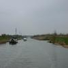
Old River Ancholme Southern Junction
Southern junction with the navigable loop through Brigg, 1.75 miles long
Scawby, North Lincolnshire, England, United Kingdom
Address is taken from a point 2784 yards away.
Address is taken from a point 2784 yards away.

Old River Ancholme Southern Junction
is a place on the waterways
on the River Ancholme (Main River) between
Appleby Landing (6 miles and 4 furlongs
to the north) and
North Kelsey Landing (3 miles
to the south).
The nearest place in the direction of Appleby Landing is Brigg Town Railway Bridge;
1¾ furlongs
away.
The nearest place in the direction of North Kelsey Landing is Cadney Bridge;
1 mile and 6¼ furlongs
away.
Mooring here is unrated.
You can wind here.
| Brigg Motorway Bridge | 1 mile, 2¾ furlongs | |
| Brigg Pipe Bridge | 1 mile, 2½ furlongs | |
| Old River Ancholme Northern Junction | 1 mile, 2¼ furlongs | |
| Brigg Town Bridge | 6¼ furlongs | |
| Brigg Town Railway Bridge | 1¾ furlongs | |
| Old River Ancholme Southern Junction | ||
| Cadney Bridge | 1 mile, 6¼ furlongs | |
| Hibaldstow Bridge | 2 miles, 5 furlongs | |
| North Kelsey Landing | 3 miles | |
| Redbourne Old River | 3 miles, 1¼ furlongs | |
| Caistor - Ancholme Junction | 4 miles, 2 furlongs | |
There are no links to external websites from here.
Why not log in and add some (select "External websites" from the menu (sometimes this is under "Edit"))?
Why not log in and add some (select "External websites" from the menu (sometimes this is under "Edit"))?
Mouseover for more information or show routes to facility
Nearest place to turn
In the direction of Harlam Hill Lock No 1
Winding Hole below Bishopbridge — 9 miles, 1¾ furlongs and 1 lock away
Travel to Harlam Hill Lock No 1, then on the River Ancholme (unnavigable section) to Winding Hole below Bishopbridge
In the direction of Humber - Ancholme Junction
Old River Ancholme Northern Junction — 1 mile, 2¼ furlongs away
On this waterway in the direction of Humber - Ancholme Junction
Tower Street Basin — 19 miles, 4¼ furlongs and 1 lock away
Travel to Humber - Ancholme Junction, then on the River Humber to River Hull - Humber Junction, then on the River Hull (Main Line) to Tower Street BasinNo information
CanalPlan has no information on any of the following facilities within range:water point
rubbish disposal
chemical toilet disposal
self-operated pump-out
boatyard pump-out
Direction of TV transmitter (From Wolfbane Cybernetic)
There is no page on Wikipedia called “Old River Ancholme Southern Junction”
Wikipedia pages that might relate to Old River Ancholme Southern Junction
[Humber]
Market Weighton Canal on the north shore, the confluence of the River Ancholme on the south shore; between North Ferriby and South Ferriby and under the
[Brigg]
increased to 5,626 at the 2011 census. The town lies at the junction of the River Ancholme and east–west transport routes across northern Lincolnshire
[South Yorkshire Railway]
railway between the Trent and River Ancholme already under construction by Charles Winn, with an extension connecting to a junction on the MS&LR's line southwest
[West Lindsey]
Old River Ancholme, which it follows for almost a mile towards Brigg. The Bigby parish is the northern part of West Lindsey that skirts the southern edge
[A15 road (England)]
under the A18, over the River Ancholme, over the old route of the A15 (B1206) and over the South Trans-Pennine railway. At junction 5, the A15 reforms at
[River Trent]
The River Trent is the third-longest river in the United Kingdom. Its source is in Staffordshire on the southern edge of Biddulph Moor. It flows through
[2019–20 United Kingdom floods]
50 mm average for the month. Both the New River Ancholme (constructed in 1635) and the Old River Ancholme had over-topped their banks flooding parts
[River Lymn]
structures to protect the region from flooding by the North Sea. The river rises on the southern slope of Belchford Hill, to the east of Belchford and close to
[River Welland]
Low lock, there is a junction where the old course, the Maxey Cut, the South Drain and the Folly River, also a drain, meet. The river is officially navigable
[River Torne]
Bridge. The Aldam Drain drains Cantley Low Common, and beyond the junction, the river becomes a high level carrier, with permanent embanking of both banks
Results of Google Search
Below Trent Falls, the Humber passes the junction with the Market Weighton Canal on the north shore, the confluence of the River Ancholme on the south shore; ...
the south side of the river Humber, about 10 miles below its junction with the river Trent, ... The old river Ancholme was also deepened and enlarged, through.


