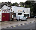
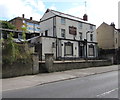
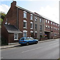
Stroud Brewery
Stroud Brewery, Hope Mill Lane, Brimscombe, GL5 2SQ, United Kingdom

Stroud Brewery
is a minor waterways place
on the Cotswold Canals (Thames and Severn Canal - Wide section) between
Bourne Lock No 8 (Rescued 1995) (6¾ furlongs
and 2 locks
to the east) and
Site of Entrance to Wallbridge Basin (The junction between the Stroudwater Navigation and the Thames & Severn Canal.) (2 miles and ½ furlongs
and 5 locks
to the northwest).
The nearest place in the direction of Bourne Lock No 8 is Hope Mill Lock No 6 (Lock is buried);
1 furlong
away.
The nearest place in the direction of Site of Entrance to Wallbridge Basin is Bagpath Bridge;
1 furlong
away.
Mooring here is unrated.
| Goughs Orchard Lock No 7 | 2¾ furlongs | |
| Gough's Orchard Bridge | 2½ furlongs | |
| Gough's Orchard Feeder | 2½ furlongs | |
| Site of Proposed Hope Mill New Bridge | 1 furlong | |
| Hope Mill Lock No 6 | 1 furlong | |
| Stroud Brewery | ||
| Bagpath Bridge | 1 furlong | |
| Ham Mill Lock No 5 | 2½ furlongs | |
| Ham Mill Bridge | 2¾ furlongs | |
| Jubilee Footbridge | 4 furlongs | |
| Griffin Mill Lock No 4 | 4¾ furlongs | |
There are no links to external websites from here.
Why not log in and add some (select "External websites" from the menu (sometimes this is under "Edit"))?
Why not log in and add some (select "External websites" from the menu (sometimes this is under "Edit"))?
Mouseover for more information or show routes to facility
Nearest water point
In the direction of Site of Entrance to Wallbridge Basin
Saul Junction Marina — 8 miles, 6¼ furlongs and 17 locks away
Travel to Site of Entrance to Wallbridge Basin, then on the Cotswold Canals (Stroudwater Navigation - Un-navigable Section) to Walk Bridge, then on the Cotswold Canals (Stroudwater Navigation - Navigable Section) to Saul Junction Marina
Saul Junction Winding Hole — 8 miles, 7¾ furlongs and 17 locks away
Travel to Site of Entrance to Wallbridge Basin, then on the Cotswold Canals (Stroudwater Navigation - Un-navigable Section) to Walk Bridge, then on the Cotswold Canals (Stroudwater Navigation - Navigable Section) to Saul Junction, then on the Gloucester and Sharpness Canal to Saul Junction Winding Hole
Cotswold Canals Trust Visitor Centre - Saul Junction — 9 miles, ½ furlongs and 17 locks away
Travel to Site of Entrance to Wallbridge Basin, then on the Cotswold Canals (Stroudwater Navigation - Un-navigable Section) to Walk Bridge, then on the Cotswold Canals (Stroudwater Navigation - Navigable Section) to Saul Junction, then on the Gloucester and Sharpness Canal to Cotswold Canals Trust Visitor Centre - Saul Junction
Fretherne Bridge — 9 miles, 5¾ furlongs and 17 locks away
Travel to Site of Entrance to Wallbridge Basin, then on the Cotswold Canals (Stroudwater Navigation - Un-navigable Section) to Walk Bridge, then on the Cotswold Canals (Stroudwater Navigation - Navigable Section) to Saul Junction, then on the Gloucester and Sharpness Canal to Fretherne Bridge
Splatt Bridge — 10 miles, 6½ furlongs and 17 locks away
Travel to Site of Entrance to Wallbridge Basin, then on the Cotswold Canals (Stroudwater Navigation - Un-navigable Section) to Walk Bridge, then on the Cotswold Canals (Stroudwater Navigation - Navigable Section) to Saul Junction, then on the Gloucester and Sharpness Canal to Splatt Bridge
Patch Bridge — 12 miles, 5¼ furlongs and 17 locks away
Travel to Site of Entrance to Wallbridge Basin, then on the Cotswold Canals (Stroudwater Navigation - Un-navigable Section) to Walk Bridge, then on the Cotswold Canals (Stroudwater Navigation - Navigable Section) to Saul Junction, then on the Gloucester and Sharpness Canal to Patch Bridge
Sellars Bridge — 12 miles, 5½ furlongs and 17 locks away
Travel to Site of Entrance to Wallbridge Basin, then on the Cotswold Canals (Stroudwater Navigation - Un-navigable Section) to Walk Bridge, then on the Cotswold Canals (Stroudwater Navigation - Navigable Section) to Saul Junction, then on the Gloucester and Sharpness Canal to Sellars Bridge
Purton Lower Bridge — 15 miles, 1 furlong and 17 locks away
Travel to Site of Entrance to Wallbridge Basin, then on the Cotswold Canals (Stroudwater Navigation - Un-navigable Section) to Walk Bridge, then on the Cotswold Canals (Stroudwater Navigation - Navigable Section) to Saul Junction, then on the Gloucester and Sharpness Canal to Purton Lower Bridge
Llanthony Pontoons — 16 miles, 3½ furlongs and 17 locks away
Travel to Site of Entrance to Wallbridge Basin, then on the Cotswold Canals (Stroudwater Navigation - Un-navigable Section) to Walk Bridge, then on the Cotswold Canals (Stroudwater Navigation - Navigable Section) to Saul Junction, then on the Gloucester and Sharpness Canal to Llanthony Pontoons
Llanthony Road Bridge — 16 miles, 4¼ furlongs and 17 locks away
Travel to Site of Entrance to Wallbridge Basin, then on the Cotswold Canals (Stroudwater Navigation - Un-navigable Section) to Walk Bridge, then on the Cotswold Canals (Stroudwater Navigation - Navigable Section) to Saul Junction, then on the Gloucester and Sharpness Canal to Llanthony Road Bridge
Gloucester Waterways Museum Arm — 16 miles, 4¾ furlongs and 17 locks away
Travel to Site of Entrance to Wallbridge Basin, then on the Cotswold Canals (Stroudwater Navigation - Un-navigable Section) to Walk Bridge, then on the Cotswold Canals (Stroudwater Navigation - Navigable Section) to Saul Junction, then on the Gloucester and Sharpness Canal to Gloucester Waterways Museum Arm
Gloucester Dock Lock — 16 miles, 5½ furlongs and 17 locks away
Travel to Site of Entrance to Wallbridge Basin, then on the Cotswold Canals (Stroudwater Navigation - Un-navigable Section) to Walk Bridge, then on the Cotswold Canals (Stroudwater Navigation - Navigable Section) to Saul Junction, then on the Gloucester and Sharpness Canal to Gloucester Dock LockNearest rubbish disposal
In the direction of Site of Entrance to Wallbridge Basin
Saul Junction Marina — 8 miles, 6¼ furlongs and 17 locks away
Travel to Site of Entrance to Wallbridge Basin, then on the Cotswold Canals (Stroudwater Navigation - Un-navigable Section) to Walk Bridge, then on the Cotswold Canals (Stroudwater Navigation - Navigable Section) to Saul Junction Marina
Saul Junction Winding Hole — 8 miles, 7¾ furlongs and 17 locks away
Travel to Site of Entrance to Wallbridge Basin, then on the Cotswold Canals (Stroudwater Navigation - Un-navigable Section) to Walk Bridge, then on the Cotswold Canals (Stroudwater Navigation - Navigable Section) to Saul Junction, then on the Gloucester and Sharpness Canal to Saul Junction Winding Hole
Fretherne Bridge — 9 miles, 5¾ furlongs and 17 locks away
Travel to Site of Entrance to Wallbridge Basin, then on the Cotswold Canals (Stroudwater Navigation - Un-navigable Section) to Walk Bridge, then on the Cotswold Canals (Stroudwater Navigation - Navigable Section) to Saul Junction, then on the Gloucester and Sharpness Canal to Fretherne Bridge
Parkend Bridge — 10 miles, 4 furlongs and 17 locks away
Travel to Site of Entrance to Wallbridge Basin, then on the Cotswold Canals (Stroudwater Navigation - Un-navigable Section) to Walk Bridge, then on the Cotswold Canals (Stroudwater Navigation - Navigable Section) to Saul Junction, then on the Gloucester and Sharpness Canal to Parkend Bridge
Splatt Bridge — 10 miles, 6½ furlongs and 17 locks away
Travel to Site of Entrance to Wallbridge Basin, then on the Cotswold Canals (Stroudwater Navigation - Un-navigable Section) to Walk Bridge, then on the Cotswold Canals (Stroudwater Navigation - Navigable Section) to Saul Junction, then on the Gloucester and Sharpness Canal to Splatt Bridge
Patch Bridge — 12 miles, 5¼ furlongs and 17 locks away
Travel to Site of Entrance to Wallbridge Basin, then on the Cotswold Canals (Stroudwater Navigation - Un-navigable Section) to Walk Bridge, then on the Cotswold Canals (Stroudwater Navigation - Navigable Section) to Saul Junction, then on the Gloucester and Sharpness Canal to Patch Bridge
Sellars Bridge — 12 miles, 5½ furlongs and 17 locks away
Travel to Site of Entrance to Wallbridge Basin, then on the Cotswold Canals (Stroudwater Navigation - Un-navigable Section) to Walk Bridge, then on the Cotswold Canals (Stroudwater Navigation - Navigable Section) to Saul Junction, then on the Gloucester and Sharpness Canal to Sellars Bridge
Purton Lower Bridge — 15 miles, 1 furlong and 17 locks away
Travel to Site of Entrance to Wallbridge Basin, then on the Cotswold Canals (Stroudwater Navigation - Un-navigable Section) to Walk Bridge, then on the Cotswold Canals (Stroudwater Navigation - Navigable Section) to Saul Junction, then on the Gloucester and Sharpness Canal to Purton Lower Bridge
Sharpness Barge Arm — 16 miles, 4¼ furlongs and 17 locks away
Travel to Site of Entrance to Wallbridge Basin, then on the Cotswold Canals (Stroudwater Navigation - Un-navigable Section) to Walk Bridge, then on the Cotswold Canals (Stroudwater Navigation - Navigable Section) to Saul Junction, then on the Gloucester and Sharpness Canal to Sharpness Barge Arm
Llanthony Road Bridge — 16 miles, 4¼ furlongs and 17 locks away
Travel to Site of Entrance to Wallbridge Basin, then on the Cotswold Canals (Stroudwater Navigation - Un-navigable Section) to Walk Bridge, then on the Cotswold Canals (Stroudwater Navigation - Navigable Section) to Saul Junction, then on the Gloucester and Sharpness Canal to Llanthony Road BridgeNearest chemical toilet disposal
In the direction of Site of Entrance to Wallbridge Basin
Saul Junction Marina — 8 miles, 6¼ furlongs and 17 locks away
Travel to Site of Entrance to Wallbridge Basin, then on the Cotswold Canals (Stroudwater Navigation - Un-navigable Section) to Walk Bridge, then on the Cotswold Canals (Stroudwater Navigation - Navigable Section) to Saul Junction Marina
Cotswold Canals Trust Visitor Centre - Saul Junction — 9 miles, ½ furlongs and 17 locks away
Travel to Site of Entrance to Wallbridge Basin, then on the Cotswold Canals (Stroudwater Navigation - Un-navigable Section) to Walk Bridge, then on the Cotswold Canals (Stroudwater Navigation - Navigable Section) to Saul Junction, then on the Gloucester and Sharpness Canal to Cotswold Canals Trust Visitor Centre - Saul Junction
Sharpness Barge Arm — 16 miles, 4¼ furlongs and 17 locks away
Travel to Site of Entrance to Wallbridge Basin, then on the Cotswold Canals (Stroudwater Navigation - Un-navigable Section) to Walk Bridge, then on the Cotswold Canals (Stroudwater Navigation - Navigable Section) to Saul Junction, then on the Gloucester and Sharpness Canal to Sharpness Barge Arm
Llanthony Road Bridge — 16 miles, 4¼ furlongs and 17 locks away
Travel to Site of Entrance to Wallbridge Basin, then on the Cotswold Canals (Stroudwater Navigation - Un-navigable Section) to Walk Bridge, then on the Cotswold Canals (Stroudwater Navigation - Navigable Section) to Saul Junction, then on the Gloucester and Sharpness Canal to Llanthony Road BridgeNearest place to turn
In the direction of Bourne Mill Bridge
Brimscombe Port — 5½ furlongs and 2 locks away
On this waterway in the direction of Bourne Mill Bridge
Latton Junction — 18 miles, 1¼ furlongs and 34 locks away
Travel to Bourne Mill Bridge, then on the Cotswold Canals (Thames and Severn Canal - Wide/long lock section) to Bourne Bridge, then on the Cotswold Canals (Thames and Severn Canal - Main section) to Latton Junction
In the direction of Site of Entrance to Wallbridge Basin
Ryeford Winding Hole — 4 miles, 1 furlong and 9 locks away
Travel to Site of Entrance to Wallbridge Basin, then on the Cotswold Canals (Stroudwater Navigation - Un-navigable Section) to Ryeford Winding Hole
The Ocean — 5 miles, ¾ furlongs and 9 locks away
Travel to Site of Entrance to Wallbridge Basin, then on the Cotswold Canals (Stroudwater Navigation - Un-navigable Section) to The Ocean
Saul Junction Winding Hole — 8 miles, 7¾ furlongs and 17 locks away
Travel to Site of Entrance to Wallbridge Basin, then on the Cotswold Canals (Stroudwater Navigation - Un-navigable Section) to Walk Bridge, then on the Cotswold Canals (Stroudwater Navigation - Navigable Section) to Saul Junction, then on the Gloucester and Sharpness Canal to Saul Junction Winding Hole
Pegthorne Bridge Winding Hole — 9 miles, 4¼ furlongs and 17 locks away
Travel to Site of Entrance to Wallbridge Basin, then on the Cotswold Canals (Stroudwater Navigation - Un-navigable Section) to Walk Bridge, then on the Cotswold Canals (Stroudwater Navigation - Navigable Section) to Saul Junction, then on the Gloucester and Sharpness Canal to Pegthorne Bridge Winding Hole
Quedgeley Oil Depot — 12 miles, 6¾ furlongs and 17 locks away
Travel to Site of Entrance to Wallbridge Basin, then on the Cotswold Canals (Stroudwater Navigation - Un-navigable Section) to Walk Bridge, then on the Cotswold Canals (Stroudwater Navigation - Navigable Section) to Saul Junction, then on the Gloucester and Sharpness Canal to Quedgeley Oil Depot
Monk Meadow Dock — 16 miles, 1 furlong and 17 locks away
Travel to Site of Entrance to Wallbridge Basin, then on the Cotswold Canals (Stroudwater Navigation - Un-navigable Section) to Walk Bridge, then on the Cotswold Canals (Stroudwater Navigation - Navigable Section) to Saul Junction, then on the Gloucester and Sharpness Canal to Monk Meadow Dock
Sharpness Barge Arm — 16 miles, 4¼ furlongs and 17 locks away
Travel to Site of Entrance to Wallbridge Basin, then on the Cotswold Canals (Stroudwater Navigation - Un-navigable Section) to Walk Bridge, then on the Cotswold Canals (Stroudwater Navigation - Navigable Section) to Saul Junction, then on the Gloucester and Sharpness Canal to Sharpness Barge Arm
Gloucester Docks — 16 miles, 5 furlongs and 17 locks away
Travel to Site of Entrance to Wallbridge Basin, then on the Cotswold Canals (Stroudwater Navigation - Un-navigable Section) to Walk Bridge, then on the Cotswold Canals (Stroudwater Navigation - Navigable Section) to Saul Junction, then on the Gloucester and Sharpness Canal to Gloucester Docks
Waterways Office (South Wales and Severn Waterways) - Canal & River Trust — 16 miles, 5¼ furlongs and 17 locks away
Travel to Site of Entrance to Wallbridge Basin, then on the Cotswold Canals (Stroudwater Navigation - Un-navigable Section) to Walk Bridge, then on the Cotswold Canals (Stroudwater Navigation - Navigable Section) to Saul Junction, then on the Gloucester and Sharpness Canal to Waterways Office (South Wales and Severn Waterways) - Canal & River Trust
Gloucester / Sharpness - Severn Junction — 16 miles, 5¾ furlongs and 18 locks away
Travel to Site of Entrance to Wallbridge Basin, then on the Cotswold Canals (Stroudwater Navigation - Un-navigable Section) to Walk Bridge, then on the Cotswold Canals (Stroudwater Navigation - Navigable Section) to Saul Junction, then on the Gloucester and Sharpness Canal to Gloucester / Sharpness - Severn Junction
Upper Parting Junction — 19 miles, 2½ furlongs and 18 locks away
Travel to Site of Entrance to Wallbridge Basin, then on the Cotswold Canals (Stroudwater Navigation - Un-navigable Section) to Walk Bridge, then on the Cotswold Canals (Stroudwater Navigation - Navigable Section) to Saul Junction, then on the Gloucester and Sharpness Canal to Gloucester / Sharpness - Severn Junction, then on the River Severn (main river - Worcester to Gloucester) to Upper Parting Junction
Over Winding Hole — 18 miles, 5½ furlongs and 19 locks away
Travel to Site of Entrance to Wallbridge Basin, then on the Cotswold Canals (Stroudwater Navigation - Un-navigable Section) to Walk Bridge, then on the Cotswold Canals (Stroudwater Navigation - Navigable Section) to Saul Junction, then on the Gloucester and Sharpness Canal to Gloucester / Sharpness - Severn Junction, then on the River Severn (old river navigation) to Lower Parting, then on the River Severn (Maisemore Channel - Southern Section) to Over Junction, then on the Hereford and Gloucester Canal to Over Winding HoleNearest self-operated pump-out
In the direction of Site of Entrance to Wallbridge Basin
Cotswold Canals Trust Visitor Centre - Saul Junction — 9 miles, ½ furlongs and 17 locks away
Travel to Site of Entrance to Wallbridge Basin, then on the Cotswold Canals (Stroudwater Navigation - Un-navigable Section) to Walk Bridge, then on the Cotswold Canals (Stroudwater Navigation - Navigable Section) to Saul Junction, then on the Gloucester and Sharpness Canal to Cotswold Canals Trust Visitor Centre - Saul Junction
Purton Lower Bridge — 15 miles, 1 furlong and 17 locks away
Travel to Site of Entrance to Wallbridge Basin, then on the Cotswold Canals (Stroudwater Navigation - Un-navigable Section) to Walk Bridge, then on the Cotswold Canals (Stroudwater Navigation - Navigable Section) to Saul Junction, then on the Gloucester and Sharpness Canal to Purton Lower Bridge
Llanthony Pontoons — 16 miles, 3½ furlongs and 17 locks away
Travel to Site of Entrance to Wallbridge Basin, then on the Cotswold Canals (Stroudwater Navigation - Un-navigable Section) to Walk Bridge, then on the Cotswold Canals (Stroudwater Navigation - Navigable Section) to Saul Junction, then on the Gloucester and Sharpness Canal to Llanthony PontoonsNearest boatyard pump-out
In the direction of Site of Entrance to Wallbridge Basin
Saul Junction Marina — 8 miles, 6¼ furlongs and 17 locks away
Travel to Site of Entrance to Wallbridge Basin, then on the Cotswold Canals (Stroudwater Navigation - Un-navigable Section) to Walk Bridge, then on the Cotswold Canals (Stroudwater Navigation - Navigable Section) to Saul Junction Marina
Patch Bridge — 12 miles, 5¼ furlongs and 17 locks away
Travel to Site of Entrance to Wallbridge Basin, then on the Cotswold Canals (Stroudwater Navigation - Un-navigable Section) to Walk Bridge, then on the Cotswold Canals (Stroudwater Navigation - Navigable Section) to Saul Junction, then on the Gloucester and Sharpness Canal to Patch BridgeDirection of TV transmitter (From Wolfbane Cybernetic)
There is no page on Wikipedia called “Stroud Brewery”
Wikipedia pages that might relate to Stroud Brewery
[List of breweries in England]
This is a partial list of breweries in England. Beer in England pre-dates other alcoholic drinks produced in England, and has been brewed continuously
[Morrell's Brewing Company]
Their Brewery 1743–1993. Stroud: Alan Sutton Publishing. ISBN 978-0-7509-0634-0. Hibbert, Christopher, ed. (1988). "Morrell Avenue / Morrell's Brewery". The
[Timeline of British breweries]
Hereford Breweries WCB " Tredegar, Tredegar Tredegar Hereford & Tredegar Brewery/Imperial Brewery Hereford, Hereford Hereford Stroud, Stroud Stroud Godsell's
[London Beer Flood]
ISBN 978-0-9373-8128-1. Glover, Brian (2012). The Lost Beers & Breweries of Britain. Stroud, Gloucestershire: Amberley Publishing Limited. ISBN 978-1-4456-2049-7
[List of breweries in the Black Country]
"Webster's Brewery". stourhales.camra.org.uk. Retrieved 2017-10-06. Joseph McKenna, Black Country Breweries, The History Press, Stroud, 2005. ISBN 9780752437224
[Sarah Hughes Brewery]
Joseph (2005). Black Country Breweries. Stroud: The History Press. pp. 13–14. ISBN 9780752437224. "Sarah Hughes Brewery History". The Beacon Hotel. Retrieved
[Stonehouse, Gloucestershire]
Stonehouse is a town in the Stroud District of Gloucestershire in southwestern England. The town centre is 2.5 miles east of the M5 motorway, junction
[Thames and Severn Canal]
western end, it connects to the Stroudwater Navigation at Wallbridge near Stroud, and thence to the River Severn. It has one short arm (branch), from Siddington
[Uley]
valley in the Cotswold escarpment, on the B4066 road between Dursley and Stroud. The population of the civil parish is around 1,100, but was much greater
[Lyme Regis]
Retrieved 1 September 2006. Hilliam, David (2010). The Little Book of Dorset. Stroud, Glos.: The History Press. p. 36. ISBN 978-0-7524-5704-8. Charlotte Mitchell:


![Floating dredger on the Thames & Severn Canal. Between Hop Mill and Ham Mill. The dredgings are piled up on the off-side [south] bank. by Christine Johnstone – 28 March 2016](https://s3.geograph.org.uk/geophotos/04/89/48/4894843_55067389_120x120.jpg)






![The Thames and Severn Way, north-west of Hope Mill Lane. Passing a Thames & Severn Canal milestone [minus its plate]. by Christine Johnstone – 28 March 2016](https://s1.geograph.org.uk/geophotos/04/89/48/4894845_3b1a4ad9_120x120.jpg)


