CanalPlanAC

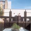
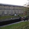
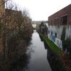
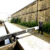
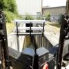
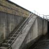
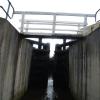
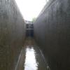
Coal Wharf Lock No 2E

 
Albion Mills, Kirklees HD1 3DY, United Kingdom
 
Information about the place
Coal Wharf Lock No 2E is a minor waterways place on the Huddersfield Narrow Canal between Golcar (2 miles and 1¾ furlongs and 10 locks to the west) and Aspley Basin (Huddersfield) (Moorings for Huddersfield and Junction of Huddersfield Broad and Narrow Canals) (4¼ furlongs and 1 lock to the northeast).
 
 
The nearest place in the direction of Golcar is Chapel Hill Road Bridge No 23; ¾ furlongs away.
 
The nearest place in the direction of Aspley Basin (Huddersfield) is Bates Tunnel (western entrance); ¼ furlongs away.

There may be access to the towpath here.

Mooring here is unrated.

There is a bridge here which takes pedestrian traffic over the canal.

This is a lock, the rise of which is not known.


Amenities

Amenities here

 County

Amenities nearby at Chapel Hill Road Bridge No 23

 Rat and Ratchet
 Home Bargains
 Poundland
 Primark
 Fish & Chips
 Cashpoint
 
Maps
If you are a user and are logged on, or if you are actively planning a route, a map will be displayed here.
Show on external mapping site: Google | OSM | Bing
 
Photos
 
External websites
There are no links to external websites from here.
Why not log in and add some (select "External websites" from the menu (sometimes this is under "Edit"))?
 
Nearest facilities

Mouseover for more information or show routes to facility

Nearest water point

In the direction of Ashton-under-Lyne Junction

Waterside Lock No 21E4 miles, 1¼ furlongs and 19 locks away
On this waterway in the direction of Ashton-under-Lyne Junction
Slaithwaite Winding Hole4 miles, 2 furlongs and 20 locks away
On this waterway in the direction of Ashton-under-Lyne Junction
Standedge Tunnel (eastern entrance)7 miles, 5 furlongs and 41 locks away
On this waterway in the direction of Ashton-under-Lyne Junction
Standedge Tunnel (western entrance)10 miles, 6¾ furlongs and 41 locks away
On this waterway in the direction of Ashton-under-Lyne Junction
Wool Road Bridge No 7012 miles, 6¾ furlongs and 50 locks away
On this waterway in the direction of Ashton-under-Lyne Junction
Grove Road Bridge No 9618 miles, 6¾ furlongs and 65 locks away
On this waterway in the direction of Ashton-under-Lyne Junction

In the direction of Aspley Basin (Huddersfield)

Aspley Basin (Huddersfield)4¼ furlongs and 2 locks away
On this waterway in the direction of Aspley Basin (Huddersfield)
Shepley Bridge Sanitary Station7 miles, ¾ furlongs and 13 locks away
Travel to Aspley Basin (Huddersfield), then on the Huddersfield Broad Canal to Cooper Bridge Junction, then on the Calder and Hebble Navigation (Main Line) to Shepley Bridge Sanitary Station
Brighouse Basin6 miles, 2¾ furlongs and 15 locks away
Travel to Aspley Basin (Huddersfield), then on the Huddersfield Broad Canal to Cooper Bridge Junction, then on the Calder and Hebble Navigation (Main Line) to Brighouse Basin
Salterhebble Sanitary Station10 miles, 4¾ furlongs and 24 locks away
Travel to Aspley Basin (Huddersfield), then on the Huddersfield Broad Canal to Cooper Bridge Junction, then on the Calder and Hebble Navigation (Main Line) to Salterhebble Sanitary Station
Broad Cut Low Lock No 313 miles, 5¾ furlongs and 21 locks away
Travel to Aspley Basin (Huddersfield), then on the Huddersfield Broad Canal to Cooper Bridge Junction, then on the Calder and Hebble Navigation (Main Line) to Broad Cut Low Lock No 3
Salterhebble Junction10 miles, 5 furlongs and 25 locks away
Travel to Aspley Basin (Huddersfield), then on the Huddersfield Broad Canal to Cooper Bridge Junction, then on the Calder and Hebble Navigation (Main Line) to Salterhebble Junction
Sowerby Bridge Basin12 miles, 6¾ furlongs and 25 locks away
Travel to Aspley Basin (Huddersfield), then on the Huddersfield Broad Canal to Cooper Bridge Junction, then on the Calder and Hebble Navigation (Main Line) to Salterhebble Junction, then on the Calder and Hebble Navigation (Main Line) to Sowerby Bridge Basin
Ramsdens Bridge Sanitary Station19 miles, 1½ furlongs and 25 locks away
Travel to Aspley Basin (Huddersfield), then on the Huddersfield Broad Canal to Cooper Bridge Junction, then on the Calder and Hebble Navigation (Main Line) to Fall Ing Junction, then on the Aire and Calder Navigation (Wakefield Section) to Ramsdens Bridge Sanitary Station
Stanley Ferry Water Point19 miles, 2¼ furlongs and 25 locks away
Travel to Aspley Basin (Huddersfield), then on the Huddersfield Broad Canal to Cooper Bridge Junction, then on the Calder and Hebble Navigation (Main Line) to Fall Ing Junction, then on the Aire and Calder Navigation (Wakefield Section) to Stanley Ferry Water Point
Hebden Bridge Services18 miles, 2¼ furlongs and 32 locks away
Travel to Aspley Basin (Huddersfield), then on the Huddersfield Broad Canal to Cooper Bridge Junction, then on the Calder and Hebble Navigation (Main Line) to Salterhebble Junction, then on the Calder and Hebble Navigation (Main Line) to Sowerby Bridge Junction, then on the Rochdale Canal to Hebden Bridge Services

Nearest rubbish disposal

In the direction of Ashton-under-Lyne Junction

Pickle Lock No 22E4 miles, 2½ furlongs and 20 locks away
On this waterway in the direction of Ashton-under-Lyne Junction
Wool Road Visitor Mooring12 miles, 7 furlongs and 50 locks away
On this waterway in the direction of Ashton-under-Lyne Junction

In the direction of Aspley Basin (Huddersfield)

Aspley Basin (Huddersfield)4¼ furlongs and 2 locks away
On this waterway in the direction of Aspley Basin (Huddersfield)
Shepley Bridge Sanitary Station7 miles, ¾ furlongs and 13 locks away
Travel to Aspley Basin (Huddersfield), then on the Huddersfield Broad Canal to Cooper Bridge Junction, then on the Calder and Hebble Navigation (Main Line) to Shepley Bridge Sanitary Station
Brighouse Lower Basin Visitor Moorings6 miles, 2¼ furlongs and 14 locks away
Travel to Aspley Basin (Huddersfield), then on the Huddersfield Broad Canal to Cooper Bridge Junction, then on the Calder and Hebble Navigation (Main Line) to Brighouse Lower Basin Visitor Moorings
Horbury Basin Residential Moorings & Sanitary Station11 miles, 5¼ furlongs and 20 locks away
Travel to Aspley Basin (Huddersfield), then on the Huddersfield Broad Canal to Cooper Bridge Junction, then on the Calder and Hebble Navigation (Main Line) to Horbury Basin Residential Moorings & Sanitary Station
Salterhebble Sanitary Station10 miles, 4¾ furlongs and 24 locks away
Travel to Aspley Basin (Huddersfield), then on the Huddersfield Broad Canal to Cooper Bridge Junction, then on the Calder and Hebble Navigation (Main Line) to Salterhebble Sanitary Station
Sowerby Bridge Basin12 miles, 6¾ furlongs and 25 locks away
Travel to Aspley Basin (Huddersfield), then on the Huddersfield Broad Canal to Cooper Bridge Junction, then on the Calder and Hebble Navigation (Main Line) to Salterhebble Junction, then on the Calder and Hebble Navigation (Main Line) to Sowerby Bridge Basin
Ramsdens Bridge Visitor Moorings19 miles, 2 furlongs and 25 locks away
Travel to Aspley Basin (Huddersfield), then on the Huddersfield Broad Canal to Cooper Bridge Junction, then on the Calder and Hebble Navigation (Main Line) to Fall Ing Junction, then on the Aire and Calder Navigation (Wakefield Section) to Ramsdens Bridge Visitor Moorings
Hebden Bridge Services18 miles, 2¼ furlongs and 32 locks away
Travel to Aspley Basin (Huddersfield), then on the Huddersfield Broad Canal to Cooper Bridge Junction, then on the Calder and Hebble Navigation (Main Line) to Salterhebble Junction, then on the Calder and Hebble Navigation (Main Line) to Sowerby Bridge Junction, then on the Rochdale Canal to Hebden Bridge Services

Nearest chemical toilet disposal

In the direction of Ashton-under-Lyne Junction

Waterside Lock No 21E4 miles, 1¼ furlongs and 19 locks away
On this waterway in the direction of Ashton-under-Lyne Junction
Pickle Lock No 22E4 miles, 2½ furlongs and 20 locks away
On this waterway in the direction of Ashton-under-Lyne Junction
Wool Road Bridge No 7012 miles, 6¾ furlongs and 50 locks away
On this waterway in the direction of Ashton-under-Lyne Junction
Grove Road Bridge No 9618 miles, 6¾ furlongs and 65 locks away
On this waterway in the direction of Ashton-under-Lyne Junction

In the direction of Aspley Basin (Huddersfield)

Aspley Basin (Huddersfield)4¼ furlongs and 2 locks away
On this waterway in the direction of Aspley Basin (Huddersfield)
Shepley Bridge Sanitary Station7 miles, ¾ furlongs and 13 locks away
Travel to Aspley Basin (Huddersfield), then on the Huddersfield Broad Canal to Cooper Bridge Junction, then on the Calder and Hebble Navigation (Main Line) to Shepley Bridge Sanitary Station
Brighouse Basin6 miles, 2¾ furlongs and 15 locks away
Travel to Aspley Basin (Huddersfield), then on the Huddersfield Broad Canal to Cooper Bridge Junction, then on the Calder and Hebble Navigation (Main Line) to Brighouse Basin
Savile Town Wharf and Basin (Dewsbury)10 miles, 4¼ furlongs and 17 locks away
Travel to Aspley Basin (Huddersfield), then on the Huddersfield Broad Canal to Cooper Bridge Junction, then on the Calder and Hebble Navigation (Main Line) to Dewsbury Arm Junction, then on the Calder and Hebble Navigation (Dewsbury Old Cut) to Savile Town Wharf and Basin (Dewsbury)
Horbury Basin Residential Moorings & Sanitary Station11 miles, 5¼ furlongs and 20 locks away
Travel to Aspley Basin (Huddersfield), then on the Huddersfield Broad Canal to Cooper Bridge Junction, then on the Calder and Hebble Navigation (Main Line) to Horbury Basin Residential Moorings & Sanitary Station
Salterhebble Sanitary Station10 miles, 4¾ furlongs and 24 locks away
Travel to Aspley Basin (Huddersfield), then on the Huddersfield Broad Canal to Cooper Bridge Junction, then on the Calder and Hebble Navigation (Main Line) to Salterhebble Sanitary Station
Sowerby Bridge Basin12 miles, 6¾ furlongs and 25 locks away
Travel to Aspley Basin (Huddersfield), then on the Huddersfield Broad Canal to Cooper Bridge Junction, then on the Calder and Hebble Navigation (Main Line) to Salterhebble Junction, then on the Calder and Hebble Navigation (Main Line) to Sowerby Bridge Basin
Ramsdens Bridge Sanitary Station19 miles, 1½ furlongs and 25 locks away
Travel to Aspley Basin (Huddersfield), then on the Huddersfield Broad Canal to Cooper Bridge Junction, then on the Calder and Hebble Navigation (Main Line) to Fall Ing Junction, then on the Aire and Calder Navigation (Wakefield Section) to Ramsdens Bridge Sanitary Station
Hebden Bridge Services18 miles, 2¼ furlongs and 32 locks away
Travel to Aspley Basin (Huddersfield), then on the Huddersfield Broad Canal to Cooper Bridge Junction, then on the Calder and Hebble Navigation (Main Line) to Salterhebble Junction, then on the Calder and Hebble Navigation (Main Line) to Sowerby Bridge Junction, then on the Rochdale Canal to Hebden Bridge Services

Nearest place to turn

In the direction of Ashton-under-Lyne Junction

Isis Lock Winding Hole1 mile, 5 furlongs and 7 locks away
On this waterway in the direction of Ashton-under-Lyne Junction
Linthwaite Winding Hole3 miles, 1½ furlongs and 15 locks away
On this waterway in the direction of Ashton-under-Lyne Junction
Slaithwaite Winding Hole4 miles, 2 furlongs and 20 locks away
On this waterway in the direction of Ashton-under-Lyne Junction

In the direction of Aspley Basin (Huddersfield)

University Arm3½ furlongs and 2 locks away
On this waterway in the direction of Aspley Basin (Huddersfield)
Aspley Basin (Huddersfield)4¼ furlongs and 2 locks away
On this waterway in the direction of Aspley Basin (Huddersfield)
Anchor Street Winding Hole1 mile, 1¼ furlongs and 2 locks away
Travel to Aspley Basin (Huddersfield), then on the Huddersfield Broad Canal to Anchor Street Winding Hole
New Road Winding Hole1 mile, 4¾ furlongs and 2 locks away
Travel to Aspley Basin (Huddersfield), then on the Huddersfield Broad Canal to New Road Winding Hole
Deighton Road Bridge Winding Hole2 miles, 6¼ furlongs and 7 locks away
Travel to Aspley Basin (Huddersfield), then on the Huddersfield Broad Canal to Deighton Road Bridge Winding Hole
Cooper Bridge Junction4 miles, ¼ furlongs and 11 locks away
Travel to Aspley Basin (Huddersfield), then on the Huddersfield Broad Canal to Cooper Bridge Junction
Battye Weir Entrance4 miles, 5½ furlongs and 12 locks away
Travel to Aspley Basin (Huddersfield), then on the Huddersfield Broad Canal to Cooper Bridge Junction, then on the Calder and Hebble Navigation (Main Line) to Battye Weir Entrance
Shepley Bridge Marina7 miles, 1¼ furlongs and 13 locks away
Travel to Aspley Basin (Huddersfield), then on the Huddersfield Broad Canal to Cooper Bridge Junction, then on the Calder and Hebble Navigation (Main Line) to Shepley Bridge Marina
Brighouse Basin6 miles, 2¾ furlongs and 15 locks away
Travel to Aspley Basin (Huddersfield), then on the Huddersfield Broad Canal to Cooper Bridge Junction, then on the Calder and Hebble Navigation (Main Line) to Brighouse Basin
Ganny Winding Hole7 miles and 16 locks away
Travel to Aspley Basin (Huddersfield), then on the Huddersfield Broad Canal to Cooper Bridge Junction, then on the Calder and Hebble Navigation (Main Line) to Ganny Winding Hole
Dewsbury Arm Junction9 miles, 4¼ furlongs and 17 locks away
Travel to Aspley Basin (Huddersfield), then on the Huddersfield Broad Canal to Cooper Bridge Junction, then on the Calder and Hebble Navigation (Main Line) to Dewsbury Arm Junction
Savile Town Wharf and Basin (Dewsbury)10 miles, 4¼ furlongs and 17 locks away
Travel to Aspley Basin (Huddersfield), then on the Huddersfield Broad Canal to Cooper Bridge Junction, then on the Calder and Hebble Navigation (Main Line) to Dewsbury Arm Junction, then on the Calder and Hebble Navigation (Dewsbury Old Cut) to Savile Town Wharf and Basin (Dewsbury)
Horbury Basin Residential Moorings & Sanitary Station11 miles, 5¼ furlongs and 20 locks away
Travel to Aspley Basin (Huddersfield), then on the Huddersfield Broad Canal to Cooper Bridge Junction, then on the Calder and Hebble Navigation (Main Line) to Horbury Basin Residential Moorings & Sanitary Station
Salterhebble Wharf10 miles, 4 furlongs and 23 locks away
Travel to Aspley Basin (Huddersfield), then on the Huddersfield Broad Canal to Cooper Bridge Junction, then on the Calder and Hebble Navigation (Main Line) to Salterhebble Wharf
Salterhebble Bottom Basin Visitor Moorings10 miles, 4¼ furlongs and 23 locks away
Travel to Aspley Basin (Huddersfield), then on the Huddersfield Broad Canal to Cooper Bridge Junction, then on the Calder and Hebble Navigation (Main Line) to Salterhebble Bottom Basin Visitor Moorings
Salterhebble Sanitary Station10 miles, 4¾ furlongs and 24 locks away
Travel to Aspley Basin (Huddersfield), then on the Huddersfield Broad Canal to Cooper Bridge Junction, then on the Calder and Hebble Navigation (Main Line) to Salterhebble Sanitary Station
Waller Bridge Winding Hole13 miles, 4 furlongs and 21 locks away
Travel to Aspley Basin (Huddersfield), then on the Huddersfield Broad Canal to Cooper Bridge Junction, then on the Calder and Hebble Navigation (Main Line) to Waller Bridge Winding Hole

Nearest self-operated pump-out

In the direction of Ashton-under-Lyne Junction

Slaithwaite Winding Hole4 miles, 2 furlongs and 20 locks away
On this waterway in the direction of Ashton-under-Lyne Junction
Wool Road Bridge No 7012 miles, 6¾ furlongs and 50 locks away
On this waterway in the direction of Ashton-under-Lyne Junction

In the direction of Aspley Basin (Huddersfield)

Ramsdens Bridge Sanitary Station19 miles, 1½ furlongs and 25 locks away
Travel to Aspley Basin (Huddersfield), then on the Huddersfield Broad Canal to Cooper Bridge Junction, then on the Calder and Hebble Navigation (Main Line) to Fall Ing Junction, then on the Aire and Calder Navigation (Wakefield Section) to Ramsdens Bridge Sanitary Station
Hebden Bridge Services18 miles, 2¼ furlongs and 32 locks away
Travel to Aspley Basin (Huddersfield), then on the Huddersfield Broad Canal to Cooper Bridge Junction, then on the Calder and Hebble Navigation (Main Line) to Salterhebble Junction, then on the Calder and Hebble Navigation (Main Line) to Sowerby Bridge Junction, then on the Rochdale Canal to Hebden Bridge Services

Nearest boatyard pump-out

Direction of TV transmitter (From Wolfbane Cybernetic)
 
 
Geograph
 
Wikipedia

There is no page on Wikipedia called “Coal Wharf Lock No 2E”

Wikipedia pages that might relate to Coal Wharf Lock No 2E
[Somerset Coal Canal] The Somerset Coal Canal (originally known as the Somersetshire Coal Canal) was a narrow canal in England, built around 1800. Its route began in basins [Kennet and Avon Canal] Bristol. A colliery wharf was sited just west of the lock, but the nearby coal mines closed in the 19th century. The river below Hanham Lock is considered to [Wey and Godalming Navigations] Triggs Lock and Bowers Lock are the Send Church footbridge and Broad Oak Bridge. Between Stoke Lock and Millmead Lock are Stoke Mill, Dapdune Wharf and Guildford [Herefordshire and Gloucestershire Canal] stages as it was completed, with extensions to Canon Frome wharf in January 1843, Whithington wharf in February 1844, and finally to Hereford basin on 22 May [River Sow Navigation] Worcestershire Canal to the centre of Stafford. There was a coal wharf in Stafford, and a single lock to connect it to the canal. It opened in 1816, and closed [Canary Wharf] Enfield Lock via Canary Wharf, Mile End and Tottenham. The route runs to the west of Canary Wharf, parallel to the River Thames. EuroVelo 2 ("The Capitals [Oxford Canal] former coal wharf. Coal traffic was relocated to a canal wharf in Juxon Street, in Jericho, Oxford. The goods wharf and the remainder of the coal wharf are [Bude Canal] Druxton Wharf, near Launceston, negotiated three descending inclined planes as it followed the southerly course of the River Tamar. With no intermediate [Southwick Ship Canal] Corporation in 1897. Both needed supplies of coal, which arrived on the canal for offloading at wharfs. Several improvements were made to the canal. [Erewash Canal] turn of the twentieth century Shipley Wharf directly above Shipley Lock was very busy with the transhipment of coal from railway wagons which had descended
 
Google

Results of Google Search

TNC On Tour 2010 Page 9
Apr 27, 2013 ... Coal Wharf Lock No 2E, Bates Tunnel beyond. Huddersfield. Huddersfield Narrow Canal. Looking back to Chapel Hill Road Bridge No 23.
Huddersfield to Slaithwaite - Voyages of Gabriel
May 26, 2016 ... So wide boats could not use the Narrow Canal, and standard narrowboats could not use the Broad Canal. Aspley Basin ... Coal Wharf Lock 2E.
YOUR ADVISORY NEIGHBORHOOD COMMISSION:
2E, and will be held at the law offices of. Foley & Lardner ... (Not pictured Kendyl Clausen, Reed Howard, Monica Roache). Continued on ... through the Georgetown locks. A second larger coal wharf was between Market Street. (33rd Street) ...
Pub. 158
II. Pub. 158. Preface. 0.0. Pub. 158, Sailing Directions (Enroute) Japan, Volume 1 , ... locked fishing harbor lying at the head of Yamada Wan, which is entered ... General cargo. Wharf No. 7. No. 1. 270m. 13.0m. 11.3m. 40,000 dwt. Coal. No. 2.
Locks 1719
Lock, SU-061-003, Adderley Lock 1, More ... Lock, BD-001-004, Bradley Lock No. ... Lock, HN-001-015, Coal Wharf Lock (Disused former Lock 2E), More.
Lock 1 Huddersfield Narrow | Canal & River Trust
Jun 25, 2020 ... ... is currently closed. Passage through Lock 1 is not possible at this time. ... Starts at: Lock 2 East, Coal Wharf Lock (See Text). Ends at: Lock 2 ...
Barry Docks - Wikipedia
The Barry Docks (Welsh: Dociau'r Barri) is a port facility in the town of Barry, Vale of Glamorgan ... A second dock and second entrance lock were added in 1898. ... John Crichton-Stuart, 2nd Marquess of Bute (1793–1848) had built the Cardiff ... Other coal mine owners had no choice but to use these docks and the Taff Vale ...
News | dailyitem.com
LEWISBURG — Bucknell University Botanist Chris Martine said he has no idea where he might have contracted COVID-19.
JARPA Geotechnical Borings September 2, 2009 (PDF)
ii. The activity will have no significant adverse impact on the environment including but not limited to fish, wildlife, fish or ... Century Bellingham Bay Coal Company wharf. The absence of ... not possible because the area was fenced and locked.