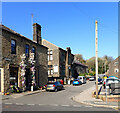
Dirker Lock No 41E
is a minor waterways place
on the Huddersfield Narrow Canal between
Railway Lock No 42E (Marsden. Eastern summit lock) (¾ furlongs
to the west) and
Titanic Mill (Linthwaite) (3 miles and 4¾ furlongs
and 24 locks
to the east).
The nearest place in the direction of Railway Lock No 42E is Goods Yard Bridge No 58;
½ furlongs
away.
The nearest place in the direction of Titanic Mill is Hopper Lock No 40E;
¾ furlongs
away.
There may be access to the towpath here.
Mooring here is unrated.
There is a bridge here which takes pedestrian traffic over the canal.
This is a lock, the rise of which is not known.
| Marsden Pipe Bridge | 1¼ furlongs | |
| Station Road Bridge No 60 | 1 furlong | |
| Railway Lock No 42E | ¾ furlongs | |
| Station Approach Bridge No 59 | ¾ furlongs | |
| Goods Yard Bridge No 58 | ½ furlongs | |
| Dirker Lock No 41E | ||
| Hopper Lock No 40E | ¾ furlongs | |
| Warehouse Hill Lock No 39E | 1½ furlongs | |
| Smithy Holme Bridge No 56 | 1½ furlongs | |
| Colne Lock No 38E | 2 furlongs | |
| Smudger's Lock No 37E | 2¼ furlongs | |
There are no links to external websites from here.
Why not log in and add some (select "External websites" from the menu (sometimes this is under "Edit"))?
Why not log in and add some (select "External websites" from the menu (sometimes this is under "Edit"))?
Mouseover for more information or show routes to facility
Nearest water point
In the direction of Ashton-under-Lyne Junction
Standedge Tunnel (eastern entrance) — 6 furlongs and 2 locks away
On this waterway in the direction of Ashton-under-Lyne Junction
Standedge Tunnel (western entrance) — 3 miles, 8 furlongs and 2 locks away
On this waterway in the direction of Ashton-under-Lyne Junction
Wool Road Bridge No 70 — 5 miles, 7¾ furlongs and 11 locks away
On this waterway in the direction of Ashton-under-Lyne Junction
Grove Road Bridge No 96 — 11 miles, 7¾ furlongs and 26 locks away
On this waterway in the direction of Ashton-under-Lyne Junction
Fairfield Junction — 19 miles, 4 furlongs and 34 locks away
Travel to Ashton-under-Lyne Junction, then on the Ashton Canal (Main Line) to Fairfield Junction
In the direction of Aspley Basin (Huddersfield)
Slaithwaite Winding Hole — 2 miles, 5 furlongs and 20 locks away
On this waterway in the direction of Aspley Basin (Huddersfield)
Waterside Lock No 21E — 2 miles, 5¾ furlongs and 20 locks away
On this waterway in the direction of Aspley Basin (Huddersfield)
Aspley Basin (Huddersfield) — 7 miles, 3¼ furlongs and 41 locks away
On this waterway in the direction of Aspley Basin (Huddersfield)
Shepley Bridge Sanitary Station — 13 miles, 7¾ furlongs and 52 locks away
Travel to Aspley Basin (Huddersfield), then on the Huddersfield Broad Canal to Cooper Bridge Junction, then on the Calder and Hebble Navigation (Main Line) to Shepley Bridge Sanitary Station
Brighouse Basin — 13 miles, 1½ furlongs and 54 locks away
Travel to Aspley Basin (Huddersfield), then on the Huddersfield Broad Canal to Cooper Bridge Junction, then on the Calder and Hebble Navigation (Main Line) to Brighouse Basin
Salterhebble Sanitary Station — 17 miles, 3½ furlongs and 63 locks away
Travel to Aspley Basin (Huddersfield), then on the Huddersfield Broad Canal to Cooper Bridge Junction, then on the Calder and Hebble Navigation (Main Line) to Salterhebble Sanitary Station
Salterhebble Junction — 17 miles, 4 furlongs and 64 locks away
Travel to Aspley Basin (Huddersfield), then on the Huddersfield Broad Canal to Cooper Bridge Junction, then on the Calder and Hebble Navigation (Main Line) to Salterhebble Junction
Sowerby Bridge Basin — 19 miles, 5¾ furlongs and 64 locks away
Travel to Aspley Basin (Huddersfield), then on the Huddersfield Broad Canal to Cooper Bridge Junction, then on the Calder and Hebble Navigation (Main Line) to Salterhebble Junction, then on the Calder and Hebble Navigation (Main Line) to Sowerby Bridge BasinNearest rubbish disposal
In the direction of Ashton-under-Lyne Junction
Wool Road Visitor Mooring — 6 miles and 11 locks away
On this waterway in the direction of Ashton-under-Lyne Junction
In the direction of Aspley Basin (Huddersfield)
Pickle Lock No 22E — 2 miles, 4½ furlongs and 19 locks away
On this waterway in the direction of Aspley Basin (Huddersfield)
Aspley Basin (Huddersfield) — 7 miles, 3¼ furlongs and 41 locks away
On this waterway in the direction of Aspley Basin (Huddersfield)
Shepley Bridge Sanitary Station — 13 miles, 7¾ furlongs and 52 locks away
Travel to Aspley Basin (Huddersfield), then on the Huddersfield Broad Canal to Cooper Bridge Junction, then on the Calder and Hebble Navigation (Main Line) to Shepley Bridge Sanitary Station
Brighouse Lower Basin Visitor Moorings — 13 miles, 1¼ furlongs and 53 locks away
Travel to Aspley Basin (Huddersfield), then on the Huddersfield Broad Canal to Cooper Bridge Junction, then on the Calder and Hebble Navigation (Main Line) to Brighouse Lower Basin Visitor Moorings
Horbury Basin Residential Moorings & Sanitary Station — 18 miles, 4¼ furlongs and 59 locks away
Travel to Aspley Basin (Huddersfield), then on the Huddersfield Broad Canal to Cooper Bridge Junction, then on the Calder and Hebble Navigation (Main Line) to Horbury Basin Residential Moorings & Sanitary Station
Salterhebble Sanitary Station — 17 miles, 3½ furlongs and 63 locks away
Travel to Aspley Basin (Huddersfield), then on the Huddersfield Broad Canal to Cooper Bridge Junction, then on the Calder and Hebble Navigation (Main Line) to Salterhebble Sanitary Station
Sowerby Bridge Basin — 19 miles, 5¾ furlongs and 64 locks away
Travel to Aspley Basin (Huddersfield), then on the Huddersfield Broad Canal to Cooper Bridge Junction, then on the Calder and Hebble Navigation (Main Line) to Salterhebble Junction, then on the Calder and Hebble Navigation (Main Line) to Sowerby Bridge BasinNearest chemical toilet disposal
In the direction of Ashton-under-Lyne Junction
Wool Road Bridge No 70 — 5 miles, 7¾ furlongs and 11 locks away
On this waterway in the direction of Ashton-under-Lyne Junction
Grove Road Bridge No 96 — 11 miles, 7¾ furlongs and 26 locks away
On this waterway in the direction of Ashton-under-Lyne Junction
Fairfield Junction — 19 miles, 4 furlongs and 34 locks away
Travel to Ashton-under-Lyne Junction, then on the Ashton Canal (Main Line) to Fairfield Junction
In the direction of Aspley Basin (Huddersfield)
Pickle Lock No 22E — 2 miles, 4½ furlongs and 19 locks away
On this waterway in the direction of Aspley Basin (Huddersfield)
Waterside Lock No 21E — 2 miles, 5¾ furlongs and 20 locks away
On this waterway in the direction of Aspley Basin (Huddersfield)
Aspley Basin (Huddersfield) — 7 miles, 3¼ furlongs and 41 locks away
On this waterway in the direction of Aspley Basin (Huddersfield)
Shepley Bridge Sanitary Station — 13 miles, 7¾ furlongs and 52 locks away
Travel to Aspley Basin (Huddersfield), then on the Huddersfield Broad Canal to Cooper Bridge Junction, then on the Calder and Hebble Navigation (Main Line) to Shepley Bridge Sanitary Station
Brighouse Basin — 13 miles, 1½ furlongs and 54 locks away
Travel to Aspley Basin (Huddersfield), then on the Huddersfield Broad Canal to Cooper Bridge Junction, then on the Calder and Hebble Navigation (Main Line) to Brighouse Basin
Savile Town Wharf and Basin (Dewsbury) — 17 miles, 3¼ furlongs and 56 locks away
Travel to Aspley Basin (Huddersfield), then on the Huddersfield Broad Canal to Cooper Bridge Junction, then on the Calder and Hebble Navigation (Main Line) to Dewsbury Arm Junction, then on the Calder and Hebble Navigation (Dewsbury Old Cut) to Savile Town Wharf and Basin (Dewsbury)
Horbury Basin Residential Moorings & Sanitary Station — 18 miles, 4¼ furlongs and 59 locks away
Travel to Aspley Basin (Huddersfield), then on the Huddersfield Broad Canal to Cooper Bridge Junction, then on the Calder and Hebble Navigation (Main Line) to Horbury Basin Residential Moorings & Sanitary Station
Salterhebble Sanitary Station — 17 miles, 3½ furlongs and 63 locks away
Travel to Aspley Basin (Huddersfield), then on the Huddersfield Broad Canal to Cooper Bridge Junction, then on the Calder and Hebble Navigation (Main Line) to Salterhebble Sanitary Station
Sowerby Bridge Basin — 19 miles, 5¾ furlongs and 64 locks away
Travel to Aspley Basin (Huddersfield), then on the Huddersfield Broad Canal to Cooper Bridge Junction, then on the Calder and Hebble Navigation (Main Line) to Salterhebble Junction, then on the Calder and Hebble Navigation (Main Line) to Sowerby Bridge BasinNearest place to turn
In the direction of Ashton-under-Lyne Junction
Standedge Tunnel End Winding Hole — 5¼ furlongs and 2 locks away
On this waterway in the direction of Ashton-under-Lyne Junction
Diggle Winding Hole — 4 miles, 2½ furlongs and 2 locks away
On this waterway in the direction of Ashton-under-Lyne Junction
Wool Road Winding Hole — 6 miles, ½ furlongs and 11 locks away
On this waterway in the direction of Ashton-under-Lyne Junction
Saddleworth Visitor Centre Winding Hole — 6 miles, 6½ furlongs and 13 locks away
On this waterway in the direction of Ashton-under-Lyne Junction
Manns Wharf Bridge Winding Hole — 8 miles, 1¼ furlongs and 15 locks away
On this waterway in the direction of Ashton-under-Lyne Junction
Roughtown Court Winding Hole — 9 miles, 2½ furlongs and 20 locks away
On this waterway in the direction of Ashton-under-Lyne Junction
Mossley Bottoms Winding Hole — 10 miles, 2¼ furlongs and 22 locks away
On this waterway in the direction of Ashton-under-Lyne Junction
Knowle Street Winding Hole — 14 miles, 2¼ furlongs and 27 locks away
On this waterway in the direction of Ashton-under-Lyne Junction
Staley Wharf Winding Hole — 15 miles, 4¼ furlongs and 31 locks away
On this waterway in the direction of Ashton-under-Lyne Junction
Ashton-under-Lyne Junction — 16 miles, 4 furlongs and 34 locks away
On this waterway in the direction of Ashton-under-Lyne Junction
Dukinfield Junction — 17 miles and 34 locks away
Travel to Ashton-under-Lyne Junction, then on the Ashton Canal (Main Line) to Dukinfield Junction
Portland Basin Arm — 17 miles, ½ furlongs and 34 locks away
Travel to Ashton-under-Lyne Junction, then on the Ashton Canal (Main Line) to Dukinfield Junction, then on the Peak Forest Canal (Lower) to Portland Basin Arm
In the direction of Aspley Basin (Huddersfield)
Booth Lock Winding Hole — 1 mile and 10 locks away
On this waterway in the direction of Aspley Basin (Huddersfield)
Slaithwaite Winding Hole — 2 miles, 5 furlongs and 20 locks away
On this waterway in the direction of Aspley Basin (Huddersfield)
Linthwaite Winding Hole — 3 miles, 5½ furlongs and 25 locks away
On this waterway in the direction of Aspley Basin (Huddersfield)
Isis Lock Winding Hole — 5 miles, 1¾ furlongs and 33 locks away
On this waterway in the direction of Aspley Basin (Huddersfield)
University Arm — 7 miles, 2½ furlongs and 41 locks away
On this waterway in the direction of Aspley Basin (Huddersfield)
Aspley Basin (Huddersfield) — 7 miles, 3¼ furlongs and 41 locks away
On this waterway in the direction of Aspley Basin (Huddersfield)
Anchor Street Winding Hole — 8 miles, ¼ furlongs and 41 locks away
Travel to Aspley Basin (Huddersfield), then on the Huddersfield Broad Canal to Anchor Street Winding Hole
New Road Winding Hole — 8 miles, 3½ furlongs and 41 locks away
Travel to Aspley Basin (Huddersfield), then on the Huddersfield Broad Canal to New Road Winding HoleNearest self-operated pump-out
In the direction of Ashton-under-Lyne Junction
Wool Road Bridge No 70 — 5 miles, 7¾ furlongs and 11 locks away
On this waterway in the direction of Ashton-under-Lyne Junction
In the direction of Aspley Basin (Huddersfield)
Slaithwaite Winding Hole — 2 miles, 5 furlongs and 20 locks away
On this waterway in the direction of Aspley Basin (Huddersfield)Nearest boatyard pump-out
In the direction of Ashton-under-Lyne Junction
Portland Basin Arm — 17 miles, ½ furlongs and 34 locks away
Travel to Ashton-under-Lyne Junction, then on the Ashton Canal (Main Line) to Dukinfield Junction, then on the Peak Forest Canal (Lower) to Portland Basin Arm
In the direction of Aspley Basin (Huddersfield)
Aspley Basin (Huddersfield) — 7 miles, 3¼ furlongs and 41 locks away
On this waterway in the direction of Aspley Basin (Huddersfield)
Shepley Bridge Marina — 14 miles and 52 locks away
Travel to Aspley Basin (Huddersfield), then on the Huddersfield Broad Canal to Cooper Bridge Junction, then on the Calder and Hebble Navigation (Main Line) to Shepley Bridge Marina
Sowerby Bridge Basin — 19 miles, 5¾ furlongs and 64 locks away
Travel to Aspley Basin (Huddersfield), then on the Huddersfield Broad Canal to Cooper Bridge Junction, then on the Calder and Hebble Navigation (Main Line) to Salterhebble Junction, then on the Calder and Hebble Navigation (Main Line) to Sowerby Bridge BasinDirection of TV transmitter (From Wolfbane Cybernetic)
There is no page on Wikipedia called “Dirker Lock No 41E”
Wikipedia pages that might relate to Dirker Lock No 41E
[Knife]
strength and angles the hooks so that the faces no longer meet vertically. The bolt in the bolt lock is a rectangle of metal that is constrained to slide
[Pocketknife]
self-defense weapon. Knives with locking blades, often referred to as lock-blade knives or clasp knives, have a locking mechanism that locks the blade into
[2017 in American television]
Variety. Retrieved May 11, 2018. Holloway, Daniel (December 18, 2017). "'Dirk Gently's Holistic Detective Agency' Canceled by BBC America". Variety. Retrieved
[Kanye West]
Kardashian. He separately wrote that the Kardashian family was attempting "to lock me up." In January 2021, CNN reported that the couple were discussing divorce
[List of Little House on the Prairie episodes]
October 12, 1981 (1981-10-12) 8403 Nancy tricks her new brother Willie into locking a classroom rival in the ice-house all night. She convinces Doc Baker and
[Joker (2019 film)]
before the Newark filming, SAG-AFTRA received a complaint that extras were locked in subway cars for more than three hours during filming in Brooklyn, a break
[Sean Connery]
southern Spain. He also had a minor role in Gerald Thomas's thriller Time Lock (1957) as a welder, appearing alongside Robert Beatty, Lee Patterson, Betty
[Stephen Hawking]
one word per minute. With this decline there was a risk of his developing locked-in syndrome, so Hawking collaborated with Intel researchers on systems that
[The Holocaust]
pseudo-scientific racism that viewed Jews as a race whose members were locked in mortal combat with the Aryan race for world domination. These ideas became
[List of Forged in Fire (TV series) episodes]
159 32 "Tomahawk and Bowie" Signature blade (using a forged key to open lock boxes of metal) Tomahawk and Bowie knife July 15, 2020 (2020-07-15) N/A Results:
Results of Google Search
Huddersfield Narrow Canal Pub GuideSlaithwaite, The Comercial Hotel Carr Lane Slaithwaite HUDDERSFIELD HD7 5AN, 01484 842920, Map, ü, ü, ü. Dirker Lock No 41E Marsden, The Railway
... km) long and has 76 locks. There are no connections to other waterways. ... length: 70' 1" (21.34 metres) - Lock 41E (Dirker Lock, Marsden) beam: 6' 10" (2.1 Â ...
Dirker Lock No 41 E. 7.4. 41. N. SE050117. 110. Railway Lock No 42 E. 7.5. 42. N. SE048117. 110. Standedge Tunnel (North-east End). The longest canal ...
Jul 24, 2014 ... thermal non-equilibrium phenomena, has grown to include the science of transport phenomena ...... the implementation of low-cost digital logic circuitry to phase-lock the optical ..... Izuchukwu Francis Okafor, Jaco Dirker, Josua P. Meyer (University of Pretoria, South Africa) ...... Session 41 (E) [8:20 - 10:00].
Products 272 - 5545 ... "No Report" indicates that enumerator was unable to get complete information at the address by personal ...... 201 Auto Lock & Speedometer Service. 202 Thos W ...... 41E Students. 41F Students ...... 615 Hiddo H Dirker.
iliamrlinAtiobnertAllwted: 41e 1alurteisioerp'. 'teardrop Charlet, ..... 40 Lock Harold IV. 44 Wyndoe David 0,, 'Dal. ...... Pullen Walter. cerrier not! Arthur. Jobling IL, grocer. Raker .1., Ifelvoirrn. n.vt. wIlltern Ft, 'ChM' ...... II Dirker IS illiam. 10 Parker ...


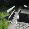


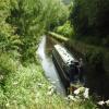


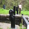






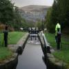


![Canal towpath below Lock 42E. The low guide rail lines the land-side of the towpath for more than a mile at Marsden. It was installed in the early 1990s [or even earlier] and I believe is designed to help people with visual impairment walk safely along the towpath. by Christine Johnstone – 20 May 2010](https://s1.geograph.org.uk/geophotos/01/88/36/1883629_dd590716_120x120.jpg)


![New fence at Marsden station. Compare this with Dr Clifton's view only a year earlier [[641670]] - the fence has appeared in the interval. The](https://s3.geograph.org.uk/photos/94/01/940127_e7a0035c_120x120.jpg)


