CanalPlanAC

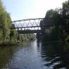
Conisbrough Road Bridge

 
With pipe bridge alongside
Also known as: Cadeby Collery Bridge
Kingswood Centre, Doncaster Road, Doncaster DN12 4EA, United Kingdom
Address is taken from a point 397 yards away.
 
Information about the place
Conisbrough Road Bridge is a minor waterways place on the Sheffield and South Yorkshire Navigation (Main Line) between Conisbrough Viaduct (1 mile and ½ furlongs to the east) and Swinton Junction (Junction of Dearne and Dove Canal with S&SYN.) (3 miles and 3 furlongs and 3 locks to the west).
 
 
The nearest place in the direction of Conisbrough Viaduct is Conisbrough Station Railway Bridge; 2 furlongs away.
 
The nearest place in the direction of Swinton Junction is Conisbrough Station Pipe Bridge; ¼ furlongs away.

There may be access to the towpath here.

Mooring here is unrated.

There is a bridge here which takes a minor road over the canal.


Amenities

Amenities here

 Cadeby Inn
 Conisborough Station

Amenities nearby at Conisbrough Station Railway Bridge

 Fish & Chips
 Fish & Chips
 Cashpoint
 NatWest
 Jacksons Diy Ltd

Amenities nearby at Conisbrough Station Pipe Bridge

 United Discount Store
 
Maps
If you are a user and are logged on, or if you are actively planning a route, a map will be displayed here.
Show on external mapping site: Google | OSM | Bing
 
Photos
 
External websites
  S&SY navigation info — associated with Sheffield and South Yorkshire Navigation
Sheffield & South Yorkshire navigation info from IWA
 
Nearest facilities

Mouseover for more information or show routes to facility

Nearest water point

In the direction of Rawmarsh Road Bridge No 39

Mexborough Low Lock No 105½ furlongs away
On this waterway in the direction of Rawmarsh Road Bridge No 39
Swinton Lock Activity Centre and CRT Sanitary Station3 miles, 2¼ furlongs and 2 locks away
On this waterway in the direction of Rawmarsh Road Bridge No 39
Kilnhurst Flood Lock No 74 miles, 7¾ furlongs and 3 locks away
On this waterway in the direction of Rawmarsh Road Bridge No 39
Eastwood Lock No 57 miles, 5½ furlongs and 5 locks away
On this waterway in the direction of Rawmarsh Road Bridge No 39
Victoria Quays15 miles, 2¼ furlongs and 21 locks away
Travel to Rawmarsh Road Bridge No 39, then on the Sheffield and South Yorkshire Navigation (Sheffield Canal) to Victoria Quays

In the direction of Bramwith Junction

Sprotbrough Lock No 112 miles, 6 furlongs away
On this waterway in the direction of Bramwith Junction
Doncaster Town Lock No 126 miles, ¼ furlongs and 1 lock away
On this waterway in the direction of Bramwith Junction
Doncaster Visitor Pontoon Moorings6 miles, 2½ furlongs and 2 locks away
On this waterway in the direction of Bramwith Junction
Long Sandall Lock No 139 miles, 3¾ furlongs and 2 locks away
On this waterway in the direction of Bramwith Junction
Barnby Dun Lift Bridge11 miles, 5¼ furlongs and 3 locks away
On this waterway in the direction of Bramwith Junction
Bramwith Lock No 1413 miles and 3 locks away
Travel to Bramwith Junction, then on the Sheffield and South Yorkshire Navigation (Bramwith to Stainforth) to Bramwith Lock No 14
Bramwith Swing Bridge13 miles, 2¾ furlongs and 4 locks away
Travel to Bramwith Junction, then on the Sheffield and South Yorkshire Navigation (Bramwith to Stainforth) to Bramwith Swing Bridge
Thorne Visitor Moorings17 miles, 5¼ furlongs and 5 locks away
Travel to Bramwith Junction, then on the Sheffield and South Yorkshire Navigation (Bramwith to Stainforth) to Stainforth Junction, then on the Sheffield and South Yorkshire Navigation (Stainforth and Keadby Canal) to Thorne Visitor Moorings

Nearest rubbish disposal

In the direction of Rawmarsh Road Bridge No 39

Eastwood Lock No 57 miles, 5½ furlongs and 5 locks away
On this waterway in the direction of Rawmarsh Road Bridge No 39
Tinsley CRT facilities12 miles, 4½ furlongs and 20 locks away
Travel to Rawmarsh Road Bridge No 39, then on the Sheffield and South Yorkshire Navigation (Sheffield Canal) to Tinsley CRT facilities
Victoria Quays15 miles, 2¼ furlongs and 21 locks away
Travel to Rawmarsh Road Bridge No 39, then on the Sheffield and South Yorkshire Navigation (Sheffield Canal) to Victoria Quays

In the direction of Bramwith Junction

Doncaster Visitor Pontoon Moorings6 miles, 2½ furlongs and 2 locks away
On this waterway in the direction of Bramwith Junction
Barnby Dun Lift Bridge11 miles, 5¼ furlongs and 3 locks away
On this waterway in the direction of Bramwith Junction
Bramwith Swing Bridge13 miles, 2¾ furlongs and 4 locks away
Travel to Bramwith Junction, then on the Sheffield and South Yorkshire Navigation (Bramwith to Stainforth) to Bramwith Swing Bridge
Thorne Visitor Moorings17 miles, 5¼ furlongs and 5 locks away
Travel to Bramwith Junction, then on the Sheffield and South Yorkshire Navigation (Bramwith to Stainforth) to Stainforth Junction, then on the Sheffield and South Yorkshire Navigation (Stainforth and Keadby Canal) to Thorne Visitor Moorings

Nearest chemical toilet disposal

In the direction of Rawmarsh Road Bridge No 39

Swinton Lock Activity Centre and CRT Sanitary Station3 miles, 2¼ furlongs and 2 locks away
On this waterway in the direction of Rawmarsh Road Bridge No 39
Eastwood Lock No 57 miles, 5½ furlongs and 5 locks away
On this waterway in the direction of Rawmarsh Road Bridge No 39
Tinsley CRT facilities12 miles, 4½ furlongs and 20 locks away
Travel to Rawmarsh Road Bridge No 39, then on the Sheffield and South Yorkshire Navigation (Sheffield Canal) to Tinsley CRT facilities
Victoria Quays15 miles, 2¼ furlongs and 21 locks away
Travel to Rawmarsh Road Bridge No 39, then on the Sheffield and South Yorkshire Navigation (Sheffield Canal) to Victoria Quays

In the direction of Bramwith Junction

Barnby Dun Lift Bridge11 miles, 5¼ furlongs and 3 locks away
On this waterway in the direction of Bramwith Junction
Bramwith Swing Bridge13 miles, 2¾ furlongs and 4 locks away
Travel to Bramwith Junction, then on the Sheffield and South Yorkshire Navigation (Bramwith to Stainforth) to Bramwith Swing Bridge
Thorne Visitor Moorings17 miles, 5¼ furlongs and 5 locks away
Travel to Bramwith Junction, then on the Sheffield and South Yorkshire Navigation (Bramwith to Stainforth) to Stainforth Junction, then on the Sheffield and South Yorkshire Navigation (Stainforth and Keadby Canal) to Thorne Visitor Moorings

Nearest place to turn

In the direction of Rawmarsh Road Bridge No 39

Swinton Road Corner2 miles, 7 furlongs and 2 locks away
On this waterway in the direction of Rawmarsh Road Bridge No 39
Swinton Junction3 miles, 3 furlongs and 3 locks away
On this waterway in the direction of Rawmarsh Road Bridge No 39
Kilnhurst Flood Lock Winding Hole5 miles, 1½ furlongs and 4 locks away
On this waterway in the direction of Rawmarsh Road Bridge No 39
Sir Frank Price Lock Weir Exit7 miles, 4¾ furlongs and 5 locks away
On this waterway in the direction of Rawmarsh Road Bridge No 39
Sir Frank Price Lock Arm7 miles, 6 furlongs and 6 locks away
On this waterway in the direction of Rawmarsh Road Bridge No 39
Rawmarsh Road Winding Hole8 miles, 2¾ furlongs and 6 locks away
Travel to Rawmarsh Road Bridge No 39, then on the Sheffield and South Yorkshire Navigation (Sheffield Canal) to Rawmarsh Road Winding Hole
Central Road Winding Hole9 miles, ¾ furlongs and 6 locks away
Travel to Rawmarsh Road Bridge No 39, then on the Sheffield and South Yorkshire Navigation (Sheffield Canal) to Central Road Winding Hole
Main Street Junction9 miles, 1½ furlongs and 7 locks away
Travel to Rawmarsh Road Bridge No 39, then on the Sheffield and South Yorkshire Navigation (Sheffield Canal) to Main Street Junction
Rotherham Junction9 miles, 3¼ furlongs and 7 locks away
Travel to Rawmarsh Road Bridge No 39, then on the Sheffield and South Yorkshire Navigation (Sheffield Canal) to Rotherham Junction
Tinsley Lower Flight Weir Exit11 miles, 3¼ furlongs and 10 locks away
Travel to Rawmarsh Road Bridge No 39, then on the Sheffield and South Yorkshire Navigation (Sheffield Canal) to Tinsley Lower Flight Weir Exit
Don Valley Stadium Visitor Moorings13 miles, 3¾ furlongs and 21 locks away
Travel to Rawmarsh Road Bridge No 39, then on the Sheffield and South Yorkshire Navigation (Sheffield Canal) to Don Valley Stadium Visitor Moorings
Shirland Road Bridge Winding Hole13 miles, 6¼ furlongs and 21 locks away
Travel to Rawmarsh Road Bridge No 39, then on the Sheffield and South Yorkshire Navigation (Sheffield Canal) to Shirland Road Bridge Winding Hole
Victoria Quays15 miles, 2¼ furlongs and 21 locks away
Travel to Rawmarsh Road Bridge No 39, then on the Sheffield and South Yorkshire Navigation (Sheffield Canal) to Victoria Quays
Sheffield Terminal Warehouse15 miles, 2½ furlongs and 21 locks away
Travel to Rawmarsh Road Bridge No 39, then on the Sheffield and South Yorkshire Navigation (Sheffield Canal) to Sheffield Terminal Warehouse

In the direction of Bramwith Junction

Sprotbrough Lock Weir Exit2 miles, 6½ furlongs and 1 lock away
On this waterway in the direction of Bramwith Junction
Doncaster Visitor Pontoon Moorings6 miles, 2½ furlongs and 2 locks away
On this waterway in the direction of Bramwith Junction
Gas House Bight6 miles, 4 furlongs and 2 locks away
On this waterway in the direction of Bramwith Junction
Wheatley Hall Road Winding Hole8 miles, 3¼ furlongs and 2 locks away
On this waterway in the direction of Bramwith Junction
Huddle Grounds Winding Hole15 miles, 2 furlongs and 4 locks away
Travel to Bramwith Junction, then on the Sheffield and South Yorkshire Navigation (Bramwith to Stainforth) to Stainforth Junction, then on the Sheffield and South Yorkshire Navigation (Stainforth and Keadby Canal) to Huddle Grounds Winding Hole

Nearest self-operated pump-out

In the direction of Bramwith Junction

Long Sandall Lock No 139 miles, 3¾ furlongs and 2 locks away
On this waterway in the direction of Bramwith Junction
Direction of TV transmitter (From Wolfbane Cybernetic)
 
 
Geograph
 
Wikipedia

There is no page on Wikipedia called “Conisbrough Road Bridge”

Wikipedia pages that might relate to Conisbrough Road Bridge
[River Don Navigation] of the Trans Pennine Trail. There are two pipe bridges just upstream of the road bridge. Conisbrough Viaduct was built in the first decade of the 20th [River Don, Yorkshire] Dunford Bridge, and flows for 70 miles (110 km) eastwards, through the Don Valley, via Penistone, Sheffield, Rotherham, Mexborough, Conisbrough, Doncaster [A roads in Zone 6 of the Great Britain numbering scheme] A roads in zone 6 in Great Britain starting east of the A6 and A7 roads, and west of the A1 (road beginning with 6). "A613 (Gateshead)". sabre-roads.org [Doncaster railway station] ISSN 0953-4563. "WATCH: Incredible time-lapse footage of new bridge being installed at Doncaster rail station". Doncaster Free Press. 26 April 2016. Retrieved 13 [B roads in Zone 6 of the Great Britain numbering scheme] B roads are numbered routes in Great Britain of lesser importance than A roads. See the article Great Britain road numbering scheme for the rationale behind [Doncaster] Norman Conquest, Nigel Fossard refortified the town and constructed Conisbrough Castle. By the time of the Domesday Book, Hexthorpe in the wapentake [Mexborough and Swinton Tramway] of the colliery due to a low bridge below the Midland Railway line; the second ran from the Old Toll Bar to Conisbrough, the terminus being two miles [Emley Moor transmitting station] beginning to fall from mast & stays. Roads close to station temporarily closed by Councils. Please notify councils when roads are safe (!) Pye monitor - no frame [Teesside Airport railway station] Airport is a railway station on the Tees Valley Line, which runs between Saltburn and Bishop Auckland via Darlington. The station, situated 5 1⁄2 miles [All the Stations] 2,563 stations on the National Rail network in Great Britain were to be visited (i.e. every station which appears on the Office of Rail and Road's website)
 
Google