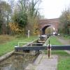
Wolvercote Lock No 45
is a minor waterways place
on the Oxford Canal (Southern Section - Main Line) between
Isis Lock Junction (2 miles and 3 furlongs
to the southeast) and
Wolvercote Junction (Junction of Duke's Cut with Oxford Canal) (5 furlongs
to the northwest).
The nearest place in the direction of Isis Lock Junction is Wolvercote Bridge No 235;
¼ furlongs
away.
The nearest place in the direction of Wolvercote Junction is Wolvercote Sanitary Station;
1½ furlongs
away.
Mooring here is unrated.
This is a lock with a rise of 3 feet and 8 inches.
Site of Second St Edwards Lift Bridge | 5½ furlongs | |
Wolvercote Railway Bridge No 236A | 4½ furlongs | |
Wolvercote Green Field Bridge No 236 | 1¾ furlongs | |
Wolvercote Footbridge | ¼ furlongs | |
Wolvercote Bridge No 235 | ¼ furlongs | |
Wolvercote Lock No 45 | ||
Wolvercote Sanitary Station | 1½ furlongs | |
Perrys Lift Bridge No 234 | 1½ furlongs | |
Western Bypass Bridge | 3¼ furlongs | |
Lift Bridge No 233 (Oxford Canal) | 3½ furlongs | |
Northern Bypass Road Bridge No 232A | 4 furlongs |
Amenities here
Amenities in City of Oxford
Amenities at other places in City of Oxford
at
at
at
at
at
at
at
at
at
at
at
at
at
at
at
at
at
at
at
at
at
at
at
at
at
at
at
at
at
at
at
at
at
at
at
at
at
at
at
at
at
at
at
at
at
at
at
at
at
at
at
at
at
at
at
at
at
at
at
at
at
at
at
at
at
at
at
at
at
at
at
at
at
at
at
at
at
at
at
at
at
at
at
at
- Oxford Canal Walk - Part One - Oxford to Thrupp - YouTube — associated with Oxford Canal
- A walk along the Oxford Canal (Southern Section) from Oxford to Thrupp Wide
Mouseover for more information or show routes to facility
Nearest water point
In the direction of Napton Junction
Wolvercote Sanitary Station — 1½ furlongs and 1 lock away
On this waterway in the direction of Napton Junction
Wolvercote Junction Water Point — 5¾ furlongs and 2 locks away
On this waterway in the direction of Napton Junction
Eynsham Lock — 4 miles and 2 locks away
Travel to Wolvercote Junction, then on the Oxford Canal (Duke's Cut) to Duke's Cut Junction, then on the River Thames (above Oxford) to Eynsham Lock
Langford Lane Bridge No 224 — 3 miles, 5¾ furlongs and 4 locks away
On this waterway in the direction of Napton Junction
Aubreys Lift Bridge No 221 — 4 miles, 3 furlongs and 4 locks away
On this waterway in the direction of Napton Junction
Thrupp Cruising Club — 4 miles, 3¼ furlongs and 4 locks away
On this waterway in the direction of Napton Junction
Shifford Lock — 14 miles, ¾ furlongs and 5 locks away
Travel to Wolvercote Junction, then on the Oxford Canal (Duke's Cut) to Duke's Cut Junction, then on the River Thames (above Oxford) to Shifford Lock
Heyford Wharf Bridge No 206 — 11 miles, 7½ furlongs and 9 locks away
On this waterway in the direction of Napton Junction
Heyford Wharf — 11 miles, 7¾ furlongs and 9 locks away
On this waterway in the direction of Napton Junction
Aynho Wharf — 18 miles and 12 locks away
On this waterway in the direction of Napton Junction
In the direction of End of Hythe Bridge Arm
St Edwards Lift Bridge No 238 — 7¼ furlongs and 1 lock away
On this waterway in the direction of End of Hythe Bridge Arm
Oxford Visitor Moorings — 2 miles, 3¾ furlongs and 1 lock away
On this waterway in the direction of End of Hythe Bridge Arm
Abingdon Lock — 11 miles, 2¾ furlongs and 5 locks away
Travel to Isis Lock Junction, then on the River Thames (Sheepwash Channel) to Sheepwash Channel Junction, then on the River Thames (above Oxford) to Osney Bridge, then on the River Thames (below Oxford) to Abingdon Lock
Abingdon Bridge Marine — 11 miles, 6¼ furlongs and 6 locks away
Travel to Isis Lock Junction, then on the River Thames (Sheepwash Channel) to Sheepwash Channel Junction, then on the River Thames (above Oxford) to Osney Bridge, then on the River Thames (below Oxford) to Abingdon Bridge MarineNearest rubbish disposal
In the direction of Napton Junction
Wolvercote Sanitary Station — 1½ furlongs and 1 lock away
On this waterway in the direction of Napton Junction
Eynsham Lock — 4 miles and 2 locks away
Travel to Wolvercote Junction, then on the Oxford Canal (Duke's Cut) to Duke's Cut Junction, then on the River Thames (above Oxford) to Eynsham Lock
Aubreys Lift Bridge No 221 — 4 miles, 3 furlongs and 4 locks away
On this waterway in the direction of Napton Junction
Thrupp Cruising Club — 4 miles, 3¼ furlongs and 4 locks away
On this waterway in the direction of Napton Junction
Heyford Wharf Bridge No 206 — 11 miles, 7½ furlongs and 9 locks away
On this waterway in the direction of Napton Junction
Heyford Wharf — 11 miles, 7¾ furlongs and 9 locks away
On this waterway in the direction of Napton Junction
Rushey Lock — 18 miles, 1¾ furlongs and 6 locks away
Travel to Wolvercote Junction, then on the Oxford Canal (Duke's Cut) to Duke's Cut Junction, then on the River Thames (above Oxford) to Rushey Lock
Aynho Wharf — 18 miles and 12 locks away
On this waterway in the direction of Napton Junction
In the direction of End of Hythe Bridge Arm
Abingdon Lock — 11 miles, 2¾ furlongs and 5 locks away
Travel to Isis Lock Junction, then on the River Thames (Sheepwash Channel) to Sheepwash Channel Junction, then on the River Thames (above Oxford) to Osney Bridge, then on the River Thames (below Oxford) to Abingdon Lock
Day's Lock — 19 miles, 4¾ furlongs and 8 locks away
Travel to Isis Lock Junction, then on the River Thames (Sheepwash Channel) to Sheepwash Channel Junction, then on the River Thames (above Oxford) to Osney Bridge, then on the River Thames (below Oxford) to Day's LockNearest chemical toilet disposal
In the direction of Napton Junction
Wolvercote Sanitary Station — 1½ furlongs and 1 lock away
On this waterway in the direction of Napton Junction
Eynsham Lock — 4 miles and 2 locks away
Travel to Wolvercote Junction, then on the Oxford Canal (Duke's Cut) to Duke's Cut Junction, then on the River Thames (above Oxford) to Eynsham Lock
Thrupp Cruising Club — 4 miles, 3¼ furlongs and 4 locks away
On this waterway in the direction of Napton Junction
Rushey Lock — 18 miles, 1¾ furlongs and 6 locks away
Travel to Wolvercote Junction, then on the Oxford Canal (Duke's Cut) to Duke's Cut Junction, then on the River Thames (above Oxford) to Rushey Lock
In the direction of End of Hythe Bridge Arm
Abingdon Lock — 11 miles, 2¾ furlongs and 5 locks away
Travel to Isis Lock Junction, then on the River Thames (Sheepwash Channel) to Sheepwash Channel Junction, then on the River Thames (above Oxford) to Osney Bridge, then on the River Thames (below Oxford) to Abingdon Lock
Day's Lock — 19 miles, 4¾ furlongs and 8 locks away
Travel to Isis Lock Junction, then on the River Thames (Sheepwash Channel) to Sheepwash Channel Junction, then on the River Thames (above Oxford) to Osney Bridge, then on the River Thames (below Oxford) to Day's LockNearest place to turn
In the direction of Napton Junction
Wolvercote Junction — 5 furlongs and 1 lock away
On this waterway in the direction of Napton Junction
Bypass Reservoir Junction — 7 furlongs and 2 locks away
Travel to Wolvercote Junction, then on the Oxford Canal (Duke's Cut) to Bypass Reservoir Junction
Duke's Cut Junction — 1 mile, 3½ furlongs and 2 locks away
Travel to Wolvercote Junction, then on the Oxford Canal (Duke's Cut) to Duke's Cut Junction
Thames - Wharf Stream Junction — 3 miles, 6 furlongs and 2 locks away
Travel to Wolvercote Junction, then on the Oxford Canal (Duke's Cut) to Duke's Cut Junction, then on the River Thames (above Oxford) to Thames - Wharf Stream Junction
Pinkhill Lock Weir Exit — 5 miles, 2¼ furlongs and 3 locks away
Travel to Wolvercote Junction, then on the Oxford Canal (Duke's Cut) to Duke's Cut Junction, then on the River Thames (above Oxford) to Pinkhill Lock Weir Exit
Thrupp Wide — 4 miles, 3¼ furlongs and 4 locks away
On this waterway in the direction of Napton Junction
Shipton Weir Junction — 5 miles, 3¾ furlongs and 5 locks away
On this waterway in the direction of Napton Junction
Enslow Winding Hole — 6 miles, 7¾ furlongs and 6 locks away
On this waterway in the direction of Napton Junction
Kirtlington Winding Hole — 8 miles, 5¼ furlongs and 7 locks away
On this waterway in the direction of Napton Junction
In the direction of End of Hythe Bridge Arm
Hythe Bridge Arm Winding Hole — 2 miles, 2¾ furlongs and 1 lock away
On this waterway in the direction of End of Hythe Bridge Arm
End of Hythe Bridge Arm — 2 miles, 3¾ furlongs and 1 lock away
On this waterway in the direction of End of Hythe Bridge Arm
Castle Mill Stream Junction — 2 miles, 3¼ furlongs and 2 locks away
Travel to Isis Lock Junction, then on the River Thames (Sheepwash Channel) to Castle Mill Stream Junction
Sheepwash Channel Junction — 2 miles, 4 furlongs and 2 locks away
Travel to Isis Lock Junction, then on the River Thames (Sheepwash Channel) to Sheepwash Channel Junction
Bossoms Boat Yard — 3 miles, 2 furlongs and 2 locks away
Travel to Isis Lock Junction, then on the River Thames (Sheepwash Channel) to Sheepwash Channel Junction, then on the River Thames (above Oxford) to Bossoms Boat Yard
Osney Lock Weir Exit — 2 miles, 7 furlongs and 3 locks away
Travel to Isis Lock Junction, then on the River Thames (Sheepwash Channel) to Sheepwash Channel Junction, then on the River Thames (above Oxford) to Osney Bridge, then on the River Thames (below Oxford) to Osney Lock Weir Exit
Thames - Cherwell Junction — 4 miles, 1 furlong and 3 locks away
Travel to Isis Lock Junction, then on the River Thames (Sheepwash Channel) to Sheepwash Channel Junction, then on the River Thames (above Oxford) to Osney Bridge, then on the River Thames (below Oxford) to Thames - Cherwell Junction
Iffley Lock Weir Entrance No 1 — 5 miles, ¼ furlongs and 3 locks away
Travel to Isis Lock Junction, then on the River Thames (Sheepwash Channel) to Sheepwash Channel Junction, then on the River Thames (above Oxford) to Osney Bridge, then on the River Thames (below Oxford) to Iffley Lock Weir Entrance No 1
Iffley Lock Weir Exit No 1 — 5 miles, 1¼ furlongs and 4 locks away
Travel to Isis Lock Junction, then on the River Thames (Sheepwash Channel) to Sheepwash Channel Junction, then on the River Thames (above Oxford) to Osney Bridge, then on the River Thames (below Oxford) to Iffley Lock Weir Exit No 1
Sandford Lock Weir Exit (Thames) — 6 miles, 7 furlongs and 5 locks away
Travel to Isis Lock Junction, then on the River Thames (Sheepwash Channel) to Sheepwash Channel Junction, then on the River Thames (above Oxford) to Osney Bridge, then on the River Thames (below Oxford) to Sandford Lock Weir Exit (Thames)
Abingdon Lock Weir Exit No 1 — 11 miles, 3¼ furlongs and 6 locks away
Travel to Isis Lock Junction, then on the River Thames (Sheepwash Channel) to Sheepwash Channel Junction, then on the River Thames (above Oxford) to Osney Bridge, then on the River Thames (below Oxford) to Abingdon Lock Weir Exit No 1Nearest self-operated pump-out
In the direction of Napton Junction
Eynsham Lock — 4 miles and 2 locks away
Travel to Wolvercote Junction, then on the Oxford Canal (Duke's Cut) to Duke's Cut Junction, then on the River Thames (above Oxford) to Eynsham Lock
Aubreys Lift Bridge No 221 — 4 miles, 3 furlongs and 4 locks away
On this waterway in the direction of Napton Junction
Thrupp Cruising Club — 4 miles, 3¼ furlongs and 4 locks away
On this waterway in the direction of Napton Junction
Rushey Lock — 18 miles, 1¾ furlongs and 6 locks away
Travel to Wolvercote Junction, then on the Oxford Canal (Duke's Cut) to Duke's Cut Junction, then on the River Thames (above Oxford) to Rushey Lock
In the direction of End of Hythe Bridge Arm
Abingdon Lock — 11 miles, 2¾ furlongs and 5 locks away
Travel to Isis Lock Junction, then on the River Thames (Sheepwash Channel) to Sheepwash Channel Junction, then on the River Thames (above Oxford) to Osney Bridge, then on the River Thames (below Oxford) to Abingdon LockNearest boatyard pump-out
In the direction of Napton Junction
Oxford Cruisers Marina — 4 miles, 7¾ furlongs and 3 locks away
Travel to Wolvercote Junction, then on the Oxford Canal (Duke's Cut) to Duke's Cut Junction, then on the River Thames (above Oxford) to Oxford Cruisers Marina
Enslow Wharf — 6 miles, 6¾ furlongs and 6 locks away
On this waterway in the direction of Napton Junction
Heyford Wharf — 11 miles, 7¾ furlongs and 9 locks away
On this waterway in the direction of Napton Junction
Aynho Wharf — 18 miles and 12 locks away
On this waterway in the direction of Napton Junction
In the direction of End of Hythe Bridge Arm
Abingdon Bridge Marine — 11 miles, 6¼ furlongs and 6 locks away
Travel to Isis Lock Junction, then on the River Thames (Sheepwash Channel) to Sheepwash Channel Junction, then on the River Thames (above Oxford) to Osney Bridge, then on the River Thames (below Oxford) to Abingdon Bridge MarineDirection of TV transmitter (From Wolfbane Cybernetic)
There is no page on Wikipedia called “Wolvercote Lock”
Wikipedia pages that might relate to Wolvercote Lock
[Oxford Canal]
King's Lock; a few hundred yards (metres) from the heart of the city centre by Oxford railway station. below Isis Lock (known to boatmen as 'Louse Lock') through
[Godstow Lock]
Godstow Lock is a lock on the River Thames in Oxfordshire, England. It is between the villages of Wolvercote and Wytham on the outskirts of Oxford. The
[King's Lock]
1928 to replace the former flash lock. At the lock there is a large island. Behind this is the start of the Wolvercote Mill Stream leading to Dukes Cut
[Duke's Cut]
STATEMENTOXFORD CANAL – WOLVERCOTE DUKE'S CUT LOCK (LOCK 44A)". Canal and River Trust. Retrieved 9 January 2020. Eade, John. "GODSTOW LOCK - (WHERE THAMES SMOOTH
[Godstow]
Oxford. It lies on the banks of the River Thames between the villages of Wolvercote to the east and Wytham to the west. The ruins of Godstow Abbey, also known
[A34 Road Bridge]
Thames. It crosses the Thames just upstream of Godstow Lock near Wolvercote on the reach to King's Lock. The bridge was built in 1961. The bridge's formal
[Osney Lock]
Oxford rejoining the Thames below the lock. On the eastern bank is the open ground of Port Meadow as far as Wolvercote. There are navigation transit markers
[Godstow Bridge]
The bridge is just upstream of Godstow Lock on the reach to King's Lock and carries a minor road between Wolvercote and Wytham. The bridge is in two parts
[River Thames]
are called the Tideway, derived from its long tidal reach up to Teddington Lock. It rises at Thames Head in Gloucestershire, and flows into the North Sea
[North Oxford]
east of Banbury Road) and Wolvercote to the west of Woodstock Road. Beyond the bypass is the village of Kidlington. Wolvercote Cemetery contains the grave
Results of Google Search
Jun 16, 2015 ... SP4909 :: Wolvercote Lock No 45 on the Oxford Canal, near to Wolvercote, Oxfordshire, Great Britain by Mat Fascione.
Hawkesbury Stop Lock No.1. 4, B4109 Tusses Bridge ... 85, Navigation Bridge. 90, A45 London Road Bridge ... Wolvercote Lock No 45. 235, Wolvercote Bridge ...
The Oxford Canal is a 78-mile (126 km) narrow canal in central England linking Oxford with ... 44B, Duke's Lock (to/from the Thames via Duke's Cut). 45, Wolvercote Lock, 3 ft 8 in (1.12 m). 46, Isis Lock (to/from the Thames via Sheepwash Channel), 3 ft 6 ...
Wolvercote Lock, No 45, with bridge No 235, Oxford Canal. Done. 36 views. Comment. Taken on October 5, 2009. Wolvercote, England, United Kingdom.
Repairs to top ground paddle, Lock 45, Wolvercote Lock, Oxford Canal ... 14/07/ 2016 12:00 inclusive. Type: Advice. Reason: Repair. Is the towpath closed? No ...
May 31, 2019 ... Oxford Canal - Wolvercote Lock ... Type: Advice. Reason: Maintenance. Is the towpath closed? No ... Starts at: Lock 45, Wolvercote Lock.
Wolvercote Lock (Number 45) on the southern section of the Oxford Canal, looking towards Oxford. Location: Wolvercote, Oxford, UK. This image is no longer for ...
Oct 23, 2009 ... As well as the bridges, the locks are all numbered too. Wolvercote Lock (No. 45) is a real gem of vernacular architecture. Green water sliding on ...