Canal Street Footbridge
is a minor waterways place
on the Rochdale Canal between
Castlefield Junction (Junction of Bridgewater and Rochdale Canals) (6½ furlongs
and 6 locks
to the west) and
Ducie Street Junction (Junction of Rochdale and Ashton Canals) (3 furlongs
and 3 locks
to the northeast).
The nearest place in the direction of Castlefield Junction is David Street Lock No 87;
¼ furlongs
away.
The nearest place in the direction of Ducie Street Junction is Sackville Street Bridge;
¼ furlongs
away.
There may be access to the towpath here.
Mooring here is unrated.
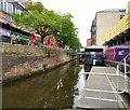
There is a bridge here which takes pedestrian traffic over the canal.
| Oxford Street Bridge No 98 | 1½ furlongs | |
| Oxford Road Lock No 88 | 1½ furlongs | |
| Atwood Street Footbridge | 1 furlong | |
| Princess Street Bridge No 97 | ½ furlongs | |
| David Street Lock No 87 | ¼ furlongs | |
| Canal Street Footbridge | ||
| Sackville Street Bridge | ¼ furlongs | |
| Chorlton Street Bridge No 95 | ¾ furlongs | |
| Chorlton Street Lock No 86 | ¾ furlongs | |
| Minshull Street Bridge | 1¼ furlongs | |
| UMIST Bridge | 1½ furlongs | |
Amenities here
Amenities nearby at David Street Lock No 87
Amenities nearby at Sackville Street Bridge
There are no links to external websites from here.
Why not log in and add some (select "External websites" from the menu (sometimes this is under "Edit"))?
Why not log in and add some (select "External websites" from the menu (sometimes this is under "Edit"))?
Mouseover for more information or show routes to facility
Nearest water point
In the direction of Castlefield Junction
Staffordshire, Kenworthy and other Arms — 7 furlongs and 6 locks away
Travel to Castlefield Junction, then on the Bridgewater Canal (Main Line) to Staffordshire, Kenworthy and other Arms
Potato Wharf Arm & The New Basin — 7½ furlongs and 6 locks away
Travel to Castlefield Junction, then on the Bridgewater Canal (Main Line) to Potato Wharf Arm & The New Basin
Stretford Marina — 3 miles, 7 furlongs and 6 locks away
Travel to Castlefield Junction, then on the Bridgewater Canal (Main Line) to Stretford Marina
Watch House Cruising Club — 4 miles, 7¼ furlongs and 6 locks away
Travel to Castlefield Junction, then on the Bridgewater Canal (Main Line) to Watch House Cruising Club
Worsley Visitor Moorings — 8 miles, 1 furlong and 6 locks away
Travel to Castlefield Junction, then on the Bridgewater Canal (Main Line) to Stretford - Waters Meeting, then on the Bridgewater Canal (Stretford and Leigh Branch) to Worsley Visitor Moorings
Bridgewater Marina — 9 miles, 4¾ furlongs and 6 locks away
Travel to Castlefield Junction, then on the Bridgewater Canal (Main Line) to Stretford - Waters Meeting, then on the Bridgewater Canal (Stretford and Leigh Branch) to Bridgewater Marina
Ye Olde Number 3 Transit Moorings — 11 miles, 6¼ furlongs and 6 locks away
Travel to Castlefield Junction, then on the Bridgewater Canal (Main Line) to Ye Olde Number 3 Transit Moorings
Plank Lane Visitor Moorings — 16 miles, 1½ furlongs and 6 locks away
Travel to Castlefield Junction, then on the Bridgewater Canal (Main Line) to Stretford - Waters Meeting, then on the Bridgewater Canal (Stretford and Leigh Branch) to Leigh Bridge No 11, then on the Leeds and Liverpool Canal (Leigh Branch) to Plank Lane Visitor Moorings
In the direction of Sowerby Bridge Junction
New Islington Marina — 7 furlongs and 5 locks away
Travel to New Islington Marina Entrance, then on the Rochdale Canal (Main Line) to Cotton Field Wharf Marina, then on the Rochdale Canal (New Islington Marina Arm) to New Islington Marina
Fairfield Junction — 4 miles, 1½ furlongs and 21 locks away
Travel to Ducie Street Junction, then on the Ashton Canal (Main Line) to Fairfield Junction
Grove Road Bridge No 96 — 11 miles, 5½ furlongs and 29 locks away
Travel to Ducie Street Junction, then on the Ashton Canal (Main Line) to Ashton-under-Lyne Junction, then on the Huddersfield Narrow Canal to Grove Road Bridge No 96
Marple Services — 14 miles, 6¾ furlongs and 37 locks away
Travel to Ducie Street Junction, then on the Ashton Canal (Main Line) to Dukinfield Junction, then on the Peak Forest Canal (Lower) to Marple Junction, then on the Macclesfield Canal to Marple Services
Braidbar Boats — 18 miles, 4½ furlongs and 37 locks away
Travel to Ducie Street Junction, then on the Ashton Canal (Main Line) to Dukinfield Junction, then on the Peak Forest Canal (Lower) to Marple Junction, then on the Macclesfield Canal to Braidbar Boats
Littleborough Sanitary Station — 16 miles and 40 locks away
On this waterway in the direction of Sowerby Bridge Junction
Furness Vale Marina — 19 miles, 5¾ furlongs and 37 locks away
Travel to Ducie Street Junction, then on the Ashton Canal (Main Line) to Dukinfield Junction, then on the Peak Forest Canal (Lower) to Marple Junction, then on the Peak Forest Canal (Upper) to Furness Vale Marina
Wool Road Bridge No 70 — 17 miles, 5¾ furlongs and 44 locks away
Travel to Ducie Street Junction, then on the Ashton Canal (Main Line) to Ashton-under-Lyne Junction, then on the Huddersfield Narrow Canal to Wool Road Bridge No 70
Standedge Tunnel (western entrance) — 19 miles, 5½ furlongs and 53 locks away
Travel to Ducie Street Junction, then on the Ashton Canal (Main Line) to Ashton-under-Lyne Junction, then on the Huddersfield Narrow Canal to Standedge Tunnel (western entrance)
Travis Mill Lock No 28 — 19 miles, 5¼ furlongs and 58 locks away
On this waterway in the direction of Sowerby Bridge JunctionNearest rubbish disposal
In the direction of Castlefield Junction
Plank Lane Pump Out — 16 miles, 2 furlongs and 6 locks away
Travel to Castlefield Junction, then on the Bridgewater Canal (Main Line) to Stretford - Waters Meeting, then on the Bridgewater Canal (Stretford and Leigh Branch) to Leigh Bridge No 11, then on the Leeds and Liverpool Canal (Leigh Branch) to Plank Lane Pump Out
In the direction of Sowerby Bridge Junction
Marple Bottom Lock Bridge Winding Hole — 13 miles, 5½ furlongs and 21 locks away
Travel to Ducie Street Junction, then on the Ashton Canal (Main Line) to Dukinfield Junction, then on the Peak Forest Canal (Lower) to Marple Bottom Lock Bridge Winding Hole
Marple Services — 14 miles, 6¾ furlongs and 37 locks away
Travel to Ducie Street Junction, then on the Ashton Canal (Main Line) to Dukinfield Junction, then on the Peak Forest Canal (Lower) to Marple Junction, then on the Macclesfield Canal to Marple Services
Braidbar Boats — 18 miles, 4½ furlongs and 37 locks away
Travel to Ducie Street Junction, then on the Ashton Canal (Main Line) to Dukinfield Junction, then on the Peak Forest Canal (Lower) to Marple Junction, then on the Macclesfield Canal to Braidbar Boats
Littleborough Sanitary Station — 16 miles and 40 locks away
On this waterway in the direction of Sowerby Bridge Junction
Wool Road Visitor Mooring — 17 miles, 5¼ furlongs and 44 locks away
Travel to Ducie Street Junction, then on the Ashton Canal (Main Line) to Ashton-under-Lyne Junction, then on the Huddersfield Narrow Canal to Wool Road Visitor MooringNearest chemical toilet disposal
In the direction of Castlefield Junction
Watch House Cruising Club — 4 miles, 7¼ furlongs and 6 locks away
Travel to Castlefield Junction, then on the Bridgewater Canal (Main Line) to Watch House Cruising Club
Oughtrington Wharf — 13 miles, 4¼ furlongs and 6 locks away
Travel to Castlefield Junction, then on the Bridgewater Canal (Main Line) to Oughtrington Wharf
In the direction of Sowerby Bridge Junction
Fairfield Junction — 4 miles, 1½ furlongs and 21 locks away
Travel to Ducie Street Junction, then on the Ashton Canal (Main Line) to Fairfield Junction
Grove Road Bridge No 96 — 11 miles, 5½ furlongs and 29 locks away
Travel to Ducie Street Junction, then on the Ashton Canal (Main Line) to Ashton-under-Lyne Junction, then on the Huddersfield Narrow Canal to Grove Road Bridge No 96
Marple Services — 14 miles, 6¾ furlongs and 37 locks away
Travel to Ducie Street Junction, then on the Ashton Canal (Main Line) to Dukinfield Junction, then on the Peak Forest Canal (Lower) to Marple Junction, then on the Macclesfield Canal to Marple Services
Littleborough Sanitary Station — 16 miles and 40 locks away
On this waterway in the direction of Sowerby Bridge Junction
Furness Vale Marina — 19 miles, 5¾ furlongs and 37 locks away
Travel to Ducie Street Junction, then on the Ashton Canal (Main Line) to Dukinfield Junction, then on the Peak Forest Canal (Lower) to Marple Junction, then on the Peak Forest Canal (Upper) to Furness Vale Marina
Wool Road Bridge No 70 — 17 miles, 5¾ furlongs and 44 locks away
Travel to Ducie Street Junction, then on the Ashton Canal (Main Line) to Ashton-under-Lyne Junction, then on the Huddersfield Narrow Canal to Wool Road Bridge No 70Nearest place to turn
In the direction of Castlefield Junction
Castlefield Junction — 6½ furlongs and 6 locks away
On this waterway in the direction of Castlefield Junction
Staffordshire, Kenworthy and other Arms — 7 furlongs and 6 locks away
Travel to Castlefield Junction, then on the Bridgewater Canal (Main Line) to Staffordshire, Kenworthy and other Arms
Grocer's Wharf — 7½ furlongs and 6 locks away
Travel to Castlefield Junction, then on the Bridgewater Canal (Main Line) to Grocer's Wharf
Potato Wharf Arm & The New Basin — 7½ furlongs and 6 locks away
Travel to Castlefield Junction, then on the Bridgewater Canal (Main Line) to Potato Wharf Arm & The New Basin
Hulme Locks Branch - Bridgewater Canal Junction — 1 mile, 1 furlong and 6 locks away
Travel to Castlefield Junction, then on the Bridgewater Canal (Main Line) to Hulme Locks Branch - Bridgewater Canal Junction
Hulme Hall Road Winding Hole — 1 mile, 2 furlongs and 6 locks away
Travel to Castlefield Junction, then on the Bridgewater Canal (Main Line) to Hulme Hall Road Winding Hole
Pomona Lock Branch Junction — 1 mile, 6½ furlongs and 6 locks away
Travel to Castlefield Junction, then on the Bridgewater Canal (Main Line) to Pomona Lock Branch Junction
Stretford - Waters Meeting — 3 miles, 5 furlongs and 6 locks away
Travel to Castlefield Junction, then on the Bridgewater Canal (Main Line) to Stretford - Waters Meeting
Stretford Marina — 3 miles, 7 furlongs and 6 locks away
Travel to Castlefield Junction, then on the Bridgewater Canal (Main Line) to Stretford Marina
Middlewood Basin No 1 — 1 mile, 5¾ furlongs and 9 locks away
Travel to Castlefield Junction, then on the Bridgewater Canal (Main Line) to Hulme Locks Branch - Bridgewater Canal Junction, then on the Bridgewater Canal (Hulme Locks Branch) to River Irwell - Hulme Locks Branch Junction, then on the Manchester Ship Canal (River Irwell Upper Reach) to Manchester, Bolton and Bury Canal - River Irwell Junction, then on the Manchester Bolton and Bury Canal (Main Line) to Middlewood Basin No 1
Middlewood Basin No 2 — 1 mile, 6¼ furlongs and 9 locks away
Travel to Castlefield Junction, then on the Bridgewater Canal (Main Line) to Hulme Locks Branch - Bridgewater Canal Junction, then on the Bridgewater Canal (Hulme Locks Branch) to River Irwell - Hulme Locks Branch Junction, then on the Manchester Ship Canal (River Irwell Upper Reach) to Manchester, Bolton and Bury Canal - River Irwell Junction, then on the Manchester Bolton and Bury Canal (Main Line) to Middlewood Basin No 2
Edge Lane Winding Hole — 4 miles, 5½ furlongs and 6 locks away
Travel to Castlefield Junction, then on the Bridgewater Canal (Main Line) to Edge Lane Winding Hole
Trafford Park Winding Hole — 4 miles, 7¼ furlongs and 6 locks away
Travel to Castlefield Junction, then on the Bridgewater Canal (Main Line) to Stretford - Waters Meeting, then on the Bridgewater Canal (Stretford and Leigh Branch) to Trafford Park Winding Hole
Salford Tunnel Basin — 1 mile, 7¼ furlongs and 10 locks away
Travel to Castlefield Junction, then on the Bridgewater Canal (Main Line) to Hulme Locks Branch - Bridgewater Canal Junction, then on the Bridgewater Canal (Hulme Locks Branch) to River Irwell - Hulme Locks Branch Junction, then on the Manchester Ship Canal (River Irwell Upper Reach) to Manchester, Bolton and Bury Canal - River Irwell Junction, then on the Manchester Bolton and Bury Canal (Main Line) to Salford Tunnel Basin
Patricroft Basin and Warehouse — 6 miles, 1¾ furlongs and 6 locks away
Travel to Castlefield Junction, then on the Bridgewater Canal (Main Line) to Stretford - Waters Meeting, then on the Bridgewater Canal (Stretford and Leigh Branch) to Patricroft Basin and Warehouse
In the direction of Sowerby Bridge Junction
Ducie Street Junction — 3 furlongs and 3 locks away
On this waterway in the direction of Sowerby Bridge Junction
New Islington Marina Entrance — 5½ furlongs and 5 locks away
On this waterway in the direction of Sowerby Bridge Junction
Butler Lane Lock Winding Hole — 1 mile, 1¼ furlongs and 6 locks away
On this waterway in the direction of Sowerby Bridge Junction
New Viaduct Winding Hole — 1 mile, 5¼ furlongs and 6 locks away
Travel to Ducie Street Junction, then on the Ashton Canal (Main Line) to New Viaduct Winding Hole
Ashton New Road Winding Hole — 2 miles, 2½ furlongs and 10 locks away
Travel to Ducie Street Junction, then on the Ashton Canal (Main Line) to Ashton New Road Winding HoleNearest self-operated pump-out
In the direction of Castlefield Junction
Plank Lane Pump Out — 16 miles, 2 furlongs and 6 locks away
Travel to Castlefield Junction, then on the Bridgewater Canal (Main Line) to Stretford - Waters Meeting, then on the Bridgewater Canal (Stretford and Leigh Branch) to Leigh Bridge No 11, then on the Leeds and Liverpool Canal (Leigh Branch) to Plank Lane Pump Out
In the direction of Sowerby Bridge Junction
New Islington Marina — 7 furlongs and 5 locks away
Travel to New Islington Marina Entrance, then on the Rochdale Canal (Main Line) to Cotton Field Wharf Marina, then on the Rochdale Canal (New Islington Marina Arm) to New Islington Marina
Wool Road Bridge No 70 — 17 miles, 5¾ furlongs and 44 locks away
Travel to Ducie Street Junction, then on the Ashton Canal (Main Line) to Ashton-under-Lyne Junction, then on the Huddersfield Narrow Canal to Wool Road Bridge No 70Nearest boatyard pump-out
In the direction of Castlefield Junction
Stretford Marina — 3 miles, 7 furlongs and 6 locks away
Travel to Castlefield Junction, then on the Bridgewater Canal (Main Line) to Stretford Marina
Bridgewater Marina — 9 miles, 4¾ furlongs and 6 locks away
Travel to Castlefield Junction, then on the Bridgewater Canal (Main Line) to Stretford - Waters Meeting, then on the Bridgewater Canal (Stretford and Leigh Branch) to Bridgewater Marina
Oughtrington Wharf — 13 miles, 4¼ furlongs and 6 locks away
Travel to Castlefield Junction, then on the Bridgewater Canal (Main Line) to Oughtrington Wharf
In the direction of Sowerby Bridge Junction
Portland Basin Arm — 6 miles, 5¾ furlongs and 21 locks away
Travel to Ducie Street Junction, then on the Ashton Canal (Main Line) to Dukinfield Junction, then on the Peak Forest Canal (Lower) to Portland Basin Arm
Braidbar Boats — 18 miles, 4½ furlongs and 37 locks away
Travel to Ducie Street Junction, then on the Ashton Canal (Main Line) to Dukinfield Junction, then on the Peak Forest Canal (Lower) to Marple Junction, then on the Macclesfield Canal to Braidbar Boats
New Mills Marina — 18 miles, 6½ furlongs and 37 locks away
Travel to Ducie Street Junction, then on the Ashton Canal (Main Line) to Dukinfield Junction, then on the Peak Forest Canal (Lower) to Marple Junction, then on the Peak Forest Canal (Upper) to New Mills MarinaDirection of TV transmitter (From Wolfbane Cybernetic)
There is no page on Wikipedia called “Canal Street Footbridge”
Wikipedia pages that might relate to Canal Street Footbridge
[Footbridge]
A footbridge (also a pedestrian bridge, pedestrian overpass, or pedestrian overcrossing) is a bridge designed solely for pedestrians. While the primary
[List of Dublin bridges and tunnels]
[L5053] Mullen Bridge [Straffan Road - R406] Footbridge Bond Bridge [Parson Street, Clane Road - R408] Royal Canal aqueduct over the River Lyreen Jackson's
[Corktown Footbridge]
Corktown Footbridge (French: Passerelle Corktown), also referred to as the Somerset Street bridge or simply the Somerset Bridge, is a footbridge in Ottawa
[List of bridges in the United Kingdom]
bridges or footbridges in the United Kingdom. Railway bridges are listed under: List of railway bridges and viaducts in the United Kingdom. Canal aqueducts
[River Don, Yorkshire]
non-navigable section of the River Don. The Sheffield Canal joins the Don immediately downstream of this footbridge. A century ago it would have cost half a penny
[Flora Footbridge]
The Flora Footbridge, named after Flora MacDonald, is a pedestrian/cycling bridge in Ottawa, Ontario, Canada, that spans the Rideau Canal, connecting
[Gas Street Basin]
boats using the canals. The Worcester Bar still exists, with boats moored to both sides of it. It is connected to Gas Street via a footbridge reconstructed
[Leeds and Liverpool Canal]
The Leeds and Liverpool Canal is a canal in Northern England, linking the cities of Leeds and Liverpool. Over a distance of 127 miles (204 km), it crosses
[Bridgewater Canal]
The Bridgewater Canal connects Runcorn, Manchester and Leigh, in North West England. It was commissioned by Francis Egerton, 3rd Duke of Bridgewater,
[Manchester Ship Canal]
The Manchester Ship Canal is a 36-mile-long (58 km) inland waterway in the North West of England linking Manchester to the Irish Sea. Starting at the
Results of Google Search
The Final Design For The Canal Street Ferry Terminal Footbridge ...Dec 18, 2017 ... Manning Architects worked on the design of the $7,300,000 footbridge. The City plans to open bidding to general contractors soon, begin ...
The main access to the isle is the Belle Isle Pedestrian Bridge that runs under the Lee Bridge. The pedestrian footbridge is accessible from Tredegar Street on ...
Aug 1, 2013 ... Bryan Seymour stands on the Walnut Street footbridge over the Ohio & Erie Canal (taken in 1906 or 1908). Photo courtesy of Rick Palsgrove, ...
The Mary Yardley Footbridge connects the Canal towpath at Fuld Avenue in Yardley Borough with a footpath to North Main Street. Please Donate to Keep This ...
Dec 13, 2017 ... ... vision for a new Canal Street ferry terminal in New Orleans, although its much ballyhooed pedestrian footbridge still carries question marks.
J. Wild Street Footbridge, Nuremberg, over de Main-Danube Canal, photographed by Nicolas Janberg in 2002 (ID 1456)
Photo and image gallery for the project 'J. Wild Street Footbridge'.
The Corktown Footbridge (French: Passerelle Corktown), also referred to as the Somerset Street bridge or simply the Somerset Bridge, is a footbridge in Ottawa, Ontario, Canada built across the Rideau Canal.
Jan 23, 2019 ... The application also includes a memorial to the student whose body was found in the canal close to the Rain Bar on Whitworth Street West on 3 ...


![Canal Street. By the Rochdale canal which is on the left. See also [[2295298]]. by Thomas Nugent – 28 February 2011](https://s2.geograph.org.uk/geophotos/02/29/52/2295262_608f26d7_120x120.jpg)


![Detail of 42-44 Sackville Street, Manchester. Close-up of the centre of this building's main elevation: [[[2795833]]]. by Stephen Richards – 24 July 2011](https://s2.geograph.org.uk/geophotos/02/79/58/2795838_78615403_120x120.jpg)
![42-44 Sackville Street, Manchester. A gorgeous example of Manchester's palazzo warehouses. By Pennington & Bridgen, c1870. Very finely proportioned, red brick with spare stone dressings to the windows, which are treated slightly differently on each floor - segmentally arched, round arched, moulded and with keystones ([[[2795838]]]). Grade II listed.It is now flats. by Stephen Richards – 24 July 2011](https://s1.geograph.org.uk/geophotos/02/79/58/2795833_12f4d33a_120x120.jpg)


