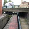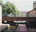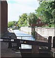
Bridge Place Bridge No 42
is a minor waterways place
on the Chesterfield Canal (Norwood to Retford) between
Chequer House Bridge No 51 (Ranby village) (5 miles and 2½ furlongs
and 3 locks
to the east) and
Manor Road Winding Hole (Feeder from Harthill Reservoir enters at winding hole) (5 miles and 6¼ furlongs
and 32 locks
to the west).
The nearest place in the direction of Chequer House Bridge No 51 is Cuckoo Wharf Elsan (Middle Door);
a few yards
away.
The nearest place in the direction of Manor Road Winding Hole is Worksop Town Lock No 50;
a few yards
away.
Mooring here is unrated.
There is a bridge here.
| Kilton Road Bridge No 43 | 2½ furlongs | |
| Canal Road Pipe Bridge (Worksop) | ¾ furlongs | |
| Cuckoo Wharf Visitor Moorings | ½ furlongs | |
| Cuckoo Wharf Wharehouse Bridge | ¼ furlongs | |
| Cuckoo Wharf Elsan | a few yards | |
| Bridge Place Bridge No 42 | ||
| Worksop Town Lock No 50 | a few yards | |
| Worksop Town - Visitor Moorings | ½ furlongs | |
| Morse Lock Winding Hole | 2¾ furlongs | |
| Morse Lock No 49 | 4 furlongs | |
| Junction with former Lady Lee Arm | 7 furlongs | |
There are no links to external websites from here.
Why not log in and add some (select "External websites" from the menu (sometimes this is under "Edit"))?
Why not log in and add some (select "External websites" from the menu (sometimes this is under "Edit"))?
Mouseover for more information or show routes to facility
Nearest water point
In the direction of West Retford Lock No 58
Forest Middle Top Water Point — 7 miles, 2 furlongs and 4 locks away
On this waterway in the direction of West Retford Lock No 58
Forest Middle Top Lock No 55 — 7 miles, 2 furlongs and 4 locks away
On this waterway in the direction of West Retford Lock No 58
Hop Pole Bridge No 59 — 11 miles, 4 furlongs and 9 locks away
Travel to West Retford Lock No 58, then on the Chesterfield Canal (Retford to the Trent) to Hop Pole Bridge No 59
Clayworth CRT Boaters Facilities — 15 miles, 6¾ furlongs and 10 locks away
Travel to West Retford Lock No 58, then on the Chesterfield Canal (Retford to the Trent) to Clayworth CRT Boaters Facilities
In the direction of Norwood Tunnel (eastern entrance)
Shireoaks Marina — 2 miles, 1¾ furlongs and 9 locks away
On this waterway in the direction of Norwood Tunnel (eastern entrance)Nearest rubbish disposal
In the direction of West Retford Lock No 58
Forest Middle Top Lock No 55 — 7 miles, 2 furlongs and 4 locks away
On this waterway in the direction of West Retford Lock No 58
Clayworth CRT Boaters Facilities — 15 miles, 6¾ furlongs and 10 locks away
Travel to West Retford Lock No 58, then on the Chesterfield Canal (Retford to the Trent) to Clayworth CRT Boaters Facilities
In the direction of Norwood Tunnel (eastern entrance)
Shireoaks Marina — 2 miles, 1¾ furlongs and 9 locks away
On this waterway in the direction of Norwood Tunnel (eastern entrance)Nearest chemical toilet disposal
In the direction of West Retford Lock No 58
Cuckoo Wharf Elsan — a few yards away
On this waterway in the direction of West Retford Lock No 58
Forest Middle Top Lock No 55 — 7 miles, 2 furlongs and 4 locks away
On this waterway in the direction of West Retford Lock No 58
Clayworth CRT Boaters Facilities — 15 miles, 6¾ furlongs and 10 locks away
Travel to West Retford Lock No 58, then on the Chesterfield Canal (Retford to the Trent) to Clayworth CRT Boaters Facilities
In the direction of Norwood Tunnel (eastern entrance)
Shireoaks Marina — 2 miles, 1¾ furlongs and 9 locks away
On this waterway in the direction of Norwood Tunnel (eastern entrance)Nearest place to turn
In the direction of West Retford Lock No 58
High Hoe Road Bridge Winding Hole — 5¼ furlongs and 1 lock away
On this waterway in the direction of West Retford Lock No 58
Ranby Bridge Winding Hole — 4 miles, 5½ furlongs and 3 locks away
On this waterway in the direction of West Retford Lock No 58
Forest Top Lock Winding Hole — 6 miles, 7¼ furlongs and 4 locks away
On this waterway in the direction of West Retford Lock No 58
Babworth Winding Hole — 8 miles, 7¾ furlongs and 7 locks away
On this waterway in the direction of West Retford Lock No 58
Retford Winding Hole — 10 miles, 3¾ furlongs and 9 locks away
Travel to West Retford Lock No 58, then on the Chesterfield Canal (Retford to the Trent) to Retford Winding Hole
Grove Mill Bridge Winding Hole — 10 miles, 5½ furlongs and 9 locks away
Travel to West Retford Lock No 58, then on the Chesterfield Canal (Retford to the Trent) to Grove Mill Bridge Winding Hole
Main Street Winding Hole — 14 miles, 1½ furlongs and 10 locks away
Travel to West Retford Lock No 58, then on the Chesterfield Canal (Retford to the Trent) to Main Street Winding Hole
Clayworth Top Bridge Winding Hole — 15 miles, 7¼ furlongs and 10 locks away
Travel to West Retford Lock No 58, then on the Chesterfield Canal (Retford to the Trent) to Clayworth Top Bridge Winding Hole
Otter's Bridge Winding Hole — 16 miles, 4 furlongs and 10 locks away
Travel to West Retford Lock No 58, then on the Chesterfield Canal (Retford to the Trent) to Otter's Bridge Winding Hole
Drakeholes Visitor Moorings — 18 miles, 7¼ furlongs and 10 locks away
Travel to West Retford Lock No 58, then on the Chesterfield Canal (Retford to the Trent) to Drakeholes Visitor Moorings
Drakeholes Tunnel (southern entrance) — 18 miles, 7¾ furlongs and 10 locks away
Travel to West Retford Lock No 58, then on the Chesterfield Canal (Retford to the Trent) to Drakeholes Tunnel (southern entrance)
In the direction of Norwood Tunnel (eastern entrance)
Morse Lock Winding Hole — 2¾ furlongs and 1 lock away
On this waterway in the direction of Norwood Tunnel (eastern entrance)
Junction with former Lady Lee Arm — 7 furlongs and 2 locks away
On this waterway in the direction of Norwood Tunnel (eastern entrance)
Shireoaks Marina — 2 miles, 1¾ furlongs and 9 locks away
On this waterway in the direction of Norwood Tunnel (eastern entrance)
Little Lane Bridge Winding Hole — 3 miles, 1¼ furlongs and 17 locks away
On this waterway in the direction of Norwood Tunnel (eastern entrance)
Manor Road Winding Hole — 5 miles, 6¼ furlongs and 32 locks away
On this waterway in the direction of Norwood Tunnel (eastern entrance)
Kiveton Waters Marina — 6 miles, 4¾ furlongs and 35 locks away
Travel to Norwood Tunnel (eastern entrance), then on the Chesterfield Canal (Unnavigable section) to Kiveton Waters Marina
Norwood Winding Hole — 8 miles, ¾ furlongs and 58 locks away
Travel to Norwood Tunnel (eastern entrance), then on the Chesterfield Canal (Unnavigable section) to Norwood Winding Hole
Hartington Harbour — 14 miles, ¼ furlongs and 73 locks away
Travel to Norwood Tunnel (eastern entrance), then on the Chesterfield Canal (Unnavigable section) to Nethermoor Lake Marina, then on the Chesterfield Canal (Central Line West) to New Leah’s Bridge No 26B, then on the Chesterfield Canal (Unnavigable section) to Hartington Harbour
Staveley Town Basin — 14 miles, 1¾ furlongs and 74 locks away
Travel to Norwood Tunnel (eastern entrance), then on the Chesterfield Canal (Unnavigable section) to Nethermoor Lake Marina, then on the Chesterfield Canal (Central Line West) to New Leah’s Bridge No 26B, then on the Chesterfield Canal (Unnavigable section) to Staveley Town BasinNo information
CanalPlan has no information on any of the following facilities within range:self-operated pump-out
boatyard pump-out
Direction of TV transmitter (From Wolfbane Cybernetic)
There is no page on Wikipedia called “Bridge Place Bridge”
Wikipedia pages that might relate to Bridge Place Bridge
[Bridge]
A bridge is a structure built to span a physical obstacle, such as a body of water, valley, or road, without closing the way underneath. It is constructed
[Howrah Bridge]
Howrah Bridge is a balanced cantilever bridge over the Hooghly River in West Bengal, India. Commissioned in 1943, the bridge was originally named the
[Brooklyn Bridge]
The Brooklyn Bridge is a hybrid cable-stayed/suspension bridge in New York City, spanning the East River between Manhattan Island and Brooklyn on Long
[Hebden Bridge]
Hebden Bridge is a market town in the Upper Calder Valley in West Yorkshire, England. It is 8 miles (13 km) west of Halifax and 14 miles (21 km) north-east
[Williamsburg Bridge]
The Williamsburg Bridge is a suspension bridge in New York City across the East River connecting the Lower East Side of Manhattan at Delancey Street with
[Queensboro Bridge]
The Queensboro Bridge, officially named the Ed Koch Queensboro Bridge, is a cantilever bridge over the East River in New York City. Completed in 1909,
[Contract bridge]
Contract bridge, or simply bridge, is a trick-taking card game using a standard 52-card deck. In its basic format, it is played by four players in two
[Øresund Bridge]
The Öresund or Øresund Bridge (Danish: Øresundsbroen [ˈøːɐsɔnsˌpʁoˀn̩]; Swedish: Öresundsbron [œrɛˈsɵ̂nːdsˌbruːn]; hybrid name: Øresundsbron) is a combined
[Crimean Bridge]
Crimean Bridge (Russian: Крымский мост, tr. Krymskiy most, IPA: [ˈkrɨmskʲij most]), also called the Kerch Strait Bridge, or colloquially the Kerch Bridge, is
[Alter Bridge]
Alter Bridge is an American rock band from Orlando, Florida. The band was formed in 2004 by vocalist/rhythm guitarist Myles Kennedy, lead guitarist Mark
Results of Google Search
Pile Repair at Firebaugh and Buttonwillow Bridges | Caltrans42-0034) and Main Drain Canal Bridge (No. 50-0013). Project Benefits. Purpose: The purpose of the project is to perform preventative maintenance at four bridges: ...
LOCATION: 14TH STREET BRIDGE. HAER NO. AR-42. Spanning the Missouri- Pacific Railroad lines on 14th Street, in the town of North Little Rock, Arkansas.
May 29, 2018 ... Of those 42 teams, CEE and its bridge, Bearodynamic, took 4th place overall. ... No need to worry though, as the four-person construction team ...
5351 Bridge Street, Unit 42, Tampa, FL 33611 is a townhouse listed for sale at ... Parcel Number: 5351 BRIDGE ST. #42. Total Acreage: 0 to less than 1/4.
NRHP reference No. 00000210. Added to NRHP, March 15, 2000. Indiana State Highway Bridge 42-11-3101, also known as Poland Bridge, is a historic Parker ... :5. It was added to the National Register of Historic Places in 2000.
REPORT NUMBER. RD-42. 9. SPONSORING / MONITORING AGENCY NAME(S ) AND ... Bridge, Hydraulics, Backwater, Contraction and Expansion, energy losses ... The location where the backwater effect is greatest is considered to be.
Bridge Number: 7100. Feature Crossed: The Minnesota River. Feature Carried: CSAH No. 42. Location: District 7 - Blue Earth County. Bridge Description: The ...
Nov 17, 2017 ... NO FEE. One Bedroom in luxury building for rent! FULLY FURNISHED huge one bedroom apartment with a HOME OFFICE. 42nd Floor offers ...
(Bridge Recall No. 027160). HAER No. LA-42. Location: Carries Louisiana Highway 132 (LA 132) over Boeuf River in the town of Rayville, Richland. Parish ...
Jul 23, 2019 ... There were no injuries, but the bridge over the Goose River near Northwood ... The bridge, which is on the National Registrar of Historic Places, ...


