Bingley Arms PH
is a minor waterways place
on the Calder and Hebble Navigation (Main Line) between
Fall Ing Junction (Junction of the Calder and Hebble Navigation and the Aire and Calder Navigation (Wakefield Section)) (5 miles and ¼ furlongs
and 4 locks
to the east) and
Dewsbury Arm Junction (Junction of Calder and Hebble (Main Line) with the Dewsbury Arm ) (2 miles and 2 furlongs
and 3 locks
to the west).
The nearest place in the direction of Fall Ing Junction is Horbury Visitor Moorings;
¼ furlongs
away.
The nearest place in the direction of Dewsbury Arm Junction is Horbury Bridge (Flood Control Point);
¼ furlongs
away.
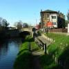
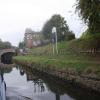
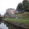
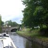
Mooring here is ok (a perfectly adequate mooring). Nice safe place to stay with local pub selling food. Horbury marina 5 mins walk with showers, toilet etc but hard to moor up inside the marina due to lack of space.
Broad Cut Top Lock No 4 | 1 mile, 4¼ furlongs | |
Broad Cut Railway Bridge No 41 | 1 mile, ¾ furlongs | |
Hartley Bank Bridge No 29 | 5½ furlongs | |
Beeston Bridge No 28 | 3¼ furlongs | |
Horbury Visitor Moorings | ¼ furlongs | |
Bingley Arms PH | ||
Horbury Bridge | ¼ furlongs | |
Horbury Basin Residential Moorings & Sanitary Station | 1¼ furlongs | |
Sykes Bridge No 26 | 5¾ furlongs | |
Figure of Three Bottom Lock No 5 | 1 mile | |
Figure of Three Top Lock No 6 | 1 mile, ½ furlongs |
Nice safe place to stay with local pub selling food. Local garage close by. Horbury marina 5 mins walk with showers, toilet etc but hard to moor up inside the marina due to lack of space.
There are no links to external websites from here.
Why not log in and add some (select "External websites" from the menu (sometimes this is under "Edit"))?
Mouseover for more information or show routes to facility
Nearest water point
In the direction of Salterhebble Junction
Shepley Bridge Sanitary Station — 4 miles, 5½ furlongs and 7 locks away
On this waterway in the direction of Salterhebble Junction
Brighouse Basin — 10 miles, ½ furlongs and 13 locks away
On this waterway in the direction of Salterhebble Junction
Aspley Basin (Huddersfield) — 11 miles, 2 furlongs and 18 locks away
Travel to Cooper Bridge Junction, then on the Huddersfield Broad Canal to Aspley Basin (Huddersfield)
Salterhebble Sanitary Station — 14 miles, 2½ furlongs and 22 locks away
On this waterway in the direction of Salterhebble Junction
Salterhebble Junction — 14 miles, 3 furlongs and 23 locks away
On this waterway in the direction of Salterhebble Junction
In the direction of Fall Ing Junction
Broad Cut Low Lock No 3 — 1 mile, 7½ furlongs and 1 lock away
On this waterway in the direction of Fall Ing Junction
Ramsdens Bridge Sanitary Station — 7 miles, 3¼ furlongs and 5 locks away
Travel to Fall Ing Junction, then on the Aire and Calder Navigation (Wakefield Section) to Ramsdens Bridge Sanitary Station
Stanley Ferry Water Point — 7 miles, 4 furlongs and 5 locks away
Travel to Fall Ing Junction, then on the Aire and Calder Navigation (Wakefield Section) to Stanley Ferry Water Point
King's Road Lock No 3 — 9 miles, 1 furlong and 6 locks away
Travel to Fall Ing Junction, then on the Aire and Calder Navigation (Wakefield Section) to King's Road Lock No 3
Woodnook Lock No 6 — 10 miles, 2¾ furlongs and 7 locks away
Travel to Fall Ing Junction, then on the Aire and Calder Navigation (Wakefield Section) to Woodnook Lock No 6
Fairies Hill Moorings — 10 miles, 6 furlongs and 9 locks away
Travel to Fall Ing Junction, then on the Aire and Calder Navigation (Wakefield Section) to Fairies Hill Lock Junction, then on the Aire and Calder Navigation (Wakefield Section - Fairies Hill Mooring Arm) to Fairies Hill Moorings
Castleford Sanitary Station — 12 miles, 5¼ furlongs and 9 locks away
Travel to Fall Ing Junction, then on the Aire and Calder Navigation (Wakefield Section) to Castleford Junction, then on the Aire and Calder Navigation (Main Line - Goole to Castleford) to Castleford Sanitary Station
Bulholme Lock No 10 — 13 miles, 2 furlongs and 9 locks away
Travel to Fall Ing Junction, then on the Aire and Calder Navigation (Wakefield Section) to Castleford Junction, then on the Aire and Calder Navigation (Main Line - Goole to Castleford) to Bulholme Lock No 10
Lemonroyd Lock No 7 — 15 miles, 8 furlongs and 8 locks away
Travel to Fall Ing Junction, then on the Aire and Calder Navigation (Wakefield Section) to Castleford Junction, then on the Aire and Calder Navigation (Main Line - Castleford to Leeds) to Lemonroyd Lock No 7
Lemonroyd Marina — 16 miles, ¾ furlongs and 9 locks away
Travel to Fall Ing Junction, then on the Aire and Calder Navigation (Wakefield Section) to Castleford Junction, then on the Aire and Calder Navigation (Main Line - Castleford to Leeds) to Lemonroyd Marina
Woodlesford Lock No 5 — 17 miles, 2½ furlongs and 9 locks away
Travel to Fall Ing Junction, then on the Aire and Calder Navigation (Wakefield Section) to Castleford Junction, then on the Aire and Calder Navigation (Main Line - Castleford to Leeds) to Woodlesford Lock No 5
Ferrybridge Flood Lock Footbridge — 17 miles, 7½ furlongs and 10 locks away
Travel to Fall Ing Junction, then on the Aire and Calder Navigation (Wakefield Section) to Castleford Junction, then on the Aire and Calder Navigation (Main Line - Goole to Castleford) to Ferrybridge Flood Lock Footbridge
Ferrybridge Flood Lock No 11 — 18 miles and 10 locks away
Travel to Fall Ing Junction, then on the Aire and Calder Navigation (Wakefield Section) to Castleford Junction, then on the Aire and Calder Navigation (Main Line - Goole to Castleford) to Ferrybridge Flood Lock No 11
Fishpond Lock No 4 — 18 miles, 1½ furlongs and 10 locks away
Travel to Fall Ing Junction, then on the Aire and Calder Navigation (Wakefield Section) to Castleford Junction, then on the Aire and Calder Navigation (Main Line - Castleford to Leeds) to Fishpond Lock No 4
Bank Dole Lock No 1 — 19 miles, 6¼ furlongs and 11 locks away
Travel to Fall Ing Junction, then on the Aire and Calder Navigation (Wakefield Section) to Castleford Junction, then on the Aire and Calder Navigation (Main Line - Goole to Castleford) to Bank Dole Junction, then on the Aire and Calder Navigation (Selby Section) to Bank Dole Lock No 1Nearest rubbish disposal
In the direction of Salterhebble Junction
Horbury Basin Residential Moorings & Sanitary Station — 1¼ furlongs away
On this waterway in the direction of Salterhebble Junction
Shepley Bridge Sanitary Station — 4 miles, 5½ furlongs and 7 locks away
On this waterway in the direction of Salterhebble Junction
Brighouse Lower Basin Visitor Moorings — 10 miles and 12 locks away
On this waterway in the direction of Salterhebble Junction
Aspley Basin (Huddersfield) — 11 miles, 2 furlongs and 18 locks away
Travel to Cooper Bridge Junction, then on the Huddersfield Broad Canal to Aspley Basin (Huddersfield)
Salterhebble Sanitary Station — 14 miles, 2½ furlongs and 22 locks away
On this waterway in the direction of Salterhebble Junction
Sowerby Bridge Basin — 16 miles, 4¾ furlongs and 23 locks away
Travel to Salterhebble Junction, then on the Calder and Hebble Navigation (Main Line) to Sowerby Bridge Basin
Pickle Lock No 22E — 16 miles, 1 furlong and 39 locks away
Travel to Cooper Bridge Junction, then on the Huddersfield Broad Canal to Aspley Basin (Huddersfield), then on the Huddersfield Narrow Canal to Pickle Lock No 22E
In the direction of Fall Ing Junction
Ramsdens Bridge Visitor Moorings — 7 miles, 3½ furlongs and 5 locks away
Travel to Fall Ing Junction, then on the Aire and Calder Navigation (Wakefield Section) to Ramsdens Bridge Visitor Moorings
Castleford Sanitary Station — 12 miles, 5¼ furlongs and 9 locks away
Travel to Fall Ing Junction, then on the Aire and Calder Navigation (Wakefield Section) to Castleford Junction, then on the Aire and Calder Navigation (Main Line - Goole to Castleford) to Castleford Sanitary Station
Lemonroyd Marina — 16 miles, ¾ furlongs and 9 locks away
Travel to Fall Ing Junction, then on the Aire and Calder Navigation (Wakefield Section) to Castleford Junction, then on the Aire and Calder Navigation (Main Line - Castleford to Leeds) to Lemonroyd Marina
Woodlesford Lock No 5 — 17 miles, 2½ furlongs and 9 locks away
Travel to Fall Ing Junction, then on the Aire and Calder Navigation (Wakefield Section) to Castleford Junction, then on the Aire and Calder Navigation (Main Line - Castleford to Leeds) to Woodlesford Lock No 5Nearest chemical toilet disposal
In the direction of Salterhebble Junction
Horbury Basin Residential Moorings & Sanitary Station — 1¼ furlongs away
On this waterway in the direction of Salterhebble Junction
Savile Town Wharf and Basin (Dewsbury) — 3 miles, 2 furlongs and 3 locks away
Travel to Dewsbury Arm Junction, then on the Calder and Hebble Navigation (Dewsbury Old Cut) to Savile Town Wharf and Basin (Dewsbury)
Shepley Bridge Sanitary Station — 4 miles, 5½ furlongs and 7 locks away
On this waterway in the direction of Salterhebble Junction
Brighouse Basin — 10 miles, ½ furlongs and 13 locks away
On this waterway in the direction of Salterhebble Junction
Aspley Basin (Huddersfield) — 11 miles, 2 furlongs and 18 locks away
Travel to Cooper Bridge Junction, then on the Huddersfield Broad Canal to Aspley Basin (Huddersfield)
Salterhebble Sanitary Station — 14 miles, 2½ furlongs and 22 locks away
On this waterway in the direction of Salterhebble Junction
Sowerby Bridge Basin — 16 miles, 4¾ furlongs and 23 locks away
Travel to Salterhebble Junction, then on the Calder and Hebble Navigation (Main Line) to Sowerby Bridge Basin
Waterside Lock No 21E — 15 miles, 7¾ furlongs and 38 locks away
Travel to Cooper Bridge Junction, then on the Huddersfield Broad Canal to Aspley Basin (Huddersfield), then on the Huddersfield Narrow Canal to Waterside Lock No 21E
Pickle Lock No 22E — 16 miles, 1 furlong and 39 locks away
Travel to Cooper Bridge Junction, then on the Huddersfield Broad Canal to Aspley Basin (Huddersfield), then on the Huddersfield Narrow Canal to Pickle Lock No 22E
In the direction of Fall Ing Junction
Ramsdens Bridge Sanitary Station — 7 miles, 3¼ furlongs and 5 locks away
Travel to Fall Ing Junction, then on the Aire and Calder Navigation (Wakefield Section) to Ramsdens Bridge Sanitary Station
Fairies Hill Moorings — 10 miles, 6 furlongs and 9 locks away
Travel to Fall Ing Junction, then on the Aire and Calder Navigation (Wakefield Section) to Fairies Hill Lock Junction, then on the Aire and Calder Navigation (Wakefield Section - Fairies Hill Mooring Arm) to Fairies Hill Moorings
Castleford Sanitary Station — 12 miles, 5¼ furlongs and 9 locks away
Travel to Fall Ing Junction, then on the Aire and Calder Navigation (Wakefield Section) to Castleford Junction, then on the Aire and Calder Navigation (Main Line - Goole to Castleford) to Castleford Sanitary Station
Lemonroyd Marina — 16 miles, ¾ furlongs and 9 locks away
Travel to Fall Ing Junction, then on the Aire and Calder Navigation (Wakefield Section) to Castleford Junction, then on the Aire and Calder Navigation (Main Line - Castleford to Leeds) to Lemonroyd MarinaNearest place to turn
In the direction of Salterhebble Junction
Horbury Basin Residential Moorings & Sanitary Station — 1¼ furlongs away
On this waterway in the direction of Salterhebble Junction
Dewsbury Arm Junction — 2 miles, 2 furlongs and 3 locks away
On this waterway in the direction of Salterhebble Junction
Savile Town Wharf and Basin (Dewsbury) — 3 miles, 2 furlongs and 3 locks away
Travel to Dewsbury Arm Junction, then on the Calder and Hebble Navigation (Dewsbury Old Cut) to Savile Town Wharf and Basin (Dewsbury)
Shepley Bridge Marina — 4 miles, 5¼ furlongs and 7 locks away
On this waterway in the direction of Salterhebble Junction
Battye Weir Entrance — 7 miles, 1 furlong and 8 locks away
On this waterway in the direction of Salterhebble Junction
Cooper Bridge Junction — 7 miles, 6 furlongs and 9 locks away
On this waterway in the direction of Salterhebble Junction
Deighton Road Bridge Winding Hole — 9 miles and 13 locks away
Travel to Cooper Bridge Junction, then on the Huddersfield Broad Canal to Deighton Road Bridge Winding Hole
Brighouse Basin — 10 miles, ½ furlongs and 13 locks away
On this waterway in the direction of Salterhebble Junction
Ganny Winding Hole — 10 miles, 5¾ furlongs and 14 locks away
On this waterway in the direction of Salterhebble Junction
New Road Winding Hole — 10 miles, 1¾ furlongs and 18 locks away
Travel to Cooper Bridge Junction, then on the Huddersfield Broad Canal to New Road Winding Hole
Anchor Street Winding Hole — 10 miles, 5¼ furlongs and 18 locks away
Travel to Cooper Bridge Junction, then on the Huddersfield Broad Canal to Anchor Street Winding Hole
Aspley Basin (Huddersfield) — 11 miles, 2 furlongs and 18 locks away
Travel to Cooper Bridge Junction, then on the Huddersfield Broad Canal to Aspley Basin (Huddersfield)
In the direction of Fall Ing Junction
Waller Bridge Winding Hole — 1 mile, 5¾ furlongs and 1 lock away
On this waterway in the direction of Fall Ing Junction
Broad Cut Weir Entrance — 1 mile, 7¾ furlongs and 2 locks away
On this waterway in the direction of Fall Ing Junction
Wakefield Weir Entrance — 4 miles, 4¼ furlongs and 3 locks away
On this waterway in the direction of Fall Ing Junction
Stanley Ferry Marina — 7 miles, 4¾ furlongs and 5 locks away
Travel to Fall Ing Junction, then on the Aire and Calder Navigation (Wakefield Section) to Stanley Ferry Marina
Fairies Hill Lock Arm — 10 miles, 1 furlong and 7 locks away
Travel to Fall Ing Junction, then on the Aire and Calder Navigation (Wakefield Section) to Fairies Hill Lock Arm
Bulholme Lock Weir Exit — 13 miles, 2½ furlongs and 10 locks away
Travel to Fall Ing Junction, then on the Aire and Calder Navigation (Wakefield Section) to Castleford Junction, then on the Aire and Calder Navigation (Main Line - Goole to Castleford) to Bulholme Lock Weir Exit
Lemonroyd Lock Weir Exit — 15 miles, 7 furlongs and 8 locks away
Travel to Fall Ing Junction, then on the Aire and Calder Navigation (Wakefield Section) to Castleford Junction, then on the Aire and Calder Navigation (Main Line - Castleford to Leeds) to Lemonroyd Lock Weir Exit
Fleet Lane Arm — 16 miles, 3 furlongs and 9 locks away
Travel to Fall Ing Junction, then on the Aire and Calder Navigation (Wakefield Section) to Castleford Junction, then on the Aire and Calder Navigation (Main Line - Castleford to Leeds) to Fleet Lane ArmNearest self-operated pump-out
In the direction of Salterhebble Junction
Slaithwaite Winding Hole — 16 miles, ¼ furlongs and 39 locks away
Travel to Cooper Bridge Junction, then on the Huddersfield Broad Canal to Aspley Basin (Huddersfield), then on the Huddersfield Narrow Canal to Slaithwaite Winding Hole
In the direction of Fall Ing Junction
Ramsdens Bridge Sanitary Station — 7 miles, 3¼ furlongs and 5 locks away
Travel to Fall Ing Junction, then on the Aire and Calder Navigation (Wakefield Section) to Ramsdens Bridge Sanitary Station
Castleford Sanitary Station — 12 miles, 5¼ furlongs and 9 locks away
Travel to Fall Ing Junction, then on the Aire and Calder Navigation (Wakefield Section) to Castleford Junction, then on the Aire and Calder Navigation (Main Line - Goole to Castleford) to Castleford Sanitary StationNearest boatyard pump-out
In the direction of Salterhebble Junction
Shepley Bridge Marina — 4 miles, 5¼ furlongs and 7 locks away
On this waterway in the direction of Salterhebble Junction
Aspley Basin (Huddersfield) — 11 miles, 2 furlongs and 18 locks away
Travel to Cooper Bridge Junction, then on the Huddersfield Broad Canal to Aspley Basin (Huddersfield)
Sowerby Bridge Basin — 16 miles, 4¾ furlongs and 23 locks away
Travel to Salterhebble Junction, then on the Calder and Hebble Navigation (Main Line) to Sowerby Bridge Basin
In the direction of Fall Ing Junction
Lemonroyd Marina — 16 miles, ¾ furlongs and 9 locks away
Travel to Fall Ing Junction, then on the Aire and Calder Navigation (Wakefield Section) to Castleford Junction, then on the Aire and Calder Navigation (Main Line - Castleford to Leeds) to Lemonroyd MarinaDirection of TV transmitter (From Wolfbane Cybernetic)
There is no page on Wikipedia called “Bingley Arms PH”
Wikipedia pages that might relate to Bingley Arms PH
[City of Bradford]
larger area which includes the towns and villages of Keighley, Shipley, Bingley, Ilkley, Haworth, Silsden, Queensbury, Thornton and Denholme. Bradford
[Halifax, West Yorkshire]
discovered the planet Uranus. The coat of arms of Halifax include the chequers from the original coat of arms of the Earls Warenne, who held the town during
[Edge Hill University]
and a music room. Between 1939 and 1946, the college was evacuated to Bingley in Yorkshire, and the Ormskirk site was requisitioned for use by the military
[Jeremy Corbyn]
Matt, and Frederick Harry Pitts, eds. Corbynism: A Critical Approach (Bingley: Emerald, 2018). Bower, Tom. Dangerous Hero: Corbyn's Ruthless Plot for
[List of postcode districts in the United Kingdom]
Norfolk PH PH01 PH1, PH2, PH14 PERTH (Perthshire) PH PH03 PH3, PH4 Auchterarder Perthshire PH PH05 PH5, PH6, PH7 Crieff Perthshire PH PH08 PH8 Dunkeld
[University of Bradford]
as a trademark. However, the motto inscribed beneath the official coat of arms is Give Invention Light, which is taken from Shakespeare's Sonnet 38. The
[List of post towns in the United Kingdom]
Barnoldswick, Blackburn, Burnley, Clitheroe, Colne, Darwen, Nelson, Rossendale BD Bingley, Bradford (West Yorkshire), Cleckheaton, Keighley, Settle, Shipley, Skipton
[School shooting]
Mediatized Violence in a Global Age. Studies in Media and Communications, 7. Bingley: Emerald, 2012. ISSN 2050-2060 ISBN 978-1-78052-918-9 Schildkraut, J.;
[Niacin]
003. PMID 22385545. Knip M, Douek IF, Moore WP, Gillmor HA, McLean AE, Bingley PJ, Gale EA (November 2000). "Safety of high-dose nicotinamide: a review"
[History of Florida]
the Civil War. (2002) 408 pp. online review Brown, Canter, Jr. Ossian Bingley Hart: Florida's Loyalist Reconstruction Governor. (1997). 320 pp. on reconstruction
Results of Google Search
The Bingley Arms - WikipediaThe Bingley Arms is a public house in Bardsey, Leeds, England. It claims to be both the oldest surviving business and oldest surviving pub in the UK.
Located in the beautiful village of Bardsey, The Bingley Arms is no ordinary pub. It's the original English pub - officially the oldest in Britain - dating back over ...
Bingley Arms, Leeds: See 551 unbiased reviews of Bingley Arms, rated 4.5 of 5 on ... Local cuisine, Bar, British, Pub, Vegetarian Friendly, Vegan Options.
Situated in picturesque Bardsey in north Leeds, The Bingley Arms is no ordinary English pub. Set against a leafy backdrop, well away from busy roads and with ...
The Bingley Arms - The Bigley Arms, Horbury Bridge, WF4 5NL Wakefield - Rated 4.5 based on 12 Reviews "We have been coming to this pub for many years,...
Jul 1, 2019 ... Step inside The Bingley Arms and you're never far from the distant past.
The Bingley Arms 953ad - 37 Church Lane, LS17 9DR Bardsey, North Yorkshire, United Kingdom - Rated 4.8 based on 110 Reviews "Love this pub, a lovely ...
Jul 27, 2017 ... @TheBingleyArms. Located in the beautiful village of Bardsey, The Bingley Arms is no ordinary pub. It's the original English pub - officially the ...
Aug 17, 2018 ... Drinkers at the Bingley Arms pub, at Horbury Bridge, are campaigning to keep it open. Resident David ...
Located in the beautiful village of Bardsey, The Bingley Arms is no ordinary pub. It's the original English pub - officially the oldest in Britain. Bardsey,Leeds,LS17Â ...