CanalPlanAC

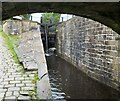
Station Road Bridge No 60

 
Station Bridge, Kirklees HD7 6DE, United Kingdom
 
Information about the place
Station Road Bridge No 60 is a minor waterways place on the Huddersfield Narrow Canal between Tunnel End Footbridge No 62 (4¼ furlongs to the west) and Railway Lock No 42E (Marsden. Eastern summit lock) (¼ furlongs to the east).
 
 
The nearest place in the direction of Tunnel End Footbridge No 62 is Marsden Pipe Bridge; a few yards away.

There may be access to the towpath here.

Mooring here is good (a nice place to moor), mooring rings or bollards are available.

There is a bridge here which takes a minor road over the canal.


Amenities

Amenities nearby at Marsden Pipe Bridge

 Marsden Station
 
Maps
If you are a user and are logged on, or if you are actively planning a route, a map will be displayed here.
Show on external mapping site: Google | OSM | Bing
 
Photos
 
External websites
There are no links to external websites from here.
Why not log in and add some (select "External websites" from the menu (sometimes this is under "Edit"))?
 
Nearest facilities

Mouseover for more information or show routes to facility

Nearest water point

In the direction of Ashton-under-Lyne Junction

On this waterway in the direction of Ashton-under-Lyne Junction
Standedge Tunnel (western entrance)3 miles, 6¾ furlongs away
On this waterway in the direction of Ashton-under-Lyne Junction
Wool Road Bridge No 705 miles, 6½ furlongs and 9 locks away
On this waterway in the direction of Ashton-under-Lyne Junction
Grove Road Bridge No 9611 miles, 6¾ furlongs and 24 locks away
On this waterway in the direction of Ashton-under-Lyne Junction
Fairfield Junction19 miles, 3 furlongs and 32 locks away
Travel to Ashton-under-Lyne Junction, then on the Ashton Canal (Main Line) to Fairfield Junction

In the direction of Aspley Basin (Huddersfield)

Slaithwaite Winding Hole2 miles, 6 furlongs and 21 locks away
On this waterway in the direction of Aspley Basin (Huddersfield)
Waterside Lock No 21E2 miles, 6¾ furlongs and 21 locks away
On this waterway in the direction of Aspley Basin (Huddersfield)
Aspley Basin (Huddersfield)7 miles, 4¼ furlongs and 42 locks away
On this waterway in the direction of Aspley Basin (Huddersfield)
Shepley Bridge Sanitary Station14 miles, 1 furlong and 53 locks away
Travel to Aspley Basin (Huddersfield), then on the Huddersfield Broad Canal to Cooper Bridge Junction, then on the Calder and Hebble Navigation (Main Line) to Shepley Bridge Sanitary Station
Brighouse Basin13 miles, 2¾ furlongs and 55 locks away
Travel to Aspley Basin (Huddersfield), then on the Huddersfield Broad Canal to Cooper Bridge Junction, then on the Calder and Hebble Navigation (Main Line) to Brighouse Basin
Salterhebble Sanitary Station17 miles, 4¾ furlongs and 64 locks away
Travel to Aspley Basin (Huddersfield), then on the Huddersfield Broad Canal to Cooper Bridge Junction, then on the Calder and Hebble Navigation (Main Line) to Salterhebble Sanitary Station
Salterhebble Junction17 miles, 5 furlongs and 65 locks away
Travel to Aspley Basin (Huddersfield), then on the Huddersfield Broad Canal to Cooper Bridge Junction, then on the Calder and Hebble Navigation (Main Line) to Salterhebble Junction
Sowerby Bridge Basin19 miles, 7 furlongs and 65 locks away
Travel to Aspley Basin (Huddersfield), then on the Huddersfield Broad Canal to Cooper Bridge Junction, then on the Calder and Hebble Navigation (Main Line) to Salterhebble Junction, then on the Calder and Hebble Navigation (Main Line) to Sowerby Bridge Basin

Nearest rubbish disposal

In the direction of Ashton-under-Lyne Junction

Wool Road Visitor Mooring5 miles, 7 furlongs and 9 locks away
On this waterway in the direction of Ashton-under-Lyne Junction

In the direction of Aspley Basin (Huddersfield)

Pickle Lock No 22E2 miles, 5½ furlongs and 20 locks away
On this waterway in the direction of Aspley Basin (Huddersfield)
Aspley Basin (Huddersfield)7 miles, 4¼ furlongs and 42 locks away
On this waterway in the direction of Aspley Basin (Huddersfield)
Shepley Bridge Sanitary Station14 miles, 1 furlong and 53 locks away
Travel to Aspley Basin (Huddersfield), then on the Huddersfield Broad Canal to Cooper Bridge Junction, then on the Calder and Hebble Navigation (Main Line) to Shepley Bridge Sanitary Station
Brighouse Lower Basin Visitor Moorings13 miles, 2¼ furlongs and 54 locks away
Travel to Aspley Basin (Huddersfield), then on the Huddersfield Broad Canal to Cooper Bridge Junction, then on the Calder and Hebble Navigation (Main Line) to Brighouse Lower Basin Visitor Moorings
Horbury Basin Residential Moorings & Sanitary Station18 miles, 5¼ furlongs and 60 locks away
Travel to Aspley Basin (Huddersfield), then on the Huddersfield Broad Canal to Cooper Bridge Junction, then on the Calder and Hebble Navigation (Main Line) to Horbury Basin Residential Moorings & Sanitary Station
Salterhebble Sanitary Station17 miles, 4¾ furlongs and 64 locks away
Travel to Aspley Basin (Huddersfield), then on the Huddersfield Broad Canal to Cooper Bridge Junction, then on the Calder and Hebble Navigation (Main Line) to Salterhebble Sanitary Station
Sowerby Bridge Basin19 miles, 7 furlongs and 65 locks away
Travel to Aspley Basin (Huddersfield), then on the Huddersfield Broad Canal to Cooper Bridge Junction, then on the Calder and Hebble Navigation (Main Line) to Salterhebble Junction, then on the Calder and Hebble Navigation (Main Line) to Sowerby Bridge Basin

Nearest chemical toilet disposal

In the direction of Ashton-under-Lyne Junction

Wool Road Bridge No 705 miles, 6½ furlongs and 9 locks away
On this waterway in the direction of Ashton-under-Lyne Junction
Grove Road Bridge No 9611 miles, 6¾ furlongs and 24 locks away
On this waterway in the direction of Ashton-under-Lyne Junction
Fairfield Junction19 miles, 3 furlongs and 32 locks away
Travel to Ashton-under-Lyne Junction, then on the Ashton Canal (Main Line) to Fairfield Junction

In the direction of Aspley Basin (Huddersfield)

Pickle Lock No 22E2 miles, 5½ furlongs and 20 locks away
On this waterway in the direction of Aspley Basin (Huddersfield)
Waterside Lock No 21E2 miles, 6¾ furlongs and 21 locks away
On this waterway in the direction of Aspley Basin (Huddersfield)
Aspley Basin (Huddersfield)7 miles, 4¼ furlongs and 42 locks away
On this waterway in the direction of Aspley Basin (Huddersfield)
Shepley Bridge Sanitary Station14 miles, 1 furlong and 53 locks away
Travel to Aspley Basin (Huddersfield), then on the Huddersfield Broad Canal to Cooper Bridge Junction, then on the Calder and Hebble Navigation (Main Line) to Shepley Bridge Sanitary Station
Brighouse Basin13 miles, 2¾ furlongs and 55 locks away
Travel to Aspley Basin (Huddersfield), then on the Huddersfield Broad Canal to Cooper Bridge Junction, then on the Calder and Hebble Navigation (Main Line) to Brighouse Basin
Savile Town Wharf and Basin (Dewsbury)17 miles, 4¼ furlongs and 57 locks away
Travel to Aspley Basin (Huddersfield), then on the Huddersfield Broad Canal to Cooper Bridge Junction, then on the Calder and Hebble Navigation (Main Line) to Dewsbury Arm Junction, then on the Calder and Hebble Navigation (Dewsbury Old Cut) to Savile Town Wharf and Basin (Dewsbury)
Horbury Basin Residential Moorings & Sanitary Station18 miles, 5¼ furlongs and 60 locks away
Travel to Aspley Basin (Huddersfield), then on the Huddersfield Broad Canal to Cooper Bridge Junction, then on the Calder and Hebble Navigation (Main Line) to Horbury Basin Residential Moorings & Sanitary Station
Salterhebble Sanitary Station17 miles, 4¾ furlongs and 64 locks away
Travel to Aspley Basin (Huddersfield), then on the Huddersfield Broad Canal to Cooper Bridge Junction, then on the Calder and Hebble Navigation (Main Line) to Salterhebble Sanitary Station
Sowerby Bridge Basin19 miles, 7 furlongs and 65 locks away
Travel to Aspley Basin (Huddersfield), then on the Huddersfield Broad Canal to Cooper Bridge Junction, then on the Calder and Hebble Navigation (Main Line) to Salterhebble Junction, then on the Calder and Hebble Navigation (Main Line) to Sowerby Bridge Basin

Nearest place to turn

In the direction of Ashton-under-Lyne Junction

On this waterway in the direction of Ashton-under-Lyne Junction
Diggle Winding Hole4 miles, 1½ furlongs away
On this waterway in the direction of Ashton-under-Lyne Junction
Wool Road Winding Hole5 miles, 7½ furlongs and 9 locks away
On this waterway in the direction of Ashton-under-Lyne Junction
Saddleworth Visitor Centre Winding Hole6 miles, 5¼ furlongs and 11 locks away
On this waterway in the direction of Ashton-under-Lyne Junction
Manns Wharf Bridge Winding Hole8 miles, ¼ furlongs and 13 locks away
On this waterway in the direction of Ashton-under-Lyne Junction
Roughtown Court Winding Hole9 miles, 1½ furlongs and 18 locks away
On this waterway in the direction of Ashton-under-Lyne Junction
Mossley Bottoms Winding Hole10 miles, 1¼ furlongs and 20 locks away
On this waterway in the direction of Ashton-under-Lyne Junction
Knowle Street Winding Hole14 miles, 1¼ furlongs and 25 locks away
On this waterway in the direction of Ashton-under-Lyne Junction
Staley Wharf Winding Hole15 miles, 3¼ furlongs and 29 locks away
On this waterway in the direction of Ashton-under-Lyne Junction
Ashton-under-Lyne Junction16 miles, 3 furlongs and 32 locks away
On this waterway in the direction of Ashton-under-Lyne Junction
Dukinfield Junction16 miles, 7 furlongs and 32 locks away
Travel to Ashton-under-Lyne Junction, then on the Ashton Canal (Main Line) to Dukinfield Junction
Portland Basin Arm16 miles, 7¼ furlongs and 32 locks away
Travel to Ashton-under-Lyne Junction, then on the Ashton Canal (Main Line) to Dukinfield Junction, then on the Peak Forest Canal (Lower) to Portland Basin Arm

In the direction of Aspley Basin (Huddersfield)

Booth Lock Winding Hole1 mile, 1 furlong and 11 locks away
On this waterway in the direction of Aspley Basin (Huddersfield)
Slaithwaite Winding Hole2 miles, 6 furlongs and 21 locks away
On this waterway in the direction of Aspley Basin (Huddersfield)
Linthwaite Winding Hole3 miles, 6¾ furlongs and 26 locks away
On this waterway in the direction of Aspley Basin (Huddersfield)
Isis Lock Winding Hole5 miles, 3 furlongs and 34 locks away
On this waterway in the direction of Aspley Basin (Huddersfield)
University Arm7 miles, 3¾ furlongs and 42 locks away
On this waterway in the direction of Aspley Basin (Huddersfield)
Aspley Basin (Huddersfield)7 miles, 4¼ furlongs and 42 locks away
On this waterway in the direction of Aspley Basin (Huddersfield)
Anchor Street Winding Hole8 miles, 1¼ furlongs and 42 locks away
Travel to Aspley Basin (Huddersfield), then on the Huddersfield Broad Canal to Anchor Street Winding Hole
New Road Winding Hole8 miles, 4¾ furlongs and 42 locks away
Travel to Aspley Basin (Huddersfield), then on the Huddersfield Broad Canal to New Road Winding Hole

Nearest self-operated pump-out

In the direction of Ashton-under-Lyne Junction

Wool Road Bridge No 705 miles, 6½ furlongs and 9 locks away
On this waterway in the direction of Ashton-under-Lyne Junction

In the direction of Aspley Basin (Huddersfield)

Slaithwaite Winding Hole2 miles, 6 furlongs and 21 locks away
On this waterway in the direction of Aspley Basin (Huddersfield)

Nearest boatyard pump-out

In the direction of Ashton-under-Lyne Junction

Portland Basin Arm16 miles, 7¼ furlongs and 32 locks away
Travel to Ashton-under-Lyne Junction, then on the Ashton Canal (Main Line) to Dukinfield Junction, then on the Peak Forest Canal (Lower) to Portland Basin Arm

In the direction of Aspley Basin (Huddersfield)

Aspley Basin (Huddersfield)7 miles, 4¼ furlongs and 42 locks away
On this waterway in the direction of Aspley Basin (Huddersfield)
Shepley Bridge Marina14 miles, 1¼ furlongs and 53 locks away
Travel to Aspley Basin (Huddersfield), then on the Huddersfield Broad Canal to Cooper Bridge Junction, then on the Calder and Hebble Navigation (Main Line) to Shepley Bridge Marina
Sowerby Bridge Basin19 miles, 7 furlongs and 65 locks away
Travel to Aspley Basin (Huddersfield), then on the Huddersfield Broad Canal to Cooper Bridge Junction, then on the Calder and Hebble Navigation (Main Line) to Salterhebble Junction, then on the Calder and Hebble Navigation (Main Line) to Sowerby Bridge Basin
Direction of TV transmitter (From Wolfbane Cybernetic)
 
 
Geograph
 
Wikipedia

Wikipedia has a page about Station Road Bridge

The Station Road Bridge, near Brecksville, Ohio, was built in 1882. It spans the Cuyahoga River between Cuyahoga County and Summit County, Ohio. It was listed on the National Register of Historic Places in 1979.

The bridge was documented in the Historic American Engineering Record in 1985.

It was built by the Massillon Bridge Company. It is a Pratt Whipple truss bridge, described as "a metal through truss of the double-intersection Pratt (Whipple) type. The essential features of the type are inclined end posts and diagonal (tension) members that extend across two panels. The bridge features an ornamental plate at the top chord at each approach which reads "Massillon Bridge Company / 82 / Builders, Massillon, Ohio".

The bridge is 128.6 feet (39.2 m) long with a single span covering 124 feet (38 m). It is 18.7 feet (5.7 m) wide carrying a roadway 14.95 feet (4.56 m) wide.

Other Wikipedia pages that might relate to Station Road Bridge
[Forth Road Bridge] Forth Road Bridge is a suspension bridge in east central Scotland. The bridge opened in 1964 and at the time was the longest suspension bridge in the [Lea Bridge Road] road are the Lea Valley Park, Lea Bridge railway station and the Baker's Arms area. Formerly the Lea Bridge Stadium was located along Lea Bridge Road [Digha–Sonpur Bridge] The Digha–Sonpur bridge (Hindi: दीघा-सोनपुर पुल) or J.P. Setu (Hindi: जेपी सेतु) is a rail-cum-road bridge across river Ganga, connecting Digha Ghat in [Westminster Bridge Road] Lambeth North Underground station (named Westminster Bridge Road station July 1906 — April 1917. There Baylis Road, Hercules Road and the A23 branch off [Basin Bridge railway station] Basin Bridge Junction is a station on the Chennai Suburban Railway and serves the locality of Basin Bridge, the confluence on the Otteri Nullah and Buckingham [Øresund Bridge] railway and motorway bridge across the Øresund strait between Sweden and Denmark. It is the longest combined road and rail bridge in Europe, running nearly [River Don Navigation] there is a road and pedestrian bridge across the river into Forge Island. Bridge Street Bridge (Chantry Bridge) is a single-span metal bridge that carries [Lea Bridge railway station] Anglia. The station is located on Argall Way, close to its junction with Lea Bridge Road (A104) and Orient Way, serving the areas of Lea Bridge and Leyton [Bogibeel Bridge] Bogibeel bridge is a combined road and rail bridge over the Brahmaputra River in the northeastern Indian state of Assam between Dhemaji district and Dibrugarh
 
Google

Results of Google Search

Pump Station Road Bridge | Springdale, AR
The bridge on Pump Station Road was damaged in the April 2017 flood. The design and construction of a new bridge is being accomplished by Arkansas Department of Transportation (ArDOT) using emergency bridge funds. ... Resolution No. 60-18 · 40th Street · 48th Street · 64th Street · Ball Road and County Line Road ...
Hampton Roads Bridge–Tunnel - Wikipedia
The Hampton Roads Bridge–Tunnel (HRBT) is a 3.5-mile (5.6 km)-long Hampton Roads crossing for Interstate 64 and U.S. Route 60. ... There were two routes: one from Hampton Boulevard near Naval Station ... A bridge–tunnel, if destroyed in wartime or due to natural disaster, would not block the vital shipping channels.
U.S. Route 60 in Kentucky - Wikipedia
U.S. Route 60 (US 60) in the state of Kentucky parallels the Ohio River from Cairo , Illinois, to ... US 60 is concurrent with US 51 and US 62 from the Ohio River bridge to the town of Wickliffe. ... Originally built as a bypass route around downtown Louisville, US 60 Alt. used several existing roads running through Louisville to ...
60 - Hayfield - New Mills - Whaley Bridge - Macclesfield – High Peak ...
60 - Hayfield - New Mills - Whaley Bridge - Macclesfield. A bus service operated ... Hayfield, adj Bus Station, 07:14, 08:10, 08:50, 09:50, 11:50, 13:50, 16:00, 16: 50. Hayfield, opp New ... New Mills, opp Cale Road, 08:21. New Mills, adj School  ...
Bus lane and bus gate enforcement - Buses
If you drive illegally in a bus lane then you may receive a £60 fine. A number of bus lanes across the city have been identified by the bus ... Bridge Street ( heading into and out of the City); Station Road - Buses and authorised vehicles only.
Fayette 7-8909 I-75 - Widening Study
three bridges overpassing the corridor at Bryan Station Road, Russell Cave ... Based on survey data, the typical lane width is reduced to no less than 60 feet.
Routes & times - Reading Buses
Reading Station to Calcot (IKEA) via Southcote, Ford's Farm, Beansheaf. 27; 29. Central Reading to Lower Caversham (Amersham Road) via Caversham Bridge  ...
FM 60 (Raymond Stotzer Parkway) Overpass Improvement
The project limits are from Turkey Creek Road to Research Parkway with a length of 0.5 mile. No additional right of way is required. ... Brazos River, primary crosstown arterial for College Station and key access to Texas A&M University ... Widen existing bridge over FM 2818 to six travel lanes (three west and three east ) with ...