River Lark Junction Bridge
is a minor waterways place
on the River Great Ouse (River Lark) between
Prickwillow Bridge (2 miles and ½ furlongs
to the southeast) and
Old West River - River Lark Junction (Junction of River Lark with Old West River) (¼ furlongs
to the northwest).
The nearest place in the direction of Prickwillow Bridge is Railway Bridge (Norwich to Ely Line);
1 mile and 6½ furlongs
away.
There is no access to the towpath here.
Mooring here is unrated.
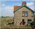
There is a bridge here which takes a minor road over the canal.
| Isleham Lock Weir Exit | 7 miles, 6¾ furlongs | |
| Prickwillow Winding Hole | 2 miles, ½ furlongs | |
| Prickwillow Bridge | 2 miles, ½ furlongs | |
| Prickwillow Visitor Moorings (EA) | 2 miles, ¼ furlongs | |
| Railway Bridge (Norwich to Ely Line) | 1 mile, 6½ furlongs | |
| River Lark Junction Bridge | ||
| Old West River - River Lark Junction | ¼ furlongs | |
- Great Ouse Navigation | boating, moorings, navigation notices — associated with River Great Ouse
- Information regarding the Great Ouse navigation and tributaries.
- Information for boaters on the River Great Ouse - GOV.UK — associated with River Great Ouse
- River Great Ouse: bridge heights, locks, overhead power lines and facilities.
- Facebook Account — associated with River Great Ouse
- Anglian Waterways Manager Facebook Account
- Facebook Anglian Waterways Page — associated with River Great Ouse
- Facebook Page for Environment Agency Anglian Waterways
Mouseover for more information or show routes to facility
Nearest water point
In the direction of West Row Bridge
Prickwillow Visitor Moorings (EA) — 2 miles, ¼ furlongs away
On this waterway in the direction of West Row Bridge
In the direction of Old West River - River Lark Junction
Willow Walk Visitor Moorings — 3 miles, 5½ furlongs away
Travel to Old West River - River Lark Junction, then on the River Great Ouse (Old West River - Large River) to Willow Walk Visitor Moorings
Fish and Duck Marina Fuel Dock — 7 miles, 4 furlongs away
Travel to Old West River - River Lark Junction, then on the River Great Ouse (Old West River - Large River) to Pope's Corner, then on the River Great Ouse (Old West River - Small River) to Fish and Duck Marina Fuel Dock
Fish and Duck Marina — 7 miles, 4¼ furlongs away
Travel to Old West River - River Lark Junction, then on the River Great Ouse (Old West River - Large River) to Pope's Corner, then on the River Cam (Main river - Large River) to Fish and Duck Marina
Windmill EA Mooring — 9 miles, 2¾ furlongs away
Travel to Old West River - River Lark Junction, then on the River Great Ouse (Old West River - Large River) to Windmill EA Mooring
Reach Lode Sluice — 10 miles, 5¼ furlongs away
Travel to Old West River - River Lark Junction, then on the River Great Ouse (Old West River - Large River) to Pope's Corner, then on the River Cam (Main river - Large River) to Cam - Reach Lode Junction, then on the River Cam (Burwell Lode) to Reach Lode Sluice
Denver Sluice — 12 miles, 2½ furlongs away
Travel to Old West River - River Lark Junction, then on the River Great Ouse (Old West River - Large River) to Denver Sluice
Downham Market Road Bridge — 13 miles, 6¼ furlongs and 1 lock away
Travel to Old West River - River Lark Junction, then on the River Great Ouse (Old West River - Large River) to Old West River - Great Ouse Relief Channel Junction, then on the River Great Ouse (Great Ouse Relief Channel) to Downham Market Road Bridge
West Head Road Bridge — 16 miles, 1½ furlongs and 1 lock away
Travel to Old West River - River Lark Junction, then on the River Great Ouse (Old West River - Large River) to Old West River - Great Ouse Relief Channel Junction, then on the River Great Ouse (Great Ouse Relief Channel) to West Head Road Bridge
Stowbridge Heron EA Moorings — 16 miles, 1¾ furlongs and 1 lock away
Travel to Old West River - River Lark Junction, then on the River Great Ouse (Old West River - Large River) to Old West River - Great Ouse Relief Channel Junction, then on the River Great Ouse (Great Ouse Relief Channel) to Stowbridge Heron EA Moorings
Wiggenhall St Mary Magdalen — 18 miles, 6¼ furlongs and 1 lock away
Travel to Old West River - River Lark Junction, then on the River Great Ouse (Old West River - Large River) to Old West River - Great Ouse Relief Channel Junction, then on the River Great Ouse (Great Ouse Relief Channel) to Wiggenhall St Mary Magdalen
Upwell Church Bridge Public Staithe (visitor mooring) — 18 miles, 4½ furlongs and 2 locks away
Travel to Old West River - River Lark Junction, then on the River Great Ouse (Old West River - Large River) to Denver Junction, then on the River Great Ouse (New Bedford River) to Salter's Lode Junction, then on the Middle Level Navigations (Well Creek) to Outwell - Lance Hunter Rowe Boat Basin, then on the Middle Level Navigations (Old River Nene) to Upwell Church Bridge Public Staithe (visitor mooring)
Westview Marina & Leisure Park — 19 miles, 5¼ furlongs and 1 lock away
Travel to Old West River - River Lark Junction, then on the River Great Ouse (Old West River - Large River) to Pope's Corner, then on the River Great Ouse (Old West River - Small River) to Earith Junction, then on the River Great Ouse (Tidal Section) to Westview Marina & Leisure ParkNearest rubbish disposal
In the direction of Old West River - River Lark Junction
Willow Walk Visitor Moorings — 3 miles, 5½ furlongs away
Travel to Old West River - River Lark Junction, then on the River Great Ouse (Old West River - Large River) to Willow Walk Visitor Moorings
Hermitage Lock — 18 miles, 7¾ furlongs away
Travel to Old West River - River Lark Junction, then on the River Great Ouse (Old West River - Large River) to Pope's Corner, then on the River Great Ouse (Old West River - Small River) to Hermitage Lock
Upwell Church Bridge Public Staithe (visitor mooring) — 18 miles, 4½ furlongs and 2 locks away
Travel to Old West River - River Lark Junction, then on the River Great Ouse (Old West River - Large River) to Denver Junction, then on the River Great Ouse (New Bedford River) to Salter's Lode Junction, then on the Middle Level Navigations (Well Creek) to Outwell - Lance Hunter Rowe Boat Basin, then on the Middle Level Navigations (Old River Nene) to Upwell Church Bridge Public Staithe (visitor mooring)Nearest chemical toilet disposal
In the direction of Old West River - River Lark Junction
Willow Walk Visitor Moorings — 3 miles, 5½ furlongs away
Travel to Old West River - River Lark Junction, then on the River Great Ouse (Old West River - Large River) to Willow Walk Visitor Moorings
Fish and Duck Marina — 7 miles, 4¼ furlongs away
Travel to Old West River - River Lark Junction, then on the River Great Ouse (Old West River - Large River) to Pope's Corner, then on the River Cam (Main river - Large River) to Fish and Duck Marina
Denver Sluice — 12 miles, 2½ furlongs away
Travel to Old West River - River Lark Junction, then on the River Great Ouse (Old West River - Large River) to Denver Sluice
Westview Marina & Leisure Park — 19 miles, 5¼ furlongs and 1 lock away
Travel to Old West River - River Lark Junction, then on the River Great Ouse (Old West River - Large River) to Pope's Corner, then on the River Great Ouse (Old West River - Small River) to Earith Junction, then on the River Great Ouse (Tidal Section) to Westview Marina & Leisure ParkNearest place to turn
In the direction of West Row Bridge
Prickwillow Winding Hole — 2 miles, ½ furlongs away
On this waterway in the direction of West Row Bridge
Isleham Lock Weir Exit — 7 miles, 6¾ furlongs away
On this waterway in the direction of West Row Bridge
Isleham Lock Weir Entrance — 8 miles, 2¼ furlongs and 1 lock away
On this waterway in the direction of West Row Bridge
In the direction of Old West River - River Lark Junction
Old West River - River Lark Junction — ¼ furlongs away
On this waterway in the direction of Old West River - River Lark Junction
Holmes River Junction — 1 mile, 7½ furlongs away
Travel to Old West River - River Lark Junction, then on the River Great Ouse (Old West River - Large River) to Holmes River Junction
Willow Walk Winding Hole — 3 miles, 5¼ furlongs away
Travel to Old West River - River Lark Junction, then on the River Great Ouse (Old West River - Large River) to Willow Walk Winding Hole
Brandon Creek Junction — 5 miles, 3½ furlongs away
Travel to Old West River - River Lark Junction, then on the River Great Ouse (Old West River - Large River) to Brandon Creek Junction
Great Ouse - Braham Dock Junction — 5 miles, 4¼ furlongs away
Travel to Old West River - River Lark Junction, then on the River Great Ouse (Old West River - Large River) to Great Ouse - Braham Dock Junction
Pope's Corner — 7 miles, 3½ furlongs away
Travel to Old West River - River Lark Junction, then on the River Great Ouse (Old West River - Large River) to Pope's Corner
Fish and Duck Marina — 7 miles, 4¼ furlongs away
Travel to Old West River - River Lark Junction, then on the River Great Ouse (Old West River - Large River) to Pope's Corner, then on the River Cam (Main river - Large River) to Fish and Duck Marina
Little Ouse - Lakenheath Lode Junction — 11 miles away
Travel to Old West River - River Lark Junction, then on the River Great Ouse (Old West River - Large River) to Brandon Creek Junction, then on the River Great Ouse (Little Ouse or Brandon Creek) to Little Ouse - Lakenheath Lode Junction
Wicken Lode Junction — 10 miles, 7½ furlongs and 1 lock away
Travel to Old West River - River Lark Junction, then on the River Great Ouse (Old West River - Large River) to Pope's Corner, then on the River Cam (Main river - Large River) to Cam - Reach Lode Junction, then on the River Cam (Burwell Lode) to Wicken Lode Junction
Old West River - Great Ouse Relief Channel Junction — 12 miles, 1½ furlongs away
Travel to Old West River - River Lark Junction, then on the River Great Ouse (Old West River - Large River) to Old West River - Great Ouse Relief Channel Junction
Denver Relief Channel Lock Weir Entrance — 12 miles, 2¼ furlongs away
Travel to Old West River - River Lark Junction, then on the River Great Ouse (Old West River - Large River) to Old West River - Great Ouse Relief Channel Junction, then on the River Great Ouse (Great Ouse Relief Channel) to Denver Relief Channel Lock Weir Entrance
Denver Junction — 12 miles, 2¾ furlongs and 1 lock away
Travel to Old West River - River Lark Junction, then on the River Great Ouse (Old West River - Large River) to Denver Junction
Salter's Lode Junction — 12 miles, 5¾ furlongs and 1 lock away
Travel to Old West River - River Lark Junction, then on the River Great Ouse (Old West River - Large River) to Denver Junction, then on the River Great Ouse (New Bedford River) to Salter's Lode Junction
Bottisham Lock Weir Exit — 14 miles, 1½ furlongs away
Travel to Old West River - River Lark Junction, then on the River Great Ouse (Old West River - Large River) to Pope's Corner, then on the River Cam (Main river - Large River) to Bottisham Lock Weir Exit
Welmore Sluice — 14 miles, ½ furlongs and 1 lock away
Travel to Old West River - River Lark Junction, then on the River Great Ouse (Old West River - Large River) to Denver Junction, then on the River Great Ouse (New Bedford River) to Welmore Sluice
Baits Bite Lock Weir Exit — 17 miles, 1¼ furlongs and 1 lock away
Travel to Old West River - River Lark Junction, then on the River Great Ouse (Old West River - Large River) to Pope's Corner, then on the River Cam (Main river - Large River) to Baits Bite Lock Weir Exit
Brandon Lock Weir Exit — 18 miles, 3½ furlongs away
Travel to Old West River - River Lark Junction, then on the River Great Ouse (Old West River - Large River) to Brandon Creek Junction, then on the River Great Ouse (Little Ouse or Brandon Creek) to Brandon Lock Weir ExitNearest self-operated pump-out
In the direction of Old West River - River Lark Junction
Willow Walk Visitor Moorings — 3 miles, 5½ furlongs away
Travel to Old West River - River Lark Junction, then on the River Great Ouse (Old West River - Large River) to Willow Walk Visitor Moorings
Denver Sluice — 12 miles, 2½ furlongs away
Travel to Old West River - River Lark Junction, then on the River Great Ouse (Old West River - Large River) to Denver Sluice
Westview Marina & Leisure Park — 19 miles, 5¼ furlongs and 1 lock away
Travel to Old West River - River Lark Junction, then on the River Great Ouse (Old West River - Large River) to Pope's Corner, then on the River Great Ouse (Old West River - Small River) to Earith Junction, then on the River Great Ouse (Tidal Section) to Westview Marina & Leisure ParkNearest boatyard pump-out
In the direction of Old West River - River Lark Junction
Fish and Duck Marina — 7 miles, 4¼ furlongs away
Travel to Old West River - River Lark Junction, then on the River Great Ouse (Old West River - Large River) to Pope's Corner, then on the River Cam (Main river - Large River) to Fish and Duck Marina
Denver Sluice — 12 miles, 2½ furlongs away
Travel to Old West River - River Lark Junction, then on the River Great Ouse (Old West River - Large River) to Denver SluiceDirection of TV transmitter (From Wolfbane Cybernetic)
There is no page on Wikipedia called “River Lark Junction Bridge”
Wikipedia pages that might relate to River Lark Junction Bridge
[River Lark]
The River Lark is a river in England that crosses the border between Suffolk and Cambridgeshire. It is a tributary of the River Great Ouse, and was extended
[River Great Ouse]
to the west at Littleport, between its present junctions with the River Little Ouse and the River Lark, and made its way via Welney, Upwell and Outwell
[River Wissey]
Below the village is the junction with the Cut-off Channel, a 28-mile (45 km) drain running from Barton Mills on the River Lark to Denver along the south-eastern
[River Arun]
part of the Railway and Canal Traffic Act of 1888. The River Lark in Suffolk was the only other river navigation abandoned at that time. The Board of Trade
[U.S. Route 9 in New York]
(North Pearl Street), which continues north, and US 9W (Lark Street), which ends at the junction. US 9 turns north on Henry Johnson Boulevard and widens
[New York State Route 443]
NY 443 and US 9W turn north into a junction with US 20 (Madison Avenue). At this intersection, US 9W runs north on Lark Street, while NY 443 terminates at
[Rochdale Branch Canal]
Beyond was Halfpenny Bridge, although not named as such in 1851, and the twin-tracked railway bridge. Sandwiched between them was Lark Corn Mill on the west
[River Gipping]
Stowupland Lock was just below the junction, beyond which the river passes under the A1120 road bridge. Beyond the bridge, Badley Mill House is a seventeenth-century
[River Little Ouse]
navigable for 16.6 miles (26.7 km) from its junction with the River Great Ouse to Santon Downham bridge. There are references to its use by boats carrying
[Cheyne Walk]
meets Cremorne Road end-on at the junction with Lots Road. The Walk runs alongside the River Thames until Battersea Bridge where, for a short distance, it
Results of Google Search
River Lark - WikipediaThe navigation was officially abandoned in 1888, but despite this, commercial use of the river continued until 1928. Following acquisition by the Great Ouse Catchment Board, locks at Barton Mills and Icklingham were rebuilt in the 1960s, but were isolated when the A11 road bridge was lowered soon afterwards. It now has ...
The River Lark Navigation Table of Landmarks and Distances. ... The River Lark From Bury to the Great Ouse. Miles. Locks/ Staunches. Navigable (N). Grid ref. OS 1:50000 Landranger Map No. Eastgate Bridge. Eastgate Street, Bury St Edmunds The legal terminus of the ... Junction with Cut to Fornham Wharf. The Cut ran ...
Description of River Lark (Great Ouse): A tributary of the Great Ouse, originally navigable for 24.5 miles from Bury St Edmunds but now only navigable from Judes Ferry, .... Prickwillow Bridge. B1382 Ely road. 22.5. 24. N. TL597824. 143. Railway bridge. Norwich to Ely Line. 22.8. 24. N. TL596828. 143. Great Ouse Junction.
RIVER LARK: Distance Table. M, F. Northgate Dock, Bury St. Edmunds (ultimate terminus), 855653, 0, 0. Bury St. Edmunds Bypass Bridge (A45 Ipswich to Cambridge Road), 854653, 0, 1. Tollgate Lock No 1, 853661, 0, 5. Tollgate Bridge, Bury St. Edmunds (Al34 Thetford road), 852661, 0, 5. Junction with short branch to ...
Sep 28, 2015 ... Challenges. • Compiegne Way approach is narrow with limited scope for expansion. • The River Lark bridge limits ability to provide additional capacity. • Congestion on the Compiegne Way roundabout can impact on A14 off-slip with potential queues on the west bound carriageway. • Lack of pedestrian ...
River Lark. FACTS IN BRIEF. • Flowing north west from its source south of Bury St Edmunds, the River Lark runs' into the Fenlands north of Ely joining the Ely Ouse near Prickwillow. ... From Eastgate Bridge, Bury St Edmunds to Great Branch Bridge near the Lark's ... final 14.5 km stretch to the junction with the Ely Ouse the .
The River Lark was once navigable all the way to Bury St. Edmunds, a winding course of around 25 miles. The Romans straightened the lower 4 miles of ... disadvantage the land carriers even more). Lambe (not surprisingly) was happy to agree to this and he also said he would provide bridges and fords where appropriate.
This bridge is one of five McDonald trusses remaining in NSW to date (one of which is no longer used by road traffic) and it is readily accessible from Sydney and the nearby alpine areas, situated in an idyllic rural setting over the Tumut River. The bridge is the only existing triple span arrangement of the McDonald's truss, ...
(651) 565-4158. River Junctions Art Council (651) 565-5414. River Junction Arts Council: “Music Under the Bridge†(651) 565-4158 ... Jewels on the River (651) 565-4776. LARK Toys www.larktoys.com (507) 767-3387. National Eagle Center www.nationaleaglecenter.org (877) 332-4537. On the River Boutique (651) 565-  ...


![Branch Bridge, 2006. The Branch Bank road crosses the River Lark, just before the confluence with the River Great Ouse (ahead).This bridge was demolished in 2009 and replaced with a new one, seen here [[3044038]] . by Rose and Trev Clough – 08 June 2006](https://s3.geograph.org.uk/geophotos/03/64/19/3641971_cdf865a7_120x120.jpg)