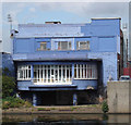
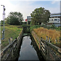
Grantham Canal Junction
Junction of the River Trent with the abandoned Grantham Canal
Nottingham Office Equipment, Meadow Lane, Nottingham NG2 3HQ, United Kingdom

Grantham Canal Junction
is a place on the waterways
at the junction of
the River Trent (non-tidal section)
with
the Grantham Canal.
Stoke Bardolph
is on
the River Trent (non-tidal section),
6 miles and ¾ furlongs
and 2 locks
to the east.
Meadow Lane Junction (Junction of Nottingham Canal with River Trent)
is on
the River Trent (non-tidal section),
1½ furlongs
to the southwest.
Grantham Basin (Infilled)
is on
the Grantham Canal,
32 miles and 7½ furlongs
and 18 locks
to the east.
The nearest place in the direction of Stoke Bardolph is Lady Bay Bridge;
½ furlongs
away.
The nearest place in the direction of Grantham Basin is Trent Lock No 1 Footbridge;
¼ furlongs
away.
Mooring here is unrated.
| River Trent (non-tidal section) | ||
|---|---|---|
| Holme Lock No 5 | 2 miles, 1½ furlongs | |
| Holme Lock Weir Entrance | 2 miles | |
| National Water Sports Centre (slalom course entrance) | 1 mile, 7 furlongs | |
| Colwick Country Park Marina | 1 mile, 6 furlongs | |
| Lady Bay Bridge | ½ furlongs | |
| Grantham Canal Junction | ||
| Meadow Lane Junction | 1½ furlongs | |
| Trent Bridge | 2¾ furlongs | |
| Nottingham County Hall | 4 furlongs | |
| Wilford Suspension Bridge | 5½ furlongs | |
| Wilford Toll Bridge | 1 mile, 4¼ furlongs | |
| Grantham Canal | ||
| Grantham Canal Junction | ||
| Trent Lock No 1 Footbridge | ¼ furlongs | |
| Trent Lock No 1 | ¼ furlongs | |
| Lady Bay Bridge No 2 | 1½ furlongs | |
| A6011 Road Bridge | 2¾ furlongs | |
| Flood Gate (Grantham Canal) | 4½ furlongs | |
Amenities nearby at Lady Bay Bridge
Amenities in Nottingham
Amenities at other places in Nottingham
There are no links to external websites from here.
Why not log in and add some (select "External websites" from the menu (sometimes this is under "Edit"))?
Mouseover for more information or show routes to facility
Nearest water point
In the direction of Wilford Toll Bridge
Beeston Lock No 5 — 6 miles, ¾ furlongs and 2 locks away
Travel to Meadow Lane Junction, then on the River Trent (Nottingham Canal) to Lenton Chain, then on the River Trent (Beeston Canal) to Beeston Lock No 5
Cranfleet Lock No 3 — 10 miles, 3½ furlongs and 3 locks away
Travel to Meadow Lane Junction, then on the River Trent (Nottingham Canal) to Lenton Chain, then on the River Trent (Beeston Canal) to Beeston Lock No 5, then on the River Trent (Western End) to Cranfleet Lock No 3
Former BW Trent Lock Waterway Office — 11 miles, 1¾ furlongs and 6 locks away
Travel to Meadow Lane Junction, then on the River Trent (Nottingham Canal) to Lenton Chain, then on the River Trent (Beeston Canal) to Beeston Lock No 5, then on the River Trent (Western End) to Trent Junction, then on the Grand Union Canal (Erewash Canal) to Former BW Trent Lock Waterway Office
Sawley Locks No 2 — 12 miles and 5 locks away
Travel to Meadow Lane Junction, then on the River Trent (Nottingham Canal) to Lenton Chain, then on the River Trent (Beeston Canal) to Beeston Lock No 5, then on the River Trent (Western End) to Sawley Locks No 2
Shardlow — 14 miles, 1¾ furlongs and 8 locks away
Travel to Meadow Lane Junction, then on the River Trent (Nottingham Canal) to Lenton Chain, then on the River Trent (Beeston Canal) to Beeston Lock No 5, then on the River Trent (Western End) to Derwent Mouth, then on the Trent and Mersey Canal (Main Line - Derwent Mouth to Burton) to Shardlow
Weston Lock No 4 — 17 miles, 1¼ furlongs and 10 locks away
Travel to Meadow Lane Junction, then on the River Trent (Nottingham Canal) to Lenton Chain, then on the River Trent (Beeston Canal) to Beeston Lock No 5, then on the River Trent (Western End) to Derwent Mouth, then on the Trent and Mersey Canal (Main Line - Derwent Mouth to Burton) to Weston Lock No 4
Bishop Meadow Lock No 54 — 19 miles, 2 furlongs and 10 locks away
Travel to Meadow Lane Junction, then on the River Trent (Nottingham Canal) to Lenton Chain, then on the River Trent (Beeston Canal) to Beeston Lock No 5, then on the River Trent (Western End) to Trent Junction, then on the Grand Union Canal (Leicester Section - River Soar Navigation) to Bishop Meadow Lock No 54
In the direction of Cromwell Lock Weir Exit
Holme Lock No 5 — 2 miles, 1½ furlongs away
On the River Trent (non-tidal section) in the direction of Cromwell Lock Weir Exit
Stoke Lock No 6 — 5 miles, 1¾ furlongs and 1 lock away
On the River Trent (non-tidal section) in the direction of Cromwell Lock Weir Exit
Gunthorpe Lock No 7 — 9 miles, 7¾ furlongs and 2 locks away
On the River Trent (non-tidal section) in the direction of Cromwell Lock Weir Exit
Hazelford Lock No 8 — 14 miles, 5¾ furlongs and 3 locks away
On the River Trent (non-tidal section) in the direction of Cromwell Lock Weir ExitNearest rubbish disposal
In the direction of Wilford Toll Bridge
Beeston Lock No 5 — 6 miles, ¾ furlongs and 2 locks away
Travel to Meadow Lane Junction, then on the River Trent (Nottingham Canal) to Lenton Chain, then on the River Trent (Beeston Canal) to Beeston Lock No 5
Cranfleet Lock No 3 — 10 miles, 3½ furlongs and 3 locks away
Travel to Meadow Lane Junction, then on the River Trent (Nottingham Canal) to Lenton Chain, then on the River Trent (Beeston Canal) to Beeston Lock No 5, then on the River Trent (Western End) to Cranfleet Lock No 3
Former BW Trent Lock Waterway Office — 11 miles, 1¾ furlongs and 6 locks away
Travel to Meadow Lane Junction, then on the River Trent (Nottingham Canal) to Lenton Chain, then on the River Trent (Beeston Canal) to Beeston Lock No 5, then on the River Trent (Western End) to Trent Junction, then on the Grand Union Canal (Erewash Canal) to Former BW Trent Lock Waterway Office
Sawley Locks No 2 — 12 miles and 5 locks away
Travel to Meadow Lane Junction, then on the River Trent (Nottingham Canal) to Lenton Chain, then on the River Trent (Beeston Canal) to Beeston Lock No 5, then on the River Trent (Western End) to Sawley Locks No 2
In the direction of Cromwell Lock Weir Exit
Holme Lock No 5 — 2 miles, 1½ furlongs away
On the River Trent (non-tidal section) in the direction of Cromwell Lock Weir Exit
Stoke Lock No 6 — 5 miles, 1¾ furlongs and 1 lock away
On the River Trent (non-tidal section) in the direction of Cromwell Lock Weir Exit
Gunthorpe Lock No 7 — 9 miles, 7¾ furlongs and 2 locks away
On the River Trent (non-tidal section) in the direction of Cromwell Lock Weir Exit
Hazelford Lock No 8 — 14 miles, 5¾ furlongs and 3 locks away
On the River Trent (non-tidal section) in the direction of Cromwell Lock Weir ExitNearest chemical toilet disposal
In the direction of Wilford Toll Bridge
Meadow Lane Lock No 7 — 1¾ furlongs away
Travel to Meadow Lane Junction, then on the River Trent (Nottingham Canal) to Meadow Lane Lock No 7
Beeston Lock No 5 — 6 miles, ¾ furlongs and 2 locks away
Travel to Meadow Lane Junction, then on the River Trent (Nottingham Canal) to Lenton Chain, then on the River Trent (Beeston Canal) to Beeston Lock No 5
Former BW Trent Lock Waterway Office — 11 miles, 1¾ furlongs and 6 locks away
Travel to Meadow Lane Junction, then on the River Trent (Nottingham Canal) to Lenton Chain, then on the River Trent (Beeston Canal) to Beeston Lock No 5, then on the River Trent (Western End) to Trent Junction, then on the Grand Union Canal (Erewash Canal) to Former BW Trent Lock Waterway Office
Sawley Locks No 2 — 12 miles and 5 locks away
Travel to Meadow Lane Junction, then on the River Trent (Nottingham Canal) to Lenton Chain, then on the River Trent (Beeston Canal) to Beeston Lock No 5, then on the River Trent (Western End) to Sawley Locks No 2
Sawley Cut Wharf — 12 miles, 1½ furlongs and 6 locks away
Travel to Meadow Lane Junction, then on the River Trent (Nottingham Canal) to Lenton Chain, then on the River Trent (Beeston Canal) to Beeston Lock No 5, then on the River Trent (Western End) to Sawley Cut Wharf
In the direction of Cromwell Lock Weir Exit
Holme Lock No 5 — 2 miles, 1½ furlongs away
On the River Trent (non-tidal section) in the direction of Cromwell Lock Weir Exit
Stoke Lock No 6 — 5 miles, 1¾ furlongs and 1 lock away
On the River Trent (non-tidal section) in the direction of Cromwell Lock Weir Exit
Gunthorpe Lock No 7 — 9 miles, 7¾ furlongs and 2 locks away
On the River Trent (non-tidal section) in the direction of Cromwell Lock Weir ExitNearest place to turn
In the direction of Wilford Toll Bridge
Poplar Arms Corner — 4¾ furlongs and 1 lock away
Travel to Meadow Lane Junction, then on the River Trent (Nottingham Canal) to Poplar Arms Corner
Canal Museum Wharf — 6½ furlongs and 1 lock away
Travel to Meadow Lane Junction, then on the River Trent (Nottingham Canal) to Canal Museum Wharf
Redfield Road Bridge Winding Hole — 2 miles, 6½ furlongs and 2 locks away
Travel to Meadow Lane Junction, then on the River Trent (Nottingham Canal) to Lenton Chain, then on the River Trent (Beeston Canal) to Redfield Road Bridge Winding Hole
Rylands Bridge Winding Hole — 4 miles, 6¾ furlongs and 2 locks away
Travel to Meadow Lane Junction, then on the River Trent (Nottingham Canal) to Lenton Chain, then on the River Trent (Beeston Canal) to Rylands Bridge Winding Hole
Cranfleet Lock Weir Exit — 10 miles, 2¾ furlongs and 3 locks away
Travel to Meadow Lane Junction, then on the River Trent (Nottingham Canal) to Lenton Chain, then on the River Trent (Beeston Canal) to Beeston Lock No 5, then on the River Trent (Western End) to Cranfleet Lock Weir Exit
Soar Mouth — 11 miles, 2¼ furlongs and 5 locks away
Travel to Meadow Lane Junction, then on the River Trent (Nottingham Canal) to Lenton Chain, then on the River Trent (Beeston Canal) to Beeston Lock No 5, then on the River Trent (Western End) to Trent Junction, then on the Grand Union Canal (Leicester Section - River Soar Navigation) to Soar Mouth
Redhill Lock Junction — 11 miles, 5 furlongs and 5 locks away
Travel to Meadow Lane Junction, then on the River Trent (Nottingham Canal) to Lenton Chain, then on the River Trent (Beeston Canal) to Beeston Lock No 5, then on the River Trent (Western End) to Trent Junction, then on the Grand Union Canal (Leicester Section - River Soar Navigation) to Redhill Lock Junction
Sawley Lock No 2 Weir Exit — 11 miles, 7¼ furlongs and 5 locks away
Travel to Meadow Lane Junction, then on the River Trent (Nottingham Canal) to Lenton Chain, then on the River Trent (Beeston Canal) to Beeston Lock No 5, then on the River Trent (Western End) to Sawley Lock No 2 Weir Exit
Former BW Trent Lock Waterway Office — 11 miles, 1¾ furlongs and 6 locks away
Travel to Meadow Lane Junction, then on the River Trent (Nottingham Canal) to Lenton Chain, then on the River Trent (Beeston Canal) to Beeston Lock No 5, then on the River Trent (Western End) to Trent Junction, then on the Grand Union Canal (Erewash Canal) to Former BW Trent Lock Waterway Office
Sheet Stores Basin — 11 miles, 6¾ furlongs and 6 locks away
Travel to Meadow Lane Junction, then on the River Trent (Nottingham Canal) to Lenton Chain, then on the River Trent (Beeston Canal) to Beeston Lock No 5, then on the River Trent (Western End) to Trent Junction, then on the Grand Union Canal (Erewash Canal) to Sheet Stores Basin
Redhill Marine Ltd — 12 miles, 1¼ furlongs and 6 locks away
Travel to Meadow Lane Junction, then on the River Trent (Nottingham Canal) to Lenton Chain, then on the River Trent (Beeston Canal) to Beeston Lock No 5, then on the River Trent (Western End) to Trent Junction, then on the Grand Union Canal (Leicester Section - River Soar Navigation) to Redhill Marine Ltd
Ratcliffe Lock Junction — 12 miles, 3¾ furlongs and 6 locks away
Travel to Meadow Lane Junction, then on the River Trent (Nottingham Canal) to Lenton Chain, then on the River Trent (Beeston Canal) to Beeston Lock No 5, then on the River Trent (Western End) to Trent Junction, then on the Grand Union Canal (Leicester Section - River Soar Navigation) to Ratcliffe Lock Junction
Sawley Flood Lock Weir Entrance — 12 miles, 5 furlongs and 7 locks away
Travel to Meadow Lane Junction, then on the River Trent (Nottingham Canal) to Lenton Chain, then on the River Trent (Beeston Canal) to Beeston Lock No 5, then on the River Trent (Western End) to Sawley Flood Lock Weir Entrance
In the direction of Cromwell Lock Weir Exit
Holme Lock Weir Entrance — 2 miles away
On the River Trent (non-tidal section) in the direction of Cromwell Lock Weir Exit
Holme Lock Weir Exit — 2 miles, 3 furlongs and 1 lock away
On the River Trent (non-tidal section) in the direction of Cromwell Lock Weir Exit
Hazelford Lock East Weir Entrance — 14 miles, ½ furlongs and 3 locks away
On the River Trent (non-tidal section) in the direction of Cromwell Lock Weir Exit
Hazelford Ferry — 14 miles, 1 furlong and 3 locks away
On the River Trent (non-tidal section) in the direction of Cromwell Lock Weir Exit
Hazelford Lock Main Weir Entrance — 14 miles, 4½ furlongs and 3 locks away
On the River Trent (non-tidal section) in the direction of Cromwell Lock Weir Exit
Hazelford Lock Main Weir Exit — 14 miles, 6¾ furlongs and 4 locks away
On the River Trent (non-tidal section) in the direction of Cromwell Lock Weir Exit
Hazelford Lock East Weir Exit — 14 miles, 7¾ furlongs and 4 locks away
On the River Trent (non-tidal section) in the direction of Cromwell Lock Weir ExitNo information
CanalPlan has no information on any of the following facilities within range:self-operated pump-out
boatyard pump-out
Direction of TV transmitter (From Wolfbane Cybernetic)
There is no page on Wikipedia called “Grantham Canal Junction”
Wikipedia pages that might relate to Grantham Canal Junction
[Grantham Canal]
The Grantham Canal ran for 33 miles (53 km) from Grantham through 18 locks to West Bridgford, where it joins the River Trent. It was built primarily for
[Ambergate, Nottingham and Boston and Eastern Junction Railway]
raise much money. It opened a standard gauge line from a junction near Nottingham to Grantham in 1853. At Nottingham it was to rely on the Midland Railway
[Grantham]
Grantham (/ˈɡrænθəm/ GRAN-thəm) is a market and industrial town in the South Kesteven district of Lincolnshire, England. It straddles the London–Edinburgh
[Boston, Sleaford and Midland Counties Railway]
reversal at Grantham. It was originally planned to extend from Allington junction, near Sedgebrook on the Nottingham and Grantham line, to a junction with the
[East Coast Main Line]
Woodwalton. North of Grantham the line is double track except for quadruple-track sections at Retford, around Doncaster, between Colton Junction (south of York)
[Grantham Ambergate Yard railway station]
Grantham Ambergate Yard railway station was first opened by the Ambergate, Nottingham, Boston and Eastern Junction Railway in 1850 between Grantham and
[Wooden Canal Boat Society]
boat for Henry Grantham who was a "Number One" (owner boatman). The boat was used to carry coal from Coventry to the Grand Union Canal, but from 1959
[History of the British canal system]
projects on the Manchester Bolton & Bury Canal and the Grantham Canal. There has also been a movement to redevelop canals in inner city areas, such as Birmingham
[Grantham and Lincoln railway line]
west of Grantham was very indirect. The line opened 1867, and was 18 miles in length, from Honington, near Grantham to Pelham Street Junction in Lincoln
[List of canals of the United Kingdom]
rivers with sections of canal (e.g. Aire and Calder Navigation) as well as "completely" artificial canals (e.g. Rochdale Canal). Bedford and Milton Keynes
Results of Google Search
Big rebuild starts on Grantham Canal locks - Canal JunctionJun 13, 2016 ... Grantham Canal volunteers painstakingly took a lock apart after the walls moved and crumbled, now they are starting to rebuild the lock.
The Grantham Canal runs for 33 miles (53 km) from Grantham through 18 locks to West ... A revised route was developed, with the junction now at West Bridgford , and an additional 3.6-mile (5.8 km) branch to Bingham. A second bill was put ...
A couple of hotels very close to the canal at Grantham nr. the A1/A607 junction: Urban Hotel* www.urbanhotelgrantham.co.uk; Premier Inn** Premier Inn.
Restoration of UK canals, restored and reopened canals, canals under restoration, canal ... The Grantham Canal runs from Nottingham to Grantham. ... More junctions with the national network are planned at Melksham (Kennet & Avon) and ...
Canal Junction Farm is an eco-friendly, family owned farm specializing in grass- based production. We raise and direct market grass-fed beef, pork, chicken, ...
500 × 500 (2 KB), Oosoom, {{Information |Description=Canal icon for group of ... Shropshire Union Railways and Canal Company · Smethwick Junction (canal) ... Template:Grantham Canal map · Template:Huddersfield Narrow Canal map ...
Grantham Canal locks at the junction with the River Trent. Image ref NTGM007081. Credit George L Roberts. photographer Roberts, George L. ImageDate 1961.
Jessop was asked to survey a new route and move the canal's junction on the River Trent further away from Newark. His new junction was to be at West Bidgeford, ...
Woolsthorpe by Belvoir and Grantham Canal is a 8.0 kilometer loop trail located near Grantham, Lincolnshire, England that features a lake and is rated as ...


![Practising eights and Lady Bay Bridge. Looking downstream towards Lady Bay Bridge from the Trent Bridge Quays housing estate on a sunny lunchtime at the end of September. I photographed the nearer crew and their coach against the light not long afterwards: [[[7889176]]]. by John Sutton – 28 September 2024](https://s1.geograph.org.uk/geophotos/07/88/91/7889189_7021c88e_120x120.jpg)