CanalPlanAC

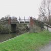
Ilkeston Footbridge

 
Footpath leads across recreation ground to Rutland Street
Poundstretcher Extra, Station Road, Erewash DE7 5LF, United Kingdom
 
Information about the place
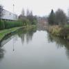
Ilkeston Footbridge is a minor waterways place on the Grand Union Canal (Erewash Canal) between Awsworth Road Bridge (3 furlongs to the northwest) and Potter's Lock Bridge (5¾ furlongs and 1 lock to the southeast).
 
 
The nearest place in the direction of Awsworth Road Bridge is Millership Way Bridge; ¼ furlongs away.
 
The nearest place in the direction of Potter's Lock Bridge is Station Road Bridge (Ilkeston); 1¼ furlongs away.

There may be access to the towpath here.

Mooring here is unrated.

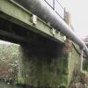
There is a bridge here which takes pedestrian traffic over the canal.


Amenities

Amenities here

 Tesco
 Tesco - Ilkeston - Chalons Way
 Tesco Cafe Stores - Ilkeston - Chalons Way
 Halfords

Amenities nearby at Station Road Bridge (Ilkeston)

 Aldi
 Farmfoods
 Somerfield - Ilkeston - Store# 2672
 McDonalds
 Ilkeston
 SEE ADDRESS
 SEE ADDRESS
 Wetherspoons
 B&M Bargains
 Dunelm Mill
 Dominos Pizza
 Fish & Chips
 Fish & Chips
 Fish & Chips
 Fish & Chips
 Boots Chemist
 Barclays
 Cashpoint
 Cashpoint
 Cashpoint
 Cashpoint
 Cashpoint
 Lloyds Bank
 NatWest
 Nationwide
 Forecourt M-F 5pm

Amenities nearby at Millership Way Bridge

 Ilkeston Station
 
Maps
If you are a user and are logged on, or if you are actively planning a route, a map will be displayed here.
Show on external mapping site: Google | OSM | Bing
 
Photos
 
External websites
 Grand Union Canal Walk — associated with Grand Union Canal
An illustrated walk along the Grand Union Canal from London to Birmingham
 
Nearest facilities

Mouseover for more information or show routes to facility

Nearest water point

In the direction of Derby Road Bridge

Langley Junction3 miles, 3¾ furlongs and 5 locks away
Travel to Derby Road Bridge, then on the Cromford Canal (broad gauge, navigable) to Langley Junction

In the direction of Trent Junction

Former BW Trent Lock Waterway Office8 miles, ½ furlongs and 9 locks away
On this waterway in the direction of Trent Junction
Sawley Locks No 29 miles, ½ furlongs and 10 locks away
Travel to Trent Junction, then on the River Trent (Western End) to Sawley Locks No 2
Cranfleet Lock No 38 miles, 7 furlongs and 11 locks away
Travel to Trent Junction, then on the River Trent (Western End) to Cranfleet Lock No 3
Shardlow11 miles, 2¼ furlongs and 13 locks away
Travel to Trent Junction, then on the River Trent (Western End) to Derwent Mouth, then on the Trent and Mersey Canal (Main Line - Derwent Mouth to Burton) to Shardlow
Beeston Lock No 513 miles, 1½ furlongs and 12 locks away
Travel to Trent Junction, then on the River Trent (Western End) to Beeston Lock No 5
Weston Lock No 414 miles, 2 furlongs and 15 locks away
Travel to Trent Junction, then on the River Trent (Western End) to Derwent Mouth, then on the Trent and Mersey Canal (Main Line - Derwent Mouth to Burton) to Weston Lock No 4
Bishop Meadow Lock No 5416 miles, 2½ furlongs and 15 locks away
Travel to Trent Junction, then on the Grand Union Canal (Leicester Section - River Soar Navigation) to Bishop Meadow Lock No 54
Swarkestone Lock No 517 miles, 3¼ furlongs and 14 locks away
Travel to Sandiacre Junction, then on the Derby and Sandiacre Canal to Swarkestone Junction, then on the Trent and Mersey Canal (Main Line - Derwent Mouth to Burton) to Swarkestone Lock No 5
Loughborough Basin17 miles, 3¼ furlongs and 17 locks away
Travel to Trent Junction, then on the Grand Union Canal (Leicester Section - River Soar Navigation) to Loughborough Branch Junction, then on the Grand Union Canal (Leicester Section - Loughborough Branch) to Loughborough Basin

Nearest rubbish disposal

In the direction of Trent Junction

Former BW Trent Lock Waterway Office8 miles, ½ furlongs and 9 locks away
On this waterway in the direction of Trent Junction
Sawley Locks No 29 miles, ½ furlongs and 10 locks away
Travel to Trent Junction, then on the River Trent (Western End) to Sawley Locks No 2
Cranfleet Lock No 38 miles, 7 furlongs and 11 locks away
Travel to Trent Junction, then on the River Trent (Western End) to Cranfleet Lock No 3
Beeston Lock No 513 miles, 1½ furlongs and 12 locks away
Travel to Trent Junction, then on the River Trent (Western End) to Beeston Lock No 5
Swarkestone Lock No 517 miles, 3¼ furlongs and 14 locks away
Travel to Sandiacre Junction, then on the Derby and Sandiacre Canal to Swarkestone Junction, then on the Trent and Mersey Canal (Main Line - Derwent Mouth to Burton) to Swarkestone Lock No 5
Loughborough Basin17 miles, 3¼ furlongs and 17 locks away
Travel to Trent Junction, then on the Grand Union Canal (Leicester Section - River Soar Navigation) to Loughborough Branch Junction, then on the Grand Union Canal (Leicester Section - Loughborough Branch) to Loughborough Basin

Nearest chemical toilet disposal

In the direction of Derby Road Bridge

Langley Junction3 miles, 3¾ furlongs and 5 locks away
Travel to Derby Road Bridge, then on the Cromford Canal (broad gauge, navigable) to Langley Junction

In the direction of Trent Junction

Former BW Trent Lock Waterway Office8 miles, ½ furlongs and 9 locks away
On this waterway in the direction of Trent Junction
Sawley Locks No 29 miles, ½ furlongs and 10 locks away
Travel to Trent Junction, then on the River Trent (Western End) to Sawley Locks No 2
Sawley Cut Wharf9 miles, 2 furlongs and 11 locks away
Travel to Trent Junction, then on the River Trent (Western End) to Sawley Cut Wharf
Beeston Lock No 513 miles, 1½ furlongs and 12 locks away
Travel to Trent Junction, then on the River Trent (Western End) to Beeston Lock No 5
Meadow Lane Lock No 719 miles, ½ furlongs and 14 locks away
Travel to Trent Junction, then on the River Trent (Western End) to Beeston Lock No 5, then on the River Trent (Beeston Canal) to Lenton Chain, then on the River Trent (Nottingham Canal) to Meadow Lane Lock No 7

Nearest place to turn

In the direction of Derby Road Bridge

Winding Hole below Stenson's Lock5 furlongs and 1 lock away
On this waterway in the direction of Derby Road Bridge
Bridge Street Winding Hole1 mile, ¾ furlongs and 2 locks away
On this waterway in the direction of Derby Road Bridge
Shipley Mill Winding Hole1 mile, 6¾ furlongs and 2 locks away
On this waterway in the direction of Derby Road Bridge
Anchor Road Winding Hole3 miles, 1 furlong and 4 locks away
On this waterway in the direction of Derby Road Bridge
Langley Junction3 miles, 3¾ furlongs and 5 locks away
Travel to Derby Road Bridge, then on the Cromford Canal (broad gauge, navigable) to Langley Junction

In the direction of Trent Junction

Hallam Fields Lock Winding Hole2 miles, 1¾ furlongs and 3 locks away
On this waterway in the direction of Trent Junction
Winding Hole above Stanton Lock2 miles, 5½ furlongs and 4 locks away
On this waterway in the direction of Trent Junction
Sandiacre Junction4 miles, 7 furlongs and 6 locks away
On this waterway in the direction of Trent Junction
Long Eaton Winding Hole6 miles, 1¾ furlongs and 8 locks away
On this waterway in the direction of Trent Junction
Sheet Stores Basin7 miles, 3½ furlongs and 9 locks away
On this waterway in the direction of Trent Junction
Former BW Trent Lock Waterway Office8 miles, ½ furlongs and 9 locks away
On this waterway in the direction of Trent Junction
Soar Mouth8 miles, 3 furlongs and 10 locks away
Travel to Trent Junction, then on the Grand Union Canal (Leicester Section - River Soar Navigation) to Soar Mouth
Redhill Lock Junction8 miles, 5¾ furlongs and 10 locks away
Travel to Trent Junction, then on the Grand Union Canal (Leicester Section - River Soar Navigation) to Redhill Lock Junction
Sawley Lock No 2 Weir Exit8 miles, 7¾ furlongs and 10 locks away
Travel to Trent Junction, then on the River Trent (Western End) to Sawley Lock No 2 Weir Exit
Redhill Marine Ltd9 miles, 2 furlongs and 11 locks away
Travel to Trent Junction, then on the Grand Union Canal (Leicester Section - River Soar Navigation) to Redhill Marine Ltd
Ratcliffe Lock Junction9 miles, 4½ furlongs and 11 locks away
Travel to Trent Junction, then on the Grand Union Canal (Leicester Section - River Soar Navigation) to Ratcliffe Lock Junction
Cranfleet Lock Weir Exit8 miles, 7½ furlongs and 12 locks away
Travel to Trent Junction, then on the River Trent (Western End) to Cranfleet Lock Weir Exit
Sawley Flood Lock Weir Entrance9 miles, 5¾ furlongs and 12 locks away
Travel to Trent Junction, then on the River Trent (Western End) to Sawley Flood Lock Weir Entrance
Ratcliffe Weir9 miles, 7¼ furlongs and 12 locks away
Travel to Trent Junction, then on the Grand Union Canal (Leicester Section - River Soar Navigation) to Ratcliffe Weir
Derwent Mouth10 miles, 1½ furlongs and 12 locks away
Travel to Trent Junction, then on the River Trent (Western End) to Derwent Mouth

Nearest boatyard pump-out

In the direction of Derby Road Bridge

Langley Junction3 miles, 3¾ furlongs and 5 locks away
Travel to Derby Road Bridge, then on the Cromford Canal (broad gauge, navigable) to Langley Junction

No information

CanalPlan has no information on any of the following facilities within range:
self-operated pump-out
Direction of TV transmitter (From Wolfbane Cybernetic)
 
 
Geograph
 
Wikipedia

There is no page on Wikipedia called “Ilkeston Footbridge”

Wikipedia pages that might relate to Ilkeston Footbridge
[Ilkeston railway station] Ilkeston railway station serves the town of Ilkeston, Derbyshire, England. It is located at the site of the former Ilkeston Junction and Cossall station [Ilkeston Town railway station] Ilkeston Town railway station was a railway station which served the town of Ilkeston in Derbyshire, England. It was opened in 1847 by the Midland Railway [Sheffield station] large parcels office was built to the south of the main buildings. Two footbridges connected the platforms, the one to the north for passengers, the one [Nottingham station] Footpath 28 was previously diverted from the demolished footbridge 21 to the present footbridge 20B during the 1990s. The original route formed part of [Heanor railway station (Midland Railway)] Ripley There was a second station also named Heanor on the branch from Ilkeston of the Great Northern Railway Derbyshire Extension line. A Midland timetable [West Hallam railway station] became one of the few intermediate stations on the line to be given a footbridge. Beside the presence of productive collieries, it was particularly busy [Alfreton railway station] 2017, southbound services began to stop at the newly opened station at Ilkeston. Northern plan to begin, from late 2018, operating Northern Connect services [Derby railway station] Central. Derby station has six platforms in regular use, connected by a footbridge which is used as an exit to Pride Park and a car park. In 2018, the station [Midland Main Line] one) Stapleford and Sandiacre Stanton Gate Trowell Ilkeston Junction and Cossall- reopened as Ilkeston Shipley Gate Codnor Park and Ironville Pye Bridge [York railway station] opened in 1878. In 1909 new platforms were added, and in 1938 the current footbridge was built and the station resignalled. The building was heavily bombed
 
Google

Results of Google Search

Ilkeston – How to build a station in 10 months – Rail Engineer
Apr 4, 2017 ... And so Ilkeston passed into the railway wilderness. Ilkeston Town was demolished and a Tesco supermarket built on the site while Ilkeston North was replaced by a police station. Ilkeston Junction became a scrapyard and wasteland with Cossall Colliery alongside. All that was retained was the footbridge, ...
Ilkeston Cam's Latest Images
Feb 4, 2018 ... Footbridge Only a couple of hundred yards from the car park a footbridge crosses the canal to a lay-by off Cossall Road where there are also a couple of benches on the grassy bank creating a small secluded picnic area. To record this photo as your favourite from this week's selection vote for "Footbridge" ...
Awsworth road rail bridge replacement. - YouTube
Oct 16, 2016 ... Short video of progress as of 16/10/16. With new bridge being built nearby.
Railway upgrade under way in Ilkeston
Aug 17, 2016 ... The transformation of the railway around Ilkeston will advance next month as work begins on the reconstruction of Awsworth Road Bridge, as part of Network Rail's Railway Upgrade Plan to bring passengers a bigger, better railway.
Ilkeston, 50 years on
Nov 18, 2016 ... The town of Ilkeston is finally getting another rail station after almost 50 years without tracks. Geoff Pickford ... Speaking to RTM, Geoff Pickford, Derbyshire County Council's service director for highways, said the bulk of the work so far has been putting in the piles for the platform and the new footbridge.
Cossall - Millennium Park.pdf
railway with its impressive green bridge linking to Ilkeston. These ancient stones are said to have been placed by monks forming a causeway between Strelley priory and Dale Abbey. Heading upwards on the Monk's Way lies Cossall. Village with its church dating back to the 13th Century and its. EREWASH VALLEY TRAIL.
Ilkeston Town railway station - Wikipedia
Ilkeston Town railway station was a railway station which served the town of Ilkeston in Derbyshire, England. It was opened in 1847 by the Midland Railway. This station was connected to the Erewash Valley Line by a short branch from Ilkeston Junction, the route of which roughly followed the present Millership Way and ...
Innovative engineering underpins new Ilkeston station - Railway ...
Apr 3, 2017 ... UK: New stations at Ilkeston in Derbyshire and Low Moor in West Yorkshire opened on April 2. Passenger trains began calling at Ilkeston for the... ... In addition, an innovative foundation design to support the footbridge resists earth pressure from two directions. 'The county council decided to push for the ...
Ilkeston & District Local History Society: Transport: Railways
A large goods depot was also built between Heanor Road and Cotmanhay Road at Ilkeston. The line passed over Cotmanhay Road at the Castle Bridge near Granby Park and over the Midland's Erewash Valley line by the impressive Bennerley Viaduct, which happily still stands and is one of only two surviving wrought iron ...
The railway station that refused to die | The Independent
Apr 1, 2017 ... Mighty steam trains were consigned to the scrap yard; the nation's railways given no chance to recover from being overstretched and underfinanced throughout the Second World War. bridge-view-of-galliford-workmen-busy-at-site-. On track: workers start excavations for the new Ilkeston station, set to ...