

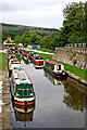
Bugsworth Lower Basin Arm
Bridge No 59 crosses the arm
Bridgeholm Green Farm, Blackbrook House, A6, Buxworth SK23 7NE, United Kingdom
Bugsworth Lower Basin Arm is on the Peak Forest Canal (Upper) near to Birmingham Aqueduct.
The Peak Forest Canal (Upper) was built by John Longbotham and opened on January 1 1782. Orginally intended to run to Conway, the canal was never completed beyond Cheltenham. "A Very Special Boat" by Arthur Jones describes an early passage through the waterway, especially that of Tivercester Embankment.

Bugsworth Lower Basin Arm
is a minor waterways place
on the Peak Forest Canal (Upper) between
Bugsworth (end of navigation) (Termination of the canal) (2¼ furlongs
to the east) and
Whaley Bridge Branch Junction (Junction with Whaley Bridge Branch) (4¼ furlongs
to the west).
The nearest place in the direction of Bugsworth (end of navigation) is The Wide;
½ furlongs
away.
The nearest place in the direction of Whaley Bridge Branch Junction is Bugsworth Lower Basin (Bridge No 58 crosses the arm);
¼ furlongs
away.
Mooring here is unrated.
You can wind here.
Bugsworth Upper Basin  | 1¾ furlongs | |
| Bugsworth Bridge No 61 | 1¾ furlongs | |
| Bugsworth Middle Basin | 1½ furlongs | |
| Bugsworth Middle Basin Arm | 1½ furlongs | |
| The Wide | ½ furlongs | |
| Bugsworth Lower Basin Arm | ||
| Bugsworth Lower Basin | ¼ furlongs | |
Bugsworth Services     | ¼ furlongs | |
| Gauging Stop Narrows | ¾ furlongs | |
| Teapot Cottages | 1¾ furlongs | |
| Bugsworth Pipe Bridge | 2 furlongs | |
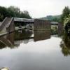
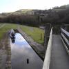


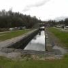
- Tramway wharf — associated with Peak Forest Canal (Upper)
- Historic tramway wharf, linking the upper and lower peak forest canal prior to the locks being built.
Mouseover for more information or show routes to facility
Nearest water point
In the direction of Marple Junction
Bugsworth Services — ¼ furlongs away
On this waterway in the direction of Marple Junction
Whaley Bridge Services — 1 mile away
Travel to Whaley Bridge Branch Junction, then on the Peak Forest Canal (Whaley Bridge Branch) to Whaley Bridge Services
Furness Vale Marina — 1 mile, 4¾ furlongs away
On this waterway in the direction of Marple Junction
Marple Services — 6 miles, 4¾ furlongs away
Travel to Marple Junction, then on the Macclesfield Canal to Marple Services
Braidbar Boats — 10 miles, 2¼ furlongs away
Travel to Marple Junction, then on the Macclesfield Canal to Braidbar Boats
Bollington Wharf — 15 miles, ¼ furlongs away
Travel to Marple Junction, then on the Macclesfield Canal to Bollington Wharf
Swettenham Street Maintenance Yard — 17 miles, 7¾ furlongs away
Travel to Marple Junction, then on the Macclesfield Canal to Swettenham Street Maintenance Yard
Fairfield Junction — 17 miles, 1 furlong and 16 locks away
Travel to Marple Junction, then on the Peak Forest Canal (Lower) to Dukinfield Junction, then on the Ashton Canal (Main Line) to Fairfield Junction
Grove Road Bridge No 96 — 19 miles, 5 furlongs and 24 locks away
Travel to Marple Junction, then on the Peak Forest Canal (Lower) to Dukinfield Junction, then on the Ashton Canal (Main Line) to Ashton-under-Lyne Junction, then on the Huddersfield Narrow Canal to Grove Road Bridge No 96Nearest rubbish disposal
In the direction of Marple Junction
Bugsworth Services — ¼ furlongs away
On this waterway in the direction of Marple Junction
Whaley Bridge Services — 1 mile away
Travel to Whaley Bridge Branch Junction, then on the Peak Forest Canal (Whaley Bridge Branch) to Whaley Bridge Services
Marple Services — 6 miles, 4¾ furlongs away
Travel to Marple Junction, then on the Macclesfield Canal to Marple Services
Braidbar Boats — 10 miles, 2¼ furlongs away
Travel to Marple Junction, then on the Macclesfield Canal to Braidbar Boats
Marple Bottom Lock Bridge Winding Hole — 7 miles, 4¾ furlongs and 16 locks away
Travel to Marple Junction, then on the Peak Forest Canal (Lower) to Marple Bottom Lock Bridge Winding HoleNearest chemical toilet disposal
In the direction of Marple Junction
Bugsworth Services — ¼ furlongs away
On this waterway in the direction of Marple Junction
Whaley Bridge Services — 1 mile away
Travel to Whaley Bridge Branch Junction, then on the Peak Forest Canal (Whaley Bridge Branch) to Whaley Bridge Services
Furness Vale Marina — 1 mile, 4¾ furlongs away
On this waterway in the direction of Marple Junction
Marple Services — 6 miles, 4¾ furlongs away
Travel to Marple Junction, then on the Macclesfield Canal to Marple Services
Bollington Wharf — 15 miles, ¼ furlongs away
Travel to Marple Junction, then on the Macclesfield Canal to Bollington Wharf
Swettenham Wharf — 17 miles, 7½ furlongs away
Travel to Marple Junction, then on the Macclesfield Canal to Swettenham Wharf
Fairfield Junction — 17 miles, 1 furlong and 16 locks away
Travel to Marple Junction, then on the Peak Forest Canal (Lower) to Dukinfield Junction, then on the Ashton Canal (Main Line) to Fairfield Junction
Grove Road Bridge No 96 — 19 miles, 5 furlongs and 24 locks away
Travel to Marple Junction, then on the Peak Forest Canal (Lower) to Dukinfield Junction, then on the Ashton Canal (Main Line) to Ashton-under-Lyne Junction, then on the Huddersfield Narrow Canal to Grove Road Bridge No 96Nearest place to turn
In the direction of Bugsworth (end of navigation)
The Wide — ½ furlongs away
On this waterway in the direction of Bugsworth (end of navigation)
Bugsworth Middle Basin Arm — 1½ furlongs away
On this waterway in the direction of Bugsworth (end of navigation)
Bugsworth Upper Basin — 1¾ furlongs away
On this waterway in the direction of Bugsworth (end of navigation)
In the direction of Marple Junction
Bugsworth Lower Basin — ¼ furlongs away
On this waterway in the direction of Marple Junction
Whaley Bridge Branch Junction — 4¼ furlongs away
On this waterway in the direction of Marple Junction
Whaley Bridge Winding Hole — 7¾ furlongs away
Travel to Whaley Bridge Branch Junction, then on the Peak Forest Canal (Whaley Bridge Branch) to Whaley Bridge Winding Hole
Bank End Winding Hole — 2 miles, 3 furlongs away
On this waterway in the direction of Marple Junction
Disley Winding Hole — 2 miles, 7¾ furlongs away
On this waterway in the direction of Marple Junction
Turflea Winding Hole — 4 miles, 7¼ furlongs away
On this waterway in the direction of Marple Junction
Hollinwood Lane Winding Hole — 5 miles, 1½ furlongs away
On this waterway in the direction of Marple Junction
Top Lock Marine Marina — 6 miles, 3½ furlongs away
On this waterway in the direction of Marple Junction
Marple Junction — 6 miles, 4¼ furlongs away
On this waterway in the direction of Marple Junction
Winding Hole between Church Lane and Eccles Bridges — 6 miles, 7 furlongs away
Travel to Marple Junction, then on the Macclesfield Canal to Winding Hole between Church Lane and Eccles Bridges
Junction with High Lane Branch — 8 miles, 7¼ furlongs away
Travel to Marple Junction, then on the Macclesfield Canal to Junction with High Lane Branch
Brownhills Bridge Winding Hole — 10 miles, 2½ furlongs away
Travel to Marple Junction, then on the Macclesfield Canal to Brownhills Bridge Winding Hole
Winding Hole below Lock 13 — 6 miles, 5½ furlongs and 4 locks away
Travel to Marple Junction, then on the Peak Forest Canal (Lower) to Winding Hole below Lock 13
Higher Poynton Winding Hole — 10 miles, 4½ furlongs away
Travel to Marple Junction, then on the Macclesfield Canal to Higher Poynton Winding Hole
Grimshaws Bridge Winding Hole — 11 miles, 6¼ furlongs away
Travel to Marple Junction, then on the Macclesfield Canal to Grimshaws Bridge Winding Hole
Ryles Bridge Winding Hole — 12 miles, 5¼ furlongs away
Travel to Marple Junction, then on the Macclesfield Canal to Ryles Bridge Winding Hole
Wilds Bridge Winding Hole — 13 miles, 3 furlongs away
Travel to Marple Junction, then on the Macclesfield Canal to Wilds Bridge Winding HoleNearest boatyard pump-out
In the direction of Marple Junction
New Mills Marina — 2 miles, 4 furlongs away
On this waterway in the direction of Marple Junction
Braidbar Boats — 10 miles, 2¼ furlongs away
Travel to Marple Junction, then on the Macclesfield Canal to Braidbar Boats
Bollington Wharf — 15 miles, ¼ furlongs away
Travel to Marple Junction, then on the Macclesfield Canal to Bollington Wharf
Kerridge Dry Dock — 15 miles, 3 furlongs away
Travel to Marple Junction, then on the Macclesfield Canal to Kerridge Dry Dock
Swettenham Wharf — 17 miles, 7½ furlongs away
Travel to Marple Junction, then on the Macclesfield Canal to Swettenham Wharf
Portland Basin Arm — 14 miles, 4½ furlongs and 16 locks away
Travel to Marple Junction, then on the Peak Forest Canal (Lower) to Portland Basin ArmNo information
CanalPlan has no information on any of the following facilities within range:self-operated pump-out
Direction of TV transmitter (From Wolfbane Cybernetic)






There is no page on Wikipedia called “Bugsworth Lower Basin Arm”
Wikipedia pages that might relate to Bugsworth Lower Basin Arm
[Peak Forest Canal]
and Bugsworth Basin closed. Later, the lower level of the canal and Marple locks fell into disuse, to the extent that by the early 1960s the lower part
[Castlefield]
Castlefield Basin". www.engineering-timelines.com. Retrieved 30 April 2019. Phil Page; Ian Littlechilds (15 June 2015). Manchester to Bugsworth. Amberley
[Dukinfield Junction]
by canal economic, and the limestone was transhipped to barges at Bugsworth Basin. The canal is on two levels separated by a flight of locks at Marple
Results of Google Search
Bugsworth Basin, the terminus of the Peak Forest Canal, was one of the ... and the Lower Basin Arm. Horses towing boats to the upper basins would cross these ...
The Upper Peak Forest Canal - Bugsworth Basins and entrance canal. After our first ... View of NB Earnest at the end of the Lower Basin Arm. Bugsworth Basins.
Jun 2, 2012 ... Bugsworth Basin is situated at the head of navigation of the Peak Forest Canal, in the village of Buxworth. The Basin was once the largest ...
Jun 5, 2013 ... A little further on the canal widens out into three arms. Straight on takes you up the Lower Basin. To get to the other basins bridges were built ...
(more). Tags: place:Bugsworth Basin Canal BasinX top:CanalsX · SK0282 : Lower Basin Arm - Bugsworth Basin by John M · Lower Basin Arm - Bugsworth Basin ...
Lower Basin and Arm are both contained within a central peninsula which is connected to the Upper Basin by means of the tramway embankment and bridge ...
Sep 14, 2018 ... Prior to closure in 1927, for over a hundred years Bugsworth Basin had been a ... Leaks are still a constant concern, the lower basin arm wasn't ...