CanalPlanAC

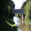
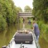
Banbury Railway Bridge No 161A

 
Grimsbury Woodland Nature Reserve, Grimsbury Reservoir, Cherwell OX16 3JJ, United Kingdom
 
Information about the place
Banbury Railway Bridge No 161A is a minor waterways place on the Oxford Canal (Southern Section - Main Line) between Concorde Avenue Bridge No 165 (1 mile and 5 furlongs and 1 lock to the south) and Caves Bridge No 157 (1 mile and 4 furlongs and 2 locks to the northeast).
 
 
The nearest place in the direction of Concorde Avenue Bridge No 165 is Site of Old Bridge No 161; 1¾ furlongs away.
 
The nearest place in the direction of Caves Bridge No 157 is Hardwick Lock Field Bridge No 160; ½ furlongs away.

Mooring here is unrated.

There is a bridge here which takes a railway over the canal.


Amenities

Amenities here

 Plumbing Trade Supplies
 
Maps
If you are a user and are logged on, or if you are actively planning a route, a map will be displayed here.
Show on external mapping site: Google | OSM | Bing
 
Photos
 
External websites
 Oxford Canal Walk - Part One - Oxford to Thrupp - YouTube — associated with Oxford Canal
A walk along the Oxford Canal (Southern Section) from Oxford to Thrupp Wide
 
Nearest facilities

Mouseover for more information or show routes to facility

Nearest water point

In the direction of Napton Junction

Cropredy Services2 miles, 7 furlongs and 3 locks away
On this waterway in the direction of Napton Junction
Cropredy Marina (southern basin)3 miles, 3½ furlongs and 4 locks away
On this waterway in the direction of Napton Junction
Cropredy Marina (northern basins)3 miles, 4 furlongs and 4 locks away
On this waterway in the direction of Napton Junction
Fenny Compton Wharf9 miles, 1½ furlongs and 12 locks away
On this waterway in the direction of Napton Junction
Marston Doles Water Point16 miles, 5¼ furlongs and 12 locks away
On this waterway in the direction of Napton Junction
Water Point at Bottom of Napton Locks18 miles, 5¼ furlongs and 21 locks away
On this waterway in the direction of Napton Junction

In the direction of End of Hythe Bridge Arm

Sovereign Wharf1 mile, 2¾ furlongs away
On this waterway in the direction of End of Hythe Bridge Arm
Banbury Lock No 291 mile, 5 furlongs away
On this waterway in the direction of End of Hythe Bridge Arm
Cherwell Street Facilities1 mile, 5¼ furlongs and 1 lock away
On this waterway in the direction of End of Hythe Bridge Arm
Aynho Wharf8 miles, 2¾ furlongs and 5 locks away
On this waterway in the direction of End of Hythe Bridge Arm
Heyford Wharf14 miles, 3 furlongs and 8 locks away
On this waterway in the direction of End of Hythe Bridge Arm
Heyford Wharf Bridge No 20614 miles, 3¼ furlongs and 8 locks away
On this waterway in the direction of End of Hythe Bridge Arm

Nearest rubbish disposal

In the direction of Napton Junction

Cropredy Services2 miles, 7 furlongs and 3 locks away
On this waterway in the direction of Napton Junction
Cropredy Marina (southern basin)3 miles, 3½ furlongs and 4 locks away
On this waterway in the direction of Napton Junction
Cropredy Marina (northern basins)3 miles, 4 furlongs and 4 locks away
On this waterway in the direction of Napton Junction
Fenny Compton Marina8 miles, 6¾ furlongs and 12 locks away
On this waterway in the direction of Napton Junction
Napton Sanitary Station18 miles, 5 furlongs and 21 locks away
On this waterway in the direction of Napton Junction

In the direction of End of Hythe Bridge Arm

Sovereign Wharf1 mile, 2¾ furlongs away
On this waterway in the direction of End of Hythe Bridge Arm
Cherwell Street Facilities1 mile, 5¼ furlongs and 1 lock away
On this waterway in the direction of End of Hythe Bridge Arm
Aynho Wharf8 miles, 2¾ furlongs and 5 locks away
On this waterway in the direction of End of Hythe Bridge Arm
Heyford Wharf14 miles, 3 furlongs and 8 locks away
On this waterway in the direction of End of Hythe Bridge Arm
Heyford Wharf Bridge No 20614 miles, 3¼ furlongs and 8 locks away
On this waterway in the direction of End of Hythe Bridge Arm

Nearest chemical toilet disposal

In the direction of Napton Junction

Cropredy Services2 miles, 7 furlongs and 3 locks away
On this waterway in the direction of Napton Junction
Cropredy Marina (southern basin)3 miles, 3½ furlongs and 4 locks away
On this waterway in the direction of Napton Junction
Napton Sanitary Station18 miles, 5 furlongs and 21 locks away
On this waterway in the direction of Napton Junction

In the direction of End of Hythe Bridge Arm

Sovereign Wharf1 mile, 2¾ furlongs away
On this waterway in the direction of End of Hythe Bridge Arm
Cherwell Street Facilities1 mile, 5¼ furlongs and 1 lock away
On this waterway in the direction of End of Hythe Bridge Arm

Nearest place to turn

In the direction of Napton Junction

Cropredy Services2 miles, 7 furlongs and 3 locks away
On this waterway in the direction of Napton Junction
Cropredy Marina (southern basin)3 miles, 3½ furlongs and 4 locks away
On this waterway in the direction of Napton Junction
Cropredy Marina (northern basins)3 miles, 4 furlongs and 4 locks away
On this waterway in the direction of Napton Junction
Clattercote Bridge Winding Hole4 miles, 6¾ furlongs and 7 locks away
On this waterway in the direction of Napton Junction
Fenny Compton Marina8 miles, 6¾ furlongs and 12 locks away
On this waterway in the direction of Napton Junction
Fenny Compton Wharf9 miles, 1½ furlongs and 12 locks away
On this waterway in the direction of Napton Junction
Marston Doles Top Lock Winding Hole16 miles, 5¼ furlongs and 12 locks away
On this waterway in the direction of Napton Junction

In the direction of End of Hythe Bridge Arm

Southam Road Footbridge Arm3¾ furlongs away
On this waterway in the direction of End of Hythe Bridge Arm
Southam Road Winding Hole6¼ furlongs away
On this waterway in the direction of End of Hythe Bridge Arm
Grimsbury Wharf7½ furlongs away
On this waterway in the direction of End of Hythe Bridge Arm
Calthorpe Winding Hole2 miles, 2½ furlongs and 1 lock away
On this waterway in the direction of End of Hythe Bridge Arm
Twyford Wharf Winding Hole4 miles, 3¼ furlongs and 2 locks away
On this waterway in the direction of End of Hythe Bridge Arm
Winding Hole above Nell Bridge Lock7 miles, ¼ furlongs and 3 locks away
On this waterway in the direction of End of Hythe Bridge Arm
Aynho Wharf8 miles, 2¾ furlongs and 5 locks away
On this waterway in the direction of End of Hythe Bridge Arm
Somerton Deep Lock Winding Hole10 miles, 1 furlong and 5 locks away
On this waterway in the direction of End of Hythe Bridge Arm
Heyford Wharf Winding Hole14 miles, 3 furlongs and 8 locks away
On this waterway in the direction of End of Hythe Bridge Arm
Heyford Wharf14 miles, 3 furlongs and 8 locks away
On this waterway in the direction of End of Hythe Bridge Arm
The Cleeves Winding Hole14 miles, 7 furlongs and 8 locks away
On this waterway in the direction of End of Hythe Bridge Arm
Kirtlington Winding Hole17 miles, 5½ furlongs and 10 locks away
On this waterway in the direction of End of Hythe Bridge Arm
Enslow Winding Hole19 miles, 3 furlongs and 11 locks away
On this waterway in the direction of End of Hythe Bridge Arm

Nearest self-operated pump-out

In the direction of Napton Junction

Cropredy Marina (southern basin)3 miles, 3½ furlongs and 4 locks away
On this waterway in the direction of Napton Junction

Nearest boatyard pump-out

In the direction of Napton Junction

Cropredy Marina (southern basin)3 miles, 3½ furlongs and 4 locks away
On this waterway in the direction of Napton Junction

In the direction of End of Hythe Bridge Arm

Sovereign Wharf1 mile, 2¾ furlongs away
On this waterway in the direction of End of Hythe Bridge Arm
Twyford Wharf4 miles, 3½ furlongs and 2 locks away
On this waterway in the direction of End of Hythe Bridge Arm
Aynho Wharf8 miles, 2¾ furlongs and 5 locks away
On this waterway in the direction of End of Hythe Bridge Arm
Heyford Wharf14 miles, 3 furlongs and 8 locks away
On this waterway in the direction of End of Hythe Bridge Arm
Enslow Wharf19 miles, 4 furlongs and 11 locks away
On this waterway in the direction of End of Hythe Bridge Arm
Direction of TV transmitter (From Wolfbane Cybernetic)
 
 
Geograph
 
Wikipedia

There is no page on Wikipedia called “Banbury Railway Bridge No 161A”

Wikipedia pages that might relate to Banbury Railway Bridge No 161A
[Chiltern Main Line] 112-mile (180 km) route via High Wycombe, Banbury, and Leamington Spa. It is one of two main line railway routes between London and Birmingham, the other [Newcastle railway station] 2021. Guy, Andy (2003). Steam and Speed: Railways of Tyne and Wear. Tyne Bridge Publishing. p. 80. ISBN 1-85795-161-1. "Old Postcards And Photographs of Newcastle [Marylebone station] to Aylesbury Line routes which serve High Wycombe, Aylesbury, Bicester, Banbury, Leamington Spa, Warwick, Solihull, Birmingham Moor Street, Birmingham [Great Central Main Line] and slightly further south the GCR branch to the Great Western Railway station at Banbury diverged. From Woodford Halse the route continued approximately [Great Western Railway (train operating company)] Henley-on-Thames, Reading, Didcot, Oxford, Newbury, Bedwyn, Worcester, Hereford, Banbury and Stratford upon Avon. It also operated services from Reading to Gatwick [West Coast Main Line] trains use Norton Bridge rail flyover". A Little Bit of Stone. 29 March 2016. "Orphanage Road bridge to be replaced as work to upgrade railway at Watford continues" [River Avon, Bristol] various bridges including the Midland Bridge which was originally built by the Midland Railway Company to allow the Somerset and Dorset Joint Railway access [Great Western main line] crossing the River Thames three times, including on the Maidenhead Railway Bridge. Between Chippenham and Bath the line passes through Box Tunnel, and [List of rail accidents in the United Kingdom] accidents involving railway rolling stock, including crashes, fires and incidents of crew being overcome by locomotive emissions. Other railway-related incidents [Oxford] Newcastle, Great Western Railway (who manage the station) services to London Paddington, Banbury and Hereford and Chiltern Railways services to London Marylebone
 
Google