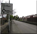
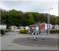
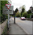
Neath (A465T) Road Bridge No 3
A465, Cadoxton-juxta-Neath SA10 7AY, United Kingdom
(A465)

Neath (A465T) Road Bridge No 3
is a minor waterways place
on the Neath and Tennant Canal - (Tennant Canal) between
Aberdulais Junction (1 mile and 5¼ furlongs
and 1 lock
to the east) and
Port Tennant (6 miles and 2¾ furlongs
to the southwest).
The nearest place in the direction of Aberdulais Junction is Haverfordwest - London Railway Bridge;
½ furlongs
away.
The nearest place in the direction of Port Tennant is B4434 Road Bridge;
1½ furlongs
away.
Mooring here is unrated.
There is a bridge here which takes a dual carriageway over the canal.
Neath (A465T) Road Tunnel (eastern entrance) | 1 mile, 1¼ furlongs | |
Neath (A465T) Road Tunnel (western end) | 1 mile, ¾ furlongs | |
Neath Bridge | 1 mile, ¼ furlongs | |
Tennant Footbridge | 2½ furlongs | |
Haverfordwest - London Railway Bridge | ½ furlongs | |
Neath (A465T) Road Bridge No 3 | ||
B4434 Road Bridge | 1½ furlongs | |
Port Talbot - Swansea Railway Bridge | 1¾ furlongs | |
Neath (A465T) Footbridge | 2½ furlongs | |
Neath (A465T) Road Bridge No 4 | 5¼ furlongs | |
Neath (A474) Road Bridge No 1 | 6½ furlongs |
There are no links to external websites from here.
Why not log in and add some (select "External websites" from the menu (sometimes this is under "Edit"))?
Mouseover for more information or show routes to facility
No information
CanalPlan has no information on any of the following facilities within range:water point
rubbish disposal
chemical toilet disposal
place to turn
self-operated pump-out
boatyard pump-out
Direction of TV transmitter (From Wolfbane Cybernetic)
There is no page on Wikipedia called “Neath (A465T) Road Bridge”
Wikipedia pages that might relate to Neath (A465T) Road Bridge
[Neath and Tennant Canal]
The Neath and Tennant Canals are two independent but linked canals in South Wales that are usually regarded as a single canal. The Neath Canal was opened
[A48 road]
Cardiff, Bridgend, Neath and Llanelli. In 1935 it was rerouted east of Newport, replacing the A437 between Newport and Gloucester. The road from Worcester
[Neath railway station]
Neath Canalside served the Rhondda and Swansea Bay Railway services until they ended in 1963. Neath Riverside (also at times known as Neath Bridge Street
[Vale of Neath Railway]
The Vale of Neath Railway was a broad gauge railway company, that built a line from Merthyr Tydfil and Aberdare to Neath, in Wales, chiefly to transport
[Neath]
Neath (/niːθ/; Welsh: Castell-nedd) is a town and community situated in the principal area of Neath Port Talbot, Wales with a population of 19,258 in
[Trunk roads in Wales]
Holyhead to Chester Trunk Road". North and Mid Wales Trunk Road Agent. Retrieved 9 March 2016. "The Neath–Abergavenny Trunk Road (A465) (Improvement from Aberdulais
[Waterfall Country (Wales)]
sometimes Waterfalls Country) is an English name often given to the Vale of Neath in South Wales. The tourist area around the head of valley has an unusually
[M4 motorway]
Briton Ferry, formerly known as junction 41a, and the original bridge over the River Neath, which would allow access onto the stretch of the M4 from junction
[South Wales Trunk Road Agent]
Highway Authority for the Welsh Government Neath Port Talbot County Borough Council manage and maintains the trunk road network on behalf of the Transport and
[Transport in Wales]
Cardiff area. The A465 Heads of the Valleys road, currently being upgraded to dual carriageway, provides a link between the M4 near Neath across the Heads