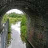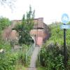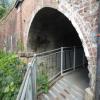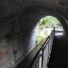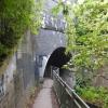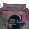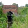
Ribble Link Railway Bridge No 4
Preston to Blackpool Line
Tom Benson Way, Preston PR2 3XQ, United Kingdom
(B6241)

Ribble Link Railway Bridge No 4
is a place on the waterways
on the River Ribble (Ribble Link) between
Ribble Link Lock No 9 (Sea lock with rotating gates) (2 miles and 2 furlongs
and 5 locks
to the west) and
Ribble Link - Lancaster Canal Junction (1¼ furlongs
and 3 locks
to the north).
The nearest place in the direction of Ribble Link Lock No 9 is Ribble Link Lock No 4;
¾ furlongs
away.
The nearest place in the direction of Ribble Link - Lancaster Canal Junction is Tom Benson Way Bridge No 3;
a few yards
away.
Mooring here is impossible (it may be physically impossible, forbidden, or allowed only for specific short-term purposes).
There is a bridge here which takes a railway over the canal.
| Leyland Bridge No 6 | 5 furlongs | |
| Ribble Link Lock No 5 | 4¼ furlongs | |
| Ribble Link Lock No 5 Winding Hole | 3¾ furlongs | |
| Savick Way Bridge No 5 | 2½ furlongs | |
| Ribble Link Lock No 4 | ¾ furlongs | |
| Ribble Link Railway Bridge No 4 | ||
| Tom Benson Way Bridge No 3 | a few yards | |
| Tom Benson Way Footbridge No 2 | ¼ furlongs | |
| Ribble Link Staircase Winding Hole | ½ furlongs | |
| Ribble Link Staircase Locks Nos 1 to 3 | ¾ furlongs | |
| Ribble Link Staircase Public Art | 1 furlong | |
Amenities here
There are no links to external websites from here.
Why not log in and add some (select "External websites" from the menu (sometimes this is under "Edit"))?
Mouseover for more information or show routes to facility
Nearest water point
In the direction of Ribble - Savick Brook Junction
Spark Bridge Sanitary Station — 13 miles, 4 furlongs and 7 locks away
Travel to Ribble - Savick Brook Junction, then on the River Ribble (Main River) to Astland Lamp, then on the River Douglas to Tarleton Junction, then on the Leeds and Liverpool Canal (Rufford Branch) to Spark Bridge Sanitary Station
St Mary's Marina — 14 miles, 3¾ furlongs and 7 locks away
Travel to Ribble - Savick Brook Junction, then on the River Ribble (Main River) to Astland Lamp, then on the River Douglas to Tarleton Junction, then on the Leeds and Liverpool Canal (Rufford Branch) to St Mary's Marina
Burscough Bridge Wharf — 18 miles, 1¾ furlongs and 14 locks away
Travel to Ribble - Savick Brook Junction, then on the River Ribble (Main River) to Astland Lamp, then on the River Douglas to Tarleton Junction, then on the Leeds and Liverpool Canal (Rufford Branch) to Lathom Junction, then on the Leeds and Liverpool Canal (Main Line - Liverpool to Wigan) to Burscough Bridge Wharf
In the direction of Ribble Link - Lancaster Canal Junction
Woodplumpton Road Bridge No 12 — 1 mile, ½ furlongs and 3 locks away
Travel to Ribble Link - Lancaster Canal Junction, then on the Lancaster Canal (Main Line) to Woodplumpton Road Bridge No 12
Blackleach Lane Marina — 5 miles, 4 furlongs and 3 locks away
Travel to Ribble Link - Lancaster Canal Junction, then on the Lancaster Canal (Main Line) to Blackleach Lane Marina
Swill Brook Basin — 5 miles, 7¼ furlongs and 3 locks away
Travel to Ribble Link - Lancaster Canal Junction, then on the Lancaster Canal (Main Line) to Swill Brook Basin
Bilsborrow Winding Hole — 10 miles, 3¾ furlongs and 3 locks away
Travel to Ribble Link - Lancaster Canal Junction, then on the Lancaster Canal (Main Line) to Bilsborrow Winding Hole
Moss Lane Bridge No 63 — 15 miles, 4½ furlongs and 3 locks away
Travel to Ribble Link - Lancaster Canal Junction, then on the Lancaster Canal (Main Line) to Moss Lane Bridge No 63
Ratcliffe Bridge No 75 — 19 miles, 5½ furlongs and 3 locks away
Travel to Ribble Link - Lancaster Canal Junction, then on the Lancaster Canal (Main Line) to Ratcliffe Bridge No 75Nearest rubbish disposal
In the direction of Ribble - Savick Brook Junction
Spark Bridge Sanitary Station — 13 miles, 4 furlongs and 7 locks away
Travel to Ribble - Savick Brook Junction, then on the River Ribble (Main River) to Astland Lamp, then on the River Douglas to Tarleton Junction, then on the Leeds and Liverpool Canal (Rufford Branch) to Spark Bridge Sanitary Station
Moss Bridge No 35 — 18 miles, 3¼ furlongs and 14 locks away
Travel to Ribble - Savick Brook Junction, then on the River Ribble (Main River) to Astland Lamp, then on the River Douglas to Tarleton Junction, then on the Leeds and Liverpool Canal (Rufford Branch) to Lathom Junction, then on the Leeds and Liverpool Canal (Main Line - Liverpool to Wigan) to Moss Bridge No 35
In the direction of Ribble Link - Lancaster Canal Junction
Woodplumpton Road Bridge No 12 — 1 mile, ½ furlongs and 3 locks away
Travel to Ribble Link - Lancaster Canal Junction, then on the Lancaster Canal (Main Line) to Woodplumpton Road Bridge No 12
Bilsborrow Winding Hole — 10 miles, 3¾ furlongs and 3 locks away
Travel to Ribble Link - Lancaster Canal Junction, then on the Lancaster Canal (Main Line) to Bilsborrow Winding HoleNearest chemical toilet disposal
In the direction of Ribble - Savick Brook Junction
Spark Bridge Sanitary Station — 13 miles, 4 furlongs and 7 locks away
Travel to Ribble - Savick Brook Junction, then on the River Ribble (Main River) to Astland Lamp, then on the River Douglas to Tarleton Junction, then on the Leeds and Liverpool Canal (Rufford Branch) to Spark Bridge Sanitary Station
St Mary's Marina — 14 miles, 3¾ furlongs and 7 locks away
Travel to Ribble - Savick Brook Junction, then on the River Ribble (Main River) to Astland Lamp, then on the River Douglas to Tarleton Junction, then on the Leeds and Liverpool Canal (Rufford Branch) to St Mary's Marina
Burscough Bridge Wharf — 18 miles, 1¾ furlongs and 14 locks away
Travel to Ribble - Savick Brook Junction, then on the River Ribble (Main River) to Astland Lamp, then on the River Douglas to Tarleton Junction, then on the Leeds and Liverpool Canal (Rufford Branch) to Lathom Junction, then on the Leeds and Liverpool Canal (Main Line - Liverpool to Wigan) to Burscough Bridge Wharf
In the direction of Ribble Link - Lancaster Canal Junction
Woodplumpton Road Bridge No 12 — 1 mile, ½ furlongs and 3 locks away
Travel to Ribble Link - Lancaster Canal Junction, then on the Lancaster Canal (Main Line) to Woodplumpton Road Bridge No 12
Bilsborrow Winding Hole — 10 miles, 3¾ furlongs and 3 locks away
Travel to Ribble Link - Lancaster Canal Junction, then on the Lancaster Canal (Main Line) to Bilsborrow Winding HoleNearest place to turn
In the direction of Ribble - Savick Brook Junction
Ribble Link Lock No 5 Winding Hole — 3¾ furlongs and 1 lock away
On this waterway in the direction of Ribble - Savick Brook Junction
Winding Hole above Lock No 8 — 1 mile, 5¼ furlongs and 4 locks away
On this waterway in the direction of Ribble - Savick Brook Junction
Tarleton Boat Yard — 10 miles, 2¼ furlongs and 7 locks away
Travel to Ribble - Savick Brook Junction, then on the River Ribble (Main River) to Astland Lamp, then on the River Douglas to Tarleton Junction, then on the Leeds and Liverpool Canal (Rufford Branch) to Tarleton Boat Yard
In the direction of Ribble Link - Lancaster Canal Junction
Ribble Link Staircase Winding Hole — ½ furlongs away
On this waterway in the direction of Ribble Link - Lancaster Canal Junction
Ribble Link - Lancaster Canal Junction — 1¼ furlongs and 3 locks away
On this waterway in the direction of Ribble Link - Lancaster Canal Junction
Tom Benson Way Bridge Winding Hole — 2¾ furlongs and 3 locks away
Travel to Ribble Link - Lancaster Canal Junction, then on the Lancaster Canal (Main Line) to Tom Benson Way Bridge Winding Hole
Bexhill Road Winding Hole — 4½ furlongs and 3 locks away
Travel to Ribble Link - Lancaster Canal Junction, then on the Lancaster Canal (Main Line) to Bexhill Road Winding Hole
Ashton Basin — 1 mile, 4½ furlongs and 3 locks away
Travel to Ribble Link - Lancaster Canal Junction, then on the Lancaster Canal (Main Line) to Ashton Basin
Ward's House Winding Hole No 1 — 2 miles, 3½ furlongs and 3 locks away
Travel to Ribble Link - Lancaster Canal Junction, then on the Lancaster Canal (Main Line) to Ward's House Winding Hole No 1
Ward's House Winding Hole No 2 — 2 miles, 5½ furlongs and 3 locks away
Travel to Ribble Link - Lancaster Canal Junction, then on the Lancaster Canal (Main Line) to Ward's House Winding Hole No 2
Salwick Hall Winding Hole — 2 miles, 7¾ furlongs and 3 locks away
Travel to Ribble Link - Lancaster Canal Junction, then on the Lancaster Canal (Main Line) to Salwick Hall Winding Hole
Swill Brook Basin — 5 miles, 7¼ furlongs and 3 locks away
Travel to Ribble Link - Lancaster Canal Junction, then on the Lancaster Canal (Main Line) to Swill Brook Basin
Moons Bridge Marina — 7 miles, 3½ furlongs and 3 locks away
Travel to Ribble Link - Lancaster Canal Junction, then on the Lancaster Canal (Main Line) to Moons Bridge Marina
Hollowforth Winding Hole — 7 miles, 4¼ furlongs and 3 locks away
Travel to Ribble Link - Lancaster Canal Junction, then on the Lancaster Canal (Main Line) to Hollowforth Winding Hole
Park Head Winding Hole — 8 miles, 2½ furlongs and 3 locks away
Travel to Ribble Link - Lancaster Canal Junction, then on the Lancaster Canal (Main Line) to Park Head Winding Hole
White Horse Winding Hole — 9 miles, 2¾ furlongs and 3 locks away
Travel to Ribble Link - Lancaster Canal Junction, then on the Lancaster Canal (Main Line) to White Horse Winding Hole
Bilsborrow Winding Hole — 10 miles, 3¾ furlongs and 3 locks away
Travel to Ribble Link - Lancaster Canal Junction, then on the Lancaster Canal (Main Line) to Bilsborrow Winding Hole
Catterall Bridge Winding Hole — 13 miles, 2 furlongs and 3 locks away
Travel to Ribble Link - Lancaster Canal Junction, then on the Lancaster Canal (Main Line) to Catterall Bridge Winding Hole
Greenhalgh Castle Bridge Winding Hole — 14 miles, 2¾ furlongs and 3 locks away
Travel to Ribble Link - Lancaster Canal Junction, then on the Lancaster Canal (Main Line) to Greenhalgh Castle Bridge Winding Hole
Dimples Bridge Winding Hole — 14 miles, 4½ furlongs and 3 locks away
Travel to Ribble Link - Lancaster Canal Junction, then on the Lancaster Canal (Main Line) to Dimples Bridge Winding HoleNearest self-operated pump-out
In the direction of Ribble - Savick Brook Junction
Spark Bridge Sanitary Station — 13 miles, 4 furlongs and 7 locks away
Travel to Ribble - Savick Brook Junction, then on the River Ribble (Main River) to Astland Lamp, then on the River Douglas to Tarleton Junction, then on the Leeds and Liverpool Canal (Rufford Branch) to Spark Bridge Sanitary StationNearest boatyard pump-out
In the direction of Ribble - Savick Brook Junction
Fettlers Wharf Marina — 14 miles, 3¾ furlongs and 7 locks away
Travel to Ribble - Savick Brook Junction, then on the River Ribble (Main River) to Astland Lamp, then on the River Douglas to Tarleton Junction, then on the Leeds and Liverpool Canal (Rufford Branch) to Fettlers Wharf Marina
St Mary's Marina — 14 miles, 3¾ furlongs and 7 locks away
Travel to Ribble - Savick Brook Junction, then on the River Ribble (Main River) to Astland Lamp, then on the River Douglas to Tarleton Junction, then on the Leeds and Liverpool Canal (Rufford Branch) to St Mary's MarinaDirection of TV transmitter (From Wolfbane Cybernetic)
There is no page on Wikipedia called “Ribble Link Railway Bridge”
Wikipedia pages that might relate to Ribble Link Railway Bridge
[Ribble Link]
Millennium Ribble Link is a linear water park and new navigation which links the once-isolated Lancaster Canal in Lancashire, England to the River Ribble. It
[River Ribble]
The River Ribble runs through North Yorkshire and Lancashire in Northern England. It starts close to the Ribblehead Viaduct in North Yorkshire, and is
[Ribble Steam Railway]
/ 53.7588°N 2.7561°W / 53.7588; -2.7561 The Ribble Steam Railway is a standard gauge preserved railway in Lancashire, in the United Kingdom. It was opened
[Bamber Bridge]
Bamber Bridge is an urban village in Lancashire, England, 3 miles (5 km) south-east of Preston, in the borough of South Ribble. The name derives from
[Martholme Viaduct]
village of Read, and lies in both the district of Hyndburn and that of Ribble Valley. The viaduct was constructed 1870–77 by engineer Sturges Meek. It
[Ribble Valley line]
The Ribble Valley line is a railway line that runs from Manchester Victoria through Blackburn to the small market town of Clitheroe in Lancashire. Regular
[Clitheroe railway station]
Clitheroe railway station serves the town of Clitheroe in Lancashire, England. The station is the northern terminus of the Ribble Valley Line / Clitheroe
[List of road–rail bridges]
The Ribble Steam Railway and tour trains visiting from the main line, still running in 2012 the bridge is used for delivery of bitumen by railway to the
[Lancaster Canal]
(historically in Westmorland). The section around the crossing of the River Ribble was never completed, and much of the southern end leased to the Leeds and
[Preston Dock]
Docklands) was a former maritime dock located on the northern bank of the River Ribble approximately 2.5 km (1.6 mi) west of Preston's town centre in Lancashire
Results of Google Search
Ribble Link - WikipediaThe Millennium Ribble Link is a linear water park and new navigation which links the ... This route also leads south to St Catherines Well on Lea Marsh, suggesting a route of ... This is now the Ribble Link bridge under the A583 Blackpool Road. ... On the left is the local city soccer team's training ground, Preston North End ...
A circular walk from the outskirts of Preston in Lancashire. The walking route follows a stretch of the Ribble Link, Britain's newest inland... ... Bamber Bridge to River Ribble. Bamber Bridge ... Preston Guild Wheel: Longride Rd to Blackpool Rd.
Jul 26, 2018 ... Opened in July 2002 The Millennium Ribble Link is Britain's newest inland waterway. ... goods across the Old Tram Bridge to the canal basin in Preston. ... Proceed along the lane over the Blackpool line railway bridge to meet ...
Opened in July 2002 The Millennium Ribble Link is Britain's newest inland waterway. ... Walton Summit taking goods across the Old Tram Bridge to the canal basin in Preston. ... Proceed along the lane over the Blackpool line railway bridge.
Sep 24, 2019 ... The Preston and Longridge Railway (P&LR) was a branch line in Lancashire ... Town Hall, Bolton Town Hall, Preston railway station and Liverpool Docks. ... It had an ambitious plan to link Fleetwood on the Lancashire coast to ... access to the seaside resorts of Fleetwood and Blackpool. ... Ribble Link Trust.
Connection and Turning Basins. 1-3. Staircase Locks. B6241 road. Preston - Blackpool Railway. 4. Lock. Savick Way bridge. 5. Lock. Lea Road bridge. 6. Lock.
railway station in the summer 2016. It will offer secure ... in Lytham, Blackpool, Southport and. Morecambe. ... Linking with the cycle route to Bamber. Bridge and  ...
We are building the Preston Western Distributor, which will link Preston and southern Fylde ... the biggest new road programme in the Preston, South Ribble and Lancashire City Deal. ... a new motorway junction; four new bridges, and; three underpasses ... View the fly through of the route for the Preston Western Distributor.


![Canal Builders. This artwork by Derbyshire artist Denis O'Connor looks down on no 1 lock on the Ribble Link. According to its creator, the sculpture, depicting a narrowboat filled with a selection of handtools, represents the people who built the canals. Alternatively, the 'wave' on which it sits represents the tidal River Ribble. The work was unveiled in 2014 replacing the first sculpture on the site which was officially known as 'Gauging the Ripple' (sic) but was christened by local people the 'Ribble Piddler'. The piddler was a giant figure carved from oak and the reason for its nickname is obvious in this view: [[3100509]]. It is tempting to think that the artist was having a joke, but in any case it had to be removed in 2008 apparently suffering from rot. by Stephen McKay – 25 April 2023](https://s0.geograph.org.uk/geophotos/07/46/85/7468504_5cd1f273_120x120.jpg)
![Lock 1, Ribble Link. The top lock, which is one of a staircase of 3.On the left is the plinth where a wooden statue used to stand. See [[3100509]]. by Ian Taylor – 26 August 2012](https://s1.geograph.org.uk/geophotos/03/10/36/3103669_0d581b4c_120x120.jpg)
![Narrow boat sculpture. Stainless steel narrow boat on top of a 3m high weathering steel plinth, by Denis O'Connor.See [[5913795]] & [[6081829]] for general views. by Ian Taylor – 06 March 2019](https://s0.geograph.org.uk/geophotos/06/08/18/6081832_c6b32b4f_120x120.jpg)


![Gauging the Ripple. Oak statue by the top lock of the Ribble Link, by Thompson Dagnall. About 5m tall.According to the Lancashire Evening Post, it was known locally as the Ribble Piddler.Whether this contributed to the leg rot that caused its removal in January 2008 is not known.Also see [[15473]] and [[22050]] . by Ian Taylor – May 2003](https://s1.geograph.org.uk/geophotos/03/10/05/3100509_b0a97e7e_120x120.jpg)
![Narrow boat sculpture. Stainless steel narrow boat on top of a 3m high weathering steel plinth, by Denis O'Connor.This was erected in 2014 by the top lock of the Ribble Link, to replace the Gauging the Ripple statue [[3100509]].See [[6081832]] for a close view. by Ian Taylor – 06 March 2019](https://s1.geograph.org.uk/geophotos/06/08/18/6081829_4ea5a4ca_120x120.jpg)


![Savick Brook. The brook flows into this basin in the foreground on the right, and flows out to the left in the background, passing under a footbridge, road bridge and railway bridge in quick succession.The staircase of 3 locks up to the Lancaster Canal is just right of centre.Boats navigating the Ribble Link have to turn through about 120° here, but due to limited space, this effectively requires a reversal of direction. I suspect that longer boats pass through the staircase backwards. See [[3113419]] for a view in the opposite direction. by Ian Taylor – 26 August 2012](https://s3.geograph.org.uk/geophotos/03/11/34/3113423_f4329f8d_120x120.jpg)


![Savick Brook. The brook flows into this basin at the far end, and flows out to the right in the foreground.Boats navigating the Ribble Link have to turn through about 120° here, but due to limited space, this effectively requires a reversal of direction. See [[3113423]] for a view in the opposite direction. by Ian Taylor – 26 August 2012](https://s3.geograph.org.uk/geophotos/03/11/34/3113419_052f7c7f_120x120.jpg)


![Basin at the top end of the Ribble Link. Bridge 1 is in the centre (see [[3115269]]), with the Lancaster Canal junction just beyond.Lock 1 is out of picture to the right (see [[3115283]]). by Ian Taylor – 26 August 2012](https://s1.geograph.org.uk/geophotos/03/11/52/3115277_0fe34eb9_120x120.jpg)