
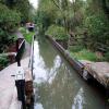
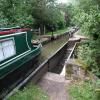
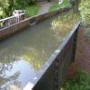
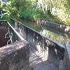
There is a small aqueduct or underbridge here which takes a stream under the canal.
| Lowsonford Lock No 32 | 6 furlongs | |
| Lowsonford Narrows | 5¼ furlongs | |
| Claverdon Narrows | 3½ furlongs | |
| Claverdon Top Lock No 33 | 1¼ furlongs | |
| Bridge No 44 (Stratford Canal) | 1¼ furlongs | |
| Yarningale Aqueduct | ||
| Bucket Lock Cottage | a few yards | |
| Bucket Lock No 34 | a few yards | |
| Claverdon Bottom Lock No 35 | 1 furlong | |
| Bridge No 45 (Stratford Canal) | 1¼ furlongs | |
| Preston Bagot Top Lock No 36 | 4¼ furlongs | |
- Stratford-upon-Avon Canal Walk (Southern Section) - YouTube — associated with Stratford-on-Avon Canal (Southern Section)
- A walk along the Stratford-upon-Avon Canal (Southern Section) from Stratford to Kingswood Junction. The walk includes the Edstone Aqueduct (the longest canal...
Mouseover for more information or show routes to facility
Nearest water point
In the direction of Junction of Stratford Canal and River Avon
In the direction of Kingswood Junction (south)
Nearest rubbish disposal
In the direction of Junction of Stratford Canal and River Avon
In the direction of Kingswood Junction (south)
Nearest chemical toilet disposal
In the direction of Junction of Stratford Canal and River Avon
In the direction of Kingswood Junction (south)
Nearest place to turn
In the direction of Junction of Stratford Canal and River Avon
In the direction of Kingswood Junction (south)
Nearest self-operated pump-out
In the direction of Junction of Stratford Canal and River Avon
In the direction of Kingswood Junction (south)
Nearest boatyard pump-out
In the direction of Junction of Stratford Canal and River Avon
In the direction of Kingswood Junction (south)
Wikipedia has a page about Yarningale Aqueduct
Yarningale Aqueduct is one of three aqueducts on a 4 miles (6 km) length of the Stratford-upon-Avon Canal in Warwickshire. It spans the Kingswood Brook near the village of Claverdon. All three aqueducts are unusual in that the towpaths are at the level of the canal bottom.
Originally built between 1812 and 1816 as a wooden structure, the aqueduct is a single-berth navigation over a local stream, and is approximately 42 feet (13 m) long. It leads into the 34th lock – "Bucket Lock" – on the canal, the middle of a three-lock flight in the Claverdon area.
In 1834, the aqueduct was destroyed by flooding of the two waterways, caused by a surge from the nearby Grand Union Canal. It was rebuilt in cast iron the same year by Horseley Ironworks.

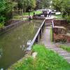
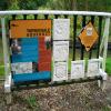
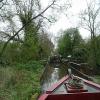



![Approaching Yarningale aqueduct. From the north along the towpath, which drops some distance to run below the canal itself as the Kingswood Brook is crossed; see [[[5538662]]]. On the left is an information board shown at http://c8.alamy.com/comp/DKNEEP/yarningale-aqueduct-information-board-stratford-upon-avon-canal-warwickshire-DKNEEP.jpg , but alas it looks as though the British Waterways information panels have been removed, perhaps for updating, though the plaques remain. by Derek Harper – 28 June 2017](https://s1.geograph.org.uk/geophotos/05/53/86/5538689_61f70c5f_120x120.jpg)

![Yarningale aqueduct. The Kingswood Brook flowing beneath the aqueduct [[[5538551]]] and its integral towpath bridge [[[5538596]]], with a clearer view of the inscribed plates](https://s3.geograph.org.uk/geophotos/05/53/86/5538607_fd8bdd22_120x120.jpg)


![Yarningale lock and aqueduct. Yarningale Lock on the Stratford-upon-Avon canal. This lock is unusual in that immediately above the lock the canal crosses a small aqueduct, constructed as an iron trough in the same style as its much longer cousin [[3786]] further down the canal at Bearley. by David Stowell – May 1991](https://s0.geograph.org.uk/photos/00/37/003788_714aa450_120x120.jpg)


![Yarningale aqueduct. Another view of the aqueduct plus integrated towpath https://www.historicengland.org.uk/listing/the-list/list-entry/1184618 shown in [[5538551]]. Beyond is the top gate of lock 34. by Derek Harper – 28 June 2017](https://s2.geograph.org.uk/geophotos/05/53/86/5538662_b5a4c10e_120x120.jpg)
![Yarningale: lock and aqueduct. See [[3408180]]; the fence on the right (which is presumably designed to prevent anyone falling over the vertical drop into the Kingswood Brook) has received a coat of white paint. The lock, 34, is listed and described at https://www.historicengland.org.uk/listing/the-list/list-entry/1382093 . by Derek Harper – 28 June 2017](https://s1.geograph.org.uk/geophotos/05/53/85/5538509_6940cd21_120x120.jpg)


![Yarningale aqueduct spans Kingswood Brook. The aqueduct, apparently bridge 44 on the Stratford-upon-Avon canal, is immediately north of lock 34. On the left of the photo is the parapet of a flight of steps that carries a footpath up to the canal. The viewpoint was very confined. Somebody: revisit with a wider-angle lens. Detail is better seen in Derek's [[5538607]]. by Robin Stott – 20 October 2010](https://s1.geograph.org.uk/geophotos/02/14/63/2146385_9c645fd1_120x120.jpg)


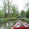
![Stratford-upon-Avon Canal near Yarningale aqueduct. From where [[[5538689]]], looking up the canal as it curves towards lock 33 http://www.geograph.org.uk/search.php?i=77041834 . by Derek Harper – 28 June 2017](https://s1.geograph.org.uk/geophotos/05/53/87/5538701_3083403e_120x120.jpg)


