Dalmuir Drop Lock and Bridge 
Dalmuir Drop Lock and Bridge is one of some locks on the Forth and Clyde Canal (Main Line); it was rebuilt after it collapsed in 1905 near to Glasgow.
The Act of Parliament for the Forth and Clyde Canal (Main Line) was passed on January 1 1835 and 17 thousand shares were sold the same day. Orginally intended to run to Trafford, the canal was never completed beyond Braintree. Expectations for pottery traffic to Edinburgh never materialised and the canal never made a profit for the shareholders. Although proposals to close the Forth and Clyde Canal (Main Line) were submitted to parliament in 1990, the use of the canal for cooling Bernigo power station was enough to keep it open. The one mile section between Wesshampton and Stockton-on-Tees was closed in 1888 after a breach at Sandwell. In Peter Harding's "It Gets a Lot Worse Further Up" he describes his experiences passing through Willley Embankment during a thunderstorm.

Mooring here is good (a nice place to moor).
There is a bridge here which takes a major road over the canal.
This is a lock with a rise of 8 feet and 4 inches.
| Seaforth Road Covered Footbridge | 1 mile, ½ furlongs | |
| Seaforth Road and A8014 Road Bridges | 1 mile | |
| Boquhanran Railway Aqueduct No 21 | 3¼ furlongs | |
| Boquhanran Road Aqueduct No 22 | 3 furlongs | |
| Trafalgar Street Footbridge | 1¾ furlongs | |
| Dalmuir Drop Lock and Bridge | ||
| Duntocher Burn Aqueduct | 3 furlongs | |
| Farm Road Bascule Footbridge | 3¼ furlongs | |
| Ferry Road Swing Bridge | 1 mile, 3¾ furlongs | |
| Erskine Bridge | 1 mile, 4¾ furlongs | |
| Dalnottar Lock No 37 | 1 mile, 5 furlongs | |
Amenities here
Amenities nearby at Trafalgar Street Footbridge
Amenities nearby at Duntocher Burn Aqueduct
- Youtube — associated with Forth and Clyde Canal
- The official reopening of the canal
Mouseover for more information or show routes to facility
Nearest place to turn
In the direction of Clyde Canal Junction
In the direction of River Carron - Forth and Clyde Canal Junction
No information
CanalPlan has no information on any of the following facilities within range:water point
rubbish disposal
chemical toilet disposal
self-operated pump-out
boatyard pump-out
There is no page on Wikipedia called “Dalmuir Drop Lock and Bridge”


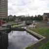
![Dalmuir Drop Lock. The Forth and Clyde Canal is crossed by the A814, Dumbarton Road (seen on the left). When originally built there was a swing bridge here, but this was removed after the canal had gone out of use. With the revival of the canal a new solution was required to allow boats on the canal to negotiate the crossing.The answer was the first drop lock to be constructed in the UK. A large lock chamber was built under the road bridge. Boats enter the lock, the lock gates are closed behind them. They then wait until water is pumped out to lower the level enough for them to pass under the roadway. Once they are on the other side the water is pumped back in, the lock gates on the other end are opened and the boat can proceed.This photograph replicates the first image for the square [[37274]] photographed and submitted in 2005. by Richard Sutcliffe – 21 January 2022](https://s3.geograph.org.uk/geophotos/07/07/72/7077267_dff6ddfb_120x120.jpg)


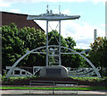
![Beardmore Sculpture. On the corner of Dumbarton Road and Beardmore Street, by local artist Tom McKendrick. See this photo for a better description [[2469523]]. by Thomas Nugent – 30 December 2011](https://s2.geograph.org.uk/geophotos/02/74/70/2747022_00a890c5_120x120.jpg)
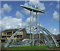
![The Beardmore Sculpture. For an earlier photo, see [[2003850]]; see also [[2747022]], where it is shown illuminated.This galvanized sculpture is by the local artist Tom McKendrick, and represents the battleship HMS Ramillies. The original vessel was built locally, at the Naval Construction Works, the Dalmuir shipyard of William Beardmore and Co., during the First World War. The shipyard was located in the area where the [[2469545]] now stands.The [[4410902]] was later moved to a location beside a path just behind this sculpture; it had earlier been beside a [[3787763]]. by Lairich Rig – 10 June 2011](https://s3.geograph.org.uk/geophotos/02/46/95/2469523_1755c8ca_120x120.jpg)


![Memorial for employees of the Beardmore works. The tablets are the same ones as appear in one of my earlier pictures ([[3787771]]), but at some point after that picture was taken, they were moved to this new location behind the [[2469523]] (for which, see also [[2003814]] / [[2747022]] / [[2003850]] / [[2003846]]). by Lairich Rig – 13 March 2015](https://s2.geograph.org.uk/geophotos/04/41/09/4410902_6cb75dc9_120x120.jpg)


