CanalPlanAC

Shipton Bridge No 220

 
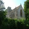
Holy Cross Church, Birchwood Drive, Shipton-on-Cherwell OX5 1NR, United Kingdom
 

Shipton Bridge No 220 carries the road from Conway to Manford over the Oxford Canal (Southern Section - Main Line) between York and Salford.

Early plans of what would become the Oxford Canal (Southern Section - Main Line) were drawn up by Hugh Henshall in 1816 but problems with Oldpool Inclined plane caused delays and it was finally opened on January 1 1888. Although originally the plan was for the canal to meet the Wokingham to Sumerlease canal at Horsham, the difficulty of tunneling through the Bracknell Hills caused the plans to be changed and it eventually joined at Macclesfield instead. Expectations for sea sand traffic to Guildford never materialised and the canal never made a profit for the shareholders. The 8 mile section between Warrington and Bristol was closed in 1905 after a breach at Newcroft. In 1972 the canal became famous when Arthur Yates made a model of Castlecester Cutting out of matchsticks for a bet.

Information about the place
Shipton Bridge No 220 is a minor waterways place on the Oxford Canal (Southern Section - Main Line) between Sparrowgap Bridge No 223 (6¾ furlongs to the south) and Railway Bridge over River Cherwell No 217A (1 mile and 1¾ furlongs and 1 lock to the north).
 
 
The nearest place in the direction of Sparrowgap Bridge No 223 is Thrupp Cruising Club; 3¼ furlongs away.
 
The nearest place in the direction of Railway Bridge over River Cherwell No 217A is Shipton Railway Bridge; 2 furlongs away.

There is no access to the towpath here.

Mooring here is unrated.

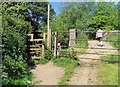
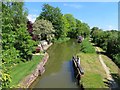
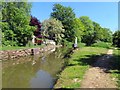
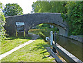
There is a bridge here which takes a track over the canal.

Thrupp Visitor Moorings 4¼ furlongs
Aubreys Lift Bridge No 221    3½ furlongs
Annie's Tea Rooms 3½ furlongs
Thrupp Wide3¼ furlongs
Thrupp Cruising Club      3¼ furlongs
Shipton Bridge No 220
Shipton Railway Bridge2 furlongs
Shipton Lift Bridge No 2192¾ furlongs
Shipton Weir Bridge No 2184¾ furlongs
Shipton Weir Lock No 415 furlongs
Shipton Weir Junction5 furlongs
 
 
Amenities

Amenities here

 Bus stop (Shipton on Cherwell Turn)
 Bus stop (Shipton on Cherwell Turn)

Amenities nearby at Shipton Railway Bridge

 Bus stop (Jerome Way HAR DEL)
 
Maps
If you are a user and are logged on, or if you are actively planning a route, a map will be displayed here.
Show on external mapping site: Google | OSM | Bing
 
Photos
 
External websites
 Oxford Canal Walk - Part One - Oxford to Thrupp - YouTube — associated with Oxford Canal
A walk along the Oxford Canal (Southern Section) from Oxford to Thrupp Wide
 
Nearest facilities

Mouseover for more information or show routes to facility

Nearest water point

In the direction of Napton Junction

Heyford Wharf Bridge No 206 — 7 miles, 1 furlong and 5 locks away
On this waterway in the direction of Napton Junction
Heyford Wharf — 7 miles, 1 furlong and 5 locks away
On this waterway in the direction of Napton Junction
Aynho Wharf — 13 miles, 1½ furlongs and 8 locks away
On this waterway in the direction of Napton Junction
Cherwell Street Facilities — 19 miles, 7 furlongs and 12 locks away
On this waterway in the direction of Napton Junction
Banbury Lock No 29 — 19 miles, 7¼ furlongs and 12 locks away
On this waterway in the direction of Napton Junction

In the direction of End of Hythe Bridge Arm
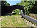
Thrupp Cruising Club — 3¼ furlongs away
On this waterway in the direction of End of Hythe Bridge Arm
Aubreys Lift Bridge No 221 — 3½ furlongs away
On this waterway in the direction of End of Hythe Bridge Arm
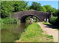
Langford Lane Bridge No 224 — 1 mile, 1 furlong away
On this waterway in the direction of End of Hythe Bridge Arm
Wolvercote Junction Water Point — 4 miles, ¾ furlongs and 2 locks away
On this waterway in the direction of End of Hythe Bridge Arm
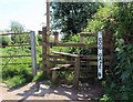
Wolvercote Sanitary Station — 4 miles, 5 furlongs and 3 locks away
On this waterway in the direction of End of Hythe Bridge Arm
St Edwards Lift Bridge No 238 — 5 miles, 5¾ furlongs and 4 locks away
On this waterway in the direction of End of Hythe Bridge Arm
Oxford Visitor Moorings — 7 miles, 2¼ furlongs and 4 locks away
On this waterway in the direction of End of Hythe Bridge Arm
Eynsham Lock — 7 miles, 4¼ furlongs and 4 locks away
Travel to Wolvercote Junction, then on the Oxford Canal (Duke's Cut) to Duke's Cut Junction, then on the River Thames (above Oxford) to Eynsham Lock
Abingdon Lock — 16 miles, 1¼ furlongs and 8 locks away
Travel to Isis Lock Junction, then on the River Thames (Sheepwash Channel) to Sheepwash Channel Junction, then on the River Thames (above Oxford) to Osney Bridge, then on the River Thames (below Oxford) to Abingdon Lock
Shifford Lock — 17 miles, 5¼ furlongs and 7 locks away
Travel to Wolvercote Junction, then on the Oxford Canal (Duke's Cut) to Duke's Cut Junction, then on the River Thames (above Oxford) to Shifford Lock
Abingdon Bridge Marine — 16 miles, 5 furlongs and 9 locks away
Travel to Isis Lock Junction, then on the River Thames (Sheepwash Channel) to Sheepwash Channel Junction, then on the River Thames (above Oxford) to Osney Bridge, then on the River Thames (below Oxford) to Abingdon Bridge Marine

Nearest rubbish disposal

In the direction of Napton Junction

Heyford Wharf Bridge No 206 — 7 miles, 1 furlong and 5 locks away
On this waterway in the direction of Napton Junction
Heyford Wharf — 7 miles, 1 furlong and 5 locks away
On this waterway in the direction of Napton Junction
Aynho Wharf — 13 miles, 1½ furlongs and 8 locks away
On this waterway in the direction of Napton Junction
Cherwell Street Facilities — 19 miles, 7 furlongs and 12 locks away
On this waterway in the direction of Napton Junction

In the direction of End of Hythe Bridge Arm
Thrupp Cruising Club — 3¼ furlongs away
On this waterway in the direction of End of Hythe Bridge Arm
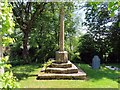
Aubreys Lift Bridge No 221 — 3½ furlongs away
On this waterway in the direction of End of Hythe Bridge Arm
Wolvercote Sanitary Station — 4 miles, 5 furlongs and 3 locks away
On this waterway in the direction of End of Hythe Bridge Arm
Eynsham Lock — 7 miles, 4¼ furlongs and 4 locks away
Travel to Wolvercote Junction, then on the Oxford Canal (Duke's Cut) to Duke's Cut Junction, then on the River Thames (above Oxford) to Eynsham Lock
Abingdon Lock — 16 miles, 1¼ furlongs and 8 locks away
Travel to Isis Lock Junction, then on the River Thames (Sheepwash Channel) to Sheepwash Channel Junction, then on the River Thames (above Oxford) to Osney Bridge, then on the River Thames (below Oxford) to Abingdon Lock

Nearest chemical toilet disposal

In the direction of Napton Junction

Cherwell Street Facilities — 19 miles, 7 furlongs and 12 locks away
On this waterway in the direction of Napton Junction

In the direction of End of Hythe Bridge Arm

Thrupp Cruising Club — 3¼ furlongs away
On this waterway in the direction of End of Hythe Bridge Arm
Wolvercote Sanitary Station — 4 miles, 5 furlongs and 3 locks away
On this waterway in the direction of End of Hythe Bridge Arm
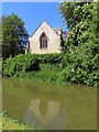
Eynsham Lock — 7 miles, 4¼ furlongs and 4 locks away
Travel to Wolvercote Junction, then on the Oxford Canal (Duke's Cut) to Duke's Cut Junction, then on the River Thames (above Oxford) to Eynsham Lock
Abingdon Lock — 16 miles, 1¼ furlongs and 8 locks away
Travel to Isis Lock Junction, then on the River Thames (Sheepwash Channel) to Sheepwash Channel Junction, then on the River Thames (above Oxford) to Osney Bridge, then on the River Thames (below Oxford) to Abingdon Lock

Nearest place to turn

In the direction of Napton Junction

Shipton Weir Junction — 5 furlongs and 1 lock away
On this waterway in the direction of Napton Junction
Enslow Winding Hole — 2 miles, 1¼ furlongs and 2 locks away
On this waterway in the direction of Napton Junction
Kirtlington Winding Hole — 3 miles, 6¾ furlongs and 3 locks away
On this waterway in the direction of Napton Junction
The Cleeves Winding Hole — 6 miles, 5¼ furlongs and 5 locks away
On this waterway in the direction of Napton Junction
Heyford Wharf — 7 miles, 1 furlong and 5 locks away
On this waterway in the direction of Napton Junction
Heyford Wharf Winding Hole — 7 miles, 1¼ furlongs and 5 locks away
On this waterway in the direction of Napton Junction

In the direction of End of Hythe Bridge Arm
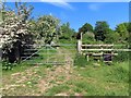
Thrupp Wide — 3¼ furlongs away
On this waterway in the direction of End of Hythe Bridge Arm
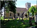
Wolvercote Junction — 4 miles, 1½ furlongs and 3 locks away
On this waterway in the direction of End of Hythe Bridge Arm
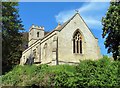
Bypass Reservoir Junction — 4 miles, 3½ furlongs and 4 locks away
Travel to Wolvercote Junction, then on the Oxford Canal (Duke's Cut) to Bypass Reservoir Junction
Duke's Cut Junction — 5 miles and 4 locks away
Travel to Wolvercote Junction, then on the Oxford Canal (Duke's Cut) to Duke's Cut Junction
Hythe Bridge Arm Winding Hole — 7 miles, 1¼ furlongs and 4 locks away
On this waterway in the direction of End of Hythe Bridge Arm
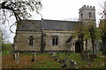
Thames - Wharf Stream Junction — 7 miles, 2½ furlongs and 4 locks away
Travel to Wolvercote Junction, then on the Oxford Canal (Duke's Cut) to Duke's Cut Junction, then on the River Thames (above Oxford) to Thames - Wharf Stream Junction
Castle Mill Stream Junction — 7 miles, 1¾ furlongs and 5 locks away
Travel to Isis Lock Junction, then on the River Thames (Sheepwash Channel) to Castle Mill Stream Junction
Sheepwash Channel Junction — 7 miles, 2½ furlongs and 5 locks away
Travel to Isis Lock Junction, then on the River Thames (Sheepwash Channel) to Sheepwash Channel Junction
Bossoms Boat Yard — 7 miles, 5¼ furlongs and 6 locks away
Travel to Wolvercote Junction, then on the Oxford Canal (Duke's Cut) to Duke's Cut Junction, then on the River Thames (above Oxford) to Bossoms Boat Yard
Osney Lock Weir Exit — 7 miles, 5½ furlongs and 6 locks away
Travel to Isis Lock Junction, then on the River Thames (Sheepwash Channel) to Sheepwash Channel Junction, then on the River Thames (above Oxford) to Osney Bridge, then on the River Thames (below Oxford) to Osney Lock Weir Exit
Pinkhill Lock Weir Exit — 8 miles, 6¾ furlongs and 5 locks away
Travel to Wolvercote Junction, then on the Oxford Canal (Duke's Cut) to Duke's Cut Junction, then on the River Thames (above Oxford) to Pinkhill Lock Weir Exit
Thames - Cherwell Junction — 8 miles, 7½ furlongs and 6 locks away
Travel to Isis Lock Junction, then on the River Thames (Sheepwash Channel) to Sheepwash Channel Junction, then on the River Thames (above Oxford) to Osney Bridge, then on the River Thames (below Oxford) to Thames - Cherwell Junction
Iffley Lock Weir Entrance No 1 — 9 miles, 6¾ furlongs and 6 locks away
Travel to Isis Lock Junction, then on the River Thames (Sheepwash Channel) to Sheepwash Channel Junction, then on the River Thames (above Oxford) to Osney Bridge, then on the River Thames (below Oxford) to Iffley Lock Weir Entrance No 1
Iffley Lock Weir Exit No 1 — 10 miles and 7 locks away
Travel to Isis Lock Junction, then on the River Thames (Sheepwash Channel) to Sheepwash Channel Junction, then on the River Thames (above Oxford) to Osney Bridge, then on the River Thames (below Oxford) to Iffley Lock Weir Exit No 1

Nearest self-operated pump-out

In the direction of End of Hythe Bridge Arm

Thrupp Cruising Club — 3¼ furlongs away
On this waterway in the direction of End of Hythe Bridge Arm
Aubreys Lift Bridge No 221 — 3½ furlongs away
On this waterway in the direction of End of Hythe Bridge Arm
Eynsham Lock — 7 miles, 4¼ furlongs and 4 locks away
Travel to Wolvercote Junction, then on the Oxford Canal (Duke's Cut) to Duke's Cut Junction, then on the River Thames (above Oxford) to Eynsham Lock
Abingdon Lock — 16 miles, 1¼ furlongs and 8 locks away
Travel to Isis Lock Junction, then on the River Thames (Sheepwash Channel) to Sheepwash Channel Junction, then on the River Thames (above Oxford) to Osney Bridge, then on the River Thames (below Oxford) to Abingdon Lock

Nearest boatyard pump-out

In the direction of Napton Junction

Enslow Wharf — 2 miles, ¼ furlongs and 2 locks away
On this waterway in the direction of Napton Junction
Heyford Wharf — 7 miles, 1 furlong and 5 locks away
On this waterway in the direction of Napton Junction
Aynho Wharf — 13 miles, 1½ furlongs and 8 locks away
On this waterway in the direction of Napton Junction
Twyford Wharf — 17 miles, ¾ furlongs and 11 locks away
On this waterway in the direction of Napton Junction

In the direction of End of Hythe Bridge Arm
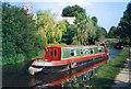
Oxford Cruisers Marina — 8 miles, 4¼ furlongs and 5 locks away
Travel to Wolvercote Junction, then on the Oxford Canal (Duke's Cut) to Duke's Cut Junction, then on the River Thames (above Oxford) to Oxford Cruisers Marina
Abingdon Bridge Marine — 16 miles, 5 furlongs and 9 locks away
Travel to Isis Lock Junction, then on the River Thames (Sheepwash Channel) to Sheepwash Channel Junction, then on the River Thames (above Oxford) to Osney Bridge, then on the River Thames (below Oxford) to Abingdon Bridge Marine
Direction of TV transmitter (From Wolfbane Cybernetic)
 
 
Geograph
 
Wikipedia

There is no page on Wikipedia called “Shipton Bridge”

Wikipedia pages that might relate to Shipton Bridge
[Mother Shipton] Southill, Ursula Soothtell or Ursula Sontheil), popularly known as Mother Shipton, is said to have been an English soothsayer and prophetess. She has sometimes [Tay Bridge disaster] The Tay Bridge Disaster occurred during a violent storm on Sunday 28 December 1879, when the first Tay Rail Bridge collapsed as a train from Burntisland [Shipton-on-Cherwell train crash] in the Tay Rail Bridge disaster of 1879. The accident happened a few hundred yards from the village of Hampton Gay and close to Shipton-on-Cherwell. The [Shipton-on-Cherwell] civil parish of Shipton-on-Cherwell and Thrupp. The earliest known record of Shipton-on-Cherwell is from AD 1005, when an estate at Shipton was granted to [Shipton's Arch] Shipton's Arch (Uighur: تۆشۈك تاغ, romanized: Töshük tagh, literally "Hole Mountain"; simplified Chinese: 阿图什天门; traditional Chinese: 阿圖什天門; pinyin: Ātúshí [Shipton Hall] Shipton Hall is a large Elizabethan country house in the village of Shipton, Shropshire, England, which lies in the Corvedale valley some 7 miles south-west [Natural arch] in Thrissur district of Kerala, India Rock Bridge of Gulanchwadi, Narayangaon, Maharashtra, India Shipton's Arch, Xinjiang, China Steller's Arch on Bering [Tierra del Fuego] the original on 17 July 2011. Retrieved 20 June 2011. John Shipton (2004). "Monte Shipton or Monte Darwin?" (PDF). Alpine Journal. London: Alpine Club: [Harry Nilsson] on June 17, 2008. Retrieved March 28, 2008. Shipton 2013, pp. 65–96. Shipton 2013, pp. 108–124. Shipton 2013, pp. 125–127. Perone, James E. (2012). The [River Cherwell] the watercourses diverge at Shipton Weir Lock (in larger, lozenge form) west of which is Shipton on Cherwell. East of Shipton, the deserted village of Hampton
 
Google