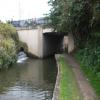
Lockoford Lane Bridge
is a minor waterways place
on the Chesterfield Canal (Derbyshire restored section) between
Chesterfield Waterside (New development under construction and limit of navigation) (7 furlongs
and 1 lock
to the south) and
Staveley Town Lock No 5A (4 miles and 5¼ furlongs
and 4 locks
to the east).
The nearest place in the direction of Chesterfield Waterside is Tapton Lock No 1;
a few yards
away.
The nearest place in the direction of Staveley Town Lock No 5A is Tapton Slipway;
¼ furlongs
away.
There may be access to the towpath here.
Mooring here is unrated.
There is a bridge here which takes a minor road over the canal.
| River Rother Flood Gate | 3½ furlongs | |
| Tapton Mill Bridge | 3½ furlongs | |
| Rother Way Tunnel (southern entrance) | ½ furlongs | |
| Rother Way Tunnel (northern entrance) | ¼ furlongs | |
| Tapton Lock No 1 | a few yards | |
| Lockoford Lane Bridge | ||
| Tapton Slipway | ¼ furlongs | |
| Rother Way Railway Bridge No 2 | 1¾ furlongs | |
| Rother Way Railway Bridge No 1 | 2 furlongs | |
| Brimington Wharf | 5¾ furlongs | |
| Station Road Bridge (Brimington) | 6 furlongs | |
Amenities here
- Chesterfield Canal Trust — associated with Chesterfield Canal (Derbyshire restored section)
- Restoration website
Mouseover for more information or show routes to facility
Nearest water point
In the direction of Staveley Town Basin
Shireoaks Marina — 16 miles, 4¾ furlongs and 69 locks away
Travel to Staveley Town Basin, then on the Chesterfield Canal (Unnavigable section) to New Leah’s Bridge No 26B, then on the Chesterfield Canal (Central Line West) to Nethermoor Lake Marina, then on the Chesterfield Canal (Unnavigable section) to Norwood Tunnel (eastern entrance), then on the Chesterfield Canal (Norwood to Retford) to Shireoaks MarinaNearest rubbish disposal
In the direction of Staveley Town Basin
Shireoaks Marina — 16 miles, 4¾ furlongs and 69 locks away
Travel to Staveley Town Basin, then on the Chesterfield Canal (Unnavigable section) to New Leah’s Bridge No 26B, then on the Chesterfield Canal (Central Line West) to Nethermoor Lake Marina, then on the Chesterfield Canal (Unnavigable section) to Norwood Tunnel (eastern entrance), then on the Chesterfield Canal (Norwood to Retford) to Shireoaks MarinaNearest chemical toilet disposal
In the direction of Staveley Town Basin
Shireoaks Marina — 16 miles, 4¾ furlongs and 69 locks away
Travel to Staveley Town Basin, then on the Chesterfield Canal (Unnavigable section) to New Leah’s Bridge No 26B, then on the Chesterfield Canal (Central Line West) to Nethermoor Lake Marina, then on the Chesterfield Canal (Unnavigable section) to Norwood Tunnel (eastern entrance), then on the Chesterfield Canal (Norwood to Retford) to Shireoaks Marina
Cuckoo Wharf Elsan — 18 miles, 6¾ furlongs and 78 locks away
Travel to Staveley Town Basin, then on the Chesterfield Canal (Unnavigable section) to New Leah’s Bridge No 26B, then on the Chesterfield Canal (Central Line West) to Nethermoor Lake Marina, then on the Chesterfield Canal (Unnavigable section) to Norwood Tunnel (eastern entrance), then on the Chesterfield Canal (Norwood to Retford) to Cuckoo Wharf ElsanNearest place to turn
In the direction of Staveley Town Basin
Bilby Lane Bridge Winding Hole — 2 miles, ¼ furlongs and 2 locks away
On this waterway in the direction of Staveley Town Basin
Works Road Winding Hole — 3 miles, 1½ furlongs and 4 locks away
On this waterway in the direction of Staveley Town Basin
Staveley Town Basin — 4 miles, 5 furlongs and 4 locks away
On this waterway in the direction of Staveley Town Basin
Hartington Harbour — 4 miles, 6¼ furlongs and 5 locks away
Travel to Staveley Town Basin, then on the Chesterfield Canal (Unnavigable section) to Hartington Harbour
Norwood Winding Hole — 10 miles, 5¾ furlongs and 20 locks away
Travel to Staveley Town Basin, then on the Chesterfield Canal (Unnavigable section) to New Leah’s Bridge No 26B, then on the Chesterfield Canal (Central Line West) to Nethermoor Lake Marina, then on the Chesterfield Canal (Unnavigable section) to Norwood Winding Hole
Kiveton Waters Marina — 12 miles, 1¾ furlongs and 43 locks away
Travel to Staveley Town Basin, then on the Chesterfield Canal (Unnavigable section) to New Leah’s Bridge No 26B, then on the Chesterfield Canal (Central Line West) to Nethermoor Lake Marina, then on the Chesterfield Canal (Unnavigable section) to Kiveton Waters Marina
Manor Road Winding Hole — 13 miles, ½ furlongs and 46 locks away
Travel to Staveley Town Basin, then on the Chesterfield Canal (Unnavigable section) to New Leah’s Bridge No 26B, then on the Chesterfield Canal (Central Line West) to Nethermoor Lake Marina, then on the Chesterfield Canal (Unnavigable section) to Norwood Tunnel (eastern entrance), then on the Chesterfield Canal (Norwood to Retford) to Manor Road Winding Hole
Little Lane Bridge Winding Hole — 15 miles, 5¼ furlongs and 61 locks away
Travel to Staveley Town Basin, then on the Chesterfield Canal (Unnavigable section) to New Leah’s Bridge No 26B, then on the Chesterfield Canal (Central Line West) to Nethermoor Lake Marina, then on the Chesterfield Canal (Unnavigable section) to Norwood Tunnel (eastern entrance), then on the Chesterfield Canal (Norwood to Retford) to Little Lane Bridge Winding Hole
Shireoaks Marina — 16 miles, 4¾ furlongs and 69 locks away
Travel to Staveley Town Basin, then on the Chesterfield Canal (Unnavigable section) to New Leah’s Bridge No 26B, then on the Chesterfield Canal (Central Line West) to Nethermoor Lake Marina, then on the Chesterfield Canal (Unnavigable section) to Norwood Tunnel (eastern entrance), then on the Chesterfield Canal (Norwood to Retford) to Shireoaks Marina
Junction with former Lady Lee Arm — 17 miles, 7½ furlongs and 76 locks away
Travel to Staveley Town Basin, then on the Chesterfield Canal (Unnavigable section) to New Leah’s Bridge No 26B, then on the Chesterfield Canal (Central Line West) to Nethermoor Lake Marina, then on the Chesterfield Canal (Unnavigable section) to Norwood Tunnel (eastern entrance), then on the Chesterfield Canal (Norwood to Retford) to Junction with former Lady Lee Arm
Morse Lock Winding Hole — 18 miles, 3¾ furlongs and 77 locks away
Travel to Staveley Town Basin, then on the Chesterfield Canal (Unnavigable section) to New Leah’s Bridge No 26B, then on the Chesterfield Canal (Central Line West) to Nethermoor Lake Marina, then on the Chesterfield Canal (Unnavigable section) to Norwood Tunnel (eastern entrance), then on the Chesterfield Canal (Norwood to Retford) to Morse Lock Winding Hole
High Hoe Road Bridge Winding Hole — 19 miles, 4 furlongs and 79 locks away
Travel to Staveley Town Basin, then on the Chesterfield Canal (Unnavigable section) to New Leah’s Bridge No 26B, then on the Chesterfield Canal (Central Line West) to Nethermoor Lake Marina, then on the Chesterfield Canal (Unnavigable section) to Norwood Tunnel (eastern entrance), then on the Chesterfield Canal (Norwood to Retford) to High Hoe Road Bridge Winding HoleNo information
CanalPlan has no information on any of the following facilities within range:self-operated pump-out
boatyard pump-out
Direction of TV transmitter (From Wolfbane Cybernetic)
There is no page on Wikipedia called “Lockoford Lane Bridge”
Wikipedia pages that might relate to Lockoford Lane Bridge
[Chesterfield, Derbyshire]
Hollis Lane is now a housing estate; the former offices were turned into flats and serviced office suites. Dema Glass's factory near Lockoford Lane closed;
Results of Google Search
Bridge Lane Wines: WelcomeBridge Lane Wine is the second label of Lieb Cellars, located in Mattituck on the North Fork of Long Island. Producing wines in bottle, boxes and kegs.
Bridge Lane Wine - 35 Cox Neck Rd, Mattituck, New York 11952 - Rated 4.6 based on 24 Reviews "I'm a fan of New Zealand Sauv Blanc, and no other region. ..
Contents: 375mL = 1/2 bottle = 2 glasses Materials: 100?ecyclable aluminum can Avg Price: $8 (= $16/bottle) Occasion: Camping, tailgates and hikes.
The Bridge 500 has been developed for the attachement of the Slice Mini Bath Chamber, emphasizing the need for maximum stability. We recommend to use ...
If you have a roadway or drainage concern on a County Road you may call in a work request directly to the Road & Bridge Department at (904) 209-0266.
Mission Statement. Maintain a safe, quality road system. Upgrade the road system to serve the public needs. Road and Bridge Dept Photo ...
See all available apartments for rent at Bridge Lane in Phoenix, AZ. Bridge Lane has rental units ranging from 481-909 sq ft starting at $669.
Sep 8, 2019 ... Video taken from Lockoford lane bridge only just made it there in time.
Read the Roads & Bridges magazine, a 108 year old leading trade publication covering the transportation, roadway construction, and road maintenance ...
See photos, floor plans and more details about Bridge Lane in Phoenix, Arizona. Visit Rent.com now for rental rates and other information about this property.