
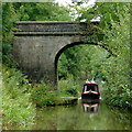
Hightown Bridge No 74
is a minor waterways place
on the Macclesfield Canal between
Ramsdell Hall Winding Hole (3 miles and 3¼ furlongs
to the southwest) and
Swettenham Wharf (10 miles
and 12 locks
to the northeast).
The nearest place in the direction of Ramsdell Hall Winding Hole is Park Lane Bridge No 75A;
½ furlongs
away.
The nearest place in the direction of Swettenham Wharf is Galley Bridge No 73;
1¾ furlongs
away.
There may be access to the towpath here.
Mooring here is unrated.
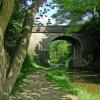
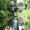
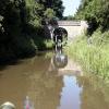
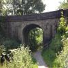
There is a bridge here which takes a minor road over the canal.
| Morris Bridge No 76 | 1½ furlongs | |
| Congleton Visitor Moorings | 1¼ furlongs | |
| Park Lane Railway Bridge | ¾ furlongs | |
| Old Park Lane Bridge No 75 | ½ furlongs | |
| Park Lane Bridge No 75A | ½ furlongs | |
| Hightown Bridge No 74 | ||
| Galley Bridge No 73 | 1¾ furlongs | |
| Blackshaw Close Narrows | 3 furlongs | |
| Dane in Shaw Brook Aqueduct | 3¾ furlongs | |
| Biddulph Valley Aqueduct | 4 furlongs | |
| Biddulph Valley Arm | 4¼ furlongs | |
Amenities nearby at Park Lane Bridge No 75A
There are no links to external websites from here.
Why not log in and add some (select "External websites" from the menu (sometimes this is under "Edit"))?
Why not log in and add some (select "External websites" from the menu (sometimes this is under "Edit"))?
Mouseover for more information or show routes to facility
Nearest water point
In the direction of Hall Green Stop Lock
Hall Green Footbridge No 93 — 4 miles, 5¼ furlongs away
On this waterway in the direction of Hall Green Stop Lock
Harecastle Tunnel (northern entrance) — 6 miles, 4 furlongs and 1 lock away
Travel to Hall Green Stop Lock, then on the Trent and Mersey Canal (Hall Green Branch) to Hardings Wood Junction, then on the Trent and Mersey Canal (Main Line - Etruria to Hardings Wood) to Harecastle Tunnel (northern entrance)
Harecastle Tunnel (southern entrance) — 8 miles, 1¼ furlongs and 1 lock away
Travel to Hall Green Stop Lock, then on the Trent and Mersey Canal (Hall Green Branch) to Hardings Wood Junction, then on the Trent and Mersey Canal (Main Line - Etruria to Hardings Wood) to Harecastle Tunnel (southern entrance)
Red Bull Services — 6 miles, 6¼ furlongs and 4 locks away
Travel to Hall Green Stop Lock, then on the Trent and Mersey Canal (Hall Green Branch) to Hardings Wood Junction, then on the Trent and Mersey Canal (Main Line - Harding's Wood to Middlewich) to Red Bull Services
Etruria Services — 11 miles, 6¾ furlongs and 1 lock away
Travel to Hall Green Stop Lock, then on the Trent and Mersey Canal (Hall Green Branch) to Hardings Wood Junction, then on the Trent and Mersey Canal (Main Line - Etruria to Hardings Wood) to Etruria Junction, then on the Trent and Mersey Canal (Caldon Branch - Main Line to Froghall) to Etruria Services
Stoke Top Lock No 40 — 11 miles, 6½ furlongs and 1 lock away
Travel to Hall Green Stop Lock, then on the Trent and Mersey Canal (Hall Green Branch) to Hardings Wood Junction, then on the Trent and Mersey Canal (Main Line - Etruria to Hardings Wood) to Etruria Junction, then on the Trent and Mersey Canal (Main Line - Great Haywood to Etruria) to Stoke Top Lock No 40
Wheelock Wharf — 13 miles, ¼ furlongs and 27 locks away
Travel to Hall Green Stop Lock, then on the Trent and Mersey Canal (Hall Green Branch) to Hardings Wood Junction, then on the Trent and Mersey Canal (Main Line - Harding's Wood to Middlewich) to Wheelock Wharf
Middlewich Junction — 18 miles, 7¾ furlongs and 32 locks away
Travel to Hall Green Stop Lock, then on the Trent and Mersey Canal (Hall Green Branch) to Hardings Wood Junction, then on the Trent and Mersey Canal (Main Line - Harding's Wood to Middlewich) to Middlewich Junction
Middlewich Town Wharf — 19 miles, 2¾ furlongs and 35 locks away
Travel to Hall Green Stop Lock, then on the Trent and Mersey Canal (Hall Green Branch) to Hardings Wood Junction, then on the Trent and Mersey Canal (Main Line - Harding's Wood to Middlewich) to Middlewich Junction, then on the Trent and Mersey Canal (Main Line - Middlewich to Preston Brook) to Middlewich Town Wharf
Middlewich Big Lock No 75 — 19 miles, 5½ furlongs and 35 locks away
Travel to Hall Green Stop Lock, then on the Trent and Mersey Canal (Hall Green Branch) to Hardings Wood Junction, then on the Trent and Mersey Canal (Main Line - Harding's Wood to Middlewich) to Middlewich Junction, then on the Trent and Mersey Canal (Main Line - Middlewich to Preston Brook) to Middlewich Big Lock No 75
In the direction of Marple Junction
Buxton Road Bridge No 68 — 1 mile, 2¾ furlongs away
On this waterway in the direction of Marple Junction
Bosley Top Lock No 1 — 5 miles, ½ furlongs and 11 locks away
On this waterway in the direction of Marple Junction
Locketts Bridge No 53 — 5 miles, 1½ furlongs and 12 locks away
On this waterway in the direction of Marple Junction
Swettenham Street Maintenance Yard — 9 miles, 7¾ furlongs and 12 locks away
On this waterway in the direction of Marple Junction
Bollington Wharf — 12 miles, 7½ furlongs and 12 locks away
On this waterway in the direction of Marple Junction
Braidbar Boats — 17 miles, 5¼ furlongs and 12 locks away
On this waterway in the direction of Marple JunctionNearest rubbish disposal
In the direction of Hall Green Stop Lock
Harecastle Tunnel (northern entrance) — 6 miles, 4 furlongs and 1 lock away
Travel to Hall Green Stop Lock, then on the Trent and Mersey Canal (Hall Green Branch) to Hardings Wood Junction, then on the Trent and Mersey Canal (Main Line - Etruria to Hardings Wood) to Harecastle Tunnel (northern entrance)
Red Bull Services — 6 miles, 6¼ furlongs and 4 locks away
Travel to Hall Green Stop Lock, then on the Trent and Mersey Canal (Hall Green Branch) to Hardings Wood Junction, then on the Trent and Mersey Canal (Main Line - Harding's Wood to Middlewich) to Red Bull Services
Etruria Services — 11 miles, 6¾ furlongs and 1 lock away
Travel to Hall Green Stop Lock, then on the Trent and Mersey Canal (Hall Green Branch) to Hardings Wood Junction, then on the Trent and Mersey Canal (Main Line - Etruria to Hardings Wood) to Etruria Junction, then on the Trent and Mersey Canal (Caldon Branch - Main Line to Froghall) to Etruria Services
Stoke Top Lock No 40 — 11 miles, 6½ furlongs and 1 lock away
Travel to Hall Green Stop Lock, then on the Trent and Mersey Canal (Hall Green Branch) to Hardings Wood Junction, then on the Trent and Mersey Canal (Main Line - Etruria to Hardings Wood) to Etruria Junction, then on the Trent and Mersey Canal (Main Line - Great Haywood to Etruria) to Stoke Top Lock No 40
Planet Lock No 3 — 12 miles, 3¾ furlongs and 3 locks away
Travel to Hall Green Stop Lock, then on the Trent and Mersey Canal (Hall Green Branch) to Hardings Wood Junction, then on the Trent and Mersey Canal (Main Line - Etruria to Hardings Wood) to Etruria Junction, then on the Trent and Mersey Canal (Caldon Branch - Main Line to Froghall) to Planet Lock No 3
Wheelock Wharf — 13 miles, ¼ furlongs and 27 locks away
Travel to Hall Green Stop Lock, then on the Trent and Mersey Canal (Hall Green Branch) to Hardings Wood Junction, then on the Trent and Mersey Canal (Main Line - Harding's Wood to Middlewich) to Wheelock Wharf
In the direction of Marple Junction
Bosley Top Lock No 1 — 5 miles, ½ furlongs and 11 locks away
On this waterway in the direction of Marple Junction
Braidbar Boats — 17 miles, 5¼ furlongs and 12 locks away
On this waterway in the direction of Marple JunctionNearest chemical toilet disposal
In the direction of Hall Green Stop Lock
Harecastle Tunnel (northern entrance) — 6 miles, 4 furlongs and 1 lock away
Travel to Hall Green Stop Lock, then on the Trent and Mersey Canal (Hall Green Branch) to Hardings Wood Junction, then on the Trent and Mersey Canal (Main Line - Etruria to Hardings Wood) to Harecastle Tunnel (northern entrance)
Red Bull Services — 6 miles, 6¼ furlongs and 4 locks away
Travel to Hall Green Stop Lock, then on the Trent and Mersey Canal (Hall Green Branch) to Hardings Wood Junction, then on the Trent and Mersey Canal (Main Line - Harding's Wood to Middlewich) to Red Bull Services
Etruria Services — 11 miles, 6¾ furlongs and 1 lock away
Travel to Hall Green Stop Lock, then on the Trent and Mersey Canal (Hall Green Branch) to Hardings Wood Junction, then on the Trent and Mersey Canal (Main Line - Etruria to Hardings Wood) to Etruria Junction, then on the Trent and Mersey Canal (Caldon Branch - Main Line to Froghall) to Etruria Services
Wheelock Wharf — 13 miles, ¼ furlongs and 27 locks away
Travel to Hall Green Stop Lock, then on the Trent and Mersey Canal (Hall Green Branch) to Hardings Wood Junction, then on the Trent and Mersey Canal (Main Line - Harding's Wood to Middlewich) to Wheelock Wharf
In the direction of Marple Junction
Bosley Top Lock No 1 — 5 miles, ½ furlongs and 11 locks away
On this waterway in the direction of Marple Junction
Swettenham Wharf — 10 miles and 12 locks away
On this waterway in the direction of Marple Junction
Bollington Wharf — 12 miles, 7½ furlongs and 12 locks away
On this waterway in the direction of Marple JunctionNearest place to turn
In the direction of Hall Green Stop Lock
Congleton Winding Hole — 3¼ furlongs away
On this waterway in the direction of Hall Green Stop Lock
Congleton Wharf — 3¾ furlongs away
On this waterway in the direction of Hall Green Stop Lock
Falmouth Road Winding Hole — 6¼ furlongs away
On this waterway in the direction of Hall Green Stop Lock
Oak Farm Winding Hole — 2 miles, ½ furlongs away
On this waterway in the direction of Hall Green Stop Lock
Ramsdell Hall Winding Hole — 3 miles, 3¼ furlongs away
On this waterway in the direction of Hall Green Stop Lock
Heritage Narrowboats — 3 miles, 5¼ furlongs away
On this waterway in the direction of Hall Green Stop Lock
Pipers Bridge Arm — 5 miles, 3¼ furlongs and 1 lock away
Travel to Hall Green Stop Lock, then on the Trent and Mersey Canal (Hall Green Branch) to Pipers Bridge Arm
Hardings Wood Junction — 6 miles, 1½ furlongs and 1 lock away
Travel to Hall Green Stop Lock, then on the Trent and Mersey Canal (Hall Green Branch) to Hardings Wood Junction
Harecastle Tunnel (southern entrance) — 8 miles, 1¼ furlongs and 1 lock away
Travel to Hall Green Stop Lock, then on the Trent and Mersey Canal (Hall Green Branch) to Hardings Wood Junction, then on the Trent and Mersey Canal (Main Line - Etruria to Hardings Wood) to Harecastle Tunnel (southern entrance)
Middleport Winding Hole — 9 miles, 6 furlongs and 1 lock away
Travel to Hall Green Stop Lock, then on the Trent and Mersey Canal (Hall Green Branch) to Hardings Wood Junction, then on the Trent and Mersey Canal (Main Line - Etruria to Hardings Wood) to Middleport Winding Hole
Burslem Branch Winding Hole — 10 miles, 4¼ furlongs and 1 lock away
Travel to Hall Green Stop Lock, then on the Trent and Mersey Canal (Hall Green Branch) to Hardings Wood Junction, then on the Trent and Mersey Canal (Main Line - Etruria to Hardings Wood) to Burslem Branch Winding Hole
Toby Carvery Festival Park — 11 miles, 3¾ furlongs and 1 lock away
Travel to Hall Green Stop Lock, then on the Trent and Mersey Canal (Hall Green Branch) to Hardings Wood Junction, then on the Trent and Mersey Canal (Main Line - Etruria to Hardings Wood) to Toby Carvery Festival Park
Festival Park Marina — 11 miles, 3¾ furlongs and 1 lock away
Travel to Hall Green Stop Lock, then on the Trent and Mersey Canal (Hall Green Branch) to Hardings Wood Junction, then on the Trent and Mersey Canal (Main Line - Etruria to Hardings Wood) to Festival Park Marina
Etruria Junction — 11 miles, 6¼ furlongs and 1 lock away
Travel to Hall Green Stop Lock, then on the Trent and Mersey Canal (Hall Green Branch) to Hardings Wood Junction, then on the Trent and Mersey Canal (Main Line - Etruria to Hardings Wood) to Etruria Junction
Etruria Services — 11 miles, 6¾ furlongs and 1 lock away
Travel to Hall Green Stop Lock, then on the Trent and Mersey Canal (Hall Green Branch) to Hardings Wood Junction, then on the Trent and Mersey Canal (Main Line - Etruria to Hardings Wood) to Etruria Junction, then on the Trent and Mersey Canal (Caldon Branch - Main Line to Froghall) to Etruria Services
Etruria Museum Winding Hole — 11 miles, 7½ furlongs and 1 lock away
Travel to Hall Green Stop Lock, then on the Trent and Mersey Canal (Hall Green Branch) to Hardings Wood Junction, then on the Trent and Mersey Canal (Main Line - Etruria to Hardings Wood) to Etruria Junction, then on the Trent and Mersey Canal (Caldon Branch - Main Line to Froghall) to Etruria Museum Winding Hole
In the direction of Marple Junction
Brook House Farm Winding Hole — 5½ furlongs away
On this waterway in the direction of Marple Junction
Town Field Bridge Winding Hole — 1 mile, 5½ furlongs away
On this waterway in the direction of Marple Junction
Winding Hole between Pearson and Stanier 2nd Bridges — 2 miles, 3¼ furlongs away
On this waterway in the direction of Marple Junction
Bosley Railway Bridge Winding Hole — 4 miles, ¾ furlongs and 1 lock away
On this waterway in the direction of Marple JunctionNearest self-operated pump-out
In the direction of Hall Green Stop Lock
Red Bull Services — 6 miles, 6¼ furlongs and 4 locks away
Travel to Hall Green Stop Lock, then on the Trent and Mersey Canal (Hall Green Branch) to Hardings Wood Junction, then on the Trent and Mersey Canal (Main Line - Harding's Wood to Middlewich) to Red Bull Services
Etruria Services — 11 miles, 6¾ furlongs and 1 lock away
Travel to Hall Green Stop Lock, then on the Trent and Mersey Canal (Hall Green Branch) to Hardings Wood Junction, then on the Trent and Mersey Canal (Main Line - Etruria to Hardings Wood) to Etruria Junction, then on the Trent and Mersey Canal (Caldon Branch - Main Line to Froghall) to Etruria Services
In the direction of Marple Junction
Bosley Top Lock No 1 — 5 miles, ½ furlongs and 11 locks away
On this waterway in the direction of Marple JunctionNearest boatyard pump-out
In the direction of Hall Green Stop Lock
Heritage Narrowboats — 3 miles, 5¼ furlongs away
On this waterway in the direction of Hall Green Stop Lock
Longport Wharf — 9 miles, 5½ furlongs and 1 lock away
Travel to Hall Green Stop Lock, then on the Trent and Mersey Canal (Hall Green Branch) to Hardings Wood Junction, then on the Trent and Mersey Canal (Main Line - Etruria to Hardings Wood) to Longport Wharf
Festival Park Marina — 11 miles, 3¾ furlongs and 1 lock away
Travel to Hall Green Stop Lock, then on the Trent and Mersey Canal (Hall Green Branch) to Hardings Wood Junction, then on the Trent and Mersey Canal (Main Line - Etruria to Hardings Wood) to Festival Park Marina
Andersen Boats Wharf — 19 miles, 2¼ furlongs and 35 locks away
Travel to Hall Green Stop Lock, then on the Trent and Mersey Canal (Hall Green Branch) to Hardings Wood Junction, then on the Trent and Mersey Canal (Main Line - Harding's Wood to Middlewich) to Middlewich Junction, then on the Trent and Mersey Canal (Main Line - Middlewich to Preston Brook) to Andersen Boats Wharf
In the direction of Marple Junction
Swettenham Wharf — 10 miles and 12 locks away
On this waterway in the direction of Marple Junction
Kerridge Dry Dock — 12 miles, 4½ furlongs and 12 locks away
On this waterway in the direction of Marple Junction
Bollington Wharf — 12 miles, 7½ furlongs and 12 locks away
On this waterway in the direction of Marple Junction
Braidbar Boats — 17 miles, 5¼ furlongs and 12 locks away
On this waterway in the direction of Marple JunctionDirection of TV transmitter (From Wolfbane Cybernetic)
There is no page on Wikipedia called “Hightown Bridge”
Wikipedia pages that might relate to Hightown Bridge
[Hightown railway station]
Hightown railway station serves the village of Hightown in Merseyside, England. The station is located on the Southport branch of the Merseyrail network's
[River Alt]
empties into the Irish Sea, near the edge of the River Mersey estuary at Hightown. The Alts upper waters deriving from small streams and, in particular,
[Altcar Rifle Range railway station]
Southport Railway, situated a third of a mile north of Hightown, Merseyside. It opened in 1862 as Hightown Rifle Station, and was renamed in July 1886. The
[List of places in Yorkshire]
(Kirklees), High Green (Sheffield), High Hoyland, High Hunsley, Higham, Hightown, Hilston, Hive, Hollym, Holme, Holme on the Wolds, Holme-on-Spalding-Moor
[Potomac River]
counties in West Virginia. The source of the South Branch is located near Hightown in northern Highland County, Virginia. The river's two branches converge
[Liverpool, Crosby and Southport Railway]
Blundellsands & Crosby - Crosby & Blundellsands Hall Road - Blundellsands Hightown - Hightown Altcar Rifle Range (closed 1921) Formby Power Station (closed c.1944)
[List of dramatic television series with LGBT characters: 2020s]
(May 22, 2020). "Hightown's Monica Raymund on Playing a Fully-Realized Lesbian Lead". The Advocate. Allah, Amari (May 11, 2020). "Hightown Cast and Character
[Southampton]
There are three fire stations within the city boundaries at St Mary's, Hightown and Redbridge. The ambulance service is provided by South Central Ambulance
[Crosby, Merseyside]
such as, Blundellsands, Brighton-Le-Sands, Little Crosby, Thornton, and Hightown, forming part of the new Sefton Central constituency represented by Bill
[Monsall tram stop]
peak The 151, operated by Stotts tours, stops nearby and runs between Hightown and Hollinwood. "Metrolink line to Oldham set to open". Transport for Greater
Results of Google Search
Nov 23, 2014 ... Some references call this Hightown Bridge, No 74 across the Macclesfield Canal. Despites its relative grandeur, it probably originated purely as ...
6-08-2010. Click to enlarge - Cliquer sur l'image pour agrandir. Hightown Bridge No.74 seen from the East. Le Pont n°74 de la Ville Haute vu de l'Est.
Nov 23, 2014 ... Shown here are the railway bridge, Bridge No 75 (the original Park Lane Bridge, maybe) and a hundred metres ahead is Bridge No 74... more.
No. 53 Quarry (Salem Stone Corp.; Div. of Medusa; Quarry No. 74-4; Aggregates Company), Hightown, Highland Co., Virginia, USA, 38° 26' 1" N, 79° 37' 2" W ...
Nearest 40 bus, taxi, tram, train stops to The Hookfield High Town. These include High Town ... No 74 Bus Stop. High Town Cannock. No 74. View Street Bus Stop High Town · High Town ... The Bridge Inn PH Bus Stop. High Town Cannock.
No. 53 Quarry (Salem Stone Corp.; Div. of Medusa; Quarry No. 74-4; Aggregates Company), Hightown, Highland Co., Virginia, USA, 38° 26' 1" N, 79° 37' 2" W ...
Nearest 40 bus, taxi, tram, train stops to Westways High Town. These include ... High Town Cannock. No 74. View Street Bus Stop High Town · High Town ...
county of Middlesex, to construct, maintain, and operate a free high- town. way bridge and approaches thereto across the Connecticut River, at a point suitable to ...




![Biddulph Road / Park Lane, Congleton. Showing position of Postbox No. CW12 22.See [[[7804410]]] for postbox. by JThomas – 30 May 2024](https://s3.geograph.org.uk/geophotos/07/80/44/7804411_0fd3411e_120x120.jpg)

![Elizabeth II postbox on Biddulph Road, Congleton. Postbox No. CW12 22.See [[[7804411]]] for context. by JThomas – 30 May 2024](https://s2.geograph.org.uk/geophotos/07/80/44/7804410_16df89f9_120x120.jpg)
![Entrance to Congleton Station. This is looking at the front of Congleton Station, from here the next stop to the left of the picture is Macclesfield, and Kidsgrove to the right. For another view of the station taken in 1986 see Ben Brooksbank's picture [[1824470]], apart from there being bushes in the borders and lines having been drawn in the car park there is very little change over the last 24 years. by Jonathan Kington – 13 July 2010](https://s1.geograph.org.uk/geophotos/01/96/03/1960305_350638c0_120x120.jpg)


![Sign for the Railway Inn. This is the sign for the [[2199335]]. The railway reached Congleton in 1847, several years after the canal- indeed it was almost built instead of the canal. The sign depicts a steam engine pulling rolling stock, a considerably more modern engine than the ones running in the mid 19th century. by Jonathan Kington – 15 December 2010](https://s0.geograph.org.uk/geophotos/02/19/93/2199340_977b9010_120x120.jpg)
![Congleton Station from the road bridge. This is looking down on Congleton Station from the road where it crosses the line. In this direction the next stop will be Macclesfield, and the line will terminate in Manchester. For a picture of this station taken in 1986 see Ben Brooksbank's [[1824470]], very little seems to have changed in 24 years. by Jonathan Kington – 13 July 2010](https://s0.geograph.org.uk/geophotos/01/96/02/1960252_5bd4d1db_120x120.jpg)
![The railway station glimpsed through the trees. In trying to replicate Ben Brooksbank's location when he took [[1824470]] in 1986, I found that a lot of the trees had grown up in 24 years and this was the closest I could get and still see at least some of the station building. I would estimate his position as being somewhere between this picture and [[1960252]]. by Jonathan Kington – 13 July 2010](https://s1.geograph.org.uk/geophotos/01/96/02/1960273_6605bc08_120x120.jpg)


![Railway Inn. Viewed from the bridge carrying the A527 over the railway and canal, the Railway Inn looks as if it is located on the old road that would have crossed the railway using a level crossing. For a close-up of the sign see [[2199340]]. by Jonathan Kington – 15 December 2010](https://s3.geograph.org.uk/geophotos/02/19/93/2199335_fe7ee033_120x120.jpg)
![Wharf Bathroom Design Centre. Situated beside the road leading to the [[1960305]]. For more information see their website at http://www.wharfbathroomdesign.co.uk/ . by Jonathan Kington – 13 July 2010](https://s0.geograph.org.uk/geophotos/01/99/16/1991624_f1952236_120x120.jpg)
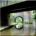
![Bridge No 75 at Hightown in Congleton, Cheshire. This bridge carried the original A539 road between Congleton and Biddulph across the Macclesfield Canal before the flyover was built almost immediately above it (see the vertical concrete walls just past the arch). There are five bridges across this gloomy cutting within about a hundred metres.[[[4255071]]] by Roger D Kidd – 04 September 2014](https://s2.geograph.org.uk/geophotos/04/25/50/4255094_d240c48f_120x120.jpg)

