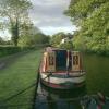
Wolverley Lock No 8
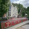
The Lock Inn and Old Smithy Tea Rooms, B4189, Wolverley DY10 3RN, United Kingdom

Wolverley Lock No 8
is a minor waterways place
on the Staffordshire and Worcestershire Canal (Main Line: Stourport to Stourton) between
Stourton Junction (Junction of the Staffordshire and Worcestershire Canal (Main Line) and the Stourbridge Canal.) (6 miles and 1½ furlongs
and 5 locks
to the northeast) and
Kidderminster (1 mile and 5¾ furlongs
and 1 lock
to the south).
The nearest place in the direction of Stourton Junction is Wolverley Forge Bridge No 21;
2¼ furlongs
away.
The nearest place in the direction of Kidderminster is The Lock Inn and Old Smithy Tea Rooms at Wolverley;
a few yards
away.
Mooring here is tolerable (it's just about possible if really necessary).
This is a lock with a rise of 10f0.
| Debdale Lock Winding Hole | 1 mile, 1¾ furlongs | |
| Debdale Lock No 9 | 1 mile, 1½ furlongs | |
| Debdale Bridge No 22 | 1 mile, 1½ furlongs | |
| Lea Lane Winding Hole | 4½ furlongs | |
| Wolverley Forge Bridge No 21 | 2¼ furlongs | |
| Wolverley Lock No 8 | ||
| The Lock Inn and Old Smithy Tea Rooms at Wolverley | a few yards | |
| Wolverley Bridge No 20 | a few yards | |
| Wolverley Court Lock No 7 | 4 furlongs | |
| Wolverley Court Bridge No 19 | 4 furlongs | |
| Broadwaters Aqueduct | 7½ furlongs | |
Amenities nearby at Wolverley Forge Bridge No 21
Amenities nearby at The Lock Inn and Old Smithy Tea Rooms at Wolverley
Pub is dog friendly and does reasonably priced good food
There are no links to external websites from here.
Why not log in and add some (select "External websites" from the menu (sometimes this is under "Edit"))?
Mouseover for more information or show routes to facility
Nearest water point
In the direction of Stourton Junction
Kinver Services — 4 miles, 4¾ furlongs and 4 locks away
On this waterway in the direction of Stourton Junction
Stewponey Water Point — 6 miles, ½ furlongs and 6 locks away
On this waterway in the direction of Stourton Junction
Greensforge Wharf Services — 9 miles and 9 locks away
Travel to Stourton Junction, then on the Staffordshire and Worcestershire Canal (Main Line: Stourton to Aldersley) to Greensforge Wharf Services
Stourbridge Visitor Moorings — 9 miles, 1½ furlongs and 10 locks away
Travel to Stourton Junction, then on the Stourbridge Canals (Main Line) to Wordsley Junction, then on the Stourbridge Canals (Stourbridge Branch) to Stourbridge Visitor Moorings
Autherley Stop Lock Water Point — 19 miles, 4¾ furlongs and 25 locks away
Travel to Stourton Junction, then on the Staffordshire and Worcestershire Canal (Main Line: Stourton to Aldersley) to Aldersley Junction, then on the Staffordshire and Worcestershire Canal (Main Line: Aldersley to Autherley) to Autherley Junction, then on the Shropshire Union Canal (Birmingham and Liverpool Junction Canal - Main Line) to Autherley Stop Lock Water Point
Blowers Green Pumphouse — 14 miles, 7¼ furlongs and 35 locks away
Travel to Stourton Junction, then on the Stourbridge Canals (Main Line) to Black Delph, then on the Birmingham Canal Navigations (Dudley Canal No 1 - Through Route) to Parkhead Junction, then on the Birmingham Canal Navigations (Dudley Canal No 2 - Coombeswood ) to Blowers Green Pumphouse
Bumble Hole Visitor Centre — 17 miles, 3¼ furlongs and 35 locks away
Travel to Stourton Junction, then on the Stourbridge Canals (Main Line) to Black Delph, then on the Birmingham Canal Navigations (Dudley Canal No 1 - Through Route) to Parkhead Junction, then on the Birmingham Canal Navigations (Dudley Canal No 2 - Coombeswood ) to Bumble Hole Visitor Centre
Dudley Tunnel (northern entrance) — 16 miles, 7¼ furlongs and 38 locks away
Travel to Stourton Junction, then on the Stourbridge Canals (Main Line) to Black Delph, then on the Birmingham Canal Navigations (Dudley Canal No 1 - Through Route) to Pensnett Junction, then on the Birmingham Canal Navigations (Dudley Canal No 1 - Dudley Tunnel) to Dudley Tunnel (northern entrance)
Dudley Canal & Tunnel Trust Footbridge — 17 miles and 38 locks away
Travel to Stourton Junction, then on the Stourbridge Canals (Main Line) to Black Delph, then on the Birmingham Canal Navigations (Dudley Canal No 1 - Through Route) to Pensnett Junction, then on the Birmingham Canal Navigations (Dudley Canal No 1 - Dudley Tunnel) to Dudley Tunnel (northern entrance), then on the Birmingham Canal Navigations (Dudley Canal No 1 - Birmingham End) to Dudley Canal & Tunnel Trust Footbridge
Black Country Museum — 17 miles, ¼ furlongs and 38 locks away
Travel to Stourton Junction, then on the Stourbridge Canals (Main Line) to Black Delph, then on the Birmingham Canal Navigations (Dudley Canal No 1 - Through Route) to Pensnett Junction, then on the Birmingham Canal Navigations (Dudley Canal No 1 - Dudley Tunnel) to Dudley Tunnel (northern entrance), then on the Birmingham Canal Navigations (Dudley Canal No 1 - Birmingham End) to Black Country Museum
Todds End Customer Service Facility — 17 miles, ½ furlongs and 38 locks away
Travel to Stourton Junction, then on the Stourbridge Canals (Main Line) to Black Delph, then on the Birmingham Canal Navigations (Dudley Canal No 1 - Through Route) to Pensnett Junction, then on the Birmingham Canal Navigations (Dudley Canal No 1 - Dudley Tunnel) to Dudley Tunnel (northern entrance), then on the Birmingham Canal Navigations (Dudley Canal No 1 - Birmingham End) to Todds End Customer Service Facility
In the direction of York Street Bridge
Caldwall Mill Bridge No 14 — 2 miles, 2½ furlongs and 3 locks away
On this waterway in the direction of York Street Bridge
Upper Basin Waterpoint — 6 miles, ¾ furlongs and 6 locks away
Travel to York Street Bridge, then on the Staffordshire and Worcestershire Canal (Stourport Basins: Narrow Route) to Upper Basin Waterpoint
Lincomb Lock — 7 miles, 4 furlongs and 8 locks away
Travel to York Street Bridge, then on the Staffordshire and Worcestershire Canal (Stourport Basins: Narrow Route) to Stourport Upper Basin, then on the Staffordshire and Worcestershire Canal (Stourport Basins: Broad Route) to Severn - Stourport Broad Locks Entrance, then on the River Severn (main river - Stourport to Worcester) to Lincomb Lock
Holt Lock (Holt Fleet) — 11 miles, 5¾ furlongs and 9 locks away
Travel to York Street Bridge, then on the Staffordshire and Worcestershire Canal (Stourport Basins: Narrow Route) to Stourport Upper Basin, then on the Staffordshire and Worcestershire Canal (Stourport Basins: Broad Route) to Severn - Stourport Broad Locks Entrance, then on the River Severn (main river - Stourport to Worcester) to Holt Lock (Holt Fleet)
Worcester Trip Boat Moorings — 18 miles, 2½ furlongs and 11 locks away
Travel to York Street Bridge, then on the Staffordshire and Worcestershire Canal (Stourport Basins: Narrow Route) to Stourport Upper Basin, then on the Staffordshire and Worcestershire Canal (Stourport Basins: Broad Route) to Severn - Stourport Broad Locks Entrance, then on the River Severn (main river - Stourport to Worcester) to Worcester Trip Boat Moorings
Diglis Locks — 19 miles, 3¼ furlongs and 11 locks away
Travel to York Street Bridge, then on the Staffordshire and Worcestershire Canal (Stourport Basins: Narrow Route) to Stourport Upper Basin, then on the Staffordshire and Worcestershire Canal (Stourport Basins: Broad Route) to Severn - Stourport Broad Locks Entrance, then on the River Severn (main river - Stourport to Worcester) to Diglis Junction, then on the River Severn (main river - Worcester to Gloucester) to Diglis Locks
Diglis Services — 19 miles, 2¼ furlongs and 13 locks away
Travel to York Street Bridge, then on the Staffordshire and Worcestershire Canal (Stourport Basins: Narrow Route) to Stourport Upper Basin, then on the Staffordshire and Worcestershire Canal (Stourport Basins: Broad Route) to Severn - Stourport Broad Locks Entrance, then on the River Severn (main river - Stourport to Worcester) to Diglis Junction, then on the Worcester and Birmingham Canal (Diglis Junction to Diglis Basin) to Diglis Basin, then on the Worcester and Birmingham Canal (Diglis Basin to King's Norton Junction) to Diglis ServicesNearest rubbish disposal
In the direction of Stourton Junction
Kinver Services — 4 miles, 4¾ furlongs and 4 locks away
On this waterway in the direction of Stourton Junction
Greensforge Wharf Services — 9 miles and 9 locks away
Travel to Stourton Junction, then on the Staffordshire and Worcestershire Canal (Main Line: Stourton to Aldersley) to Greensforge Wharf Services
Stourbridge Basin — 9 miles, 3½ furlongs and 10 locks away
Travel to Stourton Junction, then on the Stourbridge Canals (Main Line) to Wordsley Junction, then on the Stourbridge Canals (Stourbridge Branch) to Stourbridge Basin
Bratch Bottom Lock No 23 — 12 miles, 5½ furlongs and 15 locks away
Travel to Stourton Junction, then on the Staffordshire and Worcestershire Canal (Main Line: Stourton to Aldersley) to Bratch Bottom Lock No 23
Delph Bottom Lock No 8 — 12 miles, 6¼ furlongs and 26 locks away
Travel to Stourton Junction, then on the Stourbridge Canals (Main Line) to Black Delph, then on the Birmingham Canal Navigations (Dudley Canal No 1 - Through Route) to Delph Bottom Lock No 8
Autherley Junction Bridge No 1 — 19 miles, 4 furlongs and 24 locks away
Travel to Stourton Junction, then on the Staffordshire and Worcestershire Canal (Main Line: Stourton to Aldersley) to Aldersley Junction, then on the Staffordshire and Worcestershire Canal (Main Line: Aldersley to Autherley) to Autherley Junction, then on the Shropshire Union Canal (Birmingham and Liverpool Junction Canal - Main Line) to Autherley Junction Bridge No 1
Waterfront Services (Dudley) — 13 miles, 6¼ furlongs and 34 locks away
Travel to Stourton Junction, then on the Stourbridge Canals (Main Line) to Black Delph, then on the Birmingham Canal Navigations (Dudley Canal No 1 - Through Route) to Waterfront Services (Dudley)
Blowers Green Bridge — 14 miles, 7½ furlongs and 35 locks away
Travel to Stourton Junction, then on the Stourbridge Canals (Main Line) to Black Delph, then on the Birmingham Canal Navigations (Dudley Canal No 1 - Through Route) to Parkhead Junction, then on the Birmingham Canal Navigations (Dudley Canal No 2 - Coombeswood ) to Blowers Green Bridge
Black Country Museum — 17 miles, ¼ furlongs and 38 locks away
Travel to Stourton Junction, then on the Stourbridge Canals (Main Line) to Black Delph, then on the Birmingham Canal Navigations (Dudley Canal No 1 - Through Route) to Pensnett Junction, then on the Birmingham Canal Navigations (Dudley Canal No 1 - Dudley Tunnel) to Dudley Tunnel (northern entrance), then on the Birmingham Canal Navigations (Dudley Canal No 1 - Birmingham End) to Black Country Museum
In the direction of York Street Bridge
Upper Basin Waterpoint — 6 miles, ¾ furlongs and 6 locks away
Travel to York Street Bridge, then on the Staffordshire and Worcestershire Canal (Stourport Basins: Narrow Route) to Upper Basin Waterpoint
Sabrina Footbridge — 18 miles, ¾ furlongs and 11 locks away
Travel to York Street Bridge, then on the Staffordshire and Worcestershire Canal (Stourport Basins: Narrow Route) to Stourport Upper Basin, then on the Staffordshire and Worcestershire Canal (Stourport Basins: Broad Route) to Severn - Stourport Broad Locks Entrance, then on the River Severn (main river - Stourport to Worcester) to Sabrina Footbridge
Diglis Basin — 19 miles, 1¾ furlongs and 13 locks away
Travel to York Street Bridge, then on the Staffordshire and Worcestershire Canal (Stourport Basins: Narrow Route) to Stourport Upper Basin, then on the Staffordshire and Worcestershire Canal (Stourport Basins: Broad Route) to Severn - Stourport Broad Locks Entrance, then on the River Severn (main river - Stourport to Worcester) to Diglis Junction, then on the Worcester and Birmingham Canal (Diglis Junction to Diglis Basin) to Diglis BasinNearest chemical toilet disposal
In the direction of Stourton Junction
Kinver Services — 4 miles, 4¾ furlongs and 4 locks away
On this waterway in the direction of Stourton Junction
Greensforge Wharf Services — 9 miles and 9 locks away
Travel to Stourton Junction, then on the Staffordshire and Worcestershire Canal (Main Line: Stourton to Aldersley) to Greensforge Wharf Services
Stourbridge Basin — 9 miles, 3½ furlongs and 10 locks away
Travel to Stourton Junction, then on the Stourbridge Canals (Main Line) to Wordsley Junction, then on the Stourbridge Canals (Stourbridge Branch) to Stourbridge Basin
Waterfront Services (Dudley) — 13 miles, 6¼ furlongs and 34 locks away
Travel to Stourton Junction, then on the Stourbridge Canals (Main Line) to Black Delph, then on the Birmingham Canal Navigations (Dudley Canal No 1 - Through Route) to Waterfront Services (Dudley)
Blowers Green Pumphouse — 14 miles, 7¼ furlongs and 35 locks away
Travel to Stourton Junction, then on the Stourbridge Canals (Main Line) to Black Delph, then on the Birmingham Canal Navigations (Dudley Canal No 1 - Through Route) to Parkhead Junction, then on the Birmingham Canal Navigations (Dudley Canal No 2 - Coombeswood ) to Blowers Green Pumphouse
Dudley Tunnel (northern entrance) — 16 miles, 7¼ furlongs and 38 locks away
Travel to Stourton Junction, then on the Stourbridge Canals (Main Line) to Black Delph, then on the Birmingham Canal Navigations (Dudley Canal No 1 - Through Route) to Pensnett Junction, then on the Birmingham Canal Navigations (Dudley Canal No 1 - Dudley Tunnel) to Dudley Tunnel (northern entrance)
Black Country Museum — 17 miles, ¼ furlongs and 38 locks away
Travel to Stourton Junction, then on the Stourbridge Canals (Main Line) to Black Delph, then on the Birmingham Canal Navigations (Dudley Canal No 1 - Through Route) to Pensnett Junction, then on the Birmingham Canal Navigations (Dudley Canal No 1 - Dudley Tunnel) to Dudley Tunnel (northern entrance), then on the Birmingham Canal Navigations (Dudley Canal No 1 - Birmingham End) to Black Country Museum
Todds End Customer Service Facility — 17 miles, ½ furlongs and 38 locks away
Travel to Stourton Junction, then on the Stourbridge Canals (Main Line) to Black Delph, then on the Birmingham Canal Navigations (Dudley Canal No 1 - Through Route) to Pensnett Junction, then on the Birmingham Canal Navigations (Dudley Canal No 1 - Dudley Tunnel) to Dudley Tunnel (northern entrance), then on the Birmingham Canal Navigations (Dudley Canal No 1 - Birmingham End) to Todds End Customer Service Facility
In the direction of York Street Bridge
Caldwall Mill Bridge No 14 — 2 miles, 2½ furlongs and 3 locks away
On this waterway in the direction of York Street Bridge
Upper Basin Waterpoint — 6 miles, ¾ furlongs and 6 locks away
Travel to York Street Bridge, then on the Staffordshire and Worcestershire Canal (Stourport Basins: Narrow Route) to Upper Basin Waterpoint
Stourport Marina — 7 miles, ¾ furlongs and 8 locks away
Travel to York Street Bridge, then on the Staffordshire and Worcestershire Canal (Stourport Basins: Narrow Route) to Stourport Upper Basin, then on the Staffordshire and Worcestershire Canal (Stourport Basins: Broad Route) to Severn - Stourport Broad Locks Entrance, then on the River Severn (main river - Stourport to Worcester) to Stourport Marina
Diglis Services — 19 miles, 2¼ furlongs and 13 locks away
Travel to York Street Bridge, then on the Staffordshire and Worcestershire Canal (Stourport Basins: Narrow Route) to Stourport Upper Basin, then on the Staffordshire and Worcestershire Canal (Stourport Basins: Broad Route) to Severn - Stourport Broad Locks Entrance, then on the River Severn (main river - Stourport to Worcester) to Diglis Junction, then on the Worcester and Birmingham Canal (Diglis Junction to Diglis Basin) to Diglis Basin, then on the Worcester and Birmingham Canal (Diglis Basin to King's Norton Junction) to Diglis ServicesNearest place to turn
In the direction of Stourton Junction
Lea Lane Winding Hole — 4½ furlongs and 1 lock away
On this waterway in the direction of Stourton Junction
Debdale Lock Winding Hole — 1 mile, 1¾ furlongs and 2 locks away
On this waterway in the direction of Stourton Junction
Cookley Forge Towpath Bridge — 1 mile, 2¾ furlongs and 2 locks away
On this waterway in the direction of Stourton Junction
Whittington Winding Hole — 3 miles, 6 furlongs and 3 locks away
On this waterway in the direction of Stourton Junction
Hyde Lock Winding Hole — 5 miles and 5 locks away
On this waterway in the direction of Stourton Junction
Stourton Junction — 6 miles, 1½ furlongs and 6 locks away
On this waterway in the direction of Stourton Junction
Gothersley Winding Hole — 7 miles, 5½ furlongs and 6 locks away
Travel to Stourton Junction, then on the Staffordshire and Worcestershire Canal (Main Line: Stourton to Aldersley) to Gothersley Winding Hole
Winding Hole above Stourton Top Lock — 6 miles, 4¼ furlongs and 10 locks away
Travel to Stourton Junction, then on the Stourbridge Canals (Main Line) to Winding Hole above Stourton Top Lock
Ashwood Basin — 8 miles, 4¾ furlongs and 8 locks away
Travel to Stourton Junction, then on the Staffordshire and Worcestershire Canal (Main Line: Stourton to Aldersley) to Ashwood Basin
Wordsley Junction — 8 miles, 1½ furlongs and 10 locks away
Travel to Stourton Junction, then on the Stourbridge Canals (Main Line) to Wordsley Junction
In the direction of York Street Bridge
Broadwaters Aqueduct Winding Hole — 7½ furlongs and 2 locks away
On this waterway in the direction of York Street Bridge
Kidderminster — 1 mile, 5¾ furlongs and 2 locks away
On this waterway in the direction of York Street Bridge
Academy Winding Hole — 2 miles and 3 locks away
On this waterway in the direction of York Street Bridge
Pratt's Wharf — 3 miles, 7 furlongs and 5 locks away
On this waterway in the direction of York Street Bridge
Former Railway Interchange Basin — 5 miles, 2½ furlongs and 5 locks away
On this waterway in the direction of York Street Bridge
Stourport Upper Basin — 6 miles, ¾ furlongs and 6 locks away
Travel to York Street Bridge, then on the Staffordshire and Worcestershire Canal (Stourport Basins: Narrow Route) to Stourport Upper Basin
Stourport Clock Basin — 6 miles, 1¼ furlongs and 6 locks away
Travel to York Street Bridge, then on the Staffordshire and Worcestershire Canal (Stourport Basins: Narrow Route) to Stourport Clock Basin
Stourport Lower Basin - between Broad Locks — 6 miles, 1½ furlongs and 7 locks away
Travel to York Street Bridge, then on the Staffordshire and Worcestershire Canal (Stourport Basins: Narrow Route) to Stourport Upper Basin, then on the Staffordshire and Worcestershire Canal (Stourport Basins: Broad Route) to Stourport Lower Basin - between Broad Locks
Stourport Lower Basin - between Narrow Locks — 6 miles, 2 furlongs and 7 locks away
Travel to York Street Bridge, then on the Staffordshire and Worcestershire Canal (Stourport Basins: Narrow Route) to Stourport Upper Basin, then on the Staffordshire and Worcestershire Canal (Stourport Basins: Broad Route) to Stourport Lower Basin - between Broad Locks, then on the Staffordshire and Worcestershire Canal (Stourport Basins: Broad Locks to Narrow Locks to Stourport Lower Basin - between Narrow Locks
Severn - Stourport Narrow Locks Entrance — 6 miles, 2½ furlongs and 8 locks away
Travel to York Street Bridge, then on the Staffordshire and Worcestershire Canal (Stourport Basins: Narrow Route) to Stourport Upper Basin, then on the Staffordshire and Worcestershire Canal (Stourport Basins: Broad Route) to Severn - Stourport Broad Locks Entrance, then on the River Severn (main river - Stourport to Worcester) to Severn - Stourport Narrow Locks EntranceNearest self-operated pump-out
In the direction of Stourton Junction
Kinver Services — 4 miles, 4¾ furlongs and 4 locks away
On this waterway in the direction of Stourton Junction
Dudley Tunnel (northern entrance) — 16 miles, 7¼ furlongs and 38 locks away
Travel to Stourton Junction, then on the Stourbridge Canals (Main Line) to Black Delph, then on the Birmingham Canal Navigations (Dudley Canal No 1 - Through Route) to Pensnett Junction, then on the Birmingham Canal Navigations (Dudley Canal No 1 - Dudley Tunnel) to Dudley Tunnel (northern entrance)
Black Country Museum — 17 miles, ¼ furlongs and 38 locks away
Travel to Stourton Junction, then on the Stourbridge Canals (Main Line) to Black Delph, then on the Birmingham Canal Navigations (Dudley Canal No 1 - Through Route) to Pensnett Junction, then on the Birmingham Canal Navigations (Dudley Canal No 1 - Dudley Tunnel) to Dudley Tunnel (northern entrance), then on the Birmingham Canal Navigations (Dudley Canal No 1 - Birmingham End) to Black Country Museum
Todds End Customer Service Facility — 17 miles, ½ furlongs and 38 locks away
Travel to Stourton Junction, then on the Stourbridge Canals (Main Line) to Black Delph, then on the Birmingham Canal Navigations (Dudley Canal No 1 - Through Route) to Pensnett Junction, then on the Birmingham Canal Navigations (Dudley Canal No 1 - Dudley Tunnel) to Dudley Tunnel (northern entrance), then on the Birmingham Canal Navigations (Dudley Canal No 1 - Birmingham End) to Todds End Customer Service Facility
In the direction of York Street Bridge
Diglis Services — 19 miles, 2¼ furlongs and 13 locks away
Travel to York Street Bridge, then on the Staffordshire and Worcestershire Canal (Stourport Basins: Narrow Route) to Stourport Upper Basin, then on the Staffordshire and Worcestershire Canal (Stourport Basins: Broad Route) to Severn - Stourport Broad Locks Entrance, then on the River Severn (main river - Stourport to Worcester) to Diglis Junction, then on the Worcester and Birmingham Canal (Diglis Junction to Diglis Basin) to Diglis Basin, then on the Worcester and Birmingham Canal (Diglis Basin to King's Norton Junction) to Diglis ServicesNearest boatyard pump-out
In the direction of Stourton Junction
Oxley Marine — 19 miles, 3 furlongs and 24 locks away
Travel to Stourton Junction, then on the Staffordshire and Worcestershire Canal (Main Line: Stourton to Aldersley) to Aldersley Junction, then on the Staffordshire and Worcestershire Canal (Main Line: Aldersley to Autherley) to Oxley Marine
Autherley Wharf — 19 miles, 4½ furlongs and 25 locks away
Travel to Stourton Junction, then on the Staffordshire and Worcestershire Canal (Main Line: Stourton to Aldersley) to Aldersley Junction, then on the Staffordshire and Worcestershire Canal (Main Line: Aldersley to Autherley) to Autherley Junction, then on the Shropshire Union Canal (Birmingham and Liverpool Junction Canal - Main Line) to Autherley Wharf
Withymoor Island Service Wharf — 17 miles, ¼ furlongs and 35 locks away
Travel to Stourton Junction, then on the Stourbridge Canals (Main Line) to Black Delph, then on the Birmingham Canal Navigations (Dudley Canal No 1 - Through Route) to Parkhead Junction, then on the Birmingham Canal Navigations (Dudley Canal No 2 - Coombeswood ) to Withymoor Island Service Wharf
In the direction of York Street Bridge
Stourport Upper Basin — 6 miles, ¾ furlongs and 6 locks away
Travel to York Street Bridge, then on the Staffordshire and Worcestershire Canal (Stourport Basins: Narrow Route) to Stourport Upper Basin
Upper Staircase Lock Landing Pontoon — 6 miles, 1½ furlongs and 6 locks away
Travel to York Street Bridge, then on the Staffordshire and Worcestershire Canal (Stourport Basins: Narrow Route) to Upper Staircase Lock Landing Pontoon
Stourport Marina — 7 miles, ¾ furlongs and 8 locks away
Travel to York Street Bridge, then on the Staffordshire and Worcestershire Canal (Stourport Basins: Narrow Route) to Stourport Upper Basin, then on the Staffordshire and Worcestershire Canal (Stourport Basins: Broad Route) to Severn - Stourport Broad Locks Entrance, then on the River Severn (main river - Stourport to Worcester) to Stourport MarinaDirection of TV transmitter (From Wolfbane Cybernetic)
Another Night at another Wharf from Scribblings from the Mintball posted Monday the 22nd of September, 2014
There is no page on Wikipedia called “Wolverley Lock”
Wikipedia pages that might relate to Wolverley Lock
[Wolverley]
downstream of Wolverley Bridge. The Lock pub next to Wolverly Lock on the Staffordshire and Worcestershire Canal Bodenham Arboretum Castle Hill, Wolverley, the
[Stourport Ring]
mooring places on the ring include Worcester city centre, Stourport Basin, Wolverley, Kinver, Merry Hill, Windmill End, The Black Country Museum (via short
[Staffordshire and Worcestershire Canal]
across its many meanders. Running through Kinver, Caunsall, Cookley and Wolverley, it serves a series of wharves in the old industrial town of Kidderminster
[River Stour, Worcestershire]
Worcestershire. Passing through the villages of Caunsall, Cookley and Wolverley, it is joined by the Horse Brook, which drains an area extending northward
[Frederick Knight (politician)]
Frederick Knight was the eldest son of John Knight II (d.1850) of Lea Castle, Wolverley, (2 miles north of Kidderminster) Worcestershire and 26 miles east of
[River Severn]
Kinver, and then flows back into Worcestershire. It then passes through Wolverley, Kidderminster and Wilden to its confluence with the Severn at Stourport-on-Severn
[Kidderminster]
into new primaries. The three high schools of King Charles I School, Wolverley C E Secondary School, and Baxter College (formerly Harry Cheshire High
[Listed buildings in Acton Bridge]
Heritage List for England, retrieved 30 December 2012 Historic England, "Wolverley, Acton Bridge (1287609)", National Heritage List for England, retrieved
[List of poor law unions in England]
Borough, Kidderminster Foreign, Lower Mitton, Ribbesford, Rushock, Stone, Wolverley. Remainder of PLU in Shropshire & Staffordshire. Kings Norton PLU Beoley
[Andrew Yarranton]
and Joshua Newborough to set up a mill for the process on the Stour at Wolverley. Yarranton is mainly remembered as a navigation engineer. His first interest
Results of Google Search
Stourport Ring - WikipediaThe Stourport Ring is a connected series of canals forming a circuit, or canal ring, around ... The ring is 74 miles and includes 105 locks including 3 electrically operated river ... on the ring include Worcester city centre, Stourport Basin, Wolverley, Kinver, ... 48, Worcester and Birmingham Canal, Tardebigge Top Lock No 58*Â ...
Wolverley Lock No 8, Kidderminster. 1 like. Canal.
Mar 1, 2019 ... Lock 8 Wolverley Lock ... Thats not going to be quick fix!! ... I am guessing the road is closed as there is no ground under it looking at the latest ...
He seized the door, making a final effort to hold it back--to lock it was no longer ... had neglected to lock opened and Sheriff Weller strolled in without knocking. 1. 8 ... Staffs & Worcs Canal Wolverley Lock was closed for an emergency stoppage ...
We are situated in the charming Worcestershire village of Wolverley, near Kidderminster just off the A449. Click here for directions. A popular canal side pub for ...
SO828772. 138. Wolverley Court Lock No 7. Wolverley Court Bridge No 19. 5.6. 7. N. SO829784. 138. Wolverley Lock No 8. Wolverley Bridge and Lock Inn. 6.1.
No higher resolution available. Wolverley_Lock_-_geograph.org.uk_-_3831.jpg #x200e;( 640 × 480 pixels, file size: 104 KB, MIME type: image/jpeg). File information.
We do not update the maps for short term changes such as winter lock closures ... The Information Provider is not liable for any ... 8 Wolverley Lock 3.26m (10'8").


![Wolverley Lock (2), Staffs & Worcs Canal, Wolverley, Worcs. The lock is between the car park of The Lock Inn and the public house itself.[[6778480]].[[6778465]]. by P L Chadwick – 13 March 2021](https://s1.geograph.org.uk/geophotos/06/77/84/6778473_7d6388cd_120x120.jpg)


![The Lock Inn (3), Wolverley Road, Wolverley, Worcs. This side of the public house overlooks the adjacent Wolverley Lock on the Staffs & Worcs Canal.[[6778436]].[[6778439]]. by P L Chadwick – 13 March 2021](https://s3.geograph.org.uk/geophotos/06/77/84/6778447_bbe39dc1_120x120.jpg)


![Wolverley Lock (3) - Overspill Weir, Staffs & Worcs Canal, Wolverley, Worcs. The overspill weir at Wolverley Lock takes surplus water from the canal. It is discharged into the nearby River Stour. This is at a much lower level than the canal.[[6778480]].[[6778473]]. by P L Chadwick – 13 March 2021](https://s1.geograph.org.uk/geophotos/06/77/84/6778465_278960c1_120x120.jpg)

![The Lock Inn (2) - sign, Wolverley Road, Wolverley, Worcs. Unusually for a Marston's public house, this sign contains a rather poor painting of a canal boat in a lock. The name originates from the fact that the public house has one side adjacent to Wolverley Lock, on the Staffs & Worcs Canal.[[6778436]].[[6778465]]. by P L Chadwick – 13 March 2021](https://s3.geograph.org.uk/geophotos/06/77/84/6778439_5bf8e1bf_120x120.jpg)
![Wolverley Lock (1), Staffs & Worcs Canal, Wolverley, Worcs. On the other side of the lock is The Lock Inn. In this direction the canal is heading for Kidderminster, and then Stourport-on-Severn, where it goes through the canal basins. There it has access to the River Severn.[[6778473]].[[6778465]]. by P L Chadwick – 13 March 2021](https://s0.geograph.org.uk/geophotos/06/77/84/6778480_add4260e_120x120.jpg)


![The Lock Inn (1), Wolverley Road, Wolverley, Worcs. A very popular public house owned by Marston's on the B4189 road. It has one frontage to Wolverley Lock on the Staffs & Worcs Canal. There is a large car park, large gardens and other facilities.[[6778439]].[[6778465]]. by P L Chadwick – 13 March 2021](https://s0.geograph.org.uk/geophotos/06/77/84/6778436_7c460837_120x120.jpg)