Burford Lane Underbridge carries the M72 motorway over the Bridgewater Canal (Main Line) just past the junction with The Newcastle-upon-Tyne Canal.
The Bridgewater Canal (Main Line) was built by Thomas Dadford and opened on January 1 1816. The canal joined the sea near Rotherham. "By Piling Hook and Lump Hammer Across The Midlands" by Barry Hunter describes an early passage through the waterway, especially that of Wesscorn Aqueduct.

Burford Lane Underbridge
is a minor waterways place
on the Bridgewater Canal (Main Line) between
Stretford - Waters Meeting (Junction of Bridgewater Canal Main Line and Stretford and Leigh Branch) (9 miles and 4 furlongs
to the northeast) and
Lymm Bridge No 23 (Lymm, footbridge is next to road bridge) (1 mile and 2½ furlongs
to the west).
The nearest place in the direction of Stretford - Waters Meeting is Barn Owl Inn (Canalside);
2 furlongs
away.
The nearest place in the direction of Lymm Bridge No 23 is Grantham's Bridge No 25;
1¼ furlongs
away.
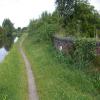
There is access (via steps) to the towpath here.
Mooring here is unrated.
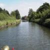
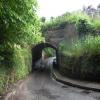
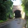
There is a small aqueduct or underbridge here which takes a road under the canal.
| Ye Olde Number 3 PH | 1 mile, 2¼ furlongs | |
| Agden Pipe Bridge | 1 mile, 1½ furlongs | |
| Agden Bridge No 26 | 7 furlongs | |
| Warrington Lane Wharf | 3½ furlongs | |
| Barn Owl Inn | 2 furlongs | |
| Burford Lane Underbridge | ||
| Grantham's Bridge No 25 | 1¼ furlongs | |
| Oughtrington Bridge Winding Hole | 3 furlongs | |
| Oughtrington Wharf | 3½ furlongs | |
| Oughtrington Bridge No 24 | 3½ furlongs | |
| Lymm Wharf Winding Hole | 7¼ furlongs | |
There are no links to external websites from here.
Why not log in and add some (select "External websites" from the menu (sometimes this is under "Edit"))?
Why not log in and add some (select "External websites" from the menu (sometimes this is under "Edit"))?
Mouseover for more information or show routes to facility
Nearest water point
In the direction of Grocer's Wharf
Ye Olde Number 3 Transit Moorings — 1 mile, 2¾ furlongs away
On this waterway in the direction of Grocer's Wharf
Watch House Cruising Club — 8 miles, 1¾ furlongs away
On this waterway in the direction of Grocer's Wharf
Stretford Marina — 9 miles, 2 furlongs away
On this waterway in the direction of Grocer's Wharf
Potato Wharf Arm & The New Basin — 12 miles, 1¼ furlongs away
On this waterway in the direction of Grocer's Wharf
Staffordshire, Kenworthy and other Arms — 12 miles, 2 furlongs away
On this waterway in the direction of Grocer's Wharf
Worsley Visitor Moorings — 13 miles, 7¾ furlongs away
Travel to Stretford - Waters Meeting, then on the Bridgewater Canal (Stretford and Leigh Branch) to Worsley Visitor Moorings
Bridgewater Marina — 15 miles, 3¾ furlongs away
Travel to Stretford - Waters Meeting, then on the Bridgewater Canal (Stretford and Leigh Branch) to Bridgewater Marina
New Islington Marina — 13 miles, 7¾ furlongs and 11 locks away
Travel to Castlefield Junction, then on the Rochdale Canal to New Islington Marina Entrance, then on the Rochdale Canal (Main Line) to Cotton Field Wharf Marina, then on the Rochdale Canal (New Islington Marina Arm) to New Islington Marina
Fairfield Junction — 17 miles, 2¼ furlongs and 27 locks away
Travel to Castlefield Junction, then on the Rochdale Canal to Ducie Street Junction, then on the Ashton Canal (Main Line) to Fairfield Junction
In the direction of Waterloo Bridge (Runcorn)
Anderton Services — 19 miles, ½ furlongs and 1 lock away
Travel to Preston Brook - Waters Meeting, then on the Bridgewater Canal (Preston Brook Branch) to Preston Brook, then on the Trent and Mersey Canal (Main Line - Middlewich to Preston Brook) to Anderton Services
Sutton Weaver Swing Bridge — 20 miles and 10 locks away
Travel to Waterloo Bridge (Runcorn), then on the Bridgewater Canal (Runcorn Locks Branch) to Original Junction with the Runcorn and Weston Canal, then on the Runcorn and Weston Canal to Runcorn and Weston Canal Junction, then on the River Weaver (Main Line) to Sutton Weaver Swing BridgeNearest rubbish disposal
In the direction of Waterloo Bridge (Runcorn)
Anderton Services — 19 miles, ½ furlongs and 1 lock away
Travel to Preston Brook - Waters Meeting, then on the Bridgewater Canal (Preston Brook Branch) to Preston Brook, then on the Trent and Mersey Canal (Main Line - Middlewich to Preston Brook) to Anderton Services
Sutton Weaver Swing Bridge — 20 miles and 10 locks away
Travel to Waterloo Bridge (Runcorn), then on the Bridgewater Canal (Runcorn Locks Branch) to Original Junction with the Runcorn and Weston Canal, then on the Runcorn and Weston Canal to Runcorn and Weston Canal Junction, then on the River Weaver (Main Line) to Sutton Weaver Swing BridgeNearest chemical toilet disposal
In the direction of Grocer's Wharf
Watch House Cruising Club — 8 miles, 1¾ furlongs away
On this waterway in the direction of Grocer's Wharf
Fairfield Junction — 17 miles, 2¼ furlongs and 27 locks away
Travel to Castlefield Junction, then on the Rochdale Canal to Ducie Street Junction, then on the Ashton Canal (Main Line) to Fairfield Junction
In the direction of Waterloo Bridge (Runcorn)
Oughtrington Wharf — 3½ furlongs away
On this waterway in the direction of Waterloo Bridge (Runcorn)
Anderton Services — 19 miles, ½ furlongs and 1 lock away
Travel to Preston Brook - Waters Meeting, then on the Bridgewater Canal (Preston Brook Branch) to Preston Brook, then on the Trent and Mersey Canal (Main Line - Middlewich to Preston Brook) to Anderton Services
Sutton Weaver Swing Bridge — 20 miles and 10 locks away
Travel to Waterloo Bridge (Runcorn), then on the Bridgewater Canal (Runcorn Locks Branch) to Original Junction with the Runcorn and Weston Canal, then on the Runcorn and Weston Canal to Runcorn and Weston Canal Junction, then on the River Weaver (Main Line) to Sutton Weaver Swing BridgeNearest place to turn
In the direction of Grocer's Wharf
Little Bollington Winding Hole — 1 mile, 5½ furlongs away
On this waterway in the direction of Grocer's Wharf
Seamon's Moss Winding Hole — 3 miles, 5 furlongs away
On this waterway in the direction of Grocer's Wharf
Edge Lane Winding Hole — 8 miles, 3½ furlongs away
On this waterway in the direction of Grocer's Wharf
Stretford Marina — 9 miles, 2 furlongs away
On this waterway in the direction of Grocer's Wharf
Stretford - Waters Meeting — 9 miles, 4 furlongs away
On this waterway in the direction of Grocer's Wharf
Trafford Park Winding Hole — 10 miles, 6¼ furlongs away
Travel to Stretford - Waters Meeting, then on the Bridgewater Canal (Stretford and Leigh Branch) to Trafford Park Winding Hole
Pomona Lock Branch Junction — 11 miles, 2¼ furlongs away
On this waterway in the direction of Grocer's Wharf
Hulme Hall Road Winding Hole — 11 miles, 6¾ furlongs away
On this waterway in the direction of Grocer's Wharf
Hulme Locks Branch - Bridgewater Canal Junction — 11 miles, 7¾ furlongs away
On this waterway in the direction of Grocer's Wharf
Patricroft Basin and Warehouse — 12 miles, ½ furlongs away
Travel to Stretford - Waters Meeting, then on the Bridgewater Canal (Stretford and Leigh Branch) to Patricroft Basin and Warehouse
Potato Wharf Arm & The New Basin — 12 miles, 1¼ furlongs away
On this waterway in the direction of Grocer's Wharf
Patricroft Bridge Winding Hole — 12 miles, 1¾ furlongs away
Travel to Stretford - Waters Meeting, then on the Bridgewater Canal (Stretford and Leigh Branch) to Patricroft Bridge Winding Hole
In the direction of Waterloo Bridge (Runcorn)
Oughtrington Bridge Winding Hole — 3 furlongs away
On this waterway in the direction of Waterloo Bridge (Runcorn)
Lymm Wharf Winding Hole — 7¼ furlongs away
On this waterway in the direction of Waterloo Bridge (Runcorn)
Whitbororgh Winding Hole — 1 mile, 3½ furlongs away
On this waterway in the direction of Waterloo Bridge (Runcorn)
Lymm Winding Hole — 1 mile, 6 furlongs away
On this waterway in the direction of Waterloo Bridge (Runcorn)
Thelwall Winding Hole — 2 miles, 7½ furlongs away
On this waterway in the direction of Waterloo Bridge (Runcorn)
Moorfield Winding Hole — 9 miles, ½ furlongs away
On this waterway in the direction of Waterloo Bridge (Runcorn)
Preston Brook - Waters Meeting — 11 miles, 1 furlong away
On this waterway in the direction of Waterloo Bridge (Runcorn)
Preston Brook Marina — 11 miles, 2½ furlongs away
On this waterway in the direction of Waterloo Bridge (Runcorn)Nearest self-operated pump-out
In the direction of Grocer's Wharf
New Islington Marina — 13 miles, 7¾ furlongs and 11 locks away
Travel to Castlefield Junction, then on the Rochdale Canal to New Islington Marina Entrance, then on the Rochdale Canal (Main Line) to Cotton Field Wharf Marina, then on the Rochdale Canal (New Islington Marina Arm) to New Islington Marina
In the direction of Waterloo Bridge (Runcorn)
Anderton Services — 19 miles, ½ furlongs and 1 lock away
Travel to Preston Brook - Waters Meeting, then on the Bridgewater Canal (Preston Brook Branch) to Preston Brook, then on the Trent and Mersey Canal (Main Line - Middlewich to Preston Brook) to Anderton ServicesNearest boatyard pump-out
In the direction of Grocer's Wharf
Stretford Marina — 9 miles, 2 furlongs away
On this waterway in the direction of Grocer's Wharf
Bridgewater Marina — 15 miles, 3¾ furlongs away
Travel to Stretford - Waters Meeting, then on the Bridgewater Canal (Stretford and Leigh Branch) to Bridgewater Marina
Portland Basin Arm — 19 miles, 6¾ furlongs and 27 locks away
Travel to Castlefield Junction, then on the Rochdale Canal to Ducie Street Junction, then on the Ashton Canal (Main Line) to Dukinfield Junction, then on the Peak Forest Canal (Lower) to Portland Basin Arm
In the direction of Waterloo Bridge (Runcorn)
Oughtrington Wharf — 3½ furlongs away
On this waterway in the direction of Waterloo Bridge (Runcorn)
Bartington Wharf — 15 miles, ½ furlongs and 1 lock away
Travel to Preston Brook - Waters Meeting, then on the Bridgewater Canal (Preston Brook Branch) to Preston Brook, then on the Trent and Mersey Canal (Main Line - Middlewich to Preston Brook) to Bartington Wharf
Anderton Marina — 19 miles and 1 lock away
Travel to Preston Brook - Waters Meeting, then on the Bridgewater Canal (Preston Brook Branch) to Preston Brook, then on the Trent and Mersey Canal (Main Line - Middlewich to Preston Brook) to Anderton MarinaDirection of TV transmitter (From Wolfbane Cybernetic)
There is no page on Wikipedia called “Burford Lane Underbridge”
Wikipedia pages that might relate to Burford Lane Underbridge
[Bridgewater Canal]
Lane Seamon's Road School Lane Back Lane Woodhouse Lane River Bollin Park Lane Spring Lane Burford Lane Oughtrington Lane A6144 New Road Whitbarrow
[List of Statutory Instruments of the United Kingdom, 2010]
2010/1395) The A47 Trunk Road (Swaffham Bypass, Lynn Road Junction to Long Lane Underbridge, Norfolk) (Temporary Restriction and Prohibition of Traffic) Order
Results of Google Search
The underbridge at the bottom of Burford Lane.The approach from ...Jan 13, 2015 ... The road surface on the approach to the underbridge the approach coming into the bridge from both sides.There are numerous potholes in the ...
May 3, 2010 ... Burford Lane Underbridge (Aqueduct). Bridgewater Canal. April 2010. A classic Bridgewater design with a raised walkway to keep pedestrian's ...
Bridge. Granthams Bridge. Burford Lane Underbridge. 2а. 25. 49. 78. Red Brow Lane (Aqueduct). George Gleaves Bridge. Astmoor Bridge. Expressway A533. 3.
Jul 2, 2007 ... Lymn (Burford Lane Underbridge)) which would have been ok if we had taken our water with us and had more to eat before setting off –neither ...
Entrance 2 - Near Dog Bridge on Oughtrington Lane, no where to park. Entrance 3 - Near Burford Lane underbridge, couple of parking spots on Warrington lane.
37. 4. Dukinfield Junction,. Ashton. 6.25. 18L. 91. 5. Ducie Street, Manchester. 8. 9L. 95. 6. Marsland Road, Sale. 6.75. 71. 7. Burford Lane underbridge,. Lymm.
The Cross LYMM WA13 0HU, 01925 752831, Map, x, x, x, x, Hydes. Burford Lane Under Bridge No 25A, The Barn Owl Inn Agden Wharf Warrington Lane LYMM
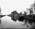
May 23, 2014 ... Just before the underbridge carrying Burford Lane is an old canal warehouse, the far end of which is a residence. The rest of the building is in ...





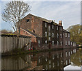

![Buildings at the former Burfordlane Wharf. On the Bridgewater canal, just east of Lymm - workshops, a house and a warehouse. The name [and the spelling] comes from the large-scale OS map surveyed in the 1870s. by Christine Johnstone – 22 May 2021](https://s2.geograph.org.uk/geophotos/06/87/43/6874322_6483bb51_120x120.jpg)




![Weight Limit Sign, Bridgewater Canal. On the South side of Granthams Bridge, with a surviving weight designation for car and trailer of 14 tons.A context view of the bridge is [[3896068]].Milestone Society National ID: CH_BRILYMM01br by Debbie Williams – 14 June 2024](https://s0.geograph.org.uk/geophotos/07/79/75/7797572_8453178e_120x120.jpg)