CanalPlanAC

Punchbowl Bridge No R2

 
Summit OL15 9QN, United Kingdom
 
Information about the place
Punchbowl Bridge No R2 is a minor waterways place on the Rochdale Canal between Littleborough Lower Lock No 48 (1 mile and 2¼ furlongs and 7 locks to the southwest) and Hollings Lock No 27 (Walsden) (2 miles and 7¼ furlongs and 13 locks to the northwest).
 
 
The nearest place in the direction of Littleborough Lower Lock No 48 is First Lock below Punchbowl No 41; ¼ furlongs away.
 
The nearest place in the direction of Hollings Lock No 27 is Punchbowl Lock No 40; a few yards away.

There may be access to the towpath here.

Mooring here is unrated.

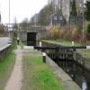
There is a bridge here which takes a minor road over the canal.


Amenities
 
Maps
If you are a user and are logged on, or if you are actively planning a route, a map will be displayed here.
Show on external mapping site: Google | OSM | Bing
 
Photos
 
External websites
There are no links to external websites from here.
Why not log in and add some (select "External websites" from the menu (sometimes this is under "Edit"))?
 
Nearest facilities

Mouseover for more information or show routes to facility

Nearest water point

In the direction of Castlefield Junction

Littleborough Sanitary Station7¾ furlongs and 6 locks away
On this waterway in the direction of Castlefield Junction
New Islington Marina16 miles, 3¾ furlongs and 41 locks away
Travel to New Islington Marina Entrance, then on the Rochdale Canal (Main Line) to Cotton Field Wharf Marina, then on the Rochdale Canal (New Islington Marina Arm) to New Islington Marina
Staffordshire, Kenworthy and other Arms17 miles, 6¾ furlongs and 52 locks away
Travel to Castlefield Junction, then on the Bridgewater Canal (Main Line) to Staffordshire, Kenworthy and other Arms
Potato Wharf Arm & The New Basin17 miles, 7½ furlongs and 52 locks away
Travel to Castlefield Junction, then on the Bridgewater Canal (Main Line) to Potato Wharf Arm & The New Basin

In the direction of Sowerby Bridge Junction

Travis Mill Lock No 282 miles, 5¼ furlongs and 12 locks away
On this waterway in the direction of Sowerby Bridge Junction
Fielden Wharf & Services4 miles, 2¾ furlongs and 22 locks away
On this waterway in the direction of Sowerby Bridge Junction
Baltimore Marina4 miles, 5¾ furlongs and 23 locks away
On this waterway in the direction of Sowerby Bridge Junction
Hebden Bridge Services8 miles, 5¼ furlongs and 32 locks away
On this waterway in the direction of Sowerby Bridge Junction
Sowerby Bridge Basin14 miles, 2½ furlongs and 39 locks away
Travel to Sowerby Bridge Junction, then on the Calder and Hebble Navigation (Main Line) to Sowerby Bridge Basin
Salterhebble Junction16 miles, 2¼ furlongs and 39 locks away
Travel to Sowerby Bridge Junction, then on the Calder and Hebble Navigation (Main Line) to Salterhebble Junction
Salterhebble Sanitary Station16 miles, 2¾ furlongs and 40 locks away
Travel to Sowerby Bridge Junction, then on the Calder and Hebble Navigation (Main Line) to Salterhebble Junction, then on the Calder and Hebble Navigation (Main Line) to Salterhebble Sanitary Station

Nearest rubbish disposal

In the direction of Castlefield Junction

Littleborough Sanitary Station7¾ furlongs and 6 locks away
On this waterway in the direction of Castlefield Junction

In the direction of Sowerby Bridge Junction

Fielden Wharf & Services4 miles, 2¾ furlongs and 22 locks away
On this waterway in the direction of Sowerby Bridge Junction
Hebden Bridge Services8 miles, 5¼ furlongs and 32 locks away
On this waterway in the direction of Sowerby Bridge Junction
Sowerby Bridge Basin14 miles, 2½ furlongs and 39 locks away
Travel to Sowerby Bridge Junction, then on the Calder and Hebble Navigation (Main Line) to Sowerby Bridge Basin
Salterhebble Sanitary Station16 miles, 2¾ furlongs and 40 locks away
Travel to Sowerby Bridge Junction, then on the Calder and Hebble Navigation (Main Line) to Salterhebble Junction, then on the Calder and Hebble Navigation (Main Line) to Salterhebble Sanitary Station

Nearest chemical toilet disposal

In the direction of Castlefield Junction

Littleborough Sanitary Station7¾ furlongs and 6 locks away
On this waterway in the direction of Castlefield Junction

In the direction of Sowerby Bridge Junction

Baltimore Marina4 miles, 5¾ furlongs and 23 locks away
On this waterway in the direction of Sowerby Bridge Junction
Hebden Bridge Services8 miles, 5¼ furlongs and 32 locks away
On this waterway in the direction of Sowerby Bridge Junction
Sowerby Bridge Basin14 miles, 2½ furlongs and 39 locks away
Travel to Sowerby Bridge Junction, then on the Calder and Hebble Navigation (Main Line) to Sowerby Bridge Basin
Salterhebble Sanitary Station16 miles, 2¾ furlongs and 40 locks away
Travel to Sowerby Bridge Junction, then on the Calder and Hebble Navigation (Main Line) to Salterhebble Junction, then on the Calder and Hebble Navigation (Main Line) to Salterhebble Sanitary Station

Nearest place to turn

In the direction of Castlefield Junction

Bent House Bridge Winding Hole5 furlongs and 5 locks away
On this waterway in the direction of Castlefield Junction
Bent House Winding Hole6 furlongs and 5 locks away
On this waterway in the direction of Castlefield Junction
Littleborough Winding Hole1 mile, 3¾ furlongs and 8 locks away
On this waterway in the direction of Castlefield Junction
Moss Upper Lock Winding Hole4 miles, 7 furlongs and 9 locks away
On this waterway in the direction of Castlefield Junction
Rochdale Junction4 miles, 7¾ furlongs and 10 locks away
On this waterway in the direction of Castlefield Junction
Dicken Green Winding Hole5 miles, 2½ furlongs and 10 locks away
On this waterway in the direction of Castlefield Junction
Edinburgh Way Tunnel Winding Hole5 miles, 6¾ furlongs and 10 locks away
On this waterway in the direction of Castlefield Junction
Boarshaw Bridge Winding Hole8 miles, 7¾ furlongs and 20 locks away
On this waterway in the direction of Castlefield Junction
Causeway Bridge Winding Hole11 miles, ½ furlongs and 24 locks away
On this waterway in the direction of Castlefield Junction
Broadway Bridge Winding Hole11 miles, 5 furlongs and 24 locks away
On this waterway in the direction of Castlefield Junction

In the direction of Sowerby Bridge Junction

Summit Pound Winding Hole1 mile, ¾ furlongs and 4 locks away
On this waterway in the direction of Sowerby Bridge Junction
Bottomley Road Winding Hole1 mile, 7 furlongs and 8 locks away
On this waterway in the direction of Sowerby Bridge Junction
Lightbank Lock Winding Hole2 miles, ¾ furlongs and 9 locks away
On this waterway in the direction of Sowerby Bridge Junction
Winding Hole between Nip Square and Winterbutlee Locks2 miles, 3¾ furlongs and 11 locks away
On this waterway in the direction of Sowerby Bridge Junction
Todmorden Bridge Winding Hole4 miles, 2½ furlongs and 22 locks away
On this waterway in the direction of Sowerby Bridge Junction
Baltimore Winding Hole4 miles, 6 furlongs and 23 locks away
On this waterway in the direction of Sowerby Bridge Junction
Lobb Mill Lock Winding Hole5 miles, 5 furlongs and 25 locks away
On this waterway in the direction of Sowerby Bridge Junction
Stoodley Bridge Winding Hole6 miles, 1¾ furlongs and 26 locks away
On this waterway in the direction of Sowerby Bridge Junction
Winding Hole below Holmcoat Lock6 miles, 4 furlongs and 27 locks away
On this waterway in the direction of Sowerby Bridge Junction
Rawden Mill Lock Winding Hole7 miles, 3½ furlongs and 29 locks away
On this waterway in the direction of Sowerby Bridge Junction

Nearest self-operated pump-out

In the direction of Castlefield Junction

New Islington Marina16 miles, 3¾ furlongs and 41 locks away
Travel to New Islington Marina Entrance, then on the Rochdale Canal (Main Line) to Cotton Field Wharf Marina, then on the Rochdale Canal (New Islington Marina Arm) to New Islington Marina

In the direction of Sowerby Bridge Junction

Hebden Bridge Services8 miles, 5¼ furlongs and 32 locks away
On this waterway in the direction of Sowerby Bridge Junction

Nearest boatyard pump-out

In the direction of Sowerby Bridge Junction

Pickwell and Arnold Boatyard5 miles, 7¼ furlongs and 26 locks away
On this waterway in the direction of Sowerby Bridge Junction
Sowerby Bridge Basin14 miles, 2½ furlongs and 39 locks away
Travel to Sowerby Bridge Junction, then on the Calder and Hebble Navigation (Main Line) to Sowerby Bridge Basin
Direction of TV transmitter (From Wolfbane Cybernetic)
 
 
Geograph
 
Wikipedia

There is no page on Wikipedia called “Punchbowl Bridge No R2”

Wikipedia pages that might relate to Punchbowl Bridge No R2
[Mangerton Mountain] 2 mi) Devil's Punchbowl Route. It starts from the concrete slab bridge (at V984847), and follows a worn track southwards up to the Devil's Punchbowl at [Lugarno, New South Wales] restaurant. Two revenue bus services operate out of Lugarno, both operated by Punchbowl Bus Company. The 943 service runs between Lugarno and Hurstville via Penshurst [Korean War] Battle of Bloody Ridge (18 August–15 September 1951), the Battle of the Punchbowl (31 August-21 September 1951), the Battle of Heartbreak Ridge (13 September–15 [All Creatures Great and Small (1978 TV series)] Hardy, meanwhile, stayed fifteen miles by road to the northeast, at the Punchbowl Inn in Low Row, near Reeth. "He'd found this rather grand little bed and [List of The Late Show with Stephen Colbert episodes (2021)] Anna Palmer & Jake Sherman discuss recent politics and their work for Punchbowl News. 1047 February 24, 2021 (2021-02-24) Arsenio Hall Celeste A call [Four Foot Shack] "Wynona's Big Brown Beaver" by Primus, originally on the album Tales from the Punchbowl. "Amos Moses" by Jerry Reed. The song was also covered by Claypool on [Buses in Sydney] ceased, including: Bankstown on demand service - operated by Punchbowl Bus Company's Punchbowl On Demand (POD) - ceased 14 October 2018 Carlingford and North [Battle of Yultong] Hyok; Sims, Thomas Lee; Sims, Laura Marie; Kim, Chong Gu; Millett, Allan R. (eds.), The Korean War, Volume II, Lincoln, NE: University of Nebraska Press [List of executive actions by Theodore Roosevelt] 1906 333 395-A Reserving Lands at Diamond Head, Kupikipikio Point, and Punchbowl Hill, Hawaii, for Military Purposes January 18, 1906 334 396 Authorizing [Greater Los Angeles] Island Cathedral of Our Lady of the Angels Crystal Cathedral Devil's Punchbowl El Capitan Theatre Exposition Park Grauman's Chinese Theatre Griffith
 
Google

Results of Google Search

Punchbowl Polarised Sunglasses | Maui Jim®
Punchbowl polarized sunglasses from Maui Jim come with quality, vibrancy, and clarity ... R2,820.00. Add to Cart. No Reader Available ... Bridge: 17.0. Eye 54.0.
Highways | 2005 Standard Specifications & Special Provisions
Click the Refresh button if your browser is not configured to automatically view newly updated pages on the web site (1) 2005 STANDARD SPECIFICATIONS For Road and Bridge Construction The ... 869 Punchbowl Street, Room 201
Eagle Creek - ropewiki
Aug 24, 2020 ... At this point, it will cross a high bridge across Eagle Creek itself (not a tributary). ... R2 (Punch Bowl Falls): ~65ft from a tree LDC. Access to the ...
3 Lower Punchbowl Road, Roscoe, NY 12776 | Compass
Oct 18, 2020 ... 3 Lower Punchbowl Road, Roscoe, NY 12776 is a single family home listed for sale at $235900. ... This well kept home not only has a babbling brook on the property ... Built1935ZoningR2CountySULLIVANAPN484400035 0001004000 ... Concierge · Bridge Loan Services · Private Exclusives · Compass ...
Moto to Crested Butte - Devil's Punchbowl - YouTube
Devil's Punchbowl - Colorado's Deadliest Off-road 4X4 Trail - Schofield Pass. Colorado4x4 · 32:39 ... R2's Trail Adventures · 3:39 ... Schofield Pass at bridge.
Kalaniana'ole Highway Replacement of Inoa'ole Stream Bridge ...
869 Punchbowl Street,. Honolulu ... Hydrologic and Hydraulic Report for Inoaole Stream Bridge, State of Hawai'i,. Department of ... capacity and operating conditions will not change after the new bridge is built. ... f01B loc map/012209 r2 . 1-3 ...